


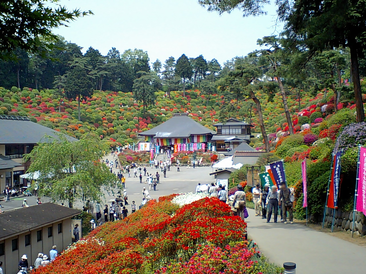


Ōme, Japan
青梅市
Ōme is a town of 133,535 people in Tokyo, Japan, founded in April 1, 1951.
Why visit Ōme
Townapedia lists 51 museums and landmarks, 95 parks and trails, 153 places to eat, 3 places to stay and 47 attractions in and around town.
Highlights include Surugadai University, シネマネコ, Yoshikawa Eiji Memorial Museum and Ōme Municipal History Provincial Museum.
Weather in Ōme
Forecast from MET Norway (CC BY 4.0). Full forecast
About Ōme
Ōme (青梅市, Ōme-shi; Japanese pronunciation: [ó̞ò̞.mè̞, ò̞ó̞.mé̞.ɕì, ó̞ó̞.mé̞-]) is a city located in the western portion of the Tokyo Metropolis, Japan. As of 1 May 2023, the city had an estimated population of 131,128, and a population density of 1300 persons per km2. The total area of the city is 103.31 square kilometres (39.89 sq mi).
From the Wikipedia article Ōme, Tokyo (this version), under CC BY-SA 4.0.
Things to do47

Surugadai University
School · 9.8 km
University in Hannō, Saitama, Japan



35 more on the map.
Museums and landmarks51





Nishiakiru Stone Age Dwelling Site
Monument and historic site · 8.3 km
Archaeological site in Japan


39 more on the map.
Parks, trails and playgrounds95



83 more on the map.
Restaurants and cafes153





141 more on the map.
History
The area of present-day Ōme was part of ancient Musashi Province. Ōme developed in the Edo period as a post station on the Ōme Kaidō highway. In the post-Meiji Restoration cadastral reform of July 22, 1878, the area became part of Nishitama District in Kanagawa Prefecture. The town of Ōme was created on April 1, 1889, with the establishment of modern municipalities system. Nishitama District was transferred to the administrative control of Tokyo Metropolis on April 1, 1893. Ōme was elevated to city status on April 1, 1951, by merging with the neighboring villages of Kasumi and Chōfu. Later in 1955, four additional villages (Yoshida, Mita, Kosoki, and Nariki) merged with Ōme.
From the History section of Ōme, Tokyo on Wikipedia, under CC BY-SA 4.0.
Where to stay3
Churches and places of worship108
Shopping30
Gas and EV charging7
Schools, colleges and libraries22
Healthcare61
Map of Ōme
250 places. The map loads OpenStreetMap tiles when you open it.
Getting there and nearby towns
Yokota Air Base (OKO) is the nearest airport with scheduled flights listed in OpenStreetMap, 10 km away.
- Tokorozawa 20 km east, about 20 min by car
- Aihara 22 km south, about 22 min by car
- Sagamihara 24 km south, about 24 min by car
- Nishi-Tokyo-shi 27 km east, about 27 min by car
- Zama 36 km south, about 36 min by car
- Yamato 39 km southeast, about 39 min by car
- Atsugi 40 km south, about 40 min by car
- Tokyo 42 km east, about 42 min by car
- Isehara 43 km south, about 43 min by car
- Hadano 46 km south, about 46 min by car
Drive times are estimates from straight-line distance, not routes.
Local news
Headlines from INDB.
Reviews, tips and questions
Loading what members have shared...
Sources and licences
- GeoNames (CC BY 4.0): population, coordinates, regions and time zone
- OpenStreetMap contributors (ODbL 1.0): places, airports, map data
- Wikidata (CC0 1.0): elevation, founding date, time zone, website, landmarks and historic places
- Wikimedia Commons (see each image): photos
- Wikipedia (CC BY-SA 4.0): overview and history text
Photo credits
- Ome City Hall New 2011.07, Hanasakijijii at Japanese Wikipedia, CC BY-SA 3.0
- OmeRailwayPark-c, Unknown author, CC BY-SA 3.0
- Ume park 梅 公園, Arashiyama, CC BY-SA 3.0
- Shiofunekannonji, Hanasakijijii, CC BY-SA 3.0
- Hinode seiundo, n-matu, Public domain
- Showa Retro Packaging Museum ac (1), Asturio Cantabrio, CC BY-SA 4.0
- Ishigami-sha (Ome), Abasaa, Public domain
- Torakashiwa-jinja(Ohme) Haiden, Taisuke.Kasuya, CC BY-SA 4.0
- Ome Municipal General Hospital, Waka77, Public domain
- 青梅市郷土博物館, Hanasakijijii, CC BY-SA 3.0
- Jogan-ji (Ome), Abasaa, Public domain
- Fujio Akatsuka Museum, Ome, Tokyo, Japan, User: (WT-shared) Shoestring at wts wikivoyage, CC BY-SA 4.0
- 吉川英治記念館 - panoramio, kob11511, CC BY 3.0
- Sokusei-ji (Ome), Abasaa, Public domain
- Kaizen-ji (Ome), Abasaa, Public domain
- Ome Sumiyosi-jinja ac, Asturio Cantabrio, CC BY-SA 4.0
- Ome city Kasumidai Junior High School, Suikotei, CC BY-SA 4.0
- 虎柏神社(青梅市)拝殿, Hanasakijijii, CC BY-SA 3.0
- 赤塚不二夫会館, Hanasakijijii, CC BY-SA 3.0
- Miyanohira Station 2021.05.18, Rory trains, CC BY-SA 4.0
- "Otedama" @Maison traditionnelle japonaise (9165122688), Takashi .M from Tokyo, Japan, CC BY 2.0
- 青梅街道-梅-01 - panoramio, TMC48, CC BY-SA 3.0
- 青梅街道-梅-02 - panoramio, TMC48, CC BY-SA 3.0
- Ome-station-with-new-plattform, Meon43, CC BY-SA 4.0
- Shirokiya 1 - panoramio, moonwalker76, CC BY 3.0
- IN The Shirokiya 2 - panoramio, moonwalker76, CC BY 3.0
- Saleswoman (Her Name is Ruka-chan) and a Customer - panoramio, moonwalker76, CC BY 3.0
- Today's Last Customer - panoramio, moonwalker76, CC BY 3.0
- IN The Shirokiya 3 - panoramio, moonwalker76, CC BY 3.0
- IN The Shirokiya 1 - panoramio, moonwalker76, CC BY 3.0
- Honcho, Oume, Tokyo 198-0083, Japan - panoramio (4), moonwalker76, CC BY 3.0
- Honcho, Oume, Tokyo 198-0083, Japan - panoramio (3), moonwalker76, CC BY 3.0
- Honcho, Oume, Tokyo 198-0083, Japan - panoramio (12), moonwalker76, CC BY 3.0
- Honcho, Oume, Tokyo 198-0083, Japan - panoramio (16), moonwalker76, CC BY 3.0
- Honcho, Oume, Tokyo 198-0083, Japan - panoramio (13), moonwalker76, CC BY 3.0
- - panoramio (4154), moonwalker76, CC BY 3.0
- Honcho, Oume, Tokyo 198-0083, Japan - panoramio (10), moonwalker76, CC BY 3.0
- Honcho, Oume, Tokyo 198-0083, Japan - panoramio (8), moonwalker76, CC BY 3.0
- Honcho, Oume, Tokyo 198-0083, Japan - panoramio (11), moonwalker76, CC BY 3.0
- Honcho, Oume, Tokyo 198-0083, Japan - panoramio (6), moonwalker76, CC BY 3.0


Page built November 4, 2026. Spotted a mistake? Tell us or suggest a place.