


Iruma, Japan
入間市
Iruma is a town of 147,166 people in Saitama, Japan, founded in November 1, 1966.
Why visit Iruma
Townapedia lists 31 museums and landmarks, 119 parks and trails, 205 places to eat, 2 places to stay and 10 attractions in and around town.
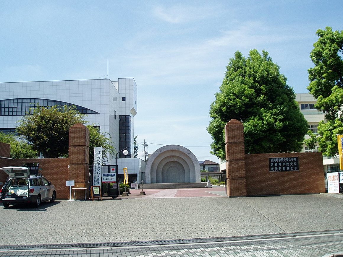
Highlights include Musashino Gakuin University, Seibu-en, Iruma City Museum and Noyamakita-Rokudōyama Park.
Weather in Iruma
Forecast from MET Norway (CC BY 4.0). Full forecast
About Iruma
Iruma (入間市, Iruma-shi; Japanese pronunciation: [í.ɾɯ̈̀.mä̀, ì.ɾɯ̈́.mä́.ɕì]) is a city located in Saitama Prefecture, Japan. As of 1 January 2021, the city had an estimated population of 147,166 in 66,516 households and a population density of 3,300 inhabitants per square kilometre (8,500/sq mi). The total area of the city is 44.69 square kilometres (17.25 sq mi).
From the Wikipedia article Iruma, Saitama (this version), under CC BY-SA 4.0.
Things to do10
Musashino Gakuin University
School · 5.7 km
Higher education institution in Saitama Prefecture, Japan

Seibu-en
Monument and historic site · 8.7 km
Amusement park in Tokorozawa, Japan



Museums and landmarks31



19 more on the map.
Parks, trails and playgrounds119




107 more on the map.
Restaurants and cafes205

Chuka soba ohsaki
Restaurant · Ramen · 3.3 km
6, 入間市
11:00-15:00, 17:00-20:00; Sa-Su 11:00-20:00; Mo off


Tea Break .m
Cafe · 2.9 km
We-Fr 11:00-15:30; Sa-Su 11:00-16:00
193 more on the map.
History
The area around Iruma was part of ancient Musashi Province and was noted for kilns producing Sue ware pottery in the Nara period and Heian period. During the Edo period, the area developed as a series of three post towns on the Nikkō Wakiōkan highway during the Edo period. The town of Toyooka and villages of Kaneko, Miyadera, Fujisawa and Higashikaneko were created within Iruma District, Saitama, with the establishment of the modern municipalities system on April 1, 1889. The Imperial Japanese Army Air Academy established an airfield in the area in 1938, which later developed into Iruma Air Base. On April 1, 1954, Higashikaneko became Seibu Town. On September 30, 1956, Toyooka, Kaneko, Miyadera, Fujisawa and Seibu merged to form the town of Musashi. Musashi was elevated to city status on November 1, 1966, becoming the city of Iruma. Discussions to merge with the neighboring city of Sayama in 2005 failed to pass a referendum. In 2017 Japan became the first country to elect an openly transgender man to any public office when Tomoya Hosoda was elected as a councillor for the city of Iruma.
From the History section of Iruma, Saitama on Wikipedia, under CC BY-SA 4.0.
Where to stay2
Churches and places of worship72
Shopping38
Gas and EV charging18
Schools, colleges and libraries56
Healthcare29
Map of Iruma
250 places. The map loads OpenStreetMap tiles when you open it.
Getting there and nearby towns
Yokota Air Base (OKO) is the nearest airport with scheduled flights listed in OpenStreetMap, 8 km away.
- Sayama 6 km northeast, about 6 min by car
- Tokorozawa 9 km east, about 9 min by car
- Akishima 11 km south, about 11 min by car
- Higashimurayama 11 km southeast, about 11 min by car
- Ōme 12 km west, about 12 min by car
- Kawagoe 15 km northeast, about 15 min by car
- Kokubunji 16 km southeast, about 16 min by car
- Niiza 17 km east, about 17 min by car
- Fujimino 17 km northeast, about 17 min by car
- Hachiōji 18 km south, about 18 min by car
Drive times are estimates from straight-line distance, not routes.
Local news
Headlines from INDB.
Reviews, tips and questions
Loading what members have shared...
Sources and licences
- GeoNames (CC BY 4.0): population, coordinates, regions and time zone
- OpenStreetMap contributors (ODbL 1.0): places, airports, map data
- Wikidata (CC0 1.0): elevation, founding date, time zone, website, landmarks and historic places
- Wikimedia Commons (see each image): photos
- Wikipedia (CC BY-SA 4.0): overview and history text
Photo credits
- Iruma city office, nattou, Public domain
- IrumaWakakusaSSHS, KY0NG-alfa, CC BY-SA 4.0
- JA Irumano Higashi-Kaneko Branch, Suikotei, CC BY 4.0
- Iruma Tea Fields from Sakurayama Observatory, Bryanmackinnon, CC BY 4.0
- Yaskawa Electric Corporation Iruma Solution Center, 正和, CC BY-SA 4.0
- Musashino-Gakuin-Univ-MainGate01, Hasec, CC0
- Seibuen Amusement Park (11152952796), Tomohiro Ohtake from Kawasaki, Japan, CC BY 2.0
- Satoyamaminkah, four horsemen, CC BY-SA 3.0
- Iruma Irumasi-hakubutukan 1, 京浜にけ, CC BY-SA 3.0
- Iruma Koyo High School, Abasaa, Public domain
- SayamaKeizaiHS, 杉山真大, CC BY-SA 4.0
- Higasino2018, 東野高等学校事務室, CC BY-SA 4.0
- 飯能市民球場, 千葉の番人, CC BY-SA 4.0
- 阿須運動公園全景, 千葉の番人, CC BY-SA 4.0
- 狭山茶畑 - panoramio, y.moroi, CC BY 3.0
- Route 16-2005-12-24, Syohei Arai, CC BY-SA 4.0
- Nakanohara Inari Jinja 01, Suikotei, CC BY 4.0
- Ogimachiya, Ohgi ( talk ), CC BY 3.0
- Λειτουργική διάταξη, Homiostasis, CC BY-SA 4.0
- Seibu 40102 S-Train 2 Bushi Station 20170325, DAJF, CC BY-SA 4.0
- Seibu 9101 Bushi Station 20170325, DAJF, CC BY-SA 4.0
- Seibu 9103 Bushi Station 20170325, DAJF, CC BY-SA 4.0
- Bushi Station - Aug 14 2020 - various 16 48 06 954000, Nesnad, CC BY 4.0
- Seibu 10103 Platinum Express ECS Bushi Station 20170325, DAJF, CC BY-SA 4.0
- Seibu 30000 series priority seat Mc32103 20241108-DSC 9702, SEMISAYAMASHI, CC BY-SA 4.0
- Bushi Station tracks east 20170325, DAJF, CC BY-SA 4.0
- Bushi Station platforms 20170325, DAJF, CC BY-SA 4.0
- Seibu 4000 series 52 Seats of Happiness car 4 4010 Bushi Station 20160806, DAJF, CC BY-SA 4.0
- Bushi Station - Aug 14 2020 - various 16 47 01 004000, Nesnad, CC BY 4.0
- Bushi Station - Aug 14 2020 - various 16 47 37 346000, Nesnad, CC BY 4.0
- Seibu 4000 series 52 Seats of Happiness car 3 4110 Bushi Station 20160806, DAJF, CC BY-SA 4.0
- Bushi Station - Aug 14 2020 - various 16 46 29 001000, Nesnad, CC BY 4.0
- Seibu 4000 series 52 Seats of Happiness Bushi Station 20160806, DAJF, CC BY-SA 4.0
- Seibu 4000 series 52 Seats of Happiness car 1 4009 Bushi Station 20160806, DAJF, CC BY-SA 4.0
- Seibu 4000 series 52 Seats of Happiness car 2 4109 Bushi Station 20160806, DAJF, CC BY-SA 4.0
- Bushi Station south entrance 20170325, DAJF, CC BY-SA 4.0
- Bushi Station South Entrance, Uploader; Vantey, Public domain
- 増岡広海碑, I-kaneko-viax, CC BY-SA 4.0
- Bushi Station - Aug 14 2020 - various 16 44 10 802000, Nesnad, CC BY 4.0
- Bushi Station north entrance 20170325, DAJF, CC BY-SA 4.0


Page built November 4, 2026. Spotted a mistake? Tell us or suggest a place.