


Gōdo, Japan
神戸町
Gōdo is a town of 19,361 people in Gifu, Japan, founded in July 1, 1889.
Why visit Gōdo
Townapedia lists 12 museums and landmarks, 17 parks and trails, 30 places to eat, 1 place to stay and 4 attractions in and around town.
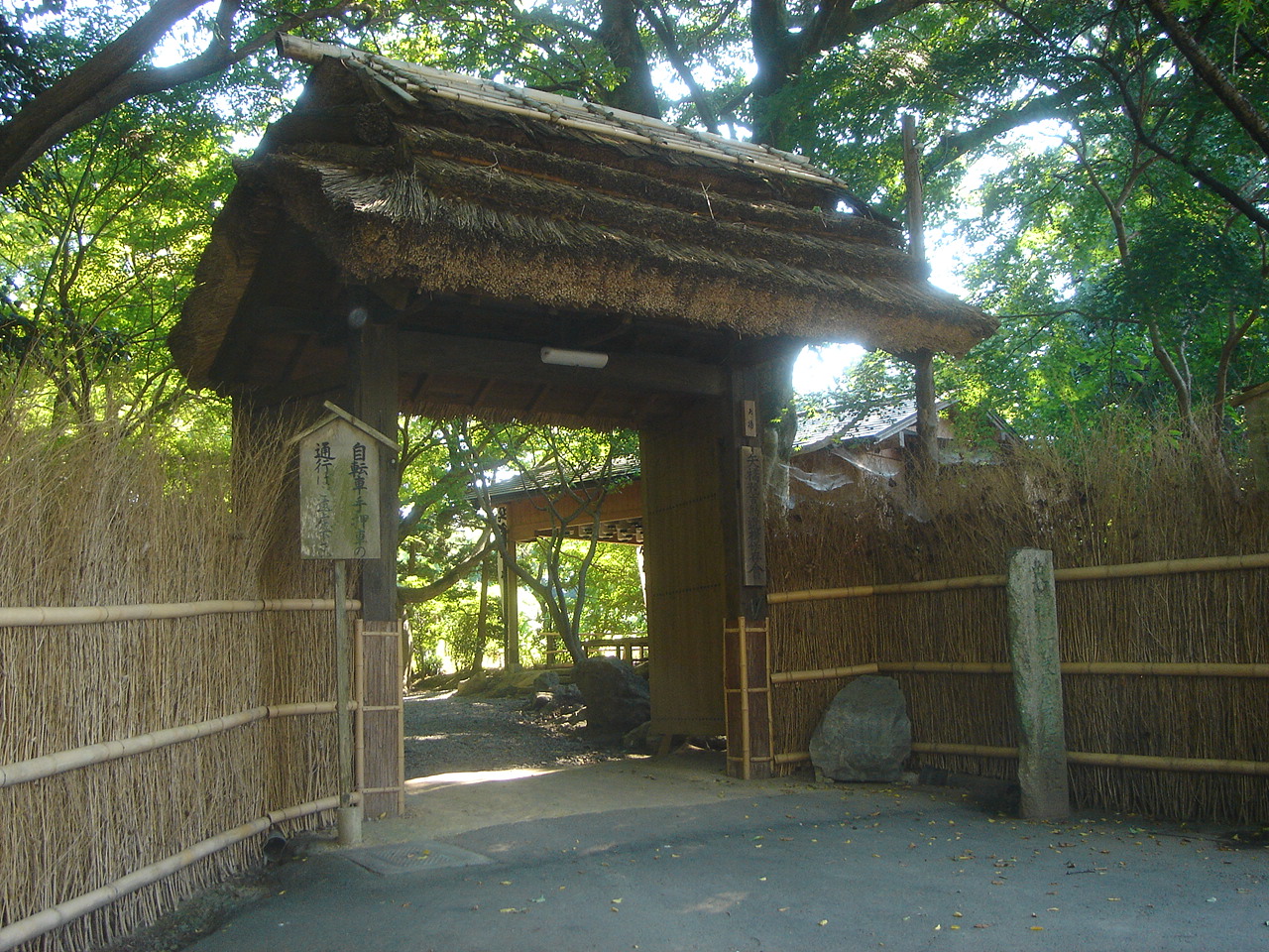
Highlights include Institute of Advanced Media Arts and Sciences, 道の駅 池田温泉, お茶屋屋敷 and 日比野五鳳記念美術館.
Weather in Gōdo
Forecast from MET Norway (CC BY 4.0). Full forecast
About Gōdo
Gōdo (神戸町, Gōdo-chō) is a town located in Gifu, Japan. As of 1 December 2018, the town had an estimated population of 19,361 and a population density of 1000 persons per km2, in 6998 households. The total area of the town was 18.78 square kilometres (7.25 sq mi).
From the Wikipedia article Gōdo, Gifu (this version), under CC BY-SA 4.0.
Things to do4

Institute of Advanced Media Arts and Sciences
School · 3.9 km
Higher education institution in Gifu Prefecture, Japan


Museums and landmarks12




Parks, trails and playgrounds17



5 more on the map.
Restaurants and cafes30


18 more on the map.
History
The area around Gōdo was part of traditional Mino Province, and was the location of a shōen controlled by Enryaku-ji during the Heian and Kamakura periods, During the Edo period, it was mostly controlled by Ōgaki Domain. During the post-Meiji restoration cadastral reforms, the area was organised into Anpachi District, Gifu, and the village of Gōdo was established with the creation of the modern municipalities system on April 1, 1889. Gōdo was raised to town status on August 5, 1892. The town annexed the village of Kita-Hirano on April 1, 1950, and the villages of Shimomiya and Minami-Hirano on April 1, 1954. The town borders expanded on April 1, 1960, by the annexation of the Nishizakura section of the neighboring town Ōno. In 2004, a proposed merger with the neighboring city of Ōgaki was rejected by a referendum.
From the History section of Gōdo, Gifu on Wikipedia, under CC BY-SA 4.0.
Where to stay1
Churches and places of worship49
Shopping11
Gas and EV charging5
Schools, colleges and libraries21
Healthcare16
Map of Gōdo
166 places. The map loads OpenStreetMap tiles when you open it.
Getting there and nearby towns
Gifu Airbase (QGU) is the nearest airport with scheduled flights listed in OpenStreetMap, 25 km away.
- Kurono 6 km northeast, about 6 min by car
- Ōgaki 8 km south, about 8 min by car
- Kitagata 8 km east, about 8 min by car
- Tarui 8 km southwest, about 8 min by car
- Gifu 15 km east, about 15 min by car
- Kasamatsuchō 16 km east, about 16 min by car
- Ichinomiya 22 km southeast, about 22 min by car
- Kakamigahara 24 km east, about 24 min by car
- Inazawa 25 km southeast, about 25 min by car
- Kōnan 26 km east, about 26 min by car
Drive times are estimates from straight-line distance, not routes.
Local news
Headlines from INDB.
Reviews, tips and questions
Loading what members have shared...
Sources and licences
- GeoNames (CC BY 4.0): population, coordinates, regions and time zone
- OpenStreetMap contributors (ODbL 1.0): places, airports, map data
- Wikidata (CC0 1.0): elevation, founding date, time zone, website, landmarks and historic places
- Wikimedia Commons (see each image): photos
- Wikipedia (CC BY-SA 4.0): overview and history text
Photo credits
- Godo Town Hall ac, Asturio Cantabrio, CC BY-SA 4.0
- Ogaki Weman's College2007-1, Monami, CC BY-SA 3.0
- Ogaki Kita Senior High School01, Monami, CC BY-SA 3.0
- Ikeda yawata elementary school, Opqr, CC BY-SA 4.0
- Ikeda elementary school Ikeda Gifu, Alpsdake, CC BY-SA 4.0
- Mizuho nishi elementary school, Opqr, CC BY-SA 4.0
- Ishibiki-Jinja, Metroplex, CC BY-SA 3.0
- Michinoeki IkedaOnsen, アラツク, CC BY-SA 4.0
- Saien-ji temple, Ogaki, 2017, 大野 一将, CC BY-SA 4.0
- Gifu Ono minami elementary school, Opqr, CC BY-SA 4.0
- Anraku-ji temple, Ogaki, 2017, 大野 一将, CC BY-SA 4.0
- Gifu Ikeda Town Library ac, Asturio Cantabrio, CC BY-SA 4.0
- 妙法寺 (大垣市赤坂町), へぼ飯, CC0
- Softpia Japan Workshop 24, Asturio Cantabrio, CC BY-SA 4.0
- 岐阜協立大学校名, 岐阜経済大学企画広報課, CC BY-SA 4.0
- Akasaka-hommachi, Metroplex, CC BY-SA 3.0
- Ono rose garden, Opqr, CC BY-SA 4.0
- Ocyaya-yashiki01, Monami, CC BY-SA 3.0
- Godo town Kita elem-sch, Bakkai, CC BY-SA 3.0
- R417-2020-033, Puchi-masashi, CC BY-SA 4.0
- Hibino goho museum, Opqr, CC BY-SA 4.0
- Ogaki Nakagawa Elementary School, hyolee2, CC BY-SA 4.0
- Itokoni, Pittyu2020, CC BY-SA 4.0
- 日本国岐阜県安八郡神戸町の火祭りと神輿 02, HISASHI UNO, CC BY-SA 4.0
- 日本国岐阜県安八郡神戸町の火祭りと神輿 01, HISASHI UNO, CC BY-SA 4.0
- 菜の花と養老鉄道(Rapeseed blossoms with Yoro Railway) 22 Mar, 2015 - panoramio, Hiroaki Kaneko, CC BY-SA 3.0
- Kitagodo station1, Opqr, CC BY-SA 4.0
- Gifu 20201031115421 (50834183018), inunami, CC BY 2.0
- 金生山 - panoramio, shikabane taro, CC BY 3.0
- ISS030-E-190805 - View of Earth, Earth Science and Remote Sensing Unit , Lyndon B. Johnson Space Center, Public domain
- ISS030-E-184137 - View of Earth, Earth Science and Remote Sensing Unit , Lyndon B. Johnson Space Center, Public domain
- ISS030-E-187369 - View of Earth, Earth Science and Remote Sensing Unit , Lyndon B. Johnson Space Center, Public domain
- ISS030-E-184136 - View of Earth, Earth Science and Remote Sensing Unit , Lyndon B. Johnson Space Center, Public domain
- ISS030-E-187368 - View of Earth, Earth Science and Remote Sensing Unit , Lyndon B. Johnson Space Center, Public domain
- 岐阜県揖斐郡池田町 - panoramio (1), gundam2345, CC BY 3.0
- 曽根城公園 - panoramio, shikabane taro, CC BY 3.0
- 曽根城公園 - panoramio (1), shikabane taro, CC BY 3.0
- 岐阜県大垣市南市橋町 - Panoramio 72602397, gundam2345, CC BY 3.0
- Yoro railway 7712F 20190429 0831, Mkb, CC BY 3.0
- 美濃赤坂 - panoramio, shikabane taro, CC BY 3.0


Page built November 4, 2026. Spotted a mistake? Tell us or suggest a place.