


Takasaka, Japan
高坂村
Takasaka is a town of 15,000 people in Saitama, Japan, founded in April 1, 1889.
Why visit Takasaka
Townapedia lists 27 museums and landmarks, 46 parks and trails, 77 places to eat, 1 place to stay and 2 attractions in and around town.
Highlights include Saitama Children's Zoo, Kagawa Nutrition University, Beatrix Potter Reference Library and Peace Museum of Saitama.
Weather in Takasaka
Forecast from MET Norway (CC BY 4.0). Full forecast
Things to do2


Kagawa Nutrition University
School · 5.4 km
Private university in Japan with campuses in Saitama Prefecture and Tokyo
Museums and landmarks27


Peace Museum of Saitama
Museum · 3.1 km
Museum in Higashimatsuyama, Saitama, Japan

15 more on the map.
Parks, trails and playgrounds46




34 more on the map.
Restaurants and cafes77



65 more on the map.
Where to stay1
Churches and places of worship30
Shopping13
Gas and EV charging5
Schools, colleges and libraries8
Healthcare15
Map of Takasaka
224 places. The map loads OpenStreetMap tiles when you open it.
Getting there and nearby towns
Yokota Air Base (OKO) is the nearest airport with scheduled flights listed in OpenStreetMap, 28 km away.
- Kawagoe 13 km southeast, about 13 min by car
- Kumagaya 15 km north, about 15 min by car
- Fujimino 16 km southeast, about 16 min by car
- Sayama 16 km south, about 16 min by car
- Iruma 20 km south, about 20 min by car
- Tokorozawa 23 km south, about 23 min by car
- Kazo 22 km northeast, about 22 min by car
- Yorii 23 km northwest, about 23 min by car
- Niiza 24 km southeast, about 24 min by car
- Iwatsuki 27 km east, about 27 min by car
Drive times are estimates from straight-line distance, not routes.
Local news
Headlines from INDB.
Reviews, tips and questions
Loading what members have shared...
Sources and licences
- GeoNames (CC BY 4.0): population, coordinates, regions and time zone
- OpenStreetMap contributors (ODbL 1.0): places, airports, map data
- Wikidata (CC0 1.0): elevation, founding date, time zone, website, landmarks and historic places
- Wikimedia Commons (see each image): photos
Photo credits
- Higashimatsuyama Municipal Takasaka Elementary School, M yanagisawa, CC0
- Takasaka Sidetrack Outside The Premises 1, 京浜にけ, CC BY-SA 3.0
- TakasakaSA, M yanagisawa, CC0
- Kagawa Nutrition University (Joshi Eiyō Daigaku), Mj-bird, CC BY-SA 4.0
- Higashimatsuyama Peace Museum Of Saitama 1, 京浜にけ, CC BY-SA 3.0
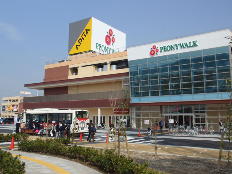
- PEONY-WALK Higashimatsuyama Shopping Center, User:うさもも, CC BY-SA 3.0
- Saitama Prefectural,Sakado High School1, Ebiebi2, CC BY-SA 3.0
- Hakusan J-High School, JunK, Public domain
- Takasaka library, JunK, Public domain
- Kodomo-shizen-zoo, Miyarin, CC BY-SA 3.0
- Yamanobe-bashi, User:うさもも (Usamomo), CC BY-SA 3.0
- Higashimatsuyama Municipal Hakusan Junior High School, Miyarin, CC BY-SA 4.0
- Higashimatsuyama Municipal Sakurayama Elementary School 2019, Miyarin, CC BY-SA 4.0
- ISS050-E-65984 - View of Earth, Earth Science and Remote Sensing Unit , Lyndon B. Johnson Space Center, Public domain
- Capybaras in Saitama Children's Zoo, Doricono, CC BY-SA 3.0
- Beatrix Potter Reference Library, Daito Bunka University - Apr 29, 2023, Nori Norisa, CC BY 2.0
- Semyoujuji Temple, M yanagisawa, CC BY-SA 4.0
- Tobu10030, A3005 This photo was taken with Canon EOS 550D, CC BY-SA 4.0
- Life Garden HigashiMatsuyama, M yanagisawa, CC BY-SA 4.0
- Sakado Shimada Bridge 3, 京浜にけ at Japanese Wikipedia This photo was taken with Canon PowerShot G9, CC BY-SA 3.0
- Sakado Shimada Bridge 2, 京浜にけ at Japanese Wikipedia This photo was taken with Canon PowerShot G9, CC BY-SA 3.0
- 島田橋倒壊現場 - panoramio, 赤カメラ, CC BY 3.0
- 千年谷公園, EastPineHill, CC BY-SA 4.0
- ぽつねんと大きな桜 - panoramio, heriheri, CC BY 3.0
- Kan-Etsu EXPWY seen from Kuzubukuro BRG 2, M yanagisawa, CC0
- こっそりと桜 - panoramio, heriheri, CC BY 3.0
- 高坂ダブルクリームパン (53812718346), Nori Norisa from 熊谷市, Japan, CC BY 2.0
- 野本村道路元標周辺 - panoramio, fum3670045, CC BY 3.0
- 野本村道路元標 - panoramio, fum3670045, CC BY 3.0
- Capybaras in Saitama Children's Zoo (cropped), Doricono, CC BY-SA 3.0


Page built November 5, 2026. Spotted a mistake? Tell us or suggest a place.