


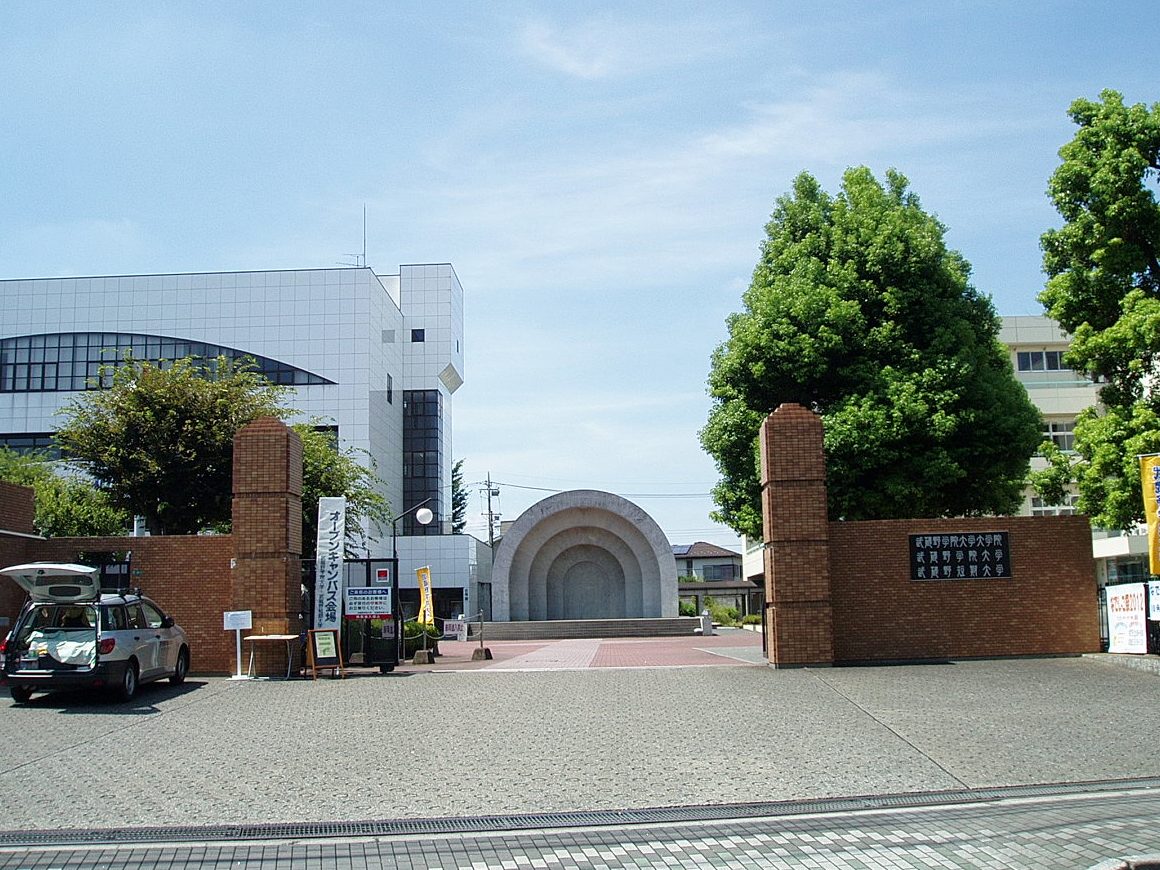


Hidaka, Japan
日高市
Hidaka is a town of 55,294 people in Saitama, Japan, founded in February 11, 1955.
Why visit Hidaka
Townapedia lists 10 museums and landmarks, 157 parks and trails, 188 places to eat, 2 places to stay and 14 attractions in and around town.
Highlights include Bunri University of Hospitality, Kagawa Nutrition University, Koma Village Stone Age Dwelling Site and Kasumigaseki Country Club.
Weather in Hidaka
Forecast from MET Norway (CC BY 4.0). Full forecast
About Hidaka
Hidaka (日高市, Hidaka-shi; Japanese pronunciation: [çí.dä̀.kä̀, çì.dä́.kä́.ɕì]) is a city located in Saitama Prefecture, Japan. As of 1 January 2021, the city had an estimated population of 55,294 in 24,328 households and a population density of 1200 persons per km2. The total area of the city is 47.48 square kilometres (18.33 sq mi).
From the Wikipedia article Hidaka, Saitama (this version), under CC BY-SA 4.0.
Things to do14

Bunri University of Hospitality
School · 5.2 km
Higher education institution in Saitama Prefecture, Japan

Kagawa Nutrition University
School · 5.9 km
Private university in Japan with campuses in Saitama Prefecture and Tokyo
Musashino Gakuin University
School · 5.9 km
Higher education institution in Saitama Prefecture, Japan

Nihon Institute of Medical Science
School · 2.4 km
Higher education institution in Saitama Prefecture, Japan

Saitama Medical University
School · 5.7 km
Higher education institution in Saitama Prefecture, Japan

Saitama Medical University College
School · 5.7 km
Higher education institution in Saitama Prefecture, Japan

Tokyo International University
School · 6.9 km
Private university in Tokyo, Japan


2 more on the map.
Museums and landmarks10

Koma Village Stone Age Dwelling Site
Monument and historic site · 6.4 km
Archaeological site in Hidaka, Japan


Parks, trails and playgrounds157





145 more on the map.
Restaurants and cafes188


ZaZa
Restaurant · Italian · 3.6 km
Mo-Th 11:00-22:00; Fr 11:00-22:30; Sa 10:30-22:30; Su,PH 10:30-22:00
176 more on the map.
History
The area of modern-day Hidaka was part of ancient Koma District, Musashi Province, mentioned in records dating from 716 AD as a place of resettlement for refugees from the Tang invasion of the Kingdom of Goguryeo on the Korean Peninsula in 668 AD. During the Edo period, the area developed as Takahagi-shuku, a post station on the Nikkō Wakiōkan highway linking Edo with Nikkō. The three villages of Komagawa, Koma and Takahagi were established within Koma District with the establishment of the modern municipalities system on April 1, 1889. In 1896 Koma District was abolished, becoming part of Iruma District. On February 11, 1955, Komagawa and Koma merged to create the town of Hidaka. Takahagi joined Hidaka on September 20, 1956. Hidaka was elevated to city status on October 1, 1991.
From the History section of Hidaka, Saitama on Wikipedia, under CC BY-SA 4.0.
Where to stay2
Churches and places of worship65
Shopping40
Gas and EV charging14
Schools, colleges and libraries51
Healthcare46
Map of Hidaka
250 places. The map loads OpenStreetMap tiles when you open it.
Getting there and nearby towns
Yokota Air Base (OKO) is the nearest airport with scheduled flights listed in OpenStreetMap, 19 km away.
- Sayama 8 km southeast, about 8 min by car
- Hannō 8 km southwest, about 8 min by car
- Ogose 8 km northwest, about 8 min by car
- Takasaka 10 km north, about 10 min by car
- Kawagoe 11 km east, about 11 min by car
- Iruma 11 km south, about 11 min by car
- Igusa 11 km northeast, about 11 min by car
- Fujimino 15 km east, about 15 min by car
- Kamifukuoka 14 km east, about 14 min by car
- Tokorozawa 16 km southeast, about 16 min by car
Drive times are estimates from straight-line distance, not routes.
Local news
Headlines from INDB.
Reviews, tips and questions
Loading what members have shared...
Sources and licences
- GeoNames (CC BY 4.0): population, coordinates, regions and time zone
- OpenStreetMap contributors (ODbL 1.0): places, airports, map data
- Wikidata (CC0 1.0): elevation, founding date, time zone, website, landmarks and historic places
- Wikimedia Commons (see each image): photos
- Wikipedia (CC BY-SA 4.0): overview and history text
Photo credits
- Hidaka city office, nattou, Public domain
- Bunri University of Hospitality, Abasaa, Public domain
- Kagawa Nutrition University (Joshi Eiyō Daigaku), Mj-bird, CC BY-SA 4.0
- Musashino-Gakuin-Univ-MainGate01, Hasec, CC0
- Nihon Institute of Medical Science, Nyao148, CC BY-SA 4.0
- Shobi-Univ-20120901, Hasec, CC0
- Tokyo International University campus1, TIU kouhou, CC BY-SA 3.0
- Hidaka Saitama Koma Vill Stone Age Dwelling Site 2, 京浜にけ, CC BY-SA 3.0
- Hidaka Saitama Koma Shrine Shinmon 1, 京浜にけ, CC BY-SA 3.0
- JosaiKioi, Unknown author, CC BY-SA 2.5
- Saitama Prefectural Sakado West High School, M yanagisawa, CC BY 3.0
- Kawagoe West High School, M yanagisawa, CC BY 3.0
- Saitama Pref. Hidaka Highschool, Waka77, CC0
- Tsurugashima Seifu High School, M yanagisawa, CC BY 3.0
- 智光山公園 - panoramio, 高橋文武, CC BY 3.0
- Saitama-medical-center 1, Ebiebi2, CC0
- Sakado campus, Josai koho, CC BY-SA 4.0
- Tikozan Park, ミラー・ハイト, CC BY-SA 4.0
- 埼玉医科大学日高キャンパス, 氷山楊汰, CC BY-SA 3.0
- Meikai University Sakado Campus 20090204, DAJF, CC BY-SA 3.0
- Saitama-Women's-Junior-College-2015080101, Hasec, CC0
- Westbighouse 1, Misodengaku, Public domain
- Musashi-Takahagi Station north entrance 20120803, 京浜にけ at Japanese Wikipedia (Keihin-nike) This photo was taken with Canon PowerShot G9, CC BY-SA 3.0
- Nishi-Oya Junction 20130726 (1), DAJF, CC BY-SA 3.0
- Nishi-Oya Junction 20130726 (2), DAJF, CC BY-SA 3.0
- Morido, Sakado, Saitama Prefecture 350-0244, Japan - panoramio (2), 赤カメラ, CC BY 3.0
- Morido, Sakado, Saitama Prefecture 350-0244, Japan - panoramio (1), 赤カメラ, CC BY 3.0
- Morido, Sakado, Saitama Prefecture 350-0244, Japan - panoramio, 赤カメラ, CC BY 3.0
- Tobu 8000 Ipponmatsu 20080524, DAJF, CC BY-SA 3.0
- Tobu 8000 81111 Ippommatsu Station 20160506, DAJF, CC BY-SA 4.0
- Ippommatsu 20111102, DAJF, CC BY-SA 3.0
- Ippommatsu Station south side 20140414, DAJF, CC BY-SA 3.0
- Tobu-railway-TJ43-Kawakado-station-building-20201114-105402, LERK, CC BY-SA 4.0
- Tobu-railway-8197F-20201114-113524, LERK, CC BY-SA 4.0
- Tobu-railway-TJ43-Kawakado-station-platform-20201114-113023, LERK, CC BY-SA 4.0
- Ipponmatsu 20000827, DAJF, CC BY-SA 3.0
- Tobu-railway-ogose-line-Ippommatsu-station-platform, LERK, CC BY 3.0
- Ippommatsu Station level crossing 20140414, DAJF, CC BY-SA 3.0
- Ippommatsu sta, Filler, CC BY-SA 3.0
- Ippommatsu Station 20140125, DAJF, CC BY-SA 3.0


Page built November 5, 2026. Spotted a mistake? Tell us or suggest a place.