


Higashimurayama, Japan
東村山市
Higashimurayama is a town of 151,815 people in Tokyo, Japan, founded in April 1, 1889.
Why visit Higashimurayama
Townapedia lists 19 museums and landmarks, 118 parks and trails, 202 places to eat, 2 places to stay and 13 attractions in and around town.
Highlights include ルネこだいら, Japan College of Social Work, Edo-Tokyo Open Air Architectural Museum and Kodaira Hirakushi Denchu Art Museum.
Weather in Higashimurayama
Forecast from MET Norway (CC BY 4.0). Full forecast
About Higashimurayama
Higashimurayama (東村山市, Higashi-murayama-shi) is a city located in the western portion of the Tokyo Metropolis, Japan. As of 1 March 2021, the city had an estimated population of 148,275, and a population density of 8700 persons per km2. The total area of the city is 17.14 square kilometres (6.62 sq mi).
From the Wikipedia article Higashimurayama, Tokyo (this version), under CC BY-SA 4.0.
Things to do13


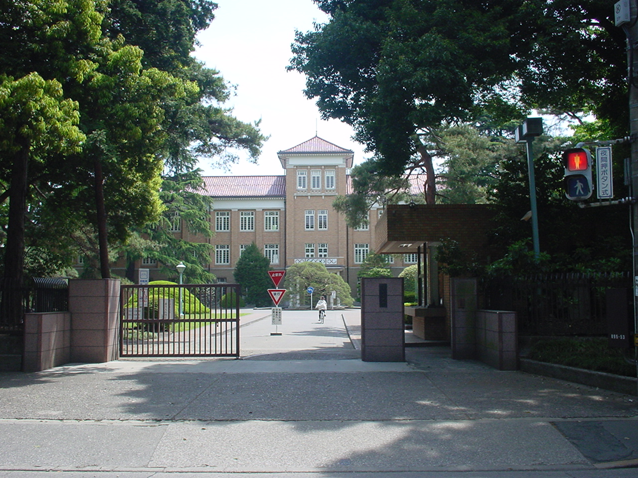
Japan College of Social Work
School · 3.7 km
Private university in Tokyo, Japan

Kunitachi College of Music
School · 5.7 km
Private University in Tokyo

Meiji Pharmaceutical University
School · 4.6 km
Private university in Kiyose, Tokyo, Japan

Musashino Art University
School · 3.7 km
University in Kodaira, western Tokyo

Seibu-en
Monument and historic site · 2.8 km
Amusement park in Tokorozawa, Japan




1 more on the map.
Museums and landmarks19


Kodaira Hirakushi Denchu Art Museum
Museum · 4.1 km
Art museum in Tokyo, Japan

Suzuki Site
Monument and historic site · 4.7 km
Archaeological site in Kodaira, Japan


7 more on the map.
Parks, trails and playgrounds118


Higashikurumeshi Chikurin Park
Park · 5.9 km
Park in Higashikurume, Japan


Tokorozawa Aviation Memorial Park
Park · 4.9 km
Park in Tokorozawa, Saitama Prefecture, Japan




106 more on the map.
Restaurants and cafes202




みんなの酒場 らんらん
Restaurant · Oriental · 0.9 km
栄町1-11-60
We-Su 17:00-22:00

190 more on the map.
History
The area of present-day Higashimurayama has been inhabited since Japanese Paleolithic times, and numerous remains from the Jōmon, Yayoi and Kofun periods have been discovered. During the Nara period, it became part of ancient Musashi Province. During the Kamakura period, it was the location of the Battle of Kumegawa in 1333.
In the post-Meiji Restoration cadastral reform of April 1, 1889, several villages merged to form Higashimurayama Village in Kitatama District, at that time part of Kanagawa Prefecture. The entire district was transferred to the control of Tokyo Prefecture(東京府) on April 1, 1893. On April 1, 1942, Higashimurayama Village became the town of Higashimurayama. On April 1, 1964, Higashimurayama was elevated to city status.
From the History section of Higashimurayama, Tokyo on Wikipedia, under CC BY-SA 4.0.
Where to stay2
Churches and places of worship39
Shopping58
Gas and EV charging8
Schools, colleges and libraries63
Healthcare68
Map of Higashimurayama
250 places. The map loads OpenStreetMap tiles when you open it.
Getting there and nearby towns
Yokota Air Base (OKO) is the nearest airport with scheduled flights listed in OpenStreetMap, 11 km away.
- Tokorozawa 5 km north, about 5 min by car
- Kokubunji 6 km south, about 6 min by car
- Nishi-Tokyo-shi 7 km southeast, about 7 min by car
- Akishima 9 km southwest, about 9 min by car
- Musashino 10 km southeast, about 10 min by car
- Niiza 11 km northeast, about 11 min by car
- Sayama 12 km northwest, about 12 min by car
- Asaka 13 km northeast, about 13 min by car
- Hachiōji 17 km southwest, about 17 min by car
- Kawagoe 17 km north, about 17 min by car
Drive times are estimates from straight-line distance, not routes.
Local news
Headlines from INDB.
Reviews, tips and questions
Loading what members have shared...
Sources and licences
- GeoNames (CC BY 4.0): population, coordinates, regions and time zone
- OpenStreetMap contributors (ODbL 1.0): places, airports, map data
- Wikidata (CC0 1.0): elevation, founding date, time zone, website, landmarks and historic places
- Wikimedia Commons (see each image): photos
- Wikipedia (CC BY-SA 4.0): overview and history text
Photo credits
- Higashimurayama city hall, Altomarina, CC BY-SA 3.0
- Yasaka shrine Higashimurayama Tokyo, Mizushimasea, CC BY-SA 4.0
- Karahori river Higashimurayama Tokyo, Mizushimasea, CC BY-SA 4.0
- Higashimurayama Tax Office, Suikotei, CC BY 4.0
- Higashimurayama Station West 2009, Yasu ( talk ), CC BY-SA 3.0
- KamakuraKaido-Higashimurayama-Northward-2025, Bryanmackinnon, CC BY 4.0
- Tokyo Metropolitan Higashimurayama High School, Yasu ( talk ), CC BY-SA 3.0
- Higashimurayama Police station Yasaka Koban, Suikotei, CC BY 4.0
- Higashimurayama Furusato Museum (1) 2023-09-10, Asanagi, CC0
- Kunitachiondai2, The original uploader was Hykw-a4 at Japanese Wikipedia ., CC BY-SA 3.0
- Meiji Pharmaceutical University, Nyao148, CC BY-SA 3.0
- Musashino Art University, The original uploader was Hykw-a4 at Japanese Wikipedia ., CC BY-SA 3.0
- Tokyokeizaiuniv, Original uploader was Hykw-a4 at ja.wikipedia, CC BY-SA 3.0
- Tsudajukuuniv, The original uploader was Hykw-a4 at Japanese Wikipedia ., CC BY-SA 3.0
- Entrance of the Edo-Tokyo Open Air Architectural Museum, Fumiya Fujihara, CC BY 2.0
- Kodaira Hirakushi Denchu Art Museum front, Calton, CC BY-SA 4.0
- Suzuki Remains Museum, Nyao148, CC BY-SA 3.0
- Chikurin Park in Higashikurume-shi (50547377101), Mikhail Kotykhov from Tokyo, Japan, CC BY 2.0
- Koganei-Park, Itasan, CC BY 3.0
- Tokorozawa Aviation Commemorative Park, Abasaa, Public domain
- Tonogayato1, Irina Gelbukh, CC BY-SA 3.0
- Seibuen Amusement Park (11152952796), Tomohiro Ohtake from Kawasaki, Japan, CC BY 2.0
- Hatogamine-Hachiman-Shrine-Main-Hall, User:Bryan MacKinnon, CC BY-SA 4.0
- Shofukuji Jizo Hall Left Front, Bryanmackinnon, Public domain
- Tama Zenshoen Sanatorium gate, photo: Qurren ( talk ) Taken with Canon PowerShot G9 X, CC BY-SA 3.0
- Kitayama Park Iris Garden, Yasu, CC BY-SA 3.0
- Seibuenvelodrome, DS80s at Japanese Wikipedia, CC BY-SA 3.0
- Nanryô-chû-seimon, eien20, CC BY-SA 4.0
- Sayama Park, Higashiyamato, Tokyo, Japan, User: (WT-shared) Shoestring at wts wikivoyage, CC BY-SA 4.0
- Kodaira Sinmeigu-9, 江戸村のとくぞう, CC BY-SA 4.0
- Tokuzo-ji main gate 2023-09-10, Asanagi, CC0
- Baigan-ji main gate (1) 2023-09-10, Asanagi, CC0
- Heian-in, Kodaira 202409-1, 運動会プロテインパワー, CC BY-SA 4.0
- 西武園競輪場 No3, DS80s at Japanese Wikipedia, CC BY-SA 3.0
- Seibuen Yuenchi Entrance 2021, Kaze315, CC BY-SA 4.0
- Itoen Kagurazaka building, Mochizuki1018, CC BY 4.0
- 東村山市青葉町 全盛園前信号 20260218, Mikagekawase, CC BY 4.0
- Runekodaira, Hiroaki Arai, CC BY-SA 4.0
- Hatomine-Hachiman-jinja entrance 2024-07-28, Asanagi, CC0
- Siraumegakuen, The original uploader was Hykw-a4 at Japanese Wikipedia ., CC BY-SA 3.0
- Hachikokuyama Taiken no Sato 2023-09-10, Asanagi, CC0


Page built November 4, 2026. Spotted a mistake? Tell us or suggest a place.