


Sayama, Japan
狭山市
Sayama is a town of 160,843 people in Saitama, Japan, founded in July 1, 1954.
Why visit Sayama
Townapedia lists 8 museums and landmarks, 101 parks and trails, 247 places to eat, 5 places to stay and 9 attractions in and around town.
Highlights include Bunri University of Hospitality, Musashino Gakuin University, Sayama City Museum and Tokorozawa Aviation Memorial Park.
Weather in Sayama
Forecast from MET Norway (CC BY 4.0). Full forecast
About Sayama
Sayama (狭山市, Sayama-shi) is a city located in Saitama Prefecture, Japan. As of 1 January 2021, the city had an estimated population of 149,826 in 69,859 households and a population density of 3100 persons per km2. The total area of the city is 45.51 square kilometres (17.57 sq mi).
From the Wikipedia article Sayama (this version), under CC BY-SA 4.0.
Things to do9

Bunri University of Hospitality
School · 8.2 km
Higher education institution in Saitama Prefecture, Japan
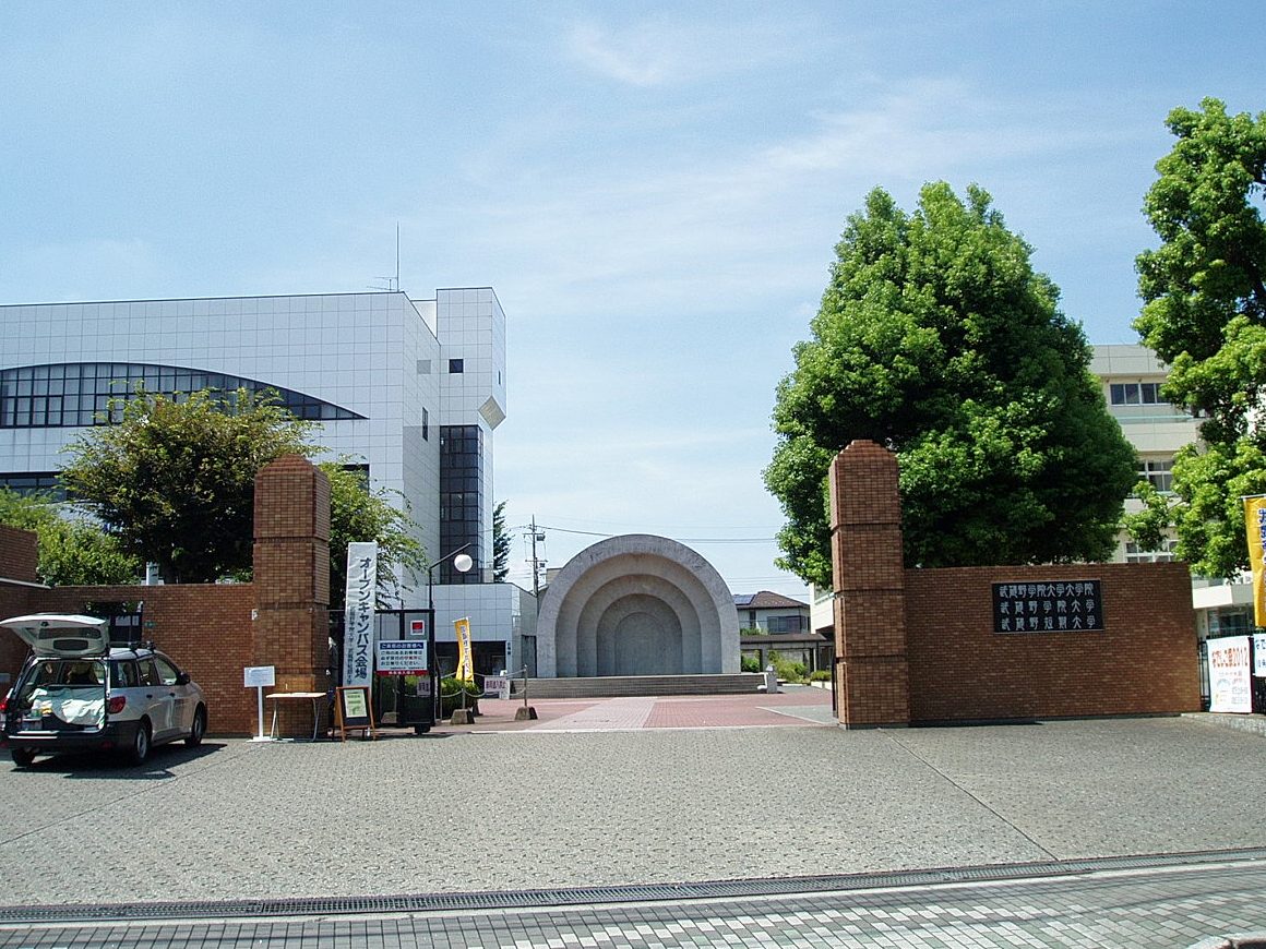
Musashino Gakuin University
School · 2.8 km
Higher education institution in Saitama Prefecture, Japan


Surugadai University
School · 7.4 km
University in Hannō, Saitama, Japan

Tokyo International University
School · 8.5 km
Private university in Tokyo, Japan



Museums and landmarks8



Parks, trails and playgrounds101

Tokorozawa Aviation Memorial Park
Park · 8.3 km
Park in Tokorozawa, Saitama Prefecture, Japan



89 more on the map.
Restaurants and cafes247





235 more on the map.
History
During the Kamakura period, the area developed as a post station on the Kamakura Kaidō highway, as the dividing point on the routes to Kōzuke Province and Shimotsuke Province.
The town of Irumagawa was established within Iruma District with the establishment of the modern municipalities system on April 1, 1889. On July 1, 1954, Irumagawa merged with the neighboring villages of Mizutomi, Kashiwahara, Okutomi, Hirokane, and Irima to create the city of Sayama.
The city was the location of the Sayama Incident, a 1963 murder and trial which resulted in the false accusation and conviction of an innocent man, a member of the Burakumin minority group, of murder.
From the History section of Sayama on Wikipedia, under CC BY-SA 4.0.
Where to stay5
Churches and places of worship53
Shopping42
Gas and EV charging11
Schools, colleges and libraries48
Healthcare48
Map of Sayama
250 places. The map loads OpenStreetMap tiles when you open it.
Getting there and nearby towns
Yokota Air Base (OKO) is the nearest airport with scheduled flights listed in OpenStreetMap, 13 km away.
- Tokorozawa 8 km southeast, about 8 min by car
- Kawagoe 9 km northeast, about 9 min by car
- Ōme 17 km southwest, about 17 min by car
- Kokubunji 18 km south, about 18 min by car
- Nishi-Tokyo-shi 18 km southeast, about 18 min by car
- Asaka 18 km east, about 18 min by car
- Musashino 21 km southeast, about 21 min by car
- Hachiōji 23 km south, about 23 min by car
- Kawaguchi 27 km east, about 27 min by car
- Tokyo 31 km southeast, about 31 min by car
Drive times are estimates from straight-line distance, not routes.
Local news
Headlines from INDB.
Reviews, tips and questions
Loading what members have shared...
Sources and licences
- GeoNames (CC BY 4.0): population, coordinates, regions and time zone
- OpenStreetMap contributors (ODbL 1.0): places, airports, map data
- Wikidata (CC0 1.0): elevation, founding date, time zone, website, landmarks and historic places
- Wikimedia Commons (see each image): photos
- Wikipedia (CC BY-SA 4.0): overview and history text
Photo credits
- Sayama shi Station-2010.3.25 1, Syohei Arai, CC BY-SA 4.0
- Sayama shi Station-2010.3.25 3, Syohei Arai, CC BY-SA 4.0
- Sayama shi Station-2010.3.25 2, Syohei Arai, CC BY-SA 4.0
- Sayama shi Station-2010.3.11, Syohei Arai This photo was taken with Canon PowerShot S5 IS, CC BY-SA 4.0
- Sayamashi Station - SkyTerrace, tokorokoko, CC BY-SA 3.0
- Hanno Shinkin Bank Sayama Branch & Shin-Sayama Branch 02, Suikotei, CC BY 4.0
- Route 16 at Sayama 2023-11-19, Asanagi, CC0
- Bunri University of Hospitality, Abasaa, Public domain
- Musashino-Gakuin-Univ-MainGate01, Hasec, CC0
- Shobi-Univ-20120901, Hasec, CC0
- Tokyo International University campus1, TIU kouhou, CC BY-SA 3.0
- Tokorozawa Aviation Commemorative Park, Abasaa, Public domain
- Sayama Hospital 1, Ebiebi2, CC BY-SA 3.0
- Iruma Koyo High School, Abasaa, Public domain
- Sayama Seiryou High School, M yanagisawa, CC BY 3.0
- SayamaKeizaiHS, 杉山真大, CC BY-SA 4.0
- Hirose jinja shrine, MasakiTomasawa, CC BY-SA 3.0
- Atago Shrine Iruma, Olivia Sciuto, CC BY-SA 4.0
- Sayama-City-Museum, Nyao148, CC BY-SA 3.0
- Chuka soba aoba nakano head store 2015, Kentin, CC BY-SA 4.0
- 埼玉石心会病院, 石心会, CC BY-SA 4.0
- JASDF Ambulance Buse (Mitsubishi Fuso Rosa, 48-3004) right front view at Iruma Air Base November 3, 2025 03, Hunini, CC BY-SA 4.0
- JASDF Ambulance Buse (Mitsubishi Fuso Rosa, 48-3004) right side view at Iruma Air Base November 3, 2025, Hunini, CC BY-SA 4.0
- Seibu 20000 series Inside Tc20101 20231125-20231125 155217, SEMISAYAMASHI, CC BY-SA 4.0
- Seibu 2000 series lintel cover MC2419 No2 20241122-DSC 0122, SEMISAYAMASHI, CC BY-SA 4.0
- Tokurin-ji in Saitama, ミラー・ハイト, CC BY-SA 4.0
- JASDF RC-2 (18-1202) taxiing at Iruma Air Base April 21, 2023 09, Hunini, CC BY-SA 4.0
- JASDF RC-2 (18-1202) taxiing at Iruma Air Base April 21, 2023 08, Hunini, CC BY-SA 4.0
- JASDF RC-2 (18-1202) taxiing at Iruma Air Base April 21, 2023 04, Hunini, CC BY-SA 4.0
- JASDF RC-2 (18-1202) taxiing at Iruma Air Base April 21, 2023 06, Hunini, CC BY-SA 4.0
- JASDF RC-2 (18-1202) taxiing at Iruma Air Base April 21, 2023 07, Hunini, CC BY-SA 4.0
- JASDF RC-2 (18-1202) taxiing at Iruma Air Base April 21, 2023 05, Hunini, CC BY-SA 4.0
- JASDF RC-2 (18-1202) taxiing at Iruma Air Base April 21, 2023 02, Hunini, CC BY-SA 4.0
- JASDF RC-2 (18-1202) taxiing at Iruma Air Base April 21, 2023 01, Hunini, CC BY-SA 4.0
- JASDF RC-2 (18-1202) taxiing at Iruma Air Base April 21, 2023 03, Hunini, CC BY-SA 4.0
- Runway of the Air Base 入間基地滑走路 - panoramio, AMANO Jun-ichi, CC BY 3.0
- Air Show at Iruma Air Base 2012 - Blue Impulse (8165387495), Takashi Hososhima from Tokyo, Japan, CC BY-SA 2.0
- Air Show at Iruma Air Base 2012 - Blue Impulse (8170704459), Takashi Hososhima from Tokyo, Japan, CC BY-SA 2.0
- Air Show at Iruma Air Base 2012 - A helicopter looking up the sky (8162635402), Takashi Hososhima from Tokyo, Japan, CC BY-SA 2.0
- Air Show at Iruma Air Base 2012 - Blue Impulse (8165421222), Takashi Hososhima from Tokyo, Japan, CC BY-SA 2.0


Page built November 4, 2026. Spotted a mistake? Tell us or suggest a place.