
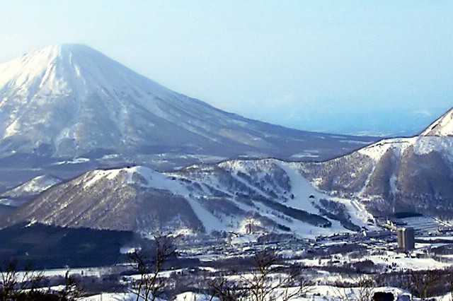


Kyōgoku, Japan
京極町
Kyōgoku is a town of 2,941 people in Hokkaido, Japan, founded in April 1, 1910.
Why visit Kyōgoku
Townapedia lists 25 museums and landmarks, 28 parks and trails, 10 places to eat, 10 places to stay and 15 attractions in and around town.
Highlights include Satonoeki Hot Kimobetsu, Rusutsu Resort and ふきだし公園.
Weather in Kyōgoku
Forecast from MET Norway (CC BY 4.0). Full forecast
About Kyōgoku
Kyōgoku (京極町, Kyōgoku-chō) is a town located in Shiribeshi Subprefecture, Hokkaido, Japan. Kyōgoku sits at the eastern foot of Mount Yōtei, an active stratovolcano volcano which dominates the skyline of the town.
From the Wikipedia article Kyōgoku, Hokkaido (this version), under CC BY-SA 4.0.
Things to do15

Satonoeki Hot Kimobetsu
Farm and orchard · 8.1 km
営業時間 10:00~16:00(月により変動あり),定休日 無休(冬季は不定休)
3, 喜茂別町
Mo-Su 10:00-16:00
Rusutsu Resort
Ski area · 12.6 km
Resort in Rusutsu, Hokkaido Prefecture, Japan



3 more on the map.
Museums and landmarks25


13 more on the map.
Parks, trails and playgrounds28






16 more on the map.
Restaurants and cafes10



History
Kyōgoku was first settled by the Japanese in 1897. Takanori Kyōgoku (1858–1928) was a former noble of the Kyōgoku clan and head of the Marugame Domain, Sanuki Province in present-day Kagawa Prefecture, Shikoku. Kyōgoku was given permission to set up an agricultural operation in the area, as part of Kutchan.
1898, 1899, 1900 - Three waves of settlement from Ishikawa Prefecture and Toyama Prefecture
1910 - With a population of 6,783, the new settlement becomes a separate village called Higashikutchan.
From the History section of Kyōgoku, Hokkaido on Wikipedia, under CC BY-SA 4.0.
Where to stay10
Churches and places of worship21
Shopping1
Gas and EV charging2
Schools, colleges and libraries5
Healthcare2
Map of Kyōgoku
119 places. The map loads OpenStreetMap tiles when you open it.
Getting there and nearby towns
Sapporo Okadama Airport (OKD) is the nearest airport with scheduled flights listed in OpenStreetMap, 48 km away.
- Kutchan 14 km west, about 14 min by car
- Makkari 14 km southwest, about 14 min by car
- Rusutsu 15 km south, about 15 min by car
- Rankoshimachi 30 km west, about 30 min by car
- Niki 34 km north, about 34 min by car
- Yoichi 39 km north, about 39 min by car
- Sapporo 43 km northeast, about 43 min by car
- Date 44 km south, about 44 min by car
- Shiraoi 50 km southeast, about 50 min by car
- Noboribetsu 51 km southeast, about 51 min by car
Drive times are estimates from straight-line distance, not routes.
Local news
Headlines from INDB.
Reviews, tips and questions
Loading what members have shared...
Sources and licences
- GeoNames (CC BY 4.0): population, coordinates, regions and time zone
- OpenStreetMap contributors (ODbL 1.0): places, airports, map data
- Wikidata (CC0 1.0): elevation, founding date, time zone, website, landmarks and historic places
- Wikimedia Commons (see each image): photos
- Wikipedia (CC BY-SA 4.0): overview and history text
Photo credits
- Rusutsu WestMt(200703), E-190, CC BY-SA 3.0
- 130922 Mount Shiribetsu-dake Hokkaido Japan01s5, 663highland, CC BY 2.5
- Kyogoku, Fukidashi Park 2024, ブルーノ・プラス, CC BY 4.0
- Kutchan Town Higashi Elementary School, 禁樹なずな, CC BY-SA 4.0
- Kyogoku spa 2011, Soica2001 ( talk ), Public domain
- 噴き出し公園(Spring water park) - panoramio, pakku, CC BY 3.0
- Michinoeki Meisui no Sto Kyogoku, Him56, CC BY-SA 3.0
- Snow poles in Japan (3214982785), MiNe, CC BY 2.0
- 20181105 Fukidashi 4690 (48428928147), Ray Swi-hymn from Sijhih-Taipei, Taiwan, CC BY-SA 2.0
- 20181105 Fukidashi 7431 (48428903512), Ray Swi-hymn from Sijhih-Taipei, Taiwan, CC BY-SA 2.0
- 20181105 Fukidashi 4691 (48428926832), Ray Swi-hymn from Sijhih-Taipei, Taiwan, CC BY-SA 2.0
- 20181105 Fukidashi 4645 (48428979532), Ray Swi-hymn from Sijhih-Taipei, Taiwan, CC BY-SA 2.0
- 20181105 Fukidashi 4644 (48428980517), Ray Swi-hymn from Sijhih-Taipei, Taiwan, CC BY-SA 2.0
- 20181105 Fukidashi 4692 (48428781731), Ray Swi-hymn from Sijhih-Taipei, Taiwan, CC BY-SA 2.0
- 20181105 Fukidashi 4693 (48428924497), Ray Swi-hymn from Sijhih-Taipei, Taiwan, CC BY-SA 2.0
- 20181105 Fukidashi 4646 (48428978562), Ray Swi-hymn from Sijhih-Taipei, Taiwan, CC BY-SA 2.0
- 20181105 Fukidashi 4694 (48428779231), Ray Swi-hymn from Sijhih-Taipei, Taiwan, CC BY-SA 2.0
- 20181105 Fukidashi 4647 (48428977727), Ray Swi-hymn from Sijhih-Taipei, Taiwan, CC BY-SA 2.0
- 20181105 Fukidashi 4695 (48428778026), Ray Swi-hymn from Sijhih-Taipei, Taiwan, CC BY-SA 2.0
- 20181105 Fukidashi 4705 (48428909787), Ray Swi-hymn from Sijhih-Taipei, Taiwan, CC BY-SA 2.0
- 20181105 Fukidashi 4704 (48428911042), Ray Swi-hymn from Sijhih-Taipei, Taiwan, CC BY-SA 2.0
- 20181105 Fukidashi 4699 (48428916457), Ray Swi-hymn from Sijhih-Taipei, Taiwan, CC BY-SA 2.0
- 20181105 Fukidashi 4700 (48428915142), Ray Swi-hymn from Sijhih-Taipei, Taiwan, CC BY-SA 2.0
- 20181105 Fukidashi 4702 (48428913172), Ray Swi-hymn from Sijhih-Taipei, Taiwan, CC BY-SA 2.0
- 20181105 Fukidashi 4703 (48428912212), Ray Swi-hymn from Sijhih-Taipei, Taiwan, CC BY-SA 2.0
- 20181105 Fukidashi 4701 (48428913977), Ray Swi-hymn from Sijhih-Taipei, Taiwan, CC BY-SA 2.0
- 20181105 Fukidashi 7413 (48428904607), Ray Swi-hymn from Sijhih-Taipei, Taiwan, CC BY-SA 2.0
- 20181105 Fukidashi 7412 (48428761611), Ray Swi-hymn from Sijhih-Taipei, Taiwan, CC BY-SA 2.0
- 20181105 Fukidashi 4696 (48428776456), Ray Swi-hymn from Sijhih-Taipei, Taiwan, CC BY-SA 2.0
- 20181105 Fukidashi 4697 (48428919072), Ray Swi-hymn from Sijhih-Taipei, Taiwan, CC BY-SA 2.0
- 20181105 Fukidashi 4698 (48428917777), Ray Swi-hymn from Sijhih-Taipei, Taiwan, CC BY-SA 2.0
- 20181105 Fukidashi 4648 (48428832016), Ray Swi-hymn from Sijhih-Taipei, Taiwan, CC BY-SA 2.0
- 20181105 YoteiHwy 4643 (48428747486), Ray Swi-hymn from Sijhih-Taipei, Taiwan, CC BY-SA 2.0
- 20181105 Fukidashi 4649 (48428975552), Ray Swi-hymn from Sijhih-Taipei, Taiwan, CC BY-SA 2.0
- Fukidashi Park 名水公園 - panoramio (2), lienyuan lee, CC BY 3.0
- Fukidashi Park 名水公園 - panoramio (1), lienyuan lee, CC BY 3.0
- 20181105 Fukidashi 4650 (48428974217), Ray Swi-hymn from Sijhih-Taipei, Taiwan, CC BY-SA 2.0
- 20181105 Fukidashi 4688 (48428786661), Ray Swi-hymn from Sijhih-Taipei, Taiwan, CC BY-SA 2.0
- 20181105 Fukidashi 4663 (48428813306), Ray Swi-hymn from Sijhih-Taipei, Taiwan, CC BY-SA 2.0
- 20181105 Fukidashi 4687 (48428931882), Ray Swi-hymn from Sijhih-Taipei, Taiwan, CC BY-SA 2.0


Page built November 5, 2026. Spotted a mistake? Tell us or suggest a place.