


Nagatoro, Japan
長瀞町
Nagatoro is a town of 6,838 people in Saitama, Japan, founded in April 1, 1889.
Why visit Nagatoro
Townapedia lists 9 museums and landmarks, 5 parks and trails, 33 places to eat, 9 places to stay and 39 attractions in and around town.
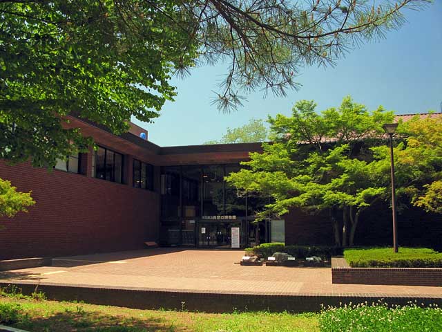
Highlights include Mt. Hodo, Saitama Museum of Natural History and Wadō Site.
Weather in Nagatoro
Forecast from MET Norway (CC BY 4.0). Full forecast
About Nagatoro
Nagatoro (長瀞町, Nagatoro-machi) is a town located in Saitama Prefecture, Japan. As of 1 March 2021, the town had an estimated population of 6,838 in 2894 households and a population density of 220 persons per km2. The total area of the town is 30.43 square kilometres (11.75 sq mi). The Nagatoro River is well known for its rapids and whitewater rafting and boating, and the entire town is designated as a prefectural nature park and preserve.
From the Wikipedia article Nagatoro, Saitama (this version), under CC BY-SA 4.0.
Things to do39


27 more on the map.
Museums and landmarks9

Wadō Site
Monument and historic site · 6.1 km
Mining site, archaeological site in Saitama, Japan



Parks, trails and playgrounds5




Restaurants and cafes33

BOOK CAFE GALLERY PNB-1253
Cafe · Cake, Coffee Shop · 2.4 km
1, 皆野町
Th-Tu 11:00-19:00

台湾料理 香林坊長瀞店
Restaurant · Chicken, Chinese, Friture, Noodles · 0.8 km
We-Mo 11:00-14:30,17:00-23:00
21 more on the map.
History
The village of Nagami was created within Chichibu District, Saitama with the establishment of the modern municipalities system on April 1, 1889, and was elevated to town status on February 15, 1940. The town absorbed neighboring Higuchi and part of Shiratori villages on September 8, 1943, and changed its name to Nagatoro on November 1, 1971. In February 1955, the town expanded by annexing the neighboring villages of Orihara, Hachigata, Obusuma, and Yodo.
From the History section of Nagatoro, Saitama on Wikipedia, under CC BY-SA 4.0.
Where to stay9
Churches and places of worship5
Shopping4
Gas and EV charging3
Schools, colleges and libraries8
Healthcare4
Map of Nagatoro
119 places. The map loads OpenStreetMap tiles when you open it.
Getting there and nearby towns
Yokota Air Base (OKO) is the nearest airport with scheduled flights listed in OpenStreetMap, 45 km away.
- Minano 3 km south, about 3 min by car
- Yorii 8 km east, about 8 min by car
- Chichibu 13 km south, about 13 min by car
- Ogano 13 km southwest, about 13 min by car
- Ogawamachi 15 km east, about 15 min by car
- Fujioka 16 km north, about 16 min by car
- Ranzan 19 km east, about 19 min by car
- Yoshii 20 km northwest, about 20 min by car
- Kumagaya 25 km east, about 25 min by car
- Takasaki 27 km north, about 27 min by car
Drive times are estimates from straight-line distance, not routes.
Local news
Headlines from INDB.
Reviews, tips and questions
Loading what members have shared...
Sources and licences
- GeoNames (CC BY 4.0): population, coordinates, regions and time zone
- OpenStreetMap contributors (ODbL 1.0): places, airports, map data
- Wikidata (CC0 1.0): elevation, founding date, time zone, website, landmarks and historic places
- Wikimedia Commons (see each image): photos
- Wikipedia (CC BY-SA 4.0): overview and history text
Photo credits
- Nagatoro Town Office, Abasaa, Public domain
- Nagatoro, Chichibu District, Saitama Prefecture 369-1305, Japan - panoramio, 赤カメラ, CC BY 3.0
- Nagatoro, Chichibu District, Saitama Prefecture 369-1305, Japan - panoramio (1), 赤カメラ, CC BY 3.0
- Nagatoro, Chichibu District, Saitama Prefecture 369-1305, Japan - panoramio (4), 赤カメラ, CC BY 3.0
- Nagatoro, Chichibu District, Saitama Prefecture 369-1305, Japan - panoramio (2), 赤カメラ, CC BY 3.0
- Nagatoro, Chichibu District, Saitama Prefecture 369-1305, Japan - panoramio (5), 赤カメラ, CC BY 3.0
- Nagatoro, Chichibu District, Saitama Prefecture 369-1305, Japan - panoramio (3), 赤カメラ, CC BY 3.0
- Chichibu Wado Ruins Open-pit Mining 1, 京浜にけ, CC BY-SA 3.0
- Saitama Prefectural Minano High School, M yanagisawa, CC BY 3.0
- Ngatoro Saitamakenritu sizennohakubutukan 1, 京浜にけ, CC BY-SA 3.0
- 寶登山神社・鳥居 - panoramio, Adachi Masayuki, CC BY-SA 3.0
- Hodosan Shrine (Mt. Treasure-climb Shrine) - 宝登山神社 - panoramio (13), Carbonium, CC BY 3.0
- Nagatoro Town Museum, Abasaa, Public domain
- 月の石もみじ公園 ライトアップ(撮影日:2008年11月) - panoramio, mocchan1982, CC BY 3.0
- Saitama Prefectural Minano High School 1, Ebiebi2, CC0
- Hodosan top, 清兵衛, CC BY-SA 3.0
- Цветущая дорога, Tedd Okano, CC BY-SA 3.0
- Tunnel Of Flowers, Tedd Okano, CC BY-SA 3.0
- Dsc 5814 1 Jpg, Araki Takashi, CC BY 3.0
- 長瀞綜合博物館付近の荒川 - panoramio, 高橋文武, CC BY 3.0
- Cherry Blossoms, Araki Takashi, CC BY 3.0
- Cherry Blossoms, Araki Takashi, CC BY 3.0
- Dsc 5794 Jpg, Araki Takashi, CC BY 3.0
- Star Of Cherry Blossoms, Araki Takashi, CC BY 3.0
- Cherry Blossoms, Araki Takashi, CC BY 3.0
- Night "DEKI", Kznrhsd, CC0
- Dsc 5819 1 Jpg, Araki Takashi, CC BY 3.0
- Dsc 5822 1 Jpg, Araki Takashi, CC BY 3.0
- Cherry Blossoms, Araki Takashi, CC BY 3.0
- ISS065-E-212800 - View of Earth, Earth Science and Remote Sensing Unit , Lyndon B. Johnson Space Center, Public domain
- ISS008-E-17330 - View of Japan, Earth Science and Remote Sensing Unit , Lyndon B. Johnson Space Center, Public domain
- Chichibu-railway-deki502-20140428, LERK, CC BY-SA 3.0
- 秩父 出遊 (11049891084), Richard, enjoy my life! from 台北市, ROC Taiwan, CC BY-SA 2.0
- 野上村道路元標周辺 - panoramio, fum3670045, CC BY 3.0
- 長瀞、岩畳対岸から - panoramio, 高橋文武, CC BY 3.0
- 野上村道路元標 - panoramio, fum3670045, CC BY 3.0
- Fireworks Of Japan, Araki Takashi, CC BY 3.0
- Fireworks Of Japan, Araki Takashi, CC BY 3.0
- Fireworks Of Japan, Araki Takashi, CC BY 3.0
- Fireworks Of Japan, Araki Takashi, CC BY 3.0


Page built November 5, 2026. Spotted a mistake? Tell us or suggest a place.