



Nakagusuku, Japan
中城村
Nakagusuku is a town of 22,157 people in Okinawa, Japan, founded in April 1, 1908.
Why visit Nakagusuku
Townapedia lists 32 museums and landmarks, 31 parks and trails, 67 places to eat, 1 place to stay and 5 attractions in and around town.
Highlights include Okinawa Christian University, Okinawa International University, Sakima Art Museum and Ogidō Shell Mound.
Weather in Nakagusuku
Forecast from MET Norway (CC BY 4.0). Full forecast
About Nakagusuku
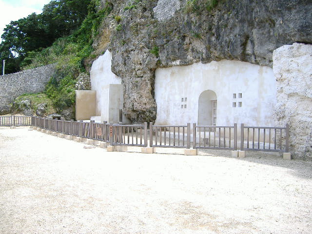
Nakagusuku (中城村, Nakagusuku-son; Okinawan: Nakagushiku) is a village located in Nakagami District, Okinawa Prefecture, Japan. As of 1 August 2024, the village has an estimated population of 22,647 and a density of 1,465 persons per km2. The total area is 15.53 km2. The ruins of a gusuku (Ryukyuan castle), Nakagusuku Castle, are also in this village.
From the Wikipedia article Nakagusuku, Okinawa (this version), under CC BY-SA 4.0.
Things to do5

Okinawa Christian University
School · 3.1 km
Higher education institution in Okinawa Prefecture, Japan
字翁長777

Okinawa International University
School · 3.2 km
Higher education institution in Okinawa Prefecture, Japan
宜野湾2-6-1
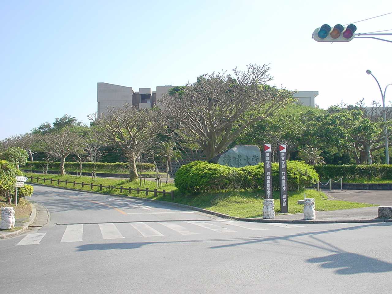
University of the Ryukyus
School · 1.8 km
Higher education institution in Okinawa Prefecture, Japan

Museums and landmarks32


Ogidō Shell Mound
Monument and historic site · 5.0 km
Shell midden in Okinawa, Japan

Ōyama Shell Mound
Monument and historic site · 4.6 km
Early Kaizuka Period shellmound in Ginowan, Okinawa

Ryukyu University Museum (Fūjukan)
Museum · 1.9 km
Museum in Nishihara, Okinawa, Japan


Urasoe yōdore
Monument and historic site · 5.2 km
Royal mausoleum in Okinawa

20 more on the map.
Parks, trails and playgrounds31


19 more on the map.
Restaurants and cafes67


Men'ya Nirai
Restaurant · Okinawa Soba, Noodle, Regional · 1.4 km
1, 中城村
Th-Tu 11:00-14:30
最強食堂
Restaurant · Japanese, Regional · 2.6 km
16, 宜野湾市
Mo-Su 11:00-22:00
Siam Binto
Restaurant · Thai · 1.4 km
Mo-Sa 11:00-14:30,17:00-20:00
55 more on the map.
History
The earliest known human habitation of present-day Nakagusuku village began sometime around the year 900–1000, in what is currently aza Arakachi. Later, Nakagusuku Castle was started, becoming the most dominant gusuku (or town center) of the area. Around the year 1440, Gosamaru was ordered to move from Zakimi Castle to Nakagusuku Castle, and a number of residents of Yomitan followed him. These followers and their descendants would form much of present-day Nakagusuku village, including the aza's of Tumai, Isshado, and Kuba. To this day, many Nakagusuku residents have a number of relatives in Yomitan. Under the Ryukyu Kingdom, Nakagusuku Castle served as the headquarters of Nakagushiku Majiri, though culturally people identified most strongly and interacted most closely within their own mura (Japanese: aza).
After the annexation of Ryukyu by Japan in 1879, the Japanese government did away with the majiri system, and formed Nakagusuku village (Japanese: son). Thus, Nakagusuku village is a relatively modern formation, and there remains a relatively strong sense of cultural uniqueness among Nakagusuku's azas. Nakagusuku's immigrant population living abroad, particularly in Hawai'i (since Hawai'i's Okinawan immigrants were among the earliest in the Okinawan diaspora), especially feel a stronger attachment to their aza, rather than to Nakagusuku village at large.
From the History section of Nakagusuku, Okinawa on Wikipedia, under CC BY-SA 4.0.
Where to stay1
Churches and places of worship12
Shopping20
Gas and EV charging15
Schools, colleges and libraries42
Nakagusuku Village Nakagusuku Junior High School
School · 2.2 km
国道329号
National University of the Ryukyus Faculty of Education affiliated elementary school
School · 1.9 km
字千原1
National University of the Ryukyus Faculty of Education affiliated Junior High School
School · 1.7 km
字千原1
Healthcare20
Map of Nakagusuku
245 places. The map loads OpenStreetMap tiles when you open it.
Getting there and nearby towns
Kadena Air Base (DNA) is the nearest airport with scheduled flights listed in OpenStreetMap, 11 km away.
- Ginowan 3 km northwest, about 3 min by car
- Nishihara 4 km west, about 4 min by car
- Urasoe 5 km west, about 5 min by car
- Yonabaru 6 km southwest, about 6 min by car
- Chatan 7 km north, about 7 min by car
- Kanegusuku 8 km southwest, about 8 min by car
- Naha 11 km west, about 11 min by car
- Nanjō 12 km south, about 12 min by car
- Kadena 13 km north, about 13 min by car
- Gushikawa 15 km northeast, about 15 min by car
Drive times are estimates from straight-line distance, not routes.
Local news
Headlines from INDB.
Reviews, tips and questions
Loading what members have shared...
Sources and licences
- GeoNames (CC BY 4.0): population, coordinates, regions and time zone
- OpenStreetMap contributors (ODbL 1.0): places, airports, map data
- Wikidata (CC0 1.0): elevation, founding date, time zone, website, landmarks and historic places
- Wikimedia Commons (see each image): photos
- Wikipedia (CC BY-SA 4.0): overview and history text
Photo credits
- Nakagusuku Castle22n3104, 663highland, CC BY 2.5
- Ryuukyuudaigaku, Hykw-a4 at ja.Wikipedia, CC BY-SA 3.0
- Sakima Art Museum03n3000, 663highland, CC BY 2.5
- Ōyama Shellmound (entrance stele), Bérangère444, CC BY-SA 4.0
- Urasoe Art Museum04s4s2940, 663highland, CC BY 2.5
- Urasoe Yodore3, あばさー, Public domain
- Ryukyu-univ hospital, Kugel~commonswiki, Public domain
- Okikiri, Hykw-a4 at ja.Wikipedia, CC BY-SA 3.0
- 新 琉球大学病院, 琉球大学病院, CC0
- The Open University of Japan, 掬茶, CC BY-SA 3.0
- 琉球大学博物館(風樹館), Kiken68, CC0
- Lopha cristagalli 54930526, Takaaki Hattori, CC BY 4.0
- Lopha cristagalli 54930532, Takaaki Hattori, CC BY 4.0
- Lopha cristagalli 54930539, Takaaki Hattori, CC BY 4.0
- Pinctada margaritifera 53037563, Takaaki Hattori, CC BY 4.0
- Pinctada margaritifera 53037555, Takaaki Hattori, CC BY 4.0
- Pinctada margaritifera 53037397, Takaaki Hattori, CC BY 4.0
- Pinctada margaritifera 53037403, Takaaki Hattori, CC BY 4.0
- Isognomon isognomum 53037154, Takaaki Hattori, CC BY 4.0
- Isognomon isognomum 53037164, Takaaki Hattori, CC BY 4.0
- 固定された椅子と机, たかやま123, CC0
- 青色の椅子と長い机, たかやま123, CC0
- 志喜屋記念図書館銘板, Kiken68, CC0
- 「学而不厭」碑文と学ぶシーサー, Kiken68, CC0
- Tucetona auriflua, Takaaki Hattori, CC BY 4.0
- 琉球大学附属図書館本館ラーニングコモンズ, Kiken68, CC0
- 千原池(琉球大学千原キャンパス内), Kiken68, CC0
- 首里の杜(琉球大学千原キャンパス), Kiken68, CC0
- Hokama sensei profile, Hirokazu Narumi, CC BY-SA 4.0
- Orgyia postica 587338818, Weiting Liu, CC BY 4.0
- 嶋袋寿純・対馬丸記念館学芸員, Okinawa1123581321, CC BY-SA 4.0
- 2018年8月販売型 WS "レザーパッケージ" 前部, CatseyeTaku, CC BY-SA 4.0
- Ginowan Manhole hdsr BL90001 01, Hyppolyte de Saint-Rambert, CC BY 4.0
- Ginowan Manhole hdsr BL90001 02, Hyppolyte de Saint-Rambert, CC BY 4.0
- Ginowan Manhole hdsr BL90001 05, Hyppolyte de Saint-Rambert, CC BY 4.0
- Ginowan Manhole hdsr BL90001 03, Hyppolyte de Saint-Rambert, CC BY 4.0
- View of Site of Arakaki Castle from Okinawa Expressway, そらみみ, CC BY-SA 4.0
- Ginowan Manhole hdsr BL90001 04, Hyppolyte de Saint-Rambert, CC BY 4.0
- Nishibaru Agari-gā Well, Bérangère444, CC BY-SA 4.0
- Nishibaru Hi-nu-kan Shrine Close-up, Bérangère444, CC BY-SA 4.0


Page built November 5, 2026. Spotted a mistake? Tell us or suggest a place.