




Takehara, Japan
竹原市
Takehara is a town of 30,506 people in Hiroshima, Japan, founded in November 3, 1958.
Why visit Takehara
Townapedia lists 28 museums and landmarks, 13 parks and trails, 10 places to eat, 8 places to stay and 10 attractions in and around town.
Highlights include Hiroshima National College of Maritime Technology, Mt. Shirataki, Poison Gas Museum and Takehara Museum of Historical and Folk Materials.
Weather in Takehara
Forecast from MET Norway (CC BY 4.0). Full forecast
About Takehara
Takehara (竹原市, Takehara-shi) is a city located in Hiroshima Prefecture, Japan. As of 30 April 2023, the city had an estimated population of 23,350 in 12,034 households and a population density of 200 persons per km2. The total area of the city is 118.23 square kilometres (45.65 sq mi).
From the Wikipedia article Takehara, Hiroshima (this version), under CC BY-SA 4.0.
Travel tips from other travellers: Takehara on Wikivoyage (CC BY-SA 4.0).
Things to do10

Hiroshima National College of Maritime Technology
School · 9.5 km
Higher education institution in Hiroshima Prefecture, Japan


Museums and landmarks28




Remains of an Air-Raid Shelter for Military Chiefs
Monument and historic site · 8.0 km
16 more on the map.
Parks, trails and playgrounds13



1 more on the map.
Restaurants and cafes10






History
The Takehara area is part of ancient Aki Province and has been settled since prehistoric times. During the Heian period, it was the location of a shōen landed estate controlled by Shimogamo Shrine in Kyoto Known as a port town since the Muromachi period, it prospered as a center of the salt industry in the latter half of the Edo period under the control of Hiroshima Domain. After the Meiji restoration, the area become part of Kamo District, Hiroshima. On April 1, 1889 the village of Shimoichi was formed with the establishment of the modern municipalities system. On April 17, 1889 Shimoichi was elevated to town status to become the town of Takehara. Takehara was elevated to city status on November 3, 1958. Takehara's Special Historical District of old warehouses was selected as one of Japan's "100 Most Scenic Towns".
From the History section of Takehara, Hiroshima on Wikipedia, under CC BY-SA 4.0.
Where to stay8
Churches and places of worship69
Shopping4
Gas and EV charging3
Schools, colleges and libraries25
Healthcare7
Map of Takehara
177 places. The map loads OpenStreetMap tiles when you open it.
Getting there and nearby towns
Hiroshima Airport (HIJ) is the nearest airport with scheduled flights listed in OpenStreetMap, 11 km away.
- Higashihiroshima 18 km northwest, about 18 min by car
- Imabari 31 km south, about 31 min by car
- Kure 34 km west, about 34 min by car
- Hōjō 42 km south, about 42 min by car
- Hiroshima 43 km west, about 43 min by car
- Fukuyama 44 km east, about 44 min by car
- Hatsukaichi 54 km west, about 54 min by car
- Niihama 55 km southeast, about 55 min by car
- Matsuyama 57 km south, about 57 min by car
- Iwakuni 67 km west, about 1 h by car
Drive times are estimates from straight-line distance, not routes.
Local news
Headlines from INDB.
Reviews, tips and questions
Loading what members have shared...
Sources and licences
- GeoNames (CC BY 4.0): population, coordinates, regions and time zone
- OpenStreetMap contributors (ODbL 1.0): places, airports, map data
- Wikidata (CC0 1.0): elevation, founding date, time zone, website, landmarks and historic places
- Wikimedia Commons (see each image): photos
- Wikipedia (CC BY-SA 4.0): overview and history text
Photo credits
- Takehara City Hall 2021-03 ac, Asturio Cantabrio, CC BY-SA 4.0
- 竹原大橋 Takehara bridge - panoramio, iloverjoa, CC BY 3.0
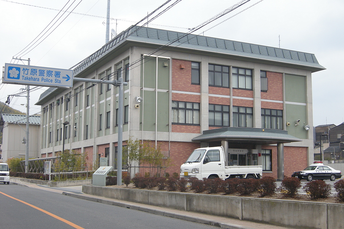
- 竹原警察署 Takehara police station - panoramio, OS6, CC BY-SA 3.0
- Takehara kuresen004, PortsmouthYAMAGATA, Public domain
- 竹原駅 Takehara station - panoramio, OS6, CC BY-SA 3.0
- JR-TakeharaStation, Ayustar, CC BY-SA 3.0
- Takehara kuresen001, PortsmouthYAMAGATA, Public domain
- Takehara kuresen002, PortsmouthYAMAGATA, Public domain
- Takehara kuresen003, PortsmouthYAMAGATA, Public domain
- JR竹原駅前 Takehara Sta. - panoramio, iloverjoa, CC BY 3.0
- JR竹原駅 Takehara Sta. - panoramio, iloverjoa, CC BY 3.0
- JR竹原駅 Takehara Sta. - panoramio (1), iloverjoa, CC BY 3.0
- 道の駅たけはら Drive-in Takehara - panoramio, iloverjoa, CC BY 3.0
- Michinoeki Takehara, 妖精書士, CC BY-SA 3.0
- 竹原市役所 Takehara city hall - panoramio, OS6, CC BY-SA 3.0
- Takehara, Hiroshima - 8408956994, Kzaral, CC BY 2.0
- Takehara, Hiroshima - 8408956836, Kzaral, CC BY 2.0
- Takehara, Hiroshima - 8408956222, Kzaral, CC BY 2.0
- Takehara, Hiroshima - 8407860461, Kzaral, CC BY 2.0
- Takehara City Museum, Hiroshima, Kzaral, CC BY 2.0
- 3 Chome Honmachi, Takehara-shi, Hiroshima-ken 725-0022, Japan - panoramio, shikabane taro, CC BY 3.0
- Hiroshima Takehara City Takehara Syoin Library 2021-03 ac, Asturio Cantabrio, CC BY-SA 4.0
- Lighthouse in Okunoshima, August 2018, Steffen Flor, CC BY-SA 2.0
- Dokugasmuseum, Sveagal at English Wikipedia, CC BY-SA 3.0
- Takehara City Historical Folk Museum 2021-03 ac, Asturio Cantabrio, CC BY-SA 4.0
- Fumeikaku,Takehara, As6022014, CC BY-SA 3.0
- Takehara city Takehara junior high school, KASEI, CC BY-SA 4.0
- Takehara city Oonori elementary school, KASEI, CC BY-SA 4.0
- Okunojima loghthouse 2024 001, VZP10224, CC0
- Mitoshiro Kofun, entrance-2, Saigen Jiro, CC0
- Okunoshima Poison Gas Museum 20180429-3, そらみみ, CC BY-SA 4.0
- JNR 105 Setouchi yellow livery Kure Line train at Takeura Station, Kzaral, CC BY 2.0
- Dai5 Sanyo ferry, 妖精書士, CC BY-SA 3.0
- R185-2020-108, Puchi-masashi, CC BY-SA 4.0
- 券売機 広島県竹原市 (41558634084), girakku, CC0
- 日の丸寫眞館 Hinomaru photo studio - panoramio, iloverjoa, CC BY 3.0
- 竹原郵便局 Post Office - panoramio, OS6, CC BY-SA 3.0
- 竹原書院図書館 (Library) - panoramio, OS6, CC BY-SA 3.0
- イズミ竹原店, OS6, CC BY-SA 3.0
- 西方寺・普明閣 - panoramio, OS6, CC BY-SA 3.0
- Horikawa (Takehara), 妖精書士, CC BY-SA 3.0


Page built November 4, 2026. Spotted a mistake? Tell us or suggest a place.