


Tsuruta, Japan
鶴田町
Tsuruta is a town of 12,870 people in Aomori, Japan, founded in April 1, 1889.
Why visit Tsuruta
Townapedia lists 14 museums and landmarks, 17 parks and trails, 55 places to eat, 2 places to stay and 3 attractions in and around town.
Highlights include Ōmori Katsuyama Site and Tachineputa Museum.
Weather in Tsuruta
Forecast from MET Norway (CC BY 4.0). Full forecast
About Tsuruta
Tsuruta (鶴田町, Tsuruta-machi) is a town located in Aomori Prefecture, Japan. As of 31 January 2023, the town had an estimated population of 11,968 in 5355 households, and a population density of 260 persons per km2. The total area of the town is 46.4 square kilometres (17.9 sq mi). The name "Tsuruta" is a combination of the character for crane (鶴) with that for rice field (田).
From the Wikipedia article Tsuruta, Aomori (this version), under CC BY-SA 4.0.
Travel tips from other travellers: Tsuruta on Wikivoyage (CC BY-SA 4.0).
Things to do3


Museums and landmarks14
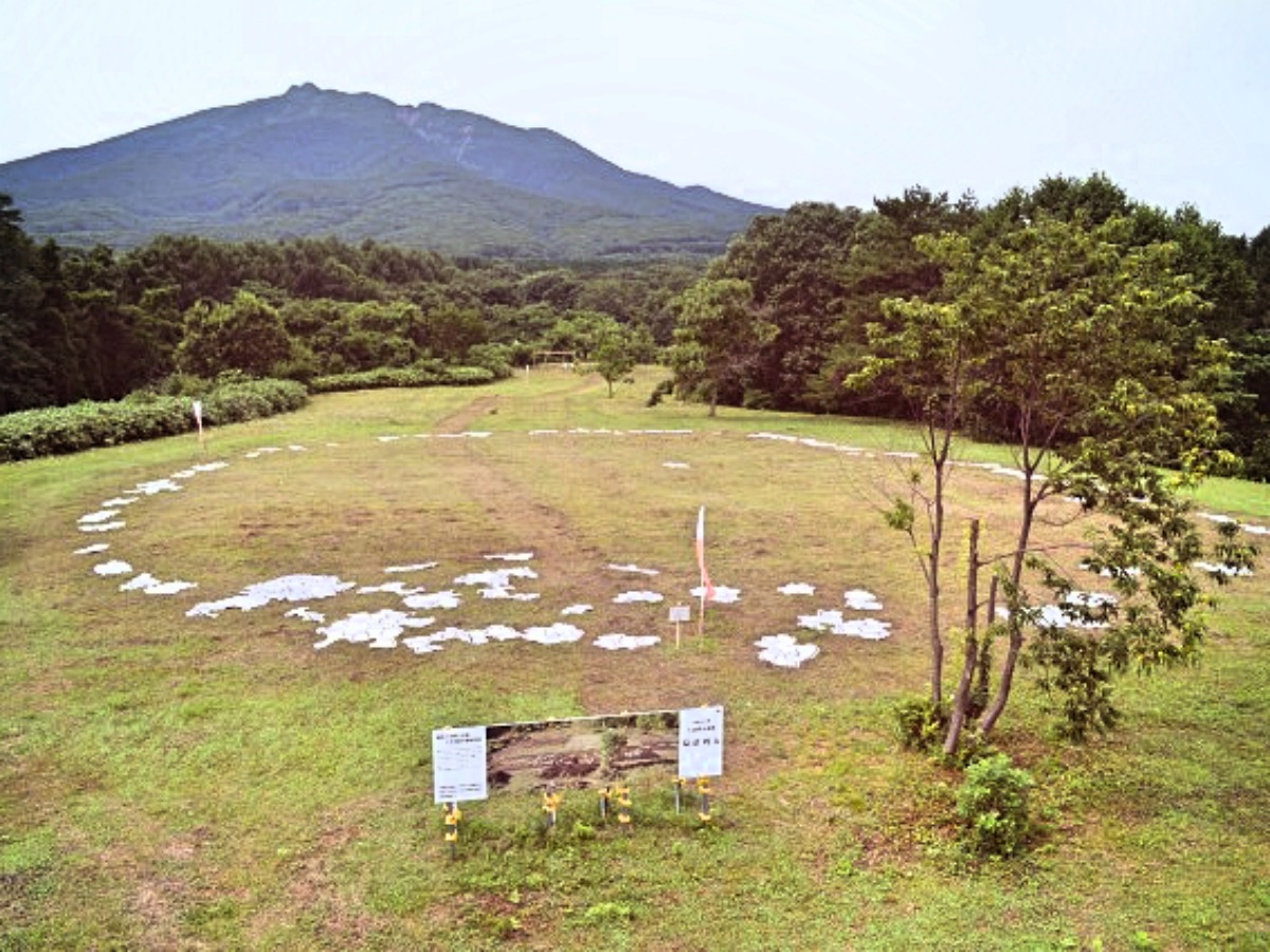
Ōmori Katsuyama Site
Monument and historic site · 8.6 km
Stone circle, settlement in Aomori, Japan




2 more on the map.
Parks, trails and playgrounds17



5 more on the map.
Restaurants and cafes55



43 more on the map.
History
The area around Tsuruta was controlled by the Tsugaru clan of Hirosaki Domain during the Edo period. After the Meiji Restoration, it was formed into a village on April 1, 1889 with the establishment of the modern municipalities system. It was elevated to town status on October 1, 1941. On March 1, 1955, it annexed the neighboring villages of Umezawa, Rokugo, and Mizumoto, and on November 1, 1958 it also annexed a portion of Itayanagi.
From the History section of Tsuruta, Aomori on Wikipedia, under CC BY-SA 4.0.
Where to stay2
Churches and places of worship12
Shopping21
Gas and EV charging8
Schools, colleges and libraries14
Healthcare13
Map of Tsuruta
159 places. The map loads OpenStreetMap tiles when you open it.
Getting there and nearby towns
Aomori Airport (AOJ) is the nearest airport with scheduled flights listed in OpenStreetMap, 22 km away.
- Goshogawara 6 km north, about 6 min by car
- Tsugaru 6 km northwest, about 6 min by car
- Itayanagi 7 km south, about 7 min by car
- Fujisaki 12 km southeast, about 12 min by car
- Namioka 14 km east, about 14 min by car
- Hirosaki 18 km south, about 18 min by car
- Kuroishi 17 km southeast, about 17 min by car
- Hirakawa 22 km southeast, about 22 min by car
- Aomori 26 km east, about 26 min by car
- Hiranai 48 km northeast, about 48 min by car
Drive times are estimates from straight-line distance, not routes.
Local news
Headlines from INDB.
Reviews, tips and questions
Loading what members have shared...
Sources and licences
- GeoNames (CC BY 4.0): population, coordinates, regions and time zone
- OpenStreetMap contributors (ODbL 1.0): places, airports, map data
- Wikidata (CC0 1.0): elevation, founding date, time zone, website, landmarks and historic places
- Wikimedia Commons (see each image): photos
- Wikipedia (CC BY-SA 4.0): overview and history text
Photo credits
- Tsuruta town hall, アラツク (Aratsuku), CC BY-SA 4.0
- Aomori Prefectural Tsuruta High School, 掬茶, CC BY-SA 4.0
- Roadside Station Tsuruta 20190908b, 掬茶, CC BY-SA 4.0
- Roadside Station Tsuruta 20190908a, 掬茶, CC BY-SA 4.0
- Roadside Station Tsuruta 20190908c, 掬茶, CC BY-SA 4.0
- Kawabe Daishō, Tsuruta-machi, Kitatsugaru-gun, Aomori-ken 038-3525, Japan - panoramio, torakiti, CC BY 3.0
- Tsuruta town Mizumoto-Chuo elementary school, 掬茶, CC BY-SA 4.0
- Omori-Katsuyama Stone Circle, MChew, CC BY-SA 4.0
- Tachineputa Hall, 掬茶, CC BY-SA 3.0
- Goshogawara Dai-ichi High School, 禁樹なずな, CC BY-SA 4.0
- Goshogawara City Library ac, Asturio Cantabrio, CC BY-SA 4.0
- Entrance of Tsugaru-City Library 180512, Yauchi, CC BY-SA 4.0
- Minami Elementary School Goshogawara 200921, Yauchi, CC BY-SA 4.0
- Kakuju Bridge and Mount Iwaki, 掬茶, CC BY-SA 4.0
- Tsurudomari Station 20200621a, 掬茶, CC BY-SA 4.0
- Tsurudomari Station 20200621b, 掬茶, CC BY-SA 4.0
- Tsurudomari Station 20200621c, 掬茶, CC BY-SA 4.0
- Gono line 20221230182517 (52646970408), inunami, CC BY 2.0
- 津軽富士見湖(tsugarufujimiko) - panoramio - torakiti (1), torakiti, CC BY 3.0
- 津軽富士見湖(tsugarufujimiko) - panoramio, torakiti, CC BY 3.0
- 津軽富士見湖(tsugarufujimiko) - panoramio - torakiti, torakiti, CC BY 3.0
- 砂沢溜池 - panoramio, torakiti, CC BY 3.0
- Shimoikegami Miwa, Hirosaki-shi, Aomori-ken 038-3611, Japan - panoramio, torakiti, CC BY 3.0
- 砂沢溜池 - panoramio (1), torakiti, CC BY 3.0
- Tsuruno-maihashi in April 2023, 掬茶, CC BY-SA 4.0
- Starry sky Tsurunomaihashi 20181102 2328, あおもりくま, CC BY-SA 3.0
- Aomori Prefectural Goshogawara Technical High School, 掬茶, CC BY-SA 4.0
- Tsugaru-Ringo-Ohashi Bridge 241013, Yauchi, CC0
- RICOH THETA Z1 Tsurunomaihashi 2019 10, aomorikuma, CC BY-SA 3.0
- Itayanagi town Itayanagi-Kita elementary school, 掬茶, CC BY-SA 4.0
- Aomori District Legal Affairs Bureau Goshogawara Branch Bureau, Hohoho, CC BY-SA 3.0
- Aomori District Legal Affairs Bureau Goshogawara Branch Bureau nameboard, Hohoho, CC BY-SA 3.0
- Goshogawara Common Building for Government Offices, Hohoho, CC BY-SA 3.0
- Goshogawara Common Building for Government Offices nameplate, Hohoho, CC BY-SA 3.0
- Tsugaru Kokusetsu Dome 20200621, 掬茶, CC BY-SA 4.0
- Tsugaru Kokusetsu Dome 20191124, 掬茶, CC BY-SA 4.0
- Mt. Iwaki, Aomori - Oct 26, 2012, Yuichi Kosio, CC BY 2.0
- AEON Mall Tsugaru-Kashiwa 20200621c, 掬茶, CC BY-SA 4.0
- AEON Mall Tsugaru-Kashiwa 20200621a, 掬茶, CC BY-SA 4.0
- AEON Mall Tsugaru-Kashiwa 20200621b, 掬茶, CC BY-SA 4.0


Page built November 4, 2026. Spotted a mistake? Tell us or suggest a place.