

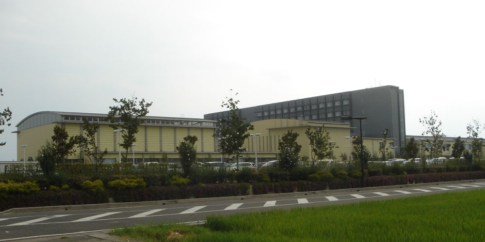


Wanouchi, Japan
輪之内町
Wanouchi is a town of 9,654 people in Gifu, Japan, founded in April 1, 1954.
Why visit Wanouchi
Townapedia lists 15 museums and landmarks, 18 parks and trails, 34 places to eat and 2 attractions in and around town.
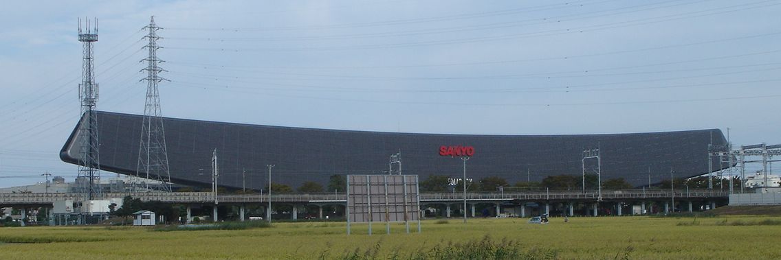
Highlights include Gifu College of Nursing, Solar Ark, Ogaki Asanaka Stadium and 安八百梅園.
Weather in Wanouchi
Forecast from MET Norway (CC BY 4.0). Full forecast
About Wanouchi
Wanouchi (輪之内町, Wanouchi-chō) is a town located in Anpachi District, Gifu Prefecture, Japan. As of 1 April 2018, the town had an estimated population of 9,910 in 3,183 households and a population density of 439 persons per km2.The total area of the town is 22.33 square kilometres (8.62 sq mi).
From the Wikipedia article Wanouchi, Gifu (this version), under CC BY-SA 4.0.
Things to do2
Gifu College of Nursing
School · 5.0 km
Higher education institution in Gifu Prefecture, Japan

Museums and landmarks15


3 more on the map.
Parks, trails and playgrounds18



6 more on the map.
Restaurants and cafes34


22 more on the map.
History
The area around Wanouchi was part of traditional Mino Province. During the Edo period, it was mostly controlled by Ōgaki Domain. In 1754, the Tokugawa shogunate, ordered the powerful Satsuma Domain from Kagoshima to build embankments in order to divert the rivers in the area for flood control and as a measure to drain off Satsuma Domain's wealth to reduce its potential as a threat to Tokugawa rule. This was later known as the Hōreki Age River Improvement Incident. The construction of these banks proved extremely dangerous and difficult, hampered both by nature and by obstruction from the Tokugawa shogunate.
During the post-Meiji restoration cadastral reforms, the area was organised into Anpachi District, Gifu. In 1954, the three villages Niki, Fukuzuka, and Oyabu were merged to form the town of Wanouchi. In 1976, the Nagara River swelled and flooded Wanouchi's neighbouring towns, Anpachi, Gifu and Sunomata, Gifu. However, the people of Wanouchi were protected from the floods because of the strong embankments.
From the History section of Wanouchi, Gifu on Wikipedia, under CC BY-SA 4.0.
Churches and places of worship29
Shopping13
Gas and EV charging3
Schools, colleges and libraries15
Healthcare2
Map of Wanouchi
131 places. The map loads OpenStreetMap tiles when you open it.
Getting there and nearby towns
Gifu Airbase (QGU) is the nearest airport with scheduled flights listed in OpenStreetMap, 24 km away.
- Hashima 6 km northeast, about 6 min by car
- Anpachi 6 km northeast, about 6 min by car
- Ōgaki 7 km north, about 7 min by car
- Kaizu 9 km south, about 9 min by car
- Mizuho 12 km north, about 12 min by car
- Tarui 13 km northwest, about 13 min by car
- Inazawa 14 km east, about 14 min by car
- Ichinomiya 15 km east, about 15 min by car
- Kasamatsuchō 15 km northeast, about 15 min by car
- Aisai 16 km southeast, about 16 min by car
Drive times are estimates from straight-line distance, not routes.
Local news
Headlines from INDB.
Reviews, tips and questions
Loading what members have shared...
Sources and licences
- GeoNames (CC BY 4.0): population, coordinates, regions and time zone
- OpenStreetMap contributors (ODbL 1.0): places, airports, map data
- Wikidata (CC0 1.0): elevation, founding date, time zone, website, landmarks and historic places
- Wikimedia Commons (see each image): photos
- Wikipedia (CC BY-SA 4.0): overview and history text
Photo credits
- 輪之内町役場, Monami at Japanese Wikipedia, CC BY-SA 3.0
- Gifu College of Nursing1, Monami at Japanese Wikipedia, CC BY-SA 3.0
- Solar Ark, Monami at Japanese Wikipedia, CC BY-SA 3.0
- Asanaka park, Opqr, CC BY-SA 4.0
- Aeon town wanouchi, Opqr, CC BY-SA 3.0
- Wanouchi kamo shrine, Opqr, CC BY-SA 4.0
- Chiyoho Inari-jinja ac (7), Asturio Cantabrio, CC BY-SA 4.0
- Ogaki Minami Senior High School01, Monami, CC BY-SA 3.0
- Kaizu special support education school, Kaizu, 2017, 大野 一将, CC BY-SA 4.0
- Yoro Town Tobu Junior high school, Alpsdake, CC BY-SA 4.0
- Houen-ji temple, Kaizu, 2017, 大野 一将, CC BY-SA 4.0
- Anpachi-Hyakubaien2008-2, Monami, CC BY-SA 3.0
- お千代保稲荷まで7.5Km (岐阜県大垣市横曽根) - panoramio, gundam2345, CC BY 3.0
- Chobo inari shrine , 千代保稲荷神社 - panoramio (10), z tanuki, CC BY 3.0
- Chobo inari shrine , 千代保稲荷神社 - panoramio (3), z tanuki, CC BY 3.0
- Chiyobo Inari Shrine 千代保稲荷5 - panoramio, baggio4ever, CC BY 3.0
- Chiyobo Inari Shrine 千代保稲荷6 - panoramio, baggio4ever, CC BY 3.0
- Chobo inari shrine , 千代保稲荷神社 - panoramio (4), z tanuki, CC BY 3.0
- Chiyobo Inari Shrine 千代保稲荷2 - panoramio, baggio4ever, CC BY 3.0
- Chobo inari shrine , 千代保稲荷神社 - panoramio (6), z tanuki, CC BY 3.0
- Chiyobo Inari Shrine 千代保稲荷1 - panoramio, baggio4ever, CC BY 3.0
- Chiyobo Inari Shrine 千代保稲荷4 - panoramio, baggio4ever, CC BY 3.0
- Chobo inari shrine , 千代保稲荷神社 - panoramio (9), z tanuki, CC BY 3.0
- Chobo inari shrine , 千代保稲荷神社 - panoramio (8), z tanuki, CC BY 3.0
- Chobo inari shrine , 千代保稲荷神社 - panoramio (5), z tanuki, CC BY 3.0
- Chobo inari shrine , 千代保稲荷神社 - panoramio (7), z tanuki, CC BY 3.0
- Chobo inari shrine , 千代保稲荷神社 - panoramio (1), z tanuki, CC BY 3.0
- Chiyobo Inari Shrine 千代保稲荷7 - panoramio, baggio4ever, CC BY 3.0
- Chiyobo Inari Shrine 千代保稲荷3 - panoramio, baggio4ever, CC BY 3.0
- Chobo inari shrine , 千代保稲荷神社 - panoramio, z tanuki, CC BY 3.0
- Chobo inari shrine , 千代保稲荷神社 - panoramio (2), z tanuki, CC BY 3.0
- Kaseki inari shrine , 荷席(かせき)稲荷神社 - panoramio (3), z tanuki, CC BY 3.0
- Kaseki inari shrine , 荷席(かせき)稲荷神社 - panoramio (4), z tanuki, CC BY 3.0
- Kaseki inari shrine , 荷席(かせき)稲荷神社 - panoramio (2), z tanuki, CC BY 3.0
- Kaseki inari shrine , 荷席(かせき)稲荷神社 - panoramio (5), z tanuki, CC BY 3.0
- Kaseki inari shrine , 荷席(かせき)稲荷神社 - panoramio, z tanuki, CC BY 3.0
- 岐阜県安八郡輪之内町 - panoramio, gundam2345, CC BY 3.0
- 買王 (岐阜県養老郡養老町) - panoramio, gundam2345, CC BY 3.0
- 買王 (岐阜県養老郡養老町船附) - panoramio, gundam2345, CC BY 3.0
- Gifu Prefectural Road Route 213 20170106, 円周率3パーセント (Enshuritsu 3 percent), CC BY-SA 4.0


Page built November 5, 2026. Spotted a mistake? Tell us or suggest a place.