


Mizuho, Japan
瑞穂市
Mizuho is a town of 56,388 people in Gifu, Japan, founded in May 1, 2003.
Why visit Mizuho
Townapedia lists 15 museums and landmarks, 73 parks and trails, 47 places to eat, 2 places to stay and 7 attractions in and around town.
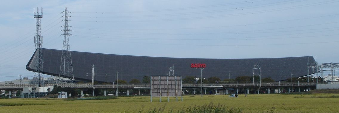
Highlights include Asahi University, Gifu Shotoku Gakuen University, Gifu City Science Museum and Solar Ark.
Weather in Mizuho
Forecast from MET Norway (CC BY 4.0). Full forecast
About Mizuho
Mizuho (瑞穂市, Mizuho-shi) is a village located in Gifu, Japan. As of 31 March 2024, the city had an estimated population of 56,168 and a population density of 1951 persons per km2, in 23,756 households. The total area of the city was 28.19 square kilometres (10.88 sq mi).
From the Wikipedia article Mizuho, Gifu (this version), under CC BY-SA 4.0.
Things to do7
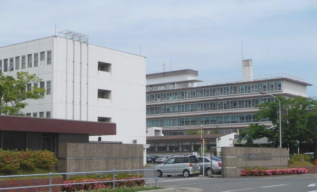
Asahi University
School · 2.4 km
Higher education institution in Gifu Prefecture, Japan
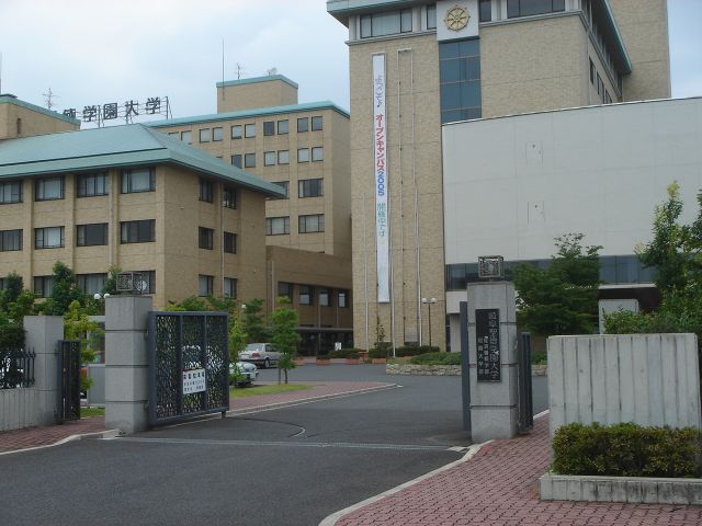
Gifu Shotoku Gakuen University
School · 5.0 km
Higher education institution in Gifu Prefecture, Japan

Institute of Advanced Media Arts and Sciences
School · 4.4 km
Higher education institution in Gifu Prefecture, Japan

National Institute of Technology, Gifu College
School · 5.8 km
National college in Motosu, Japan


Museums and landmarks15


The Museum of Fine Arts, Gifu
Museum · 5.6 km
Art museum in Gifu, Gifu, Japan


3 more on the map.
Parks, trails and playgrounds73



61 more on the map.
Restaurants and cafes47


not curry
Restaurant · Curry, Japanese Curry, Hokkaido Curry, Soup Curry · 4.7 km
11:30-20:00
35 more on the map.
History
The area around Mizuho was part of traditional Mino Province. During the Edo period, Mieji-juku prospered as a post station: on the Nakasendo highway connecting Edo with Kyoto. Under the Tokugawa shogunate, most of the area of Mizuho was part of Ogaki Domain or was tenryō territory administered by various hatamoto. In the post-Meiji restoration cadastral reforms, Motosu District in Gifu prefecture was created, and with the establishment of the modern municipalities system on July 1, 1889, the town of Kozuchi was created. The modern city of Mizuho was established on May 1, 2003, from the merger of the towns of Hozumi (穂積) and Sunami (巣南). (both from Motosu District).
From the History section of Mizuho, Gifu on Wikipedia, under CC BY-SA 4.0.
Where to stay2
Churches and places of worship44
Shopping15
Gas and EV charging9
Schools, colleges and libraries47
Healthcare8
Map of Mizuho
250 places. The map loads OpenStreetMap tiles when you open it.
Getting there and nearby towns
Gifu Airbase (QGU) is the nearest airport with scheduled flights listed in OpenStreetMap, 18 km away.
- Kitagata 5 km north, about 5 min by car
- Ōgaki 7 km southwest, about 7 min by car
- Gōdo 7 km west, about 7 min by car
- Hashima 7 km south, about 7 min by car
- Kurono 9 km north, about 9 min by car
- Gifu 9 km east, about 9 min by car
- Kasamatsuchō 9 km east, about 9 min by car
- Motosu 10 km north, about 10 min by car
- Tarui 13 km west, about 13 min by car
- Yamagata 13 km northeast, about 13 min by car
Drive times are estimates from straight-line distance, not routes.
Local news
Headlines from INDB.
Reviews, tips and questions
Loading what members have shared...
Sources and licences
- GeoNames (CC BY 4.0): population, coordinates, regions and time zone
- OpenStreetMap contributors (ODbL 1.0): places, airports, map data
- Wikidata (CC0 1.0): elevation, founding date, time zone, website, landmarks and historic places
- Wikimedia Commons (see each image): photos
- Wikipedia (CC BY-SA 4.0): overview and history text
Photo credits
- Mizuho City Hall ac, Asturio Cantabrio, CC BY-SA 4.0
- Noda Shinden, Mizuho, Gifu Prefecture 501-0232, Japan - panoramio (7), blue.reaf, CC BY 3.0
- Noda Shinden, Mizuho, Gifu Prefecture 501-0232, Japan - panoramio (8), blue.reaf, CC BY 3.0
- Noda Shinden, Mizuho, Gifu Prefecture 501-0232, Japan - panoramio (6), blue.reaf, CC BY 3.0
- Noda Shinden, Mizuho, Gifu Prefecture 501-0232, Japan - panoramio, blue.reaf, CC BY 3.0
- Noda Shinden, Mizuho, Gifu Prefecture 501-0232, Japan - panoramio (3), blue.reaf, CC BY 3.0
- Noda Shinden, Mizuho, Gifu Prefecture 501-0232, Japan - panoramio (4), blue.reaf, CC BY 3.0
- Noda Shinden, Mizuho, Gifu Prefecture 501-0232, Japan - panoramio (2), blue.reaf, CC BY 3.0
- Noda Shinden, Mizuho, Gifu Prefecture 501-0232, Japan - panoramio (1), blue.reaf, CC BY 3.0
- DCM21 Mizuho, Sinryow, CC BY-SA 4.0
- Mizuho City Skyline01, Nryate, CC BY-SA 4.0
- Asahi University, Monami at Japanese Wikipedia, CC BY-SA 3.0
- Gifu City Science Museum 1, Hide-sp, CC BY-SA 3.0
- Solar Ark, Monami at Japanese Wikipedia, CC BY-SA 3.0
- THE MUSEUM OF FINE ARTS,GIFU 1, Hide-sp, CC BY-SA 3.0
- LOC City Ogaki Shopping Center 03, Gnsin, CC BY-SA 3.0
- Kitagata junior high school,gifu 1, o4y4r4n, CC BY-SA 3.0
- Kitagata elementary school,gifu 2, O4y4r4n, CC BY-SA 3.0
- GifuCity Gifu Commercial Highschool01, Monami, CC BY-SA 3.0
- Ogaki Kita Senior High School01, Monami, CC BY-SA 3.0
- Gifu Sogo Gakuen Highschool01, Monami, CC BY-SA 3.0
- Asahi University Hospital, Waka77, CC0
- Mizuho City Library ac (1), Asturio Cantabrio, CC BY-SA 4.0
- Musubu-Jinjya01, Monami, CC BY-SA 3.0
- Shūgaku-in temple, Mizuho, 2020, 大野 一将, CC BY-SA 4.0
- Kannon-in temple, Mizuho, 2020, 大野 一将, CC BY-SA 4.0
- Sunomata Castle 墨俣一夜城4 - panoramio, baggio4ever, CC BY 3.0
- Softpia Japan Workshop 24, Asturio Cantabrio, CC BY-SA 4.0
- Gifu Shotoku Gakuen University1, The original uploader was Monami at Japanese Wikipedia ., CC BY-SA 3.0
- 岐阜協立大学校名, 岐阜経済大学企画広報課, CC BY-SA 4.0
- Gifu prefectural Ogaki commercial high school, Unknown author, CC BY-SA 3.0
- Hiro-Gakuen1, Monami, CC BY-SA 3.0
- AEON TOWN Ogaki EAST, Sinryow, CC BY 4.0
- Al plaza tsurumi, Opqr, CC BY-SA 4.0
- Gifu Fureai Plaza02, Monami, CC BY-SA 3.0
- 本巣郡北方町立北方西小学校, 中指の第二関節, CC0
- 墨俣一夜城 歴史資料館, The original uploader was Monami at Japanese Wikipedia ., CC BY-SA 3.0
- Sinsei library, Opqr, CC BY-SA 4.0
- Ozu-kouen2008-1, Monami, CC BY-SA 3.0
- Orthetrum melania melania - りなべる - 605637224, りなべる, CC BY 4.0


Page built November 5, 2026. Spotted a mistake? Tell us or suggest a place.