
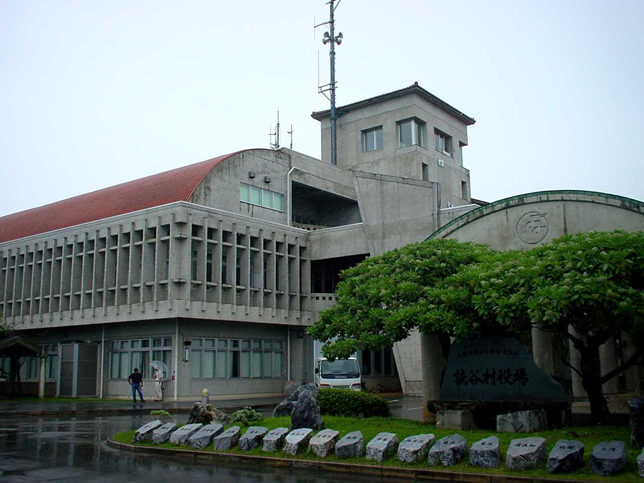


Yomitan, Japan
読谷村
Yomitan is a town of 41,206 people in Okinawa, Japan, founded in April 1, 1908.
Why visit Yomitan
Townapedia lists 75 museums and landmarks, 57 parks and trails, 164 places to eat, 43 places to stay and 10 attractions in and around town.
Highlights include Cape Zanpa Lighthouse, グレイスファーム, Yuntanza Museum and Ryukyu-mura.
Weather in Yomitan
Forecast from MET Norway (CC BY 4.0). Full forecast
About Yomitan
Yomitan (Japanese: 読谷村, Hepburn: Yomitan-son; Okinawan: Yuntan) is a village located in Nakagami District, Okinawa Prefecture, Japan.
From the Wikipedia article Yomitan (this version), under CC BY-SA 4.0.
Things to do10





Museums and landmarks75



Zakimi Castle
Monument and historic site · 0.8 km
6, 読谷村
Forest adventure Onna
Monument and historic site · 3.9 km
Ziplining through and above the trees.
1525 県道6号

Iha Shell Mound
Monument and historic site · 7.8 km
Archaeological site in Okinawa Prefecture, Japan
Momenbaru Site
Monument and historic site · 3.7 km
Archaeological site in Yomitan, Japan

Nakadomari
Monument and historic site · 5.9 km
Archaeological site in Onna, Japan
63 more on the map.
Parks, trails and playgrounds57






45 more on the map.
Restaurants and cafes164


Hanahou
Restaurant · Seafood, Chicken, Caribbean, Japanese, Pizza, Regional · 2.7 km
Th-Tu 11:30-15:00, 18:00-22:00


152 more on the map.
History
Originally known as Yomitanzan (読谷山; Okinawan: Yuntanja), it was part of the Kingdom of Chūzan during the Sanzan period. In 1416, the Aji of Yomitanzan Magiri, Gosamaru, helped Shō Hashi invade Hokuzan. Although Gosamaru lived in Yamada Castle, Shō Hashi allowed him to build Zakimi Castle. The castle, along with other castle sites in Okinawa, was designated a World Heritage Site by UNESCO in November 2000. The port of Hamanaga, which was located in the north of Yomitanzan, was an important center of Nanban, or "southern barbarian", trade of the Ryukyu Kingdom. Yomitanzan was also the site of a landing during the Invasion of Ryukyu by Satsuma Domain in 1609. After Japan annexed Ryukyu in 1879, Yomitanzan continued to be a magiri; all of the magiri were abolished in 1907 and Yomitanzan became a village.
From the History section of Yomitan on Wikipedia, under CC BY-SA 4.0.
Where to stay43
Churches and places of worship50
Shopping24
Gas and EV charging9
Schools, colleges and libraries19
Healthcare21
Map of Yomitan
250 places. The map loads OpenStreetMap tiles when you open it.
Getting there and nearby towns
Kadena Air Base (DNA) is the nearest airport with scheduled flights listed in OpenStreetMap, 6 km away.
- Kadena 4 km south, about 4 min by car
- Ishikawa 8 km east, about 8 min by car
- Chatan 11 km south, about 11 min by car
- Uruma 12 km east, about 12 min by car
- Gushikawa 13 km east, about 13 min by car
- Onna 15 km northeast, about 15 min by car
- Ginowan 16 km south, about 16 min by car
- Urasoe 16 km south, about 16 min by car
- Nishihara 16 km south, about 16 min by car
- Nakagusuku 17 km south, about 17 min by car
Drive times are estimates from straight-line distance, not routes.
Local news
Headlines from INDB.
Reviews, tips and questions
Loading what members have shared...
Sources and licences
- GeoNames (CC BY 4.0): population, coordinates, regions and time zone
- OpenStreetMap contributors (ODbL 1.0): places, airports, map data
- Wikidata (CC0 1.0): elevation, founding date, time zone, website, landmarks and historic places
- Wikimedia Commons (see each image): photos
- Wikipedia (CC BY-SA 4.0): overview and history text
Photo credits
- Yomitan village office, ja:user:Hykw-a4, CC BY-SA 3.0
- Yomitan from bus 120 5, Syced, CC0
- Yomitan from bus 120 7, Syced, CC0
- Yomitan Post Office 20150317, そらみみ, CC BY-SA 4.0
- Yomitan from bus 120 6, Syced, CC0
- Yomitan from bus 120 3, Syced, CC0
- Yomitan from bus 120 4, Syced, CC0
- Yomitan from bus 120 8, Syced, CC0
- Yomitan from bus 120 2, Syced, CC0
- Yomitan from bus 120 9, Syced, CC0
- Yomitan from bus 120 10, Syced, CC0
- Iha Shell Mound, Pre-war photographer, Public domain
- 仲泊遺跡 第三貝塚, Haruharuha, CC BY-SA 4.0
- Okinawa Temple Front, Epachamo, CC BY-SA 4.0
- Zanpa Misaki Lighthouse 201905, Kugel~commonswiki, CC BY-SA 4.0
- Kadena High School, Abasaa, Public domain
- Yomitan High School, Kattin at Japanese Wikipedia, CC BY-SA 3.0
- Ryukyu Mura entrance, Yuet Man Lee, CC BY-SA 4.0
- IMG 残波岬灯台, Taiga.sato, CC BY 4.0
- Michinoeki KinaBanjo, アラツク This photo was taken with Sony DSC-HX5V, CC BY-SA 4.0
- Yomiton Pottery Village (5715484670), wongaboo, CC BY 2.0
- ガラス工房 清天 (41534505704), girakku, CC0
- Zakimi Eingang, Renate Hano, CC BY-SA 4.0
- Zakimi Mauer, Renate Hano, CC BY-SA 4.0
- 座喜味城趾 - panoramio, Toshihiro Matsui, CC BY-SA 3.0
- Zakimi-gusuku, Vitalie Ciubotaru, CC BY-SA 3.0
- 座喜味城跡 20130204 - panoramio, 690 Noda, CC BY 3.0
- 座喜味城趾アーチ門 - panoramio, Toshihiro Matsui, CC BY-SA 3.0
- 座喜味城城壁 - panoramio, Toshihiro Matsui, CC BY-SA 3.0
- 座喜味城跡公園から 20130204 - panoramio, 690 Noda, CC BY 3.0
- Bus 120 Kadena to Onna 4, Syced, CC0
- 不発弾処理 - panoramio, Toshihiro Matsui, CC BY-SA 3.0
- Okinawa asa - panoramio, phil henin, CC BY-SA 3.0
- Okinawa Zanpa - panoramio, phil henin, CC BY-SA 3.0
- Okinawa Christian School International, Keiko Mizoguchi, CC BY-SA 4.0
- 長浜ダム(沖縄県) - panoramio, Arichika Taniguchi, CC BY-SA 3.0
- Stele of mausoleum of Sho Hashi, Sho Chu and Sho Shitatsu, Kugel~commonswiki, CC BY-SA 4.0
- Mausoleum of Sho Hashi, Sho Chu and Sho Shitatsu 01, Kugel~commonswiki, CC BY-SA 4.0
- Mausoleum of Sho Hashi, Sho Chu and Sho Shitatsu 03, Kugel~commonswiki, CC BY-SA 4.0
- Mausoleum of Sho Hashi, Sho Chu and Sho Shitatsu 02, Kugel~commonswiki, CC BY-SA 4.0


Page built November 5, 2026. Spotted a mistake? Tell us or suggest a place.