



Why visit Menominee
Townapedia lists 17 museums and landmarks, 19 parks and trails, 33 places to eat, 5 places to stay and 6 attractions in and around town.
Highlights include Menominee Pier Light, Mariner Theatre, Alvin Clark and Bijou Theatre.
July is the warmest month, with average highs of 80°F; January lows average 10°F, and about 44 inches of snow fall in a normal year.
Weather in Menominee
Forecast from the National Weather Service. Full forecast
About Menominee
Menominee ( mə-NOM-ə-nee; Menominee: Menekaunee) is a city in Menominee County, Michigan, United States, and its county seat. The population was 8,488 at the 2020 census. It is the southernmost city of the Upper Peninsula, on the north bank of the Menominee River at its mouth on Green Bay, part of Lake Michigan. Menominee is the fourth-largest city in the Upper Peninsula, behind Marquette, Sault Ste.
From the Wikipedia article Menominee, Michigan (this version), under CC BY-SA 4.0.
Things to do6
Menominee Pier Light
Lighthouse · National Register of Historic Places · 2.6 mi
Lighthouse in Michigan, United States



Menominee Opera House
Cinema and theater · 1.7 mi
Theater and movie theater in Menominee, Michigan, United States

University of Wisconsin–Marinette
School · 3.6 mi
Two-year college in Marinette, Wisconsin, U.S

Museums and landmarks17

Alvin Clark
Monument and historic site · National Register of Historic Places · 1.3 mi
United States historic place

Bijou Theatre
Monument and historic site · National Register of Historic Places · 1.7 mi
Commercial building and former movie theater in Marinette, Wisconsin

Charles G. Janson Garage
Monument and historic site · National Register of Historic Places · 1.3 mi
Commercial building in Menominee, Michigan
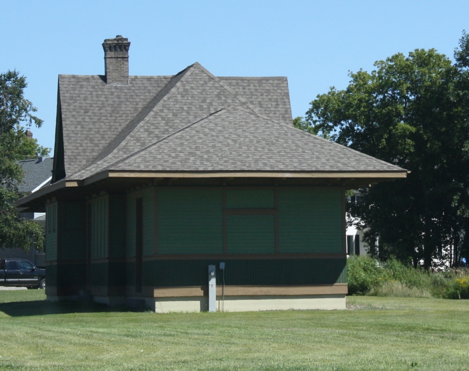
Chicago, Milwaukee, St. Paul and Pacific Railroad Station
Monument and historic site · National Register of Historic Places · 1.9 mi
Railway station in Menominee, the United States of America

Dunlap Square Building
Monument and historic site · National Register of Historic Places · 1.7 mi
Commercial building in Marinettem, Wisconsin

F.J. Lauerman House
Monument and historic site · National Register of Historic Places · 1.8 mi
Historic house in Marinette, Wisconsin, United States
First Street Historic District
Monument and historic site · National Register of Historic Places · 1.6 mi
Historic district in Menominee, Michigan, United States

Independent Order of Odd Fellows-Lodge No. 189 Building
Monument and historic site · National Register of Historic Places · 2.0 mi
Building in Wisconsin, United States

Lauerman Brothers Department Store
Monument and historic site · National Register of Historic Places · 1.7 mi
Department store in Wisconsin, United States of America

Marinette station
Monument and historic site · National Register of Historic Places · 2.3 mi
Former railway station in Marinette, Wisconsin
Menominee County Courthouse
Monument and historic site · National Register of Historic Places · 1.2 mi
County courthouse in Menominee, Michigan, United States
Riverside Site
Monument and historic site · National Register of Historic Places · 2.0 mi
Archaeological site in Michigan, United States
5 more on the map.
Parks, trails and playgrounds19




7 more on the map.
Restaurants and cafes33

The Watermark Bay View Restaurant & Bakery
Diner · American · 0.5 mi
2720 10th Street, Menominee
Su-Th 07:30-16:00,Fr-Sa 07:30-20:00

35th & Coffee
Cafe · Coffee Shop · 0.7 mi
3417 10th Street, Menominee
Mo-Fr 05:00-15:30,Sa 06:00-14:00,Su 08:00-14:00

Murray's Irish Pub and Grille
Restaurant · Pizza, Pub, Sports Bar, Barbecue, Bar, Banquet · 1.6 mi
715 1st Street, Menominee
The Pirates Cove
Restaurant · Pub, Burger, Pizza, American, Sandwich · 1.6 mi
727 1st Street, Menominee

Stephenson Bakery
Bakery · 1.0 mi
4000 10th Street, Menominee
Tu-We 05:00-16:00, Th-Fr 05:00-19:00, Sa 05:00-12:00

21 more on the map.
History
In historic times, this area was the traditional territory of the Menominee Indian Tribe. The town of Menominee was named after their English name which roughly translates as "wild rice," a nickname given to them by their Ojibwe neighbors based on their cultivation of wild rice as a staple food. In their own language, they are known as Mamaceqtaw which means simply "the people", and the town of Menominee is known as Menekaunee (sometimes spelled Menīkāneh), which means "at the good village". They were removed to west of the Mississippi River and now have a reservation along the Wolf River in North Central Wisconsin after ceding their territory to the United States in the 1836 Treaty of the Cedars.
From the History section of Menominee, Michigan on Wikipedia, under CC BY-SA 4.0.
Where to stay5
Churches and places of worship19
Shopping4
Gas and EV charging10
Schools, colleges and libraries21
Healthcare5
Map of Menominee
139 places. The map loads OpenStreetMap tiles when you open it.
Climate by month
Monthly table
| Month | High | Low | Rain | Snow |
|---|---|---|---|---|
| Jan | 26°F | 10°F | 1.7 in | 11.7 in |
| Feb | 29°F | 12°F | 1.2 in | 11.1 in |
| Mar | 39°F | 21°F | 1.9 in | 7.6 in |
| Apr | 51°F | 33°F | 3.0 in | 3.4 in |
| May | 64°F | 44°F | 3.5 in | 0.0 in |
| Jun | 74°F | 55°F | 3.9 in | 0.0 in |
| Jul | 80°F | 60°F | 3.9 in | 0.0 in |
| Aug | 78°F | 59°F | 3.3 in | 0.0 in |
| Sep | 70°F | 51°F | 3.3 in | 0.0 in |
| Oct | 57°F | 39°F | 3.3 in | 0.1 in |
| Nov | 43°F | 28°F | 2.4 in | 1.9 in |
| Dec | 32°F | 17°F | 1.8 in | 8.0 in |
U.S. Climate Normals 1991-2020 for Marinette (2 mi away), NOAA NCEI.
People and cost of living
American Community Survey 5-year estimates, 2020-2024, U.S. Census Bureau. Estimates have margins of error, larger for small towns.
Disaster history
Menominee County has had 5 federal disaster declarations since 2000, most often for floods.
- 2026-06-30: Severe Storms, Tornadoes, And Flooding (Flood)
- 2020-03-27: Covid-19 Pandemic (Biological)
- 2020-03-13: Covid-19 (Biological)
- 2018-08-02: Severe Storms, Flooding, Landslides, And Mudslides (Flood)
- 2005-09-07: Hurricane Katrina Evacuation (Hurricane)
OpenFEMA disaster declarations summaries.
Getting there and nearby towns
Menominee-Marinette Airport (MNM) is the nearest airport with scheduled flights listed in OpenStreetMap, 1 miles away.
- Marinette 3 mi south, about 4 min by car
- Suamico 40 mi southwest, about 1 h by car
- Howard 44 mi southwest, about 1 h 15 min by car
- Green Bay 45 mi southwest, about 1 h 15 min by car
- Bellevue 49 mi south, about 1 h 15 min by car
- Allouez 49 mi southwest, about 1 h 15 min by car
- Ashwaubenon 50 mi southwest, about 1 h 15 min by car
- Escanaba 50 mi northeast, about 1 h 15 min by car
- Hobart 51 mi southwest, about 1 h 15 min by car
- De Pere 53 mi southwest, about 1 h 30 min by car
Drive times are estimates from straight-line distance, not routes.
Local news
Headlines from INDB, the NEMICO news database.
Reviews, tips and questions
Loading what members have shared...
Sources and licences
- NCES EDGE (Public domain): public schools
- NOAA NCEI U.S. Climate Normals 1991-2020 (Public domain): climate by month
- OpenFEMA (Public domain): disaster declarations
- OpenStreetMap contributors (ODbL 1.0): places, airports, map data
- U.S. Census Bureau (Public domain): population, income, housing, education, commute
- Wikidata (CC0 1.0): elevation, founding date, time zone, website, landmarks and historic places
- Wikimedia Commons (see each image): photos
- Wikipedia (CC BY-SA 4.0): overview and history text
Photo credits
- 2009-0619-Menominee-1StDist, Bobak Ha'Eri, CC BY 3.0
- Menominee Michigan Railroad Station, Royalbroil, CC BY-SA 3.0
- Lauerman Brothers Department Store September 2013, Shawn Conrad, CC BY-SA 3.0
- MenomineeLight, Jjegers at English Wikipedia, CC BY 2.5
- Independent Order of Odd Fellows Lodge No. 189, rossograph, CC BY-SA 4.0
- Milwaukee Road Depot (Marinette, Wisconsin) September 2013 02, Shawn Conrad, CC BY-SA 3.0
- 2009-0619-Marinette-DunlapSquare, Bobak Ha'Eri, CC BY 3.0
- St. John the Baptist Catholic Church Menominee Michigan, Royalbroil, CC BY-SA 3.0
- F.J. Lauerman House, Jim Roberts, CC BY-SA 4.0
- Charles G Janson Garage Menominee Michigan, Royalbroil, CC BY-SA 3.0
- Bijou Theatre Building, Jim Roberts, CC BY-SA 4.0
- Menominee Opera House 1 2020-09-06, August Schwerdfeger, CC BY 4.0
- Interstate Bridge MWMM, Dick Lund, CC BY-SA 3.0

Page built October 30, 2026. Spotted a mistake? Tell us or suggest a place.