


Merion Station, Pennsylvania
Merion Station is a community of 5,788 people in Montgomery County, Pennsylvania.
Why visit Merion Station
Townapedia lists 57 museums and landmarks, 28 parks and trails, 86 places to eat, 1 place to stay and 22 attractions in and around town.
Highlights include Belmont Avenue Bridge in Philadelphia, Reel Cinemas, Overbrook Elementary School and AMY Northwest Middle School.
July is the warmest month, with average highs of 89°F; January lows average 28°F.
Weather in Merion Station
Forecast from the National Weather Service. Full forecast
About Merion Station
Merion Station, also known as Merion, is an unincorporated community in Montgomery County, Pennsylvania. It borders Philadelphia to its west and is one of the communities that make up the Philadelphia Main Line. Merion Station is within Lower Merion Township, Montgomery County. The community is known for its grand mansions and for the wealth of its residents.
From the Wikipedia article Merion Station, Pennsylvania (this version), under CC BY-SA 4.0.
Things to do22

Belmont Avenue Bridge in Philadelphia
Bridge · National Register of Historic Places · 1.8 mi
Bridge in United States of America


Ridge Avenue Bridge in Philadelphia
Bridge · National Register of Historic Places · 2.4 mi
Arch bridge in Pennsylvania, United States of America

Wissahickon Memorial Bridge
Bridge · National Register of Historic Places · 3.2 mi
Spans the above creek in Philadelphia

Chain Bridge at Falls of Schuylkill
Bridge · 3.0 mi
Bridge in Philadelphia, Pennsylvania
City Avenue Bridges
Bridge · 2.4 mi
Twin bridges over the Schuylkill River in Philadelphia, Pennsylvania
Columbia Railroad Bridge
Bridge · 2.8 mi
Bridge in Philadelphia, Pennsylvania
Green Lane Bridge
Bridge · 2.0 mi
Road bridge over the Schuylkill River in Philadelphia, Pennsylvania

Manayunk Bridge
Bridge · 2.0 mi
Rail trail bridge over the Schuylkill River in Pennsylvania
Mule Bridge
Bridge · 2.0 mi
Rail bridge over the Schuylkill River in Philadelphia, Pennsylvania
10 more on the map.
Museums and landmarks57

Overbrook Elementary School
Monument and historic site · National Register of Historic Places · 1.5 mi
Public elementary school in Philadelphia, Pennsylvania
6201 Lebanon Avenue, Philadelphia

AMY Northwest Middle School
Monument and historic site · National Register of Historic Places · 2.7 mi
Public middle school in Philadelphia, Pennsylvania

Bala Cynwyd Junior High School Complex
Monument and historic site · National Register of Historic Places · 0.8 mi
Primary school in Pennsylvania, United States of America

City Line Avenue Bridge
Monument and historic site · National Register of Historic Places · 1.4 mi
Bridge in United States of America
Dimner Beeber Middle School
Monument and historic site · National Register of Historic Places · 1.2 mi
Public middle school in Philadelphia, Pennsylvania

Dobson Mills
Monument and historic site · National Register of Historic Places · 3.3 mi
Historic district in Pennsylvania, United States of America
General Wayne Inn
Monument and historic site · National Register of Historic Places · 0.4 mi
Inn in Pennsylvania, United States of America

George L. Brooks School
Monument and historic site · National Register of Historic Places · 2.6 mi
School building in Philadelphia, Pennsylvania
Gladwyne Historic District
Monument and historic site · National Register of Historic Places · 2.8 mi
Historic district in Pennsylvania, United States
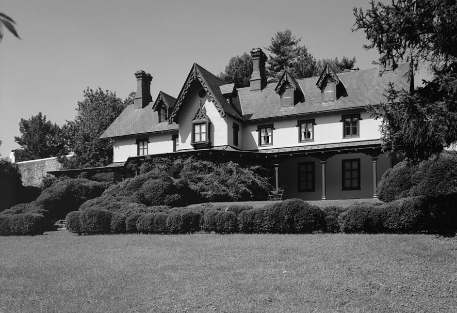
Grange Estate
Monument and historic site · National Register of Historic Places · 2.7 mi
Human settlement in Pennsylvania, United States of America


Holmes Junior High School
Monument and historic site · National Register of Historic Places · 3.2 mi
High school in Pennsylvania, United States
Idlewild Farm Complex
Monument and historic site · National Register of Historic Places · 3.2 mi
Building in Pennsylvania, United States
45 more on the map.
Parks, trails and playgrounds28

Mann Center for the Performing Arts
Park · 2.0 mi
Park in Pennsylvania, United States of America
Smith Memorial Playground & Playhouse
Park · 3.3 mi
Historic site in Philadelphia, Pennsylvania
Wissahickon Valley Park
Park · 3.3 mi
Second-largest park in Philadelphia, Pennsylvania, United States
16 more on the map.
Restaurants and cafes86

Al Sham 2 (City Line)
Restaurant · Middle Eastern · 0.9 mi
201 City Avenue, Bala Cynwyd
Mo-Th,Su 10:00-22:00; Fr-Sa 10:00-23:00
Coco Thai Bistro
Restaurant · Thai · 0.6 mi
231 Haverford Avenue, Narberth
Mo off; Tu-Th 16:00-20:30; Fr 16:00-21:30; Sa 12:00-21:30; Su 12:00-20:30
Hymie's Delicatessen
Restaurant · Deli, Sandwich, Bagel · 0.4 mi
342 Montgomery Avenue, Merion Station
Mo-Sa 07:00-21:00
Maki Han
Restaurant · Asian · 0.5 mi
138 Montgomery Avenue, Bala Cynwyd
Mo-Th 11:30-22:00; Fr-Sa 11:30-22:30; Su 11:30-22:30
Olive Garden
Restaurant · Italian · 1.4 mi
83 East City Avenue, Bala Cynwyd
Mo-Th,Su 11:00-22:00; Fr,Sa 11:00-23:00
Rudee's Thai cuisine
Restaurant · Thai · 1.5 mi
333 East Lancaster Avenue, Wynnewood
Tu-Su 15:00-21:00
SangKee Asian Bistro
Restaurant · Chinese · 1.4 mi
339 East Lancaster Avenue, Wynnewood
Mo-Su 11:30-21:30; Fr,Sa 11:30-22:30

74 more on the map.
History
Merion Meeting House was built at the present intersection of Montgomery Avenue and Meetinghouse Lane in 1695 by Welsh settlers.
The General Wayne Inn and Merion Friends Meeting House are listed on the National Register of Historic Places. The Merion Friends Meeting House is also a National Historic Landmark.
From the History section of Merion Station, Pennsylvania on Wikipedia, under CC BY-SA 4.0.
Where to stay1
Churches and places of worship43
Merion Friends Meeting
Church · Quaker · 0.5 mi
615 East Montgomery Avenue, Lower Merion Township
Adath Israel
Place of worship · Conservative · 0.5 mi
250 North Highland Avenue, Merion Station
All Saints' Church
Church · Episcopal · 1.4 mi
1325 East Montgomery Avenue, Wynnewood
Shopping12
Saint Joseph's University Bookstore
Shop · 1.0 mi
2461 North 54th Street, Philadelphia
Gas and EV charging4
Schools, colleges and libraries69
Alliance For Progress Cs
School · 4.9 mi
1821-39 Cecil B Moore Avenue, Philadelphia
Healthcare5
Map of Merion Station
250 places. The map loads OpenStreetMap tiles when you open it.
Climate by month
Monthly table
| Month | High | Low | Rain | Snow |
|---|---|---|---|---|
| Jan | 42°F | 28°F | 3.6 in | 6.4 in |
| Feb | 45°F | 30°F | 3.3 in | 4.0 in |
| Mar | 54°F | 36°F | 4.5 in | 2.0 in |
| Apr | 66°F | 46°F | 4.0 in | 0.1 in |
| May | 76°F | 56°F | 4.1 in | 0.0 in |
| Jun | 85°F | 66°F | 4.8 in | 0.0 in |
| Jul | 89°F | 71°F | 4.8 in | 0.0 in |
| Aug | 87°F | 70°F | 5.0 in | 0.0 in |
| Sep | 80°F | 63°F | 4.9 in | 0.0 in |
| Oct | 68°F | 51°F | 4.2 in | 0.0 in |
| Nov | 56°F | 41°F | 3.4 in | 0.1 in |
| Dec | 46°F | 33°F | 4.3 in | 3.5 in |
U.S. Climate Normals 1991-2020 for Phila Franklin Inst (5 mi away), NOAA NCEI.
People and cost of living
American Community Survey 5-year estimates, 2020-2024, U.S. Census Bureau. Estimates have margins of error, larger for small towns.
Disaster history
Montgomery County has had 19 federal disaster declarations since 2000, most often for hurricanes.
- 2021-09-10: Remnants Of Hurricane Ida (Hurricane)
- 2020-03-30: Covid-19 Pandemic (Biological)
- 2020-03-13: Covid-19 (Biological)
- 2016-03-23: Severe Winter Storm And Snowstorm (Snowstorm)
- 2014-02-06: Severe Winter Storm (Severe Ice Storm)
- 2013-01-10: Hurricane Sandy (Hurricane)
OpenFEMA disaster declarations summaries.
Getting there and nearby towns
Philadelphia International Airport (PHL) is the nearest airport with scheduled flights listed in OpenStreetMap, 9 miles away.
- Bala Cynwyd 1 mi northeast, about 2 min by car
- Ardmore 2 mi west, about 4 min by car
- Millbourne 3 mi south, about 4 min by car
- Haverford College 3 mi west, about 5 min by car
- Bryn Mawr 4 mi west, about 6 min by car
- East Lansdowne 4 mi south, about 7 min by car
- Drexel Hill 5 mi southwest, about 8 min by car
- Lansdowne 5 mi south, about 7 min by car
- Yeadon 5 mi south, about 8 min by car
- Philadelphia 6 mi east, about 10 min by car
Drive times are estimates from straight-line distance, not routes.
Local news
Headlines from INDB, the NEMICO news database.
Reviews, tips and questions
Loading what members have shared...
Sources and licences
- NCES EDGE (Public domain): public schools
- NOAA NCEI U.S. Climate Normals 1991-2020 (Public domain): climate by month
- OpenFEMA (Public domain): disaster declarations
- OpenStreetMap contributors (ODbL 1.0): places, airports, map data
- U.S. Census Bureau (Public domain): population, income, housing, education, commute
- Wikidata (CC0 1.0): elevation, founding date, time zone, website, landmarks and historic places
- Wikimedia Commons (see each image): photos
- Wikipedia (CC BY-SA 4.0): overview and history text
Photo credits
- Merion Friends Meeting House, 615 Montgomery Avenue (changed from Montgomery Avenue & Meetinghouse Lane), Merion Station (Montgomery County, Pennsylvania), Unknown author Unknown author, Public domain
- Merion Station post office, Ii2nmd, CC0
- Overbrook School 1913, Smallbones, Public domain
- Ridge Ave Bridge Philly, Smallbones, Public domain
- HenryAvenueBridge, Joseph Elliott, Public domain
- NitreHall, User:Smallbones on English Wikipedia., Public domain
- Dobson Mills Philly, Smallbones, Public domain
- Overbrook High School, Smallbones, Public domain
- 750 Mill Creek Rd MontCo PA, Smallbones, CC BY-SA 3.0
- Warner 2 LH Philly, Smallbones, CC0
- Dupont Street in Manayunk, Dasprevailz, Public domain
- Mann School Philly, Smallbones, Public domain
- Aspden tomb West Laurel Hill, Smallbones, CC BY-SA 3.0
- Brooks School Philly, Smallbones, Public domain
- Lower Merion Academy PA, Smallbones, CC0
- Mount Pleasant, Fairmount Park, wide view of land side, ProfReader, CC BY-SA 3.0
- Sulzberger Jr HS Philly, Smallbones, Public domain
- Walnut Lane Bridge (cropped), Helen P. Ross, HAER., Public domain
- Levering School Philly, Smallbones, Public domain
- Holmes School Philly, Smallbones, Public domain
- Montevista apts, Smallbones, Public domain
- Better Belmont Bridge, Smallbones, Public domain
- GrangeEstate, Unknown (US government). Original uploader was BillFlis at en.wikipedia, Public domain
- MemorialHallPhila02, Davidt8, Public domain
- Walnut Park Plaza A, Smallbones, Public domain
- Shoemaker Jr HS Philly, Smallbones, Public domain
- Belmont Hills Public Library, Spybeak, CC BY-SA 4.0
- Photo Dec 21 2022, 2 49 28 PM, Dhagerty1122, CC BY-SA 4.0
- - 1989 “40 ACRES” - Signed lower right - Facsimile - Framed, matted, and glazed - 24 3/8 x 28 1/4 in, Arthur Dawson, Public domain
- Waldron Mercy Academy (49041229356), Craig Talbert, CC BY 2.0
- MuralLita2, YoureTheDude, CC BY-SA 4.0
- MuralLita, YoureTheDude, CC BY-SA 4.0
- 20191229ADATHISRAEL MERION Exterior, Morris Levin, CC BY-SA 4.0
- 20191229ADATHISRAEL MERION Sanctuary, Moriah Levin, CC BY-SA 4.0
- General Wayne Inn PA, Smallbones, CC0
- 20120405 0625HAZELHURST, Morris Levin, CC BY-SA 4.0
- MerionFriendsMeetinghouse4, Magicpiano, CC BY-SA 4.0
- MerionFriendsMeetinghouse1, Magicpiano, CC BY-SA 4.0
- MerionFriendsMeetinghouseShed, Magicpiano, CC BY-SA 4.0
- MerionFriendsMeetinghouseCemetery, Magicpiano, CC BY-SA 4.0


Page built October 30, 2026. Spotted a mistake? Tell us or suggest a place.