




Milton, Massachusetts
Milton is a community of 28,587 people in Norfolk County, Massachusetts, founded in 1636.
Why visit Milton
Townapedia lists 109 museums and landmarks, 81 parks and trails, 88 places to eat, 10 places to stay and 38 attractions in and around town.
Highlights include AMC Braintree 10, Eliot Tower, Captain Robert Bennet Forbes House and Chickatawbut Observation Tower.
July is the warmest month, with average highs of 82°F; January lows average 18°F, and about 70 inches of snow fall in a normal year.
Weather in Milton
Forecast from the National Weather Service. Full forecast
About Milton
Milton is a town in Norfolk County, Massachusetts, United States and an immediate southern suburb of Boston. The population was 28,630 at the 2020 census.
From the Wikipedia article Milton, Massachusetts (this version), under CC BY-SA 4.0.
Things to do38


26 more on the map.
Museums and landmarks109

Captain Robert Bennet Forbes House
Monument and historic site · National Register of Historic Places · 1.8 mi
Historic house in Massachusetts, United States
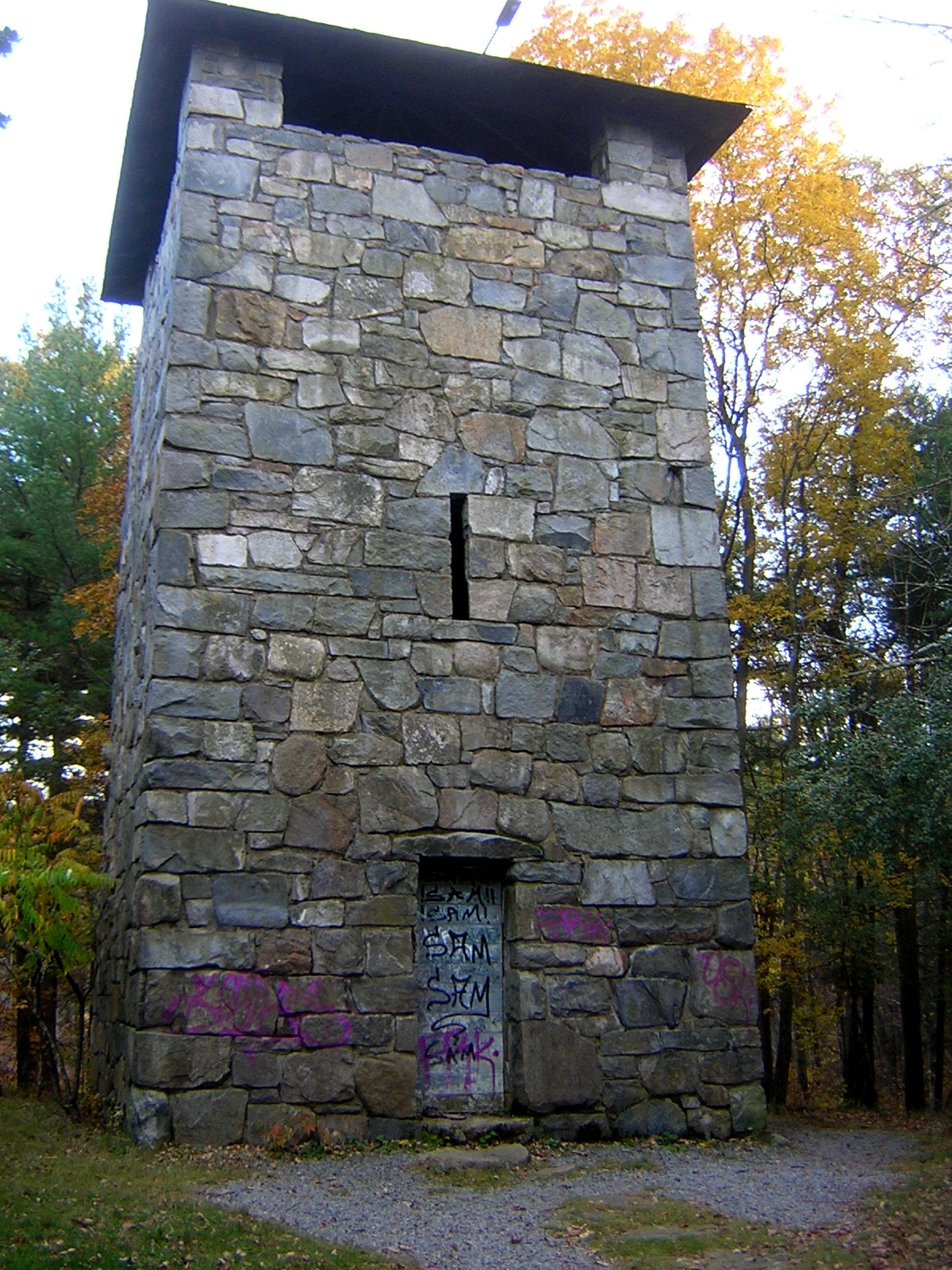
Chickatawbut Observation Tower
Monument and historic site · National Register of Historic Places · 1.6 mi
Observation tower in Quincy, United States of America

Dorchester Park
Monument and historic site · National Register of Historic Places · 2.5 mi
Park in Massachusetts, United States of America
Fairview Cemetery
Monument and historic site · National Register of Historic Places · 3.0 mi
Cemetery in Hyde Park, Boston, Massachusetts

Refreshment Pavilion
Monument and historic site · National Register of Historic Places · 2.4 mi
Historic building in Milton, Massachusetts
848 Hillside Street

A. C. Smith & Co. Gas Station
Monument and historic site · National Register of Historic Places · 3.5 mi
Filling station in Quincy, Massachusetts
Adams National Historical Park
Monument and historic site · National Register of Historic Places · 3.8 mi
Park commemerating the Adams political family
All Souls Church
Monument and historic site · National Register of Historic Places · 4.4 mi
Church in Braintree, Massachusetts, United States
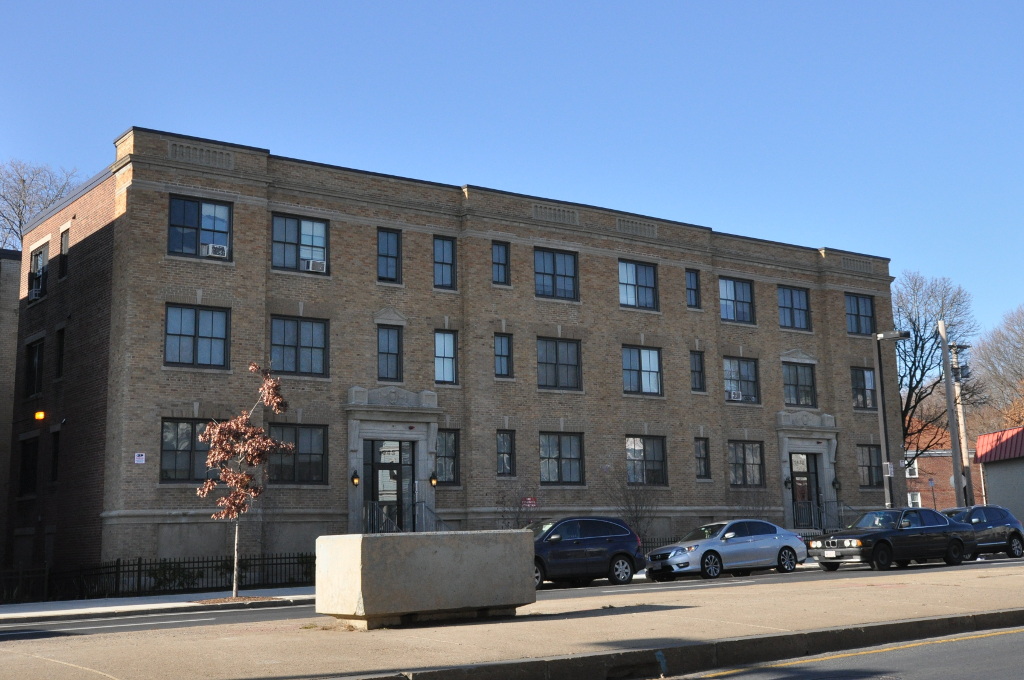


Almont Apartments
Monument and historic site · National Register of Historic Places · 2.4 mi
Historic building in Boston, Massachusetts, USA
Ames Schoolhouse
Monument and historic site · National Register of Historic Places · 4.7 mi
School building in Dedham, Massachusetts
Barnes House
Monument and historic site · National Register of Historic Places · 3.1 mi
Historic house in Massachusetts, United States
Baxter–King House
Monument and historic site · National Register of Historic Places · 3.6 mi
Historic house in Massachusetts, United States
97 more on the map.
Parks, trails and playgrounds81




69 more on the map.
Restaurants and cafes88

Cappy's Pizzeria
Restaurant · Pizza, Burger, Italian, American, Chicken · 2.0 mi
672 Truman Parkway, Boston
Tu-Sa 11:00-21:00

Coffee Break Cafe
Cafe · Coffee Shop · 2.0 mi
24 Central Avenue, Milton
Mo-Fr 05:30-17:00; Sa 06:00-17:00; Su 07:00-15:00

Fairmount Grille
Diner · American · 2.1 mi
81;81-87 Fairmount Avenue, Boston;Hyde Park
Mo-Tu 16:00-24:00, We-Th 16:00-01:00, Fr-Sa 11:30-01:00, Su 10:00-24:00
MOTW Coffee & Pastries
Cafe · Arab · 2.6 mi
279 Willard Street
Mo-Th 06:30-21:00; Fr 06:30-00:00; Sa 08:00-00:00; Su 08:00-20:00
Old Railroad Cafe
Restaurant · Pizza, Sandwich · 2.6 mi
273 Willard Street
Su-Th 10:00-22:00; Fr-Sa 10:00-23:00
Pat's Pizza
Restaurant · Pizza · 2.3 mi
2254 Dorchester Avenue, Dorchester
Mo-Sa 10:00-21:30, Su 11:00-20:00
Steel & Rye
Diner · American · 2.0 mi
95 Eliot Street, Milton
Mo 07:00-14:30; Tu-Th 07:00-21:00; Fr 07:00-22:00; Sa 08:00-22:00;...
Talk and Wok Cafe
Restaurant · Chinese · 2.4 mi
1277 River Street, Hyde Park
Tu-Th 11:00-22:30; Fr 11:00-23:30; Sa 11:30-23:30; Su 12:00-22:30

76 more on the map.
Where to stay10
Churches and places of worship38
Parkway United Methodist Church
Church · Methodist · 1.5 mi
158 Blue Hills Parkway
Shopping18
Gas and EV charging22
Residence Inn / 110 Grill Braintree
EV charging · 2.9 mi
3 180 Forbes Road, Braintree
Schools, colleges and libraries103
Academy Of the Pacific Rim Charter Public School
School · 2.6 mi
1 Westinghouse Plaza, Hyde Park
Hyde Park Education Complex
School · 2.3 mi
655 Metropolitan Avenue, Hyde Park
Healthcare11
Passport Health Quincy Travel Clinic
Clinic and pharmacy · 2.4 mi
40 Willard Street, Quincy
Map of Milton
250 places. The map loads OpenStreetMap tiles when you open it.
Climate by month
Monthly table
| Month | High | Low | Rain | Snow |
|---|---|---|---|---|
| Jan | 35°F | 18°F | 4.5 in | 18.6 in |
| Feb | 37°F | 20°F | 4.0 in | 18.2 in |
| Mar | 44°F | 27°F | 5.5 in | 15.0 in |
| Apr | 56°F | 38°F | 4.8 in | 2.8 in |
| May | 67°F | 48°F | 3.8 in | 0.0 in |
| Jun | 75°F | 58°F | 4.6 in | 0.0 in |
| Jul | 82°F | 64°F | 3.5 in | 0.0 in |
| Aug | 80°F | 63°F | 3.9 in | 0.0 in |
| Sep | 73°F | 56°F | 4.1 in | 0.0 in |
| Oct | 61°F | 44°F | 5.5 in | 0.7 in |
| Nov | 50°F | 34°F | 4.3 in | 1.8 in |
| Dec | 40°F | 25°F | 5.4 in | 12.6 in |
U.S. Climate Normals 1991-2020 for Blue Hill Coop Hcn (3 mi away), NOAA NCEI.
People and cost of living
American Community Survey 5-year estimates, 2020-2024, U.S. Census Bureau. Estimates have margins of error, larger for small towns.
Disaster history
Norfolk County has had 25 federal disaster declarations since 2000, most often for snowstorms.
- 2023-09-15: Hurricane Lee (Hurricane)
- 2022-04-18: Severe Winter Storm And Snowstorm (Snowstorm)
- 2020-03-27: Covid-19 Pandemic (Biological)
- 2020-03-13: Covid-19 (Biological)
- 2018-07-19: Severe Winter Storm And Snowstorm (Snowstorm)
- 2018-06-25: Severe Winter Storm And Flooding (Severe Storm)
OpenFEMA disaster declarations summaries.
Getting there and nearby towns
Norwood Memorial Airport (OWD) is the nearest airport with scheduled flights listed in OpenStreetMap, 6 miles away.
- Quincy 4 mi east, about 6 min by car
- Braintree Town 5 mi southeast, about 8 min by car
- Dedham 5 mi west, about 8 min by car
- Brookline 6 mi northwest, about 10 min by car
- Boston 7 mi northeast, about 12 min by car
- Holbrook 8 mi southeast, about 13 min by car
- Needham 9 mi west, about 14 min by car
- Cambridge 9 mi north, about 15 min by car
- Brockton 11 mi south, about 18 min by car
- Chelsea 11 mi north, about 18 min by car
Drive times are estimates from straight-line distance, not routes.
Local news
Headlines from INDB, the NEMICO news database.
Reviews, tips and questions
Loading what members have shared...
Sources and licences
- NCES EDGE (Public domain): public schools
- NOAA NCEI U.S. Climate Normals 1991-2020 (Public domain): climate by month
- OpenFEMA (Public domain): disaster declarations
- OpenStreetMap contributors (ODbL 1.0): places, airports, map data
- U.S. Census Bureau (Public domain): population, income, housing, education, commute
- Wikidata (CC0 1.0): elevation, founding date, time zone, website, landmarks and historic places
- Wikimedia Commons (see each image): photos
- Wikipedia (CC BY-SA 4.0): overview and history text
Photo credits
- Closed street in East Milton Square, March 2017, Pi.1415926535, CC BY-SA 4.0
- Fairview Cemetery Boston MA 01, Jameslwoodward, CC BY-SA 3.0
- Robert B Forbes House Milton MA, Jameslwoodward, CC BY-SA 3.0
- Chickatawbut Observation Tower Quincy MA 02, Jameslwoodward, CC BY-SA 3.0
- Dorchester Park Boston MA, Jameslwoodward, CC BY-SA 3.0
- Refreshment Pavilion MIlton MA 03, Jameslwoodward, CC BY-SA 3.0
- Suffolk Resolves House Milton MA 04, Jameslwoodward, CC BY-SA 3.0
- Boston Consumptives Hospital Boston MA 01, Jameslwoodward, CC BY-SA 3.0
- Truman Parkway Boston MA, Jameslwoodward, CC BY-SA 3.0
- Across the street from the JQA Birthplace, National Park Service, Public domain
- Quincy Water Company Pumping Station Site, Jameslwoodward, CC BY-SA 3.0
- Christ Church Hyde Park Boston MA 02, Jameslwoodward, CC BY-SA 3.0
- S. H. Barnicoat Monuments Site Quincy MA, Jameslwoodward, CC BY-SA 3.0
- BostonMA AlmontApartments, Magicpiano, CC BY-SA 3.0
- Nightengale House, Sswonk, CC BY-SA 3.0
- Edward J Lennon House Quincy MA, Jameslwoodward, CC BY-SA 3.0
- House at 92 Willard Street Quincy MA 02, Jameslwoodward, CC BY-SA 3.0
- Christ Church Burial Ground Quincy MA, Sswonk, CC BY-SA 3.0
- Neoponset Valley Parkway MA 02, Jameslwoodward, CC BY-SA 3.0
- QuincyMA RailwayIncline 1, Magicpiano, CC BY-SA 3.0
- Milton Cemetery MA 01, Jameslwoodward, CC BY-SA 3.0
- Salem Lutheran Church Quincy MA, Sswonk, CC BY-SA 3.0
- Pauls Bridge MA north side 02, Jameslwoodward, CC BY-SA 3.0
- Lyons Turning Mill Quincy MA 04, Jameslwoodward, CC BY-SA 3.0
- Edwin W. Marsh House, Sswonk, CC BY-SA 3.0


Page built October 30, 2026. Spotted a mistake? Tell us or suggest a place.