


Ciudad General Escobedo, Mexico
General Escobedo
Ciudad General Escobedo is a town of 454,967 people in Nuevo León, Mexico, founded in April 25, 1604.
Why visit Ciudad General Escobedo
Townapedia lists 6 museums and landmarks, 62 parks and trails, 140 places to eat, 13 places to stay and 14 attractions in and around town.
Highlights include Auditorio Banamex, Mirador del Obispado, Faro del Comercio and Government Palace Museum.
Weather in Ciudad General Escobedo
Forecast from MET Norway (CC BY 4.0). Full forecast
About Ciudad General Escobedo
General Escobedo, or simply Escobedo, is a city and municipality in Nuevo León, Mexico, that is part of the Monterrey Metropolitan area. As of the census of 2005, the population was 295,131 in the city and 299,364 in the municipality. The municipality has an area of around 149 km2 (58 sq mi) and shares borders to the south with San Nicolás de los Garza, Monterrey and Santa Catarina; to the north with Hidalgo and El Carmen; to the east with Apodaca and Salinas Victoria; and to the west with García. Escobedo is also the home of the Mexican Army's 7th Military Zone Army Base.
From the Wikipedia article General Escobedo (this version), under CC BY-SA 4.0.
Things to do14

Auditorio Banamex
Cinema and theater · 13.7 km
Amphitheater in Mexico
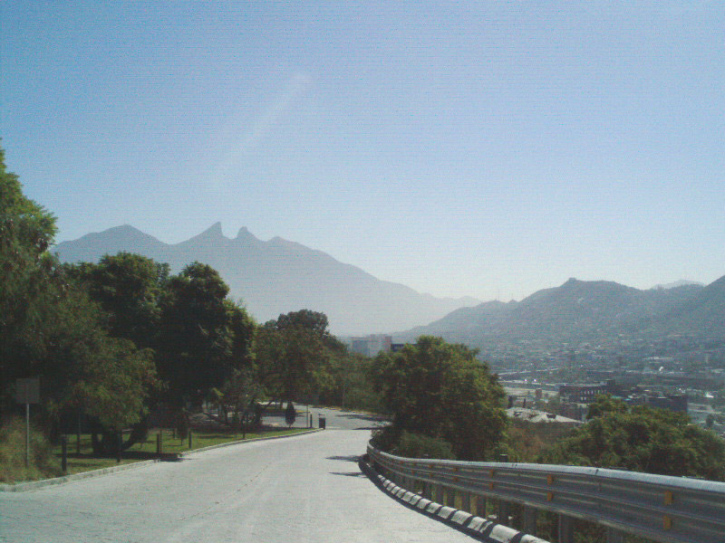
Mirador del Obispado
Monument and historic site · 13.7 km
Hill and lookout in Monterrey, Mexico

Universidad Autónoma Nuevo León
School · 7.8 km
Public university in the state Nuevo León in Mexico

Universidad de la vida, la casa de los famosos
School · 14.0 km
Institution of higher education in Monterrey, México
Universidad Metropolitana de Monterrey
School · 13.7 km
Mexican university


2 more on the map.
Museums and landmarks6

Faro del Comercio
Monument and historic site · 14.5 km
Monument in Mexico

Government Palace Museum
Museum · 13.8 km
State government building in Monterrey, Mexico
Museo de Arte Contemporáneo de Monterrey
Museum · 14.2 km
Museum of Contemporary Art in Monterrey, Mexico

Museum of Steel
Museum · 13.6 km
Museum in Monterrey, Nuevo León, Mexico

Palacio del Obispado
Museum · 13.9 km
History Museum in Nuevo Leon, MX

Parks, trails and playgrounds62

Parque Lineal Acueducto
Park · 2.1 km
S/N Avenida Acueducto, General Escobedo
24/7
Parque Lineal Las Torres
Park · 0.8 km
Parque característico de General Escobedo.
Avenida Las Torres, General Escobedo
24/7


Parque Fomerrey 9
Park · 1.2 km
Doctor Plinio Daniel Ordóñez, General Escobedo
24/7
Cancha de futbol
Park · 5.6 km
Calle Universidad Labastida, san nicolas de los garza
50 more on the map.
Restaurants and cafes140

Ninjato Sushi
Restaurant · Asian, Sushi · 6.4 km
101 Avenida República Mexicana
Su-Mo, We-Th 12:00-22:00; Fr-Sa 12:00-23:00

Boyak Club
Bar and pub · 4.4 km
Restaurante bar en Plaza Andenes, está dirigido a personas de entre 18 y 30 años. Hay karaoke entre semana y DJ los fines de semana.
1250 Avenida Universidad, San Nicolás de los Garza
Tu-Su 18:00-2:00
El Camaroncito
Restaurant · Seafood · 0.6 km
500 Avenida Licenciado Raúl Caballero Escamilla, General Escobedo
Mo-Su 10:00-20:00
Mi Pueblo
Restaurant · Mexican · 6.4 km
100 Cristina Larralde de Treviño, San Nicolas de los Garza
Tu-Su 12:00-23:00

Panadería Maná
Bakery · 0.6 km
501 Avenida Licenciado Raúl Caballero Escamilla, General Escobedo
Mo-Su 06:00-22:00
Winchester Tacos
Restaurant · Regional · 5.2 km
Avenida de la Concordia, apodaca

128 more on the map.
History
The land was originally known as "Los Llanos del Topo" (Hills of the Topo). The first owner of these lands was Captain José de Treviño, who was granted the territory on April 25, 1604, by Gov. Diego de Montemayor. Although Treviño was the original owner, the city itself was established by his son José de Ayala with the "Hacienda del Topo de San Nicolas Tolentino" by the time known as "Topo de los Ayala" or "Topo Grande", not to be confused with "Topo de los Gonzalez" or "Topo Chico".
In recent years Escobedo has undergone major growth, with many urban projects like shopping malls and the expansion of the Escobedo Industrial Park.The town was the location of Blue Diamond Trucks, a joint venture between Navistar and Ford Motor Company, until that company was dissolved in 2009.
The population in year 2005 in General Escobedo was 295,131 people, 148,835 men and 146,296 women. It was the 5th most populous city in the state, representing 7.03% of the total population.
This is due to the exponential growth on expansion on commerce, neighborhoods and Industries along the municipality, Escobedo along Apodaca N.L. are the two municipalities with the biggest growth in recent years
From the History section of General Escobedo on Wikipedia, under CC BY-SA 4.0.
Where to stay13
Churches and places of worship24
La Iglesia de Jesucristo de los Santos de los Últimos Días
Church · Mormon · 1.9 km
921 Calle José María Velasco, General Escobedo
Misión parroquial Nuestra Señora del Refugio y San José
Church · Catholic · 2.1 km
109 Calle Monte Horeb, General Escobedo
Shopping64
Plaza Metro Sendero
Shopping center · 4.0 km
113 Carretera a Colombia, General Escobedo
Gas and EV charging64
Schools, colleges and libraries91
Universidad Alfonso Reyes - Unidad Escobedo
School · 1.5 km
250 Avenida Licenciado Raúl Salinas Lozano, General Escobedo
Escuela Secundaria Técnica No. 129 Héctor Carrizosa Andrade
School · 2.4 km
S/N Avenida Mirasur, General Escobedo
Healthcare77
Unidad de Medicina Familiar No. 43
Clinic and pharmacy · 2.5 km
S/N Calle Guanajuato, General Escobedo
Centro Médico ROA
Clinic and pharmacy · 4.2 km
101 Avenida Sendero Norte, Escobedo
Map of Ciudad General Escobedo
250 places. The map loads OpenStreetMap tiles when you open it.
Getting there and nearby towns
Del Norte International Airport (NTR) is the nearest airport with scheduled flights listed in OpenStreetMap, 11 km away.
- San Nicolás de los Garza 6 km south, about 6 min by car
- Simeprodeso (Colectivo Nuevo) 7 km northeast, about 7 min by car
- Buena Vista 7 km northwest, about 7 min by car
- Fraccionamiento Cosmópolis Octavo Sector 8 km northeast, about 8 min by car
- Monterrey 12 km south, about 12 min by car
- Ciudad Apodaca 13 km east, about 13 min by car
- Guadalupe 15 km southeast, about 15 min by car
- San Pedro Garza García 17 km southwest, about 17 min by car
- Santa Catarina 20 km southwest, about 20 min by car
- Saltillo 78 km southwest, about 1 h 15 min by car
Drive times are estimates from straight-line distance, not routes.
Local news
Headlines from INDB.
Reviews, tips and questions
Loading what members have shared...
Sources and licences
- GeoNames (CC BY 4.0): population, coordinates, regions and time zone
- OpenStreetMap contributors (ODbL 1.0): places, airports, map data
- Wikidata (CC0 1.0): elevation, founding date, time zone, website, landmarks and historic places
- Wikimedia Commons (see each image): photos
- Wikipedia (CC BY-SA 4.0): overview and history text
Photo credits
- PalacioMunicipalEsc, Jvr solid, Public domain
- Auditorio Banamex, Tavoman666, CC BY-SA 3.0
- Torre Rectoria UANL (2023), Davidmejoradas, CC BY-SA 4.0
- Farodelcomercio, Cvmontuy, CC BY-SA 3.0
- PALACIO DE GOB, LABNL Lab Cultural Ciudadano, CC BY-SA 2.0
- Fachada MARCO, Limbo@MX C, CC BY 2.5
- Antiguo Obispado o Museo Regional de Nuevo León, Brendablue77, CC BY-SA 3.0
- Parque Fundidora, Monterrey1, México en Fotos, CC BY-SA 2.0
- Monterrey - Catedral de la Inmaculada Concepción - 4, This illustration was made by Peter Potrowl . Please credit this with : © Peter Potrowl in the immediate vicinity of the image. A link to my website sitemai.eu would be much appreciated but isn't..., CC BY-SA 4.0
- Cerro del Topo Chico, Valdez Lopez, CC BY-SA 3.0
- Mirador Obispado 3, Unknown author, CC BY-SA 2.5
- Cerro del Topo Chico 2, Valdez Lopez, CC BY-SA 3.0
- Pabellón Sopladores del Museo del Acero en el Parque Fundidora, Rick González, CC BY 2.0
- ISS062-E-47245 - View of Earth, Earth Science and Remote Sensing Unit, NASA Johnson Space Center, Public domain
- ISS062-E-47244 - View of Earth, Earth Science and Remote Sensing Unit, NASA Johnson Space Center, Public domain
- ISS062-E-47242 - View of Earth, Earth Science and Remote Sensing Unit, NASA Johnson Space Center, Public domain
- ISS062-E-47243 - View of Earth, Earth Science and Remote Sensing Unit, NASA Johnson Space Center, Public domain
- Papilio ornythion ornythion, Rogelio Antonio Reyna Hernández, CC BY-SA 4.0
- Oficinas de DeliPrime Alimentos, Salsas Del Primo, CC BY-SA 4.0
- Monterrey-Colombia Km 6 - panoramio, JAGarcia, CC BY 3.0
- Monterrey-Colombia Km 6 - panoramio (1), JAGarcia, CC BY 3.0
- Echinocereus viereckii santamariensis 5, Rogelio Reyna-Hernández, CC BY-SA 4.0
- Lenophyllum latum 518628716, Rogelio Reyna-Hernández, CC BY-SA 4.0
- Colibrí Pico Ancho - panoramio, panza-rayada, CC BY-SA 3.0
- Colibrí Pico Ancho, Roberto González, CC BY 2.0
- Templo de San Nicolás Tolentino, Brenda A. Cerda Zarazua, CC BY-SA 4.0
- Ampelis Chinito - panoramio, panza.rayada, CC BY-SA 3.0
- Paloma de Alas Blancas - panoramio, panza.rayada, CC BY-SA 3.0
- Carpintero Cheje - panoramio, panza-rayada, CC BY-SA 3.0
- Pericos en el nogal - panoramio, panza.rayada, CC BY-SA 3.0
- Carpintero Cheje, Roberto González, CC BY 2.0
- Loros Cachete Amarillo, Roberto González, CC BY 2.0
- Chipe Corona Naranja, Roberto González, CC BY 2.0
- Mirlo Pardo, Roberto González, CC BY 2.0
- Flor de Granado, Roberto González, CC BY 2.0
- Loros Cachete Amarillo en Monterrey - panoramio, panza-rayada, CC BY-SA 3.0
- Chipe Corona Naranja - panoramio, panza-rayada, CC BY-SA 3.0
- Flor de Granado - panoramio, panza-rayada, CC BY-SA 3.0
- Paloma Ala Blanca - panoramio, panza-rayada, CC BY-SA 3.0
- Mirlo Pardo - panoramio, panza-rayada, CC BY-SA 3.0


Page built November 4, 2026. Spotted a mistake? Tell us or suggest a place.