


Cuautla, Mexico
Cuautla de Morelos
Cuautla is a town of 157,336 people in Morelos, Mexico.
Why visit Cuautla
Townapedia lists 21 museums and landmarks, 59 parks and trails, 61 places to eat, 16 places to stay and 2 attractions in and around town.
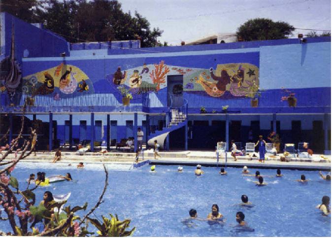
Highlights include Hacienda Cocoyoc, Monumental Flag, BALNEARIO AGUA HEDIONDA and Six Flags Hurricane Harbor Oaxtepec.
Weather in Cuautla
Forecast from MET Norway (CC BY 4.0). Full forecast
About Cuautla
Cuautla (Nahuatl pronunciation: [ˈkʷaʍt͡ɬa], meaning "where the eagles roam"), officially Heroica e Histórica Ciudad de Cuautla de Morelos (Heroic and Historic City of Cuautla of Morelos) or H. H. Cuautla, Morelos, is a city and municipality in the Mexican state of Morelos, about 104 kilometers south of Mexico City. In the 2010 census the city population was 154,358.
From the Wikipedia article Cuautla, Morelos (this version), under CC BY-SA 4.0.
Travel tips from other travellers: Cuautla on Wikivoyage (CC BY-SA 4.0).
Things to do2

Museums and landmarks21
Hacienda Cocoyoc
Monument and historic site · 8.5 km
Archeological site in Mexico



9 more on the map.
Parks, trails and playgrounds59

Six Flags Hurricane Harbor Oaxtepec
Sports field and stadium · 9.6 km
Autopista México-Cuautla KM 27, Oaxtepec

MULTICANCHA, UNIDAD DEPORTIVA DE CUAUTLA
Sports field and stadium · 0.9 km
Carretera Santa Bárbara - Izúcar de Matamoros
Parque techado Lázaro Cárdenas
Park · 5.6 km
Calle Patzcuaro, Lázaro Cárdenas, 62757 Cuautla, Mor. 18.859474, -98.933819
47 more on the map.
Restaurants and cafes61

Burger DEMAK
Restaurant · Burger, Snacks · 1.8 km
# 17 Calle Escolta de Morelos, San Pedro Apatlaco, Cd. Ayala
Mo-Th 15:00-22:00, Sa-Su 15:00-23:00

McCarthy's Irish Pub Cuautla
Bar and pub · 6.1 km
Tierra larga, Cuautla, Morelos
97a Camino a Calderón
Mo-Su 14:00-00:00
Toks Cuautla Morelos
Restaurant · 4.1 km
4 Local R1,Colonia Revolución , Morelos,Miguel Hidalgo Antigua Carretera México, Cuautla ,, Cuautla , Morelos.

49 more on the map.
Where to stay16
Hacienda Cocoyoc Hotel
Motel and hotel · 8.5 km
S/N Carretera Federal, Cuernavaca - Cuautla Km 32.5, Cocoyoc
Churches and places of worship6
Shopping28
Gas and EV charging11
Schools, colleges and libraries38
Telesecundaria "Pablo Torres Burgos"
School · 4.9 km
Calle Niños Héroes, ExHacienda El Hospital
Healthcare19
Map of Cuautla
250 places. The map loads OpenStreetMap tiles when you open it.
Getting there and nearby towns
General Mariano Matamoros International Airport (CVJ) is the nearest airport with scheduled flights listed in OpenStreetMap, 32 km away.
- Chalco de Díaz Covarrubias 50 km north, about 50 min by car
- Xochimilco 52 km north, about 52 min by car
- Ixtapaluca 56 km north, about 56 min by car
- Tlalpan 58 km north, about 58 min by car
- Ciudad Nezahualcoyotl 66 km north, about 1 h by car
- Iztacalco 66 km north, about 1 h by car
- Benito Juarez 68 km north, about 1 h 15 min by car
- Mexico City 71 km north, about 1 h 15 min by car
- Cuauhtémoc 73 km north, about 1 h 15 min by car
- Miguel Hidalgo 74 km north, about 1 h 15 min by car
Drive times are estimates from straight-line distance, not routes.
Local news
Headlines from INDB.
Reviews, tips and questions
Loading what members have shared...
Sources and licences
- GeoNames (CC BY 4.0): population, coordinates, regions and time zone
- OpenStreetMap contributors (ODbL 1.0): places, airports, map data
- Wikidata (CC0 1.0): elevation, founding date, time zone, website, landmarks and historic places
- Wikimedia Commons (see each image): photos
- Wikipedia (CC BY-SA 4.0): overview and history text
Photo credits
- TrapicheNocheHaciendaCocoyoc, Pedrorivto, CC BY-SA 3.0
- Bandera Monumental Ensenada, José R. Quintanilla, CC BY 2.5
- IMSS Oaxtepec01, BetoCG, CC BY 3.0
- 6 Museo Histórico del Oriente Casa e Morelos, SERFEDCONMAT, CC BY-SA 4.0
- Izando la bandera monumental del zocalo, gib_l, CC BY-SA 2.0
- Agua Hedionda, Healkids, Public domain
Page built November 4, 2026. Spotted a mistake? Tell us or suggest a place.