


Miguel Hidalgo, Mexico
Miguel Hidalgo is a town of 372,889 people in Mexico City, Mexico.
Why visit Miguel Hidalgo
Townapedia lists 127 museums and landmarks, 39 parks and trails, 305 places to eat, 14 places to stay and 38 attractions in and around town.
Highlights include Acuario Inbursa, Instituto Tecnológico Autónomo de México, Jumex Museum and Museo Nacional de Antropología.
Weather in Miguel Hidalgo
Forecast from MET Norway (CC BY 4.0). Full forecast
About Miguel Hidalgo
Miguel Hidalgo is a borough (alcaldía) in western Mexico City, it encompasses the historic areas of Tacuba, Chapultepec and Tacubaya along with a number of notable neighborhoods such as Polanco and Lomas de Chapultepec. With landmarks such as Chapultepec Park and the Museo Nacional de Antropología, it is the second most visited borough in Mexico City after Cuauhtémoc where the historic center of Mexico City is located. Tacubaya and Tacuba both have long histories as independent settlements and were designated as "Barrios Mágicos" by the city for tourism purposes.
From the Wikipedia article Miguel Hidalgo, Mexico City (this version), under CC BY-SA 4.0.
Things to do38


Instituto Tecnológico Autónomo de México
School · 9.9 km
Private research university in Mexico

La Feria Chapultepec Mágico
Monument and historic site · 2.1 km
Former amusement park in Mexico City, Mexico


Open and Distance Education University of Mexico
School · 8.7 km
Online public university of Mexico

Palace of Fine arts
Cinema and theater · 6.2 km
Cultural centre in Mexico City
Panamerican University
School · 6.8 km
Mexican university in Mexico City

Polyforum Cultural Siqueiros
Cinema and theater · 5.3 km
Building in Mexico City, Mexico

Royal and Pontifical University of Mexico
School · 7.2 km
Historic university in Mexico City (1551–1865)

Teatro de la Ciudad
Cinema and theater · 6.6 km
Theatre in Mexico City

Teatro de los Insurgentes
Cinema and theater · 8.0 km
Theatre in Mexico City
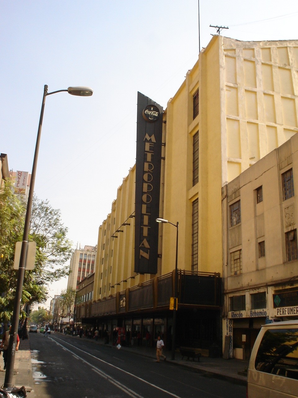
Teatro Metropólitan
Cinema and theater · 5.6 km
Music venue and theater in Mexico City, formerly a movie theater
26 more on the map.
Museums and landmarks127

Jumex Museum
Museum · 0.8 km
303 Blv. Miguel de Cervantes, Ciudad de México
Tu-Sa 11:00-19:00; Su 11:00-20:00
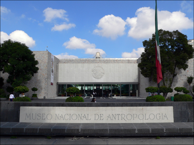
Museo Nacional de Antropología
Museum · 1.7 km
Paseo de la Reforma, Ciudad de México
Tu-Sa 09:00-18:00; Su 10:00-17:00


Academy of San Carlos
Museum · 7.5 km
First major art academy and the first art museum in the Americas

Alfredo Guati Rojo National Watercolor Museum
Museum · 9.8 km
Art Museum in Mexico City

Canadian totem
Monument and historic site · 2.1 km
Monument in Mexico City

Caricature Museum, Mexico City
Museum · 7.1 km
Building in Mexico City, Mexico

Centro Cultural de España
Museum · 7.1 km
Cultural center of Spain in Mexico

Complejo Cultural Los Pinos
Museum · 2.3 km
Mexico City cultural complex


Frida Kahlo Museum
Museum · 9.6 km
Historic house museum and art museum dedicated to the life and work of Mexican artist Frida Kahlo
115 more on the map.
Parks, trails and playgrounds39


27 more on the map.
Restaurants and cafes305


Cafebrería El Péndulo
Restaurant · Breakfast, Chicken, Coffee Shop, Mexican, Sandwich, Tea · 0.6 km
81 Calle Alejandro Dumas, Ciudad de México
Mo-Sa 08:00-23:00; Su 09:00-22:00

Centanni Ristorante Vivo Polanco
Restaurant · Pizza, Italian, Pasta, Steak House · 0.7 km
38 Calle Julio Verne, Ciudad de México
Mo-Su 13:00-02:00

Starbucks
Cafe · Coffee Shop · 0.9 km
243 Calle Lago Zurich, Ciudad de México
Mo-Su 07:00-21:00
Baia Coffee
Cafe · Cake, Coffee Shop, Mediterranean · 1.0 km
199 Avenida Campos Elíseos
Mo-Fr 08:00-20:00; Sa-Su 08:30-18:30
Chai
Cafe · Sandwich, Bagel, Breakfast, Tea, Mexican, Coffee Shop · 0.9 km
38 Calle Galileo, Ciudad de México
Mo-Su 08:00-20:00
Chez Vous #Timecafe
Cafe · 1.0 km
41 Boulevard Miguel de Cervantes Saavedra
Su-Th 07:30-21:30; Fr-Sa 07:30-22:00

El Bajío
Restaurant · Mexican · 0.9 km
7 Alejandro Dumas, Ciudad de México
Mo-Sa 08:00-23:00; Su 09:00-22:00
Signora Mariola
Cafe · 0.9 km
75 Calle Lago Tangañica, Ciudad de México
Mo-Fr 07:00-20:00; Sa, Su 08:00-16:00
293 more on the map.
History
The borough is named after Miguel Hidalgo y Costilla, who began the Mexican War of Independence . The borough was created by fusing various former municipalities such as Tacuba, Tacubaya and the Chapultepec Park area along with the neighborhoods such as Polanco, Lomas de Chapultepec, Bosques de las Lomas, Popotla, Las Pensil, La Argentina, America, Santa Julia and Observatorio. The center of the borough is considered to be Chapultepec Park.
Until the 20th century, Tacuba, Chapultepec and Tacubaya had separate histories, all part of the Federal District of Mexico City during most of this entity's existence under various arrangements. In 1899, the Federal District was divided into the municipality of Mexico and six prefectures, one of which was Tacubaya. This arrangement was reconfirmed in 1917. In 1928, the Federal District was reorganized as a department under the direct control of the federal government. The territory was reorganized into Mexico City proper and thirteen boroughs: Guadalupe-Hidalgo, Azcapotzalco, Iztacalco, General Anaya, Coyoacán, San Ángel, La Magdalena Contreras, Cuajimalpa, Tlalpan, Iztapalapa, Xochimilco, Milpa Alta and Tláhuac. The city proper was divided into twelve districts. What is now Miguel Hidalgo, was part of Mexico City proper. In 1970, the city area was subdivided into four parts, Cuauhtémoc, Venustiano Carranza, Benito Juárez and Miguel Hidalgo.
From the History section of Miguel Hidalgo, Mexico City on Wikipedia, under CC BY-SA 4.0.
Where to stay14
Dominion Corporate Suites
Motel and hotel · 0.9 km
21 Calle Aristóteles, Ciudad de México
Intercontinental Presidente Chapultepec
Motel and hotel · 1.0 km
218 Campos Elíseos, Ciudad de México
Churches and places of worship24
Shopping41
Gas and EV charging7
Schools, colleges and libraries17
Colegio Ciudad de México - Plantel polanco
School · 1.2 km
139 Campos Eliseos, Ciudad de México
Cumbres International School Lomas
School · 1.4 km
50 Calle Rosedal, Ciudad de México
ESCUELA SECUNDARIA Nº 260 "IZKALOTZIN"
School · 1.5 km
Lago Ginebra, Ciudad de México
Healthcare30
Instituto Nacional de Perinatología
Hospital · 1.4 km
800 Montes Urales, Cd de México
Farmacia Genéricos Eben Ezer
Clinic and pharmacy · 1.5 km
Lago Hielmar, Ciudad de México
Map of Miguel Hidalgo
250 places. The map loads OpenStreetMap tiles when you open it.
Getting there and nearby towns
Mexico City International Airport (MEX) is the nearest airport with scheduled flights listed in OpenStreetMap, 14 km away.
- Cuauhtémoc 6 km east, about 6 min by car
- Benito Juarez 6 km southeast, about 6 min by car
- Azcapotzalco 6 km north, about 6 min by car
- Naucalpan de Juárez 6 km northwest, about 6 min by car
- Mexico City 8 km east, about 8 min by car
- Iztacalco 12 km east, about 12 min by car
- Tlalpan 16 km south, about 16 min by car
- Ciudad Nezahualcoyotl 20 km east, about 20 min by car
- Xochimilco 22 km southeast, about 22 min by car
- Ecatepec de Morelos 24 km northeast, about 24 min by car
Drive times are estimates from straight-line distance, not routes.
Local news
Headlines from INDB.
Reviews, tips and questions
Loading what members have shared...
Sources and licences
- GeoNames (CC BY 4.0): population, coordinates, regions and time zone
- OpenStreetMap contributors (ODbL 1.0): places, airports, map data
- Wikidata (CC0 1.0): elevation, founding date, time zone, website, landmarks and historic places
- Wikimedia Commons (see each image): photos
- Wikipedia (CC BY-SA 4.0): overview and history text
Photo credits
- Mexico DF Polanco rain, Pvt.Billinghurst, CC0
- Parque América - Polanco, Miguel Hidalgo - Mexico 2024 (5), José Luiz, CC BY-SA 4.0
- El Palacio de Hierro - Polanco, Miguel Hidalgo - Mexico 2024, José Luiz, CC BY-SA 4.0
- Parque América - Polanco, Miguel Hidalgo - Mexico 2024 (4), José Luiz, CC BY-SA 4.0
- Parque América - Polanco, Miguel Hidalgo - Mexico 2024 (3), José Luiz, CC BY-SA 4.0
- Parque América - Polanco, Miguel Hidalgo - Mexico 2024 (2), José Luiz, CC BY-SA 4.0
- Plaza Roja, ITAM, ITAM, CC BY-SA 4.0
- La Feria Chapultepec Mágico, Dag Lindgren, Public domain
- Atardecer En Bellas Artes Vertical, Octavio Alonso Maya Castro, CC BY-SA 3.0
- PolyforumSiqueiros06, AlejandroLinaresGarcia, CC BY-SA 3.0
- Placa relativa a la Real y Pontificia Universidad de México, Patricia Alzuarte Díaz, CC BY-SA 3.0
- Teatro de la Ciudad de Mexico, Arturo de Albornoz, CC BY-SA 2.0
- Teatro de los Insurgentes, StellarD, CC BY-SA 4.0
- TEATRO METROPOLITAN EN EL D. F., No machine-readable author provided. JEDIKNIGHT1970 assumed (based on copyright claims)., CC BY-SA 2.5
- SanCarlosAcademyDF, Thelmadatter, Public domain
- MainHouseAcuarela, AlejandroLinaresGarcia, CC BY-SA 4.0
- Totem Canadiense DSC 0441 (33954720623), Gobierno CDMX, CC0
- Colegio de Cristo Mexico City, Ymblanter, CC BY-SA 4.0
- CCEMEXFacade01, AlejandroLinaresGarcia, CC BY-SA 3.0
- Los Pinos, Mexico 2018, Drkgk, CC BY-SA 4.0
- El Carmen Church San Angel, Ymblanter, CC BY-SA 4.0
- Museo Frida Kahlo, No machine-readable author provided. Nachtwächter assumed (based on copyright claims)., CC BY-SA 3.0
- ClockTowerPolancoDF, Thelmadatter, Public domain
- Alameda Central CDMX IMG 0731 (25892685445), Gobierno CDMX, CC0
- Parque Bicentenario, D.f., Adrián Cerón, CC BY-SA 3.0
- Dgzentradachapultepec, Nonbeach, CC BY-SA 3.0
- Jardín Ramón López Velarde, Haakon S. Krohn, CC BY-SA 3.0
- Santuario de los Remedios Lateral y Sagrario, Ludan68, CC BY-SA 3.0
- MonumentAlvaroObrgonDF, Thelmadatter, Public domain
- Homenaje a José José en Parque de la China - 1, ProtoplasmaKid, CC BY-SA 4.0
- Monumento al Gral. Lázaro Cárdenas, Equipo 9mkt, CC BY-SA 3.0
- Parque Hundido1, Andrés Tonini, CC BY-SA 3.0
- Parque Lira - Arco de Entrada (Francesco Saverio Cavallari), Keizers, CC BY-SA 3.0
- ParqueNaucalli, ProtoplasmaKid, CC BY-SA 4.0
- FacadeSoledadDF3, Thelmadatter, CC BY-SA 3.0
- ValvaneraChurchDF, Thelmadatter, Public domain
- TEMPLO DE SAN BERNARDO 1, Tonatiuh101, CC BY-SA 3.0
- Convento de San Francisco - Ciudad de México - 1, ProtoplasmaKid, CC BY-SA 3.0
- CourtyardJLCMuseumDF, Thelmadatter, Public domain
- FacadeLaEnseñanza1DF, Thelmadatter, Public domain
- Templo de la Santísima Trinidad 2012-09-03 19-30-26, EdwinDlacruz, CC BY-SA 3.0
- Catedral Metropolitana de la Ciudad de México 1, ProtoplasmaKid, CC BY-SA 4.0
- LoretoChurchBackDF, Thelmadatter, Public domain
- Templo y Convento de Regina Coeli, México D.F., México, 2013-10-16, DD 08, Diego Delso, CC BY-SA 3.0
- FacadeMuseoLuzDF, Thelmadatter, CC BY-SA 3.0
- ExTeresaArteActualDF, Thelmadatter, Public domain
- Museo Júmex front, Keizers, CC BY-SA 3.0
- Musee National Anthropologie-Entree, kornemuz, CC BY-SA 3.0
- Acuario Inbursa entrance, Keizers, CC BY-SA 3.0
- UnADM, UNAMD, Public domain
- Cafebrería El Péndulo (39701060925), Nan Palmero from San Antonio, TX, USA, CC BY 2.0


Page built November 4, 2026. Spotted a mistake? Tell us or suggest a place.