




Narberth, Pennsylvania
Narberth is a borough of 4,511 people in Montgomery County, Pennsylvania, founded in 1682.
Why visit Narberth
Townapedia lists 47 museums and landmarks, 23 parks and trails, 88 places to eat and 11 attractions in and around town.
Highlights include Belmont Avenue Bridge in Philadelphia, Reel Cinemas, Allgates and AMY Northwest Middle School.
July is the warmest month, with average highs of 89°F; January lows average 28°F.
Weather in Narberth
Forecast from the National Weather Service. Full forecast
About Narberth
Narberth is a borough in Montgomery County, Pennsylvania, United States. It is one of many neighborhoods on the historic Philadelphia Main Line. The population was 4,492 at the 2020 census.
From the Wikipedia article Narberth, Pennsylvania (this version), under CC BY-SA 4.0.
Things to do11

Belmont Avenue Bridge in Philadelphia
Bridge · National Register of Historic Places · 2.6 mi
Bridge in United States of America


Ridge Avenue Bridge in Philadelphia
Bridge · National Register of Historic Places · 3.0 mi
Arch bridge in Pennsylvania, United States of America

Bryn Mawr College
School · 3.0 mi
Liberal arts college in Pennsylvania, US
City Avenue Bridges
Bridge · 3.0 mi
Twin bridges over the Schuylkill River in Philadelphia, Pennsylvania
Green Lane Bridge
Bridge · 2.3 mi
Road bridge over the Schuylkill River in Philadelphia, Pennsylvania
Manayunk Bridge
Bridge · 2.3 mi
Rail trail bridge over the Schuylkill River in Pennsylvania
Mule Bridge
Bridge · 2.5 mi
Rail bridge over the Schuylkill River in Philadelphia, Pennsylvania
Pencoyd Bridge
Bridge · 2.7 mi
Former rail and current road bridge over the Schuylkill River in Pennsylvania

Woodside Amusement Park
Monument and historic site · 2.8 mi
Former amusement park in Philadelphia, Pennsylvania
Museums and landmarks47

Allgates
Monument and historic site · National Register of Historic Places · 3.4 mi
House in Haverford Township, Pennsylvania

AMY Northwest Middle School
Monument and historic site · National Register of Historic Places · 3.1 mi
Public middle school in Philadelphia, Pennsylvania

Bala Cynwyd Junior High School Complex
Monument and historic site · National Register of Historic Places · 1.2 mi
Primary school in Pennsylvania, United States of America
Baldwin School
Monument and historic site · National Register of Historic Places · 2.8 mi
Private school for girls in Bryn Mawr, Pennsylvania, United States

City Line Avenue Bridge
Bridge · National Register of Historic Places · 1.6 mi
Bridge in United States of America

Dimner Beeber Middle School
Monument and historic site · National Register of Historic Places · 1.8 mi
Public middle school in Philadelphia, Pennsylvania

Federal School
Monument and historic site · National Register of Historic Places · 3.4 mi
Human settlement in Pennsylvania, United States of America

General Wayne Inn
Monument and historic site · National Register of Historic Places · 0.5 mi
Inn in Pennsylvania, United States of America

George L. Brooks School
Monument and historic site · National Register of Historic Places · 3.2 mi
School building in Philadelphia, Pennsylvania

Gladwyne Historic District
Monument and historic site · National Register of Historic Places · 2.2 mi
Historic district in Pennsylvania, United States
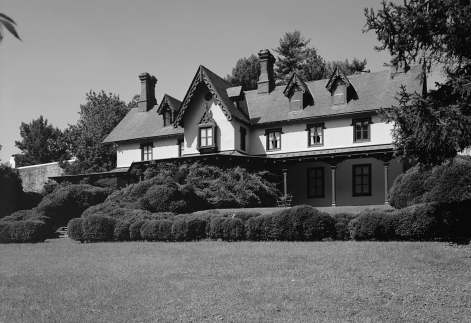


Grange Estate
Monument and historic site · National Register of Historic Places · 2.5 mi
Human settlement in Pennsylvania, United States of America
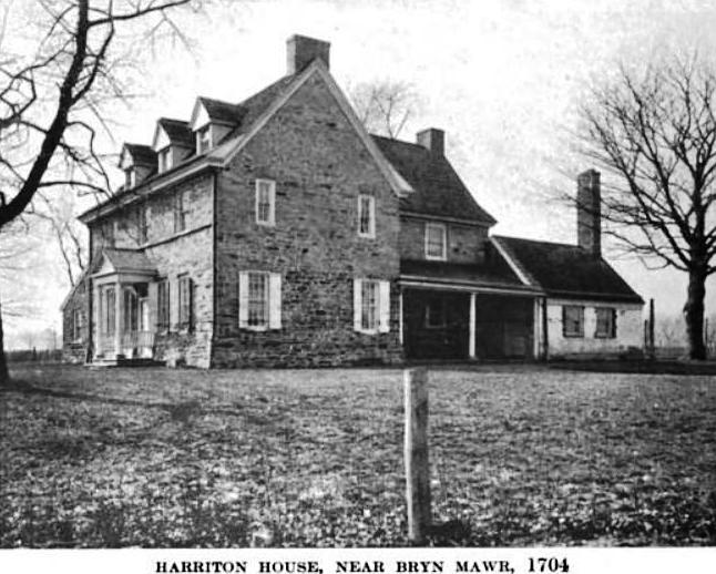
Harriton House
Monument and historic site · National Register of Historic Places · 3.2 mi
Originally Bryn Mawr, historic house in Bryn Mawr, Pennsylvania, United States
35 more on the map.
Parks, trails and playgrounds23

Mann Center for the Performing Arts
Park · 2.7 mi
Park in Pennsylvania, United States of America
Morris Park, Philadelphia
Park · 2.0 mi
City park in Overbrook, Philadelphia
11 more on the map.
Restaurants and cafes88

Ardmore Pizza
Restaurant · Pizza · 1.4 mi
10 Rittenhouse Place, Ardmore
Mo-Th,Su 11:00-24:00; Fr-Sa 11:00-25:00
Bella Italia Pizza
Restaurant · Pizza · 1.4 mi
12 East Lancaster Avenue, Ardmore
Mo-Th 10:00-22:00; Fr-Sa 10:00-23:00; Su 11:00-22:00
Buena Vista
Restaurant · Mexican · 1.5 mi
5 West Lancaster Avenue, Ardmore
Mo-Fr 11:30-21:00; Sa,Su 12:00-21:00
Coco Thai Bistro
Restaurant · Thai
231 Haverford Avenue, Narberth
Mo off; Tu-Th 16:00-20:30; Fr 16:00-21:30; Sa 12:00-21:30; Su 12:00-20:30
DePaul's Table
Restaurant · Italian · 1.4 mi
7 East Lancaster Avenue, Ardmore
Mo-Th,Su 17:00-21:00; Fr-Sa 17:00-22:00
Hymie's Delicatessen
Restaurant · Deli, Sandwich, Bagel · 1.1 mi
342 Montgomery Avenue, Merion Station
Mo-Sa 07:00-21:00
Maki Han
Restaurant · Asian · 1.3 mi
138 Montgomery Avenue, Bala Cynwyd
Mo-Th 11:30-22:00; Fr-Sa 11:30-22:30; Su 11:30-22:30

Not Your Average Joe's
Diner · American · 1.3 mi
49 Saint James Place, Ardmore
Mo-Th 11:30-21:00; Fr 11:30-22:00; Sa 11:00-22:00; Su 11:00-21:00
Positano Ristorante
Restaurant · Italian · 1.5 mi
21 West Lancaster Avenue, Ardmore
Mo-Tu off; We-Th 17:00-21:30; Fr-Sa 17:00-22:00; Su 16:00-21:30
Rosa Mexicano
Restaurant · Mexican · 1.3 mi
105 Coulter Avenue, Ardmore
Mo-We 11:30-23:00; Th, Fr 11:30-00:00; Sa 11:00-00:00; Su 11:00-23:00
76 more on the map.
History
Narberth is located on a parcel of land originally deeded to Edward Rees, which later became "Prees" and eventually "Price", who arrived from Wales in 1682. A portion of this original tract became the 100-acre (0.40 km2) farm of Edward R. Price, who founded Elm as a Quaker-friendly town in 1881. The town name changed to Narberth in 1893, and Narberth was incorporated in 1895. In 1995, the borough celebrated its 100th birthday with a year-long celebration.
The Narbrook Park Historic District was listed on the National Register of Historic Places in 2003.
From the History section of Narberth, Pennsylvania on Wikipedia, under CC BY-SA 4.0.
Churches and places of worship27
Merion Friends Meeting
Church · Quaker · 0.5 mi
615 East Montgomery Avenue, Lower Merion Township
Adath Israel
Place of worship · Conservative · 1.3 mi
250 North Highland Avenue, Merion Station
All Saints' Church
Church · Episcopal · 0.6 mi
1325 East Montgomery Avenue, Wynnewood
Shopping15
Gas and EV charging1
Schools, colleges and libraries60
Alliance For Progress Cs
School · 5.6 mi
1821-39 Cecil B Moore Avenue, Philadelphia
Healthcare3
Map of Narberth
250 places. The map loads OpenStreetMap tiles when you open it.
Climate by month
Monthly table
| Month | High | Low | Rain | Snow |
|---|---|---|---|---|
| Jan | 42°F | 28°F | 3.6 in | 6.4 in |
| Feb | 45°F | 30°F | 3.3 in | 4.0 in |
| Mar | 54°F | 36°F | 4.5 in | 2.0 in |
| Apr | 66°F | 46°F | 4.0 in | 0.1 in |
| May | 76°F | 56°F | 4.1 in | 0.0 in |
| Jun | 85°F | 66°F | 4.8 in | 0.0 in |
| Jul | 89°F | 71°F | 4.8 in | 0.0 in |
| Aug | 87°F | 70°F | 5.0 in | 0.0 in |
| Sep | 80°F | 63°F | 4.9 in | 0.0 in |
| Oct | 68°F | 51°F | 4.2 in | 0.0 in |
| Nov | 56°F | 41°F | 3.4 in | 0.1 in |
| Dec | 46°F | 33°F | 4.3 in | 3.5 in |
U.S. Climate Normals 1991-2020 for Phila Franklin Inst (6 mi away), NOAA NCEI.
People and cost of living
American Community Survey 5-year estimates, 2020-2024, U.S. Census Bureau. Estimates have margins of error, larger for small towns.
Disaster history
Montgomery County has had 19 federal disaster declarations since 2000, most often for hurricanes.
- 2021-09-10: Remnants Of Hurricane Ida (Hurricane)
- 2020-03-30: Covid-19 Pandemic (Biological)
- 2020-03-13: Covid-19 (Biological)
- 2016-03-23: Severe Winter Storm And Snowstorm (Snowstorm)
- 2014-02-06: Severe Winter Storm (Severe Ice Storm)
- 2013-01-10: Hurricane Sandy (Hurricane)
OpenFEMA disaster declarations summaries.
Getting there and nearby towns
Wings Field (BBX) is the nearest airport with scheduled flights listed in OpenStreetMap, 9 miles away.
- Merion Station 1 mi east, about 1 min by car
- Ardmore 2 mi west, about 3 min by car
- Bala Cynwyd 2 mi east, about 3 min by car
- Haverford College 2 mi west, about 4 min by car
- Bryn Mawr 3 mi west, about 5 min by car
- Millbourne 3 mi south, about 5 min by car
- East Lansdowne 4 mi south, about 7 min by car
- Drexel Hill 5 mi southwest, about 7 min by car
- Lansdowne 5 mi south, about 8 min by car
- Yeadon 5 mi south, about 8 min by car
Drive times are estimates from straight-line distance, not routes.
Local news
Headlines from INDB, the NEMICO news database.
Reviews, tips and questions
Loading what members have shared...
Sources and licences
- NCES EDGE (Public domain): public schools
- NOAA NCEI U.S. Climate Normals 1991-2020 (Public domain): climate by month
- OpenFEMA (Public domain): disaster declarations
- OpenStreetMap contributors (ODbL 1.0): places, airports, map data
- U.S. Census Bureau (Public domain): population, income, housing, education, commute
- Wikidata (CC0 1.0): elevation, founding date, time zone, website, landmarks and historic places
- Wikimedia Commons (see each image): photos
- Wikipedia (CC BY-SA 4.0): overview and history text
Photo credits
- 18 Narbrook Montco PA, Smallbones, CC0
- Dupont Street in Manayunk, Dasprevailz, Public domain
- Harriton House 1919, John Thomson Faris, Public domain
- Bryn Mawr College Cloisters, Jeffrey M. Vinocur, CC BY 2.5
- Brooks School Philly, Smallbones, Public domain
- Lower Merion Academy PA, Smallbones, CC0
- FederalSchool, User:Smallbones on English Wikipedia., Public domain
- Allgates, User:Smallbones on English Wikipedia., Public domain
- City Line Bridge Philly, Smallbones, Public domain
- Better Belmont Bridge, Smallbones, Public domain
- GrangeEstate, Unknown (US government). Original uploader was BillFlis at en.wikipedia, Public domain
- 750 Mill Creek Rd MontCo PA, Smallbones, CC BY-SA 3.0
- General Wayne Inn PA, Smallbones, CC0
- Merion 1, Mark E. Wangerin on English Wikipedia., Public domain
- Dobson School Philly, Smallbones, Public domain
- Merion Friends Meeting House, 615 Montgomery Avenue (changed from Montgomery Avenue & Meetinghouse Lane), Merion Station (Montgomery County, Pennsylvania), Unknown author Unknown author, Public domain
- Gladwyne HD 1 Guard House, Hshuvaeva, CC BY-SA 3.0
- Idlewild 1 MontCo PA, Smallbones, CC BY-SA 3.0
- Beeber Jr HS, Smallbones, Public domain
- NitreHall, User:Smallbones on English Wikipedia., Public domain
- Overbrook High School, Smallbones, Public domain
- Overbrook School 1913, Smallbones, Public domain
- Mann School Philly, Smallbones, Public domain
- Aspden tomb West Laurel Hill, Smallbones, CC BY-SA 3.0
- Llanerch school, EytanMelech, CC BY-SA 4.0
- Levering School Philly, Smallbones, Public domain
- Seville Theater exterior, Smallbones, Public domain
- Montevista apts, Smallbones, Public domain


Page built October 30, 2026. Spotted a mistake? Tell us or suggest a place.