



Abeokuta, Nigeria
Abeokuta is a regional capital of 735,000 people in Ogun State, Nigeria, founded in 1825.
Why visit Abeokuta
Townapedia lists 2 museums and landmarks, 3 parks and trails, 2 places to eat, 2 places to stay and 5 attractions in and around town.
Highlights include Chrisland University, Crescent University, Olokemeji Forest Reserve and M.K.O Abiola Stadium.
Weather in Abeokuta
Forecast from MET Norway (CC BY 4.0). Full forecast
About Abeokuta
Abeokuta () is the capital city of Ogun State, which is located in southwestern Nigeria. It is situated on both banks of the Ogun River, near a group of rocky outcrops in a wooded savanna; 77 kilometres (48 mi) north of Lagos by railway, or 130 kilometres (81 mi) by water. As of 2006, Abeokuta (comprising the two local government areas of Abeokuta North and South) had a combined population of 449,088. Its estimated population as at 2022 based on this definition was 735,000 inhabitants, although the city limits has sprawled into the neighbouring LGA of Odeda since the last enumeration exercise.
From the Wikipedia article Abeokuta (this version), under CC BY-SA 4.0.
Travel tips from other travellers: Abeokuta on Wikivoyage (CC BY-SA 4.0).
Things to do5



D.S. Adegbenro ICT Polytechnic
School · 2.4 km
Educational institution in Nigeria
Federal University of Agriculture, Abeokuta
School · 13.3 km
Public university in Nigeria
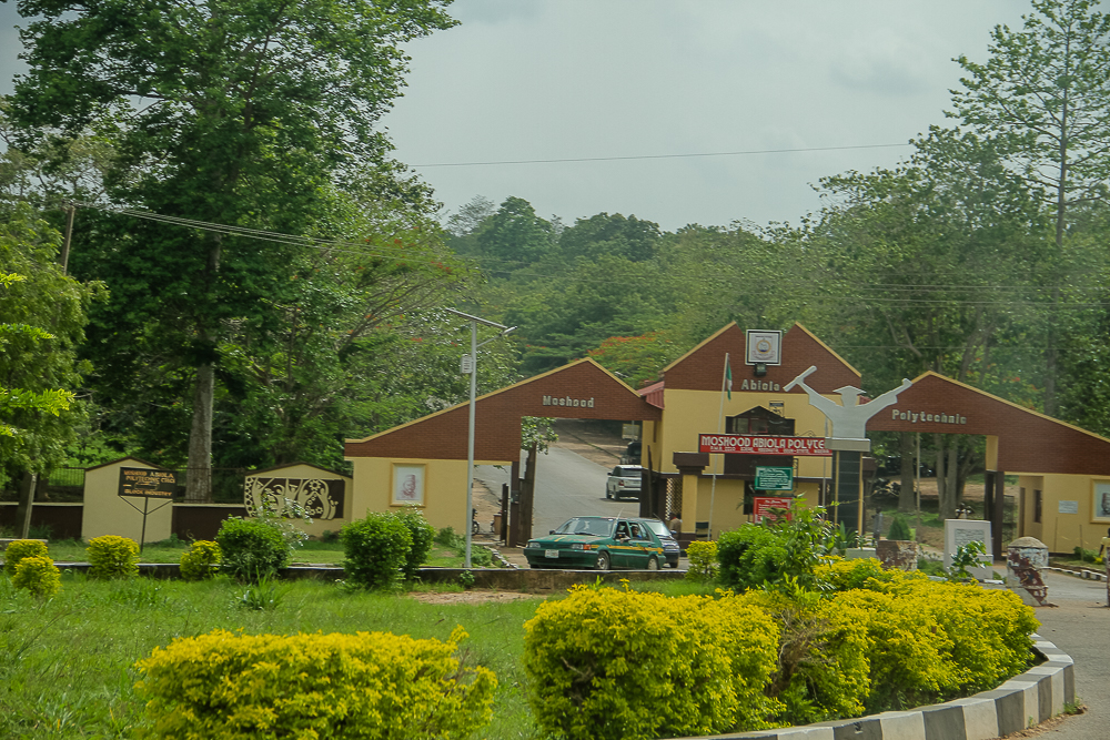
Moshood Abiola Polytechnic
School · 6.3 km
Public university in Abeokuta, Ogun State, Nigeria
Museums and landmarks2


Parks, trails and playgrounds3

Restaurants and cafes2

Vybe Lounge
Bar and pub · 5.7 km
10 Abeokuta-Sagamu Expressway, Abeokuta
Mo-Su 09:00-23:00

History
An account suggests that the early Abeokuta settlements were established by Yoruba migrants from various places within Yoruba land. According to The History of the Yorubas by Samuel Johnson, Eso Ikoyi Chiefs in the retinue of the first Alake of the Egba joined him in founding a new community—the confederacy of towns that became known as Orile Egba—in the forest after they left the nascent Oyo empire in around the 13th century AD. Orile Egba continued to exist until its destruction during the Yoruba Civil Wars of the 19th century. As a result, many of the leading families of the Egba claim descent from the Eso Ikoyis today.
Abeokuta was founded as a replacement for Orile Egba in around 1830 by the Egbas after the collapse of the Oyo empire during the civil war. The city was founded because of its strong defensive physical position by refugees trying to protect themselves against slave raiders from Dahomey, who were trying to benefit from the war.
From the History section of Abeokuta on Wikipedia, under CC BY-SA 4.0.
Where to stay2
Churches and places of worship10
Grace Reformed Baptist Church
Church · Reformed · 4.7 km
Last Building on the right, SOAS Estate, Road 1A Adigbe, Abeokuta
Upper Room Baptist Church, Abeokuta Parish
Church · Pentecostal · 4.0 km
18 HALELUYAH STR, OWOKOMAGBE B/STOP, ONIREKE ALOWONLE,, ADIGBE, ABEOKUTA
Shopping1
Gas and EV charging3
Schools, colleges and libraries9
Healthcare2
Neuropsychiatric Hospital
Hospital · 6.4 km
Aro Lagos-Abeokuta Expressway, Abeokuta
Map of Abeokuta
39 places. The map loads OpenStreetMap tiles when you open it.
Getting there and nearby towns
Gateway International Airport (GWI) is the nearest airport with scheduled flights listed in OpenStreetMap, 46 km away.
- Owode 29 km southeast, about 29 min by car
- Igbo-Ora 32 km north, about 32 min by car
- Agege 60 km south, about 1 h by car
- Ikeja 62 km south, about 1 h by car
- Ibadan 67 km east, about 1 h by car
- Shomolu 69 km south, about 1 h 15 min by car
- Surulere 73 km south, about 1 h 15 min by car
- Ijebu Ode 73 km southeast, about 1 h 15 min by car
- Lagos 78 km south, about 1 h 15 min by car
- Obalende 79 km south, about 1 h 15 min by car
Drive times are estimates from straight-line distance, not routes.
Local news
Headlines from INDB.
Reviews, tips and questions
Loading what members have shared...
Sources and licences
- GeoNames (CC BY 4.0): population, coordinates, regions and time zone
- OpenStreetMap contributors (ODbL 1.0): places, airports, map data
- Wikidata (CC0 1.0): elevation, founding date, time zone, website, landmarks and historic places
- Wikimedia Commons (see each image): photos
- Wikipedia (CC BY-SA 4.0): overview and history text
Photo credits
- Urban view of Abeouta from the top of OlumoRock, Adenekan19, CC BY-SA 4.0
- Moshood Abiola Polytechnic entrance gate, Abeokuta, Ogun state, Kaizenify, CC BY-SA 4.0
- St. Peter & Paul Catholic Church, Abeokuta, Lightshot1, CC BY-SA 4.0
- Federal University of Agriculture Abeokuta gate, Abeokuta, Kaizenify, CC BY-SA 4.0
- Moshood Abiola Stadium, Abokuta6, Lightshot1, CC BY-SA 4.0
- Crescent University, Abeokuta, Addjimedu, CC0
- CLU SWENSON CENTER, Newkkwiki, CC BY-SA 4.0
Page built November 3, 2026. Spotted a mistake? Tell us or suggest a place.