


Why visit Ajegunle
Townapedia lists 2 museums and landmarks, 1 park or trail, 2 places to eat and 2 attractions in and around town.
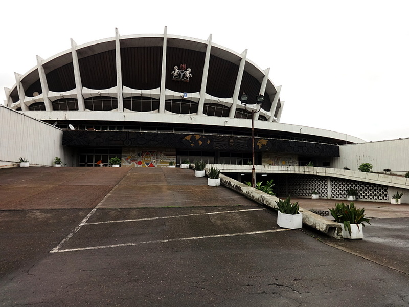
Highlights include Apapa Amusement Park, Nigerian University of Technology and Management, National Arts Theatre and National Gallery of Modern Art.
Weather in Ajegunle
Forecast from MET Norway (CC BY 4.0). Full forecast
About Ajegunle
Ajegunle, popularly known as "AJ City" or simply "AJ", is a neighbourhood located in the heart of Lagos, Lagos State, Nigeria. It is located in the Ajeromi-Ifelodun local government area of Lagos. Ajegunle in the Yoruba language means "A place where riches dwells."
From the Wikipedia article Ajegunle (this version), under CC BY-SA 4.0.
Travel tips from other travellers: Ajegunle on Wikivoyage (CC BY-SA 4.0).
Things to do2
Apapa Amusement Park
Monument and historic site · 4.0 km
Theme park in Lagos, Nigeria

Nigerian University of Technology and Management
School · 2.6 km
University in Nigeria
Museums and landmarks2


National Arts Theatre
Monument and historic site · 5.0 km
Theater in Lagos, Nigeria
National Gallery of Modern Art
Museum · 5.0 km
National gallery in Nigeria
Parks, trails and playgrounds1

Restaurants and cafes2


History
The community was subject to the Ijaw/Ilaje conflict that became an inspiration for the album CRISIS, released in 2007 by African China.
The last national population census in Nigeria was conducted in 2006. It recorded a population of approximately 140 million people. A census was planned for 2024.
Ajegunle, a densely populated suburb of Lagos, has experienced significant changes since 2008. Traditionally known for its challenges such as poverty, crime, and inadequate infrastructure, the community has nonetheless produced notable figures in Nigerian entertainment and sports, such as musicians and footballers. However, the area remains marked by underdevelopment.
In recent years, Ajegunle has seen some degree of urban renewal. Investments from private individuals have led to the construction of modern buildings, hotels, and event centers, replacing older, dilapidated structures. This wave of development has been described as gentrification, with the influx of private capital transforming the community while also raising concerns about displacement and inadequate infrastructure planning.
From the History section of Ajegunle on Wikipedia, under CC BY-SA 4.0.
Churches and places of worship1
St Joseph Catholic Parish kirikiri
Church · Catholic · 2.3 km
Dillion Street, Lagos
Gas and EV charging3
Healthcare10
Map of Ajegunle
21 places. The map loads OpenStreetMap tiles when you open it.
Getting there and nearby towns
Murtala Mohammed International Airport (LOS) is the nearest airport with scheduled flights listed in OpenStreetMap, 14 km away.
- Aliayabiagba 0 km southeast, about 1 min by car
- Aiyetoro 1 km northeast, about 1 min by car
- Lagos 7 km east, about 7 min by car
- Surulere 6 km northeast, about 6 min by car
- Obalende 9 km east, about 9 min by car
- Shomolu 11 km northeast, about 11 min by car
- Ikeja 16 km north, about 16 min by car
- Agege 18 km north, about 18 min by car
- Ijebu Ode 77 km northeast, about 1 h 15 min by car
- Abeokuta 78 km north, about 1 h 15 min by car
Drive times are estimates from straight-line distance, not routes.
Local news
Headlines from INDB.
Reviews, tips and questions
Loading what members have shared...
Sources and licences
- GeoNames (CC BY 4.0): population, coordinates, regions and time zone
- OpenStreetMap contributors (ODbL 1.0): places, airports, map data
- Wikidata (CC0 1.0): elevation, founding date, time zone, website, landmarks and historic places
- Wikimedia Commons (see each image): photos
- Wikipedia (CC BY-SA 4.0): overview and history text
Photo credits
- Super Star, Freak Out and KMG Booster, night, Unknown author, CC BY-SA 2.0
- Garden front of National Theater, Iganmu, Lagos, Omoeko Media, CC BY-SA 4.0
- National arts theatre (19799909141), dotun55, CC BY-SA 2.0
Page built November 3, 2026. Spotted a mistake? Tell us or suggest a place.