


Why visit Basey
Townapedia lists 13 museums and landmarks, 15 parks and trails, 224 places to eat, 57 places to stay and 5 attractions in and around town.
Highlights include San Juanico Bridge, Santo Niño Shrine and Heritage Museum, Yolanda Shipwreck Memorial Park and MacArthur Landing Memorial National Park.
Weather in Basey
Forecast from MET Norway (CC BY 4.0). Full forecast
About Basey
Basey, officially the Municipality of Basey ( bah-SY; Waray: Bungto han Basey; Tagalog: Bayan ng Basey), is a municipality in the province of Samar, Philippines. According to the 2024 census, it has a population of 57,645 people.
From the Wikipedia article Basey (this version), under CC BY-SA 4.0.
Travel tips from other travellers: Basey on Wikivoyage (CC BY-SA 4.0).
Things to do5
San Juanico Bridge
Bridge · 10.9 km
Long truss bridge in the Philippines


Museums and landmarks13

Santo Niño Shrine and Heritage Museum
Museum · 9.0 km
Museum in Tacloban, Philippines

Yolanda Shipwreck Memorial Park
Monument and historic site · 9.2 km
Memorial park and monument in Philippines


The Philippine-Japan Commemorative Peace Park
Monument and historic site · 7.8 km
University of the Philippines Tacloban College Marker
Monument and historic site · 7.7 km
1 more on the map.
Parks, trails and playgrounds15

MacArthur Landing Memorial National Park
Park · 13.7 km
National park in the Philippines

3 more on the map.
Restaurants and cafes224

Cafe Esquinita
Restaurant · Filipino, Asian, Coffee Shop, Bubble Tea, Frappe · 8.7 km
Santo Niño Street, Tacloban
Mo-Sa 09:00-20:00
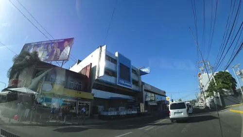
Rafael’s lomi-bulalo-‘silogs
Restaurant · Filipino · 8.6 km
80 Real Street
24/7
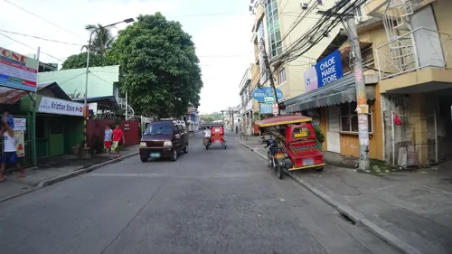
Royal Kitchen
Restaurant · Chinese Food · 8.4 km
Justice Romualdez Street, Tacloban
Mo-Fr 08:00-21:00
JO's Milagrina Tacloban
Restaurant · Chicken · 8.6 km
P. Burgos Street, Tacloban
11:00-21:00
KyuKyu Ramen 99
Restaurant · Japanese, Noodle, Pasta, Ramen · 8.5 km
Justice Romualdez Street
Mo-Su 09:00-21:00
Agarun
Restaurant · Chicken · 8.5 km
P. Burgos Street, Tacloban City



212 more on the map.
Where to stay57
Churches and places of worship16
Christ Lutheran Church
Church · Lutheran · 8.6 km
253 Avenida Veteranos, Tacloban
The Church of Jesus Christ of Latter-day Saints
Church · Mormon · 8.6 km
P. Burgos Street, Tacloban
Shopping57
Gaisano Capital Tacloban
Shopping center · 8.5 km
Justice Romualdez Street, Tacloban
Gas and EV charging6
Schools, colleges and libraries89
Asian Development Foundation College (ADFC Main Campus)
School · 8.6 km
262 P. Burgos Street, Tacloban
Healthcare39
Eastern Visayas Medical Center - Magsaysay
Hospital · 7.8 km
Magsaysay Boulevard, Tacloban City
Map of Basey
250 places. The map loads OpenStreetMap tiles when you open it.
Getting there and nearby towns
Daniel Z. Romualdez Airport (TAC) is the nearest airport with scheduled flights listed in OpenStreetMap, 8 km away.
- Tacloban 8 km southwest, about 8 min by car
- Pawing 14 km southwest, about 14 min by car
- Palo 16 km southwest, about 16 min by car
- Tanauan 20 km south, about 20 min by car
- Santa Rita 23 km northwest, about 23 min by car
- Dagami 31 km southwest, about 31 min by car
- Dulag 37 km south, about 37 min by car
- Barugo 36 km west, about 36 min by car
- Burauen 39 km southwest, about 39 min by car
- Carigara 43 km west, about 43 min by car
Drive times are estimates from straight-line distance, not routes.
Local news
Headlines from INDB.
Reviews, tips and questions
Loading what members have shared...
Sources and licences
- GeoNames (CC BY 4.0): population, coordinates, regions and time zone
- Mapillary (see each image): photos
- OpenStreetMap contributors (ODbL 1.0): places, airports, map data
- Wikidata (CC0 1.0): elevation, founding date, time zone, website, landmarks and historic places
- Wikimedia Commons (see each image): photos
- Wikipedia (CC BY-SA 4.0): overview and history text
Photo credits
- Boat Samar Philippines, Magalhães, Public domain
- San Juanico Bridge, byron alcantara from Fredon, United States, Public domain
- Santo Niño Shrine and Heritage Museum, Bap Flores, CC0
- MV Eva Jocelyn Shrine (Anibong, Tacloban, Leyte; 04-29-2023), Patrickroque01, CC BY-SA 4.0
- Palo Cathedral 01, Jojit Ballesteros, CC BY 4.0
- Street-level photo, DyniseLira, CC BY-SA 4.0
- Street-level photo, danbjoseph, CC BY-SA 4.0
- Street-level photo, feyeandal, CC BY-SA 4.0
- Street-level photo, danbjoseph, CC BY-SA 4.0
- Street-level photo, feyeandal, CC BY-SA 4.0
- Street-level photo, Yoanna_Cabacaba, CC BY-SA 4.0
- Street-level photo, feyeandal, CC BY-SA 4.0
- Street-level photo, maning, CC BY-SA 4.0
- Street-level photo, mipangan, CC BY-SA 4.0
- Street-level photo, mipangan, CC BY-SA 4.0
- Street-level photo, lanz, CC BY-SA 4.0
- Street-level photo, feyeandal, CC BY-SA 4.0
- Street-level photo, DyniseLira, CC BY-SA 4.0
- Street-level photo, wmcfall2, CC BY-SA 4.0
- Street-level photo, DyniseLira, CC BY-SA 4.0
- Street-level photo, makkudaren, CC BY-SA 4.0
- Street-level photo, feyeandal, CC BY-SA 4.0
Page built November 7, 2026. Spotted a mistake? Tell us or suggest a place.