


Why visit Jiabong
Townapedia lists 1 museum or landmark, 3 parks and trails and 1 place to eat in and around town.
Weather in Jiabong
Forecast from MET Norway (CC BY 4.0). Full forecast
About Jiabong
Jiabong, officially the Municipality of Jiabong (Waray: Bungto han Jiabong; Tagalog: Bayan ng Jiabong), is a municipality in the province of Samar, Philippines. According to the 2024 census, it has a population of 19,482 people.
From the Wikipedia article Jiabong (this version), under CC BY-SA 4.0.
Museums and landmarks1

Parks, trails and playgrounds3


Restaurants and cafes1


Churches and places of worship3

Santo Niño Church
Church · Catholic · 6.9 km
Santo Niño-San Andres Road, Catbalogan
History
In 1882, during the Spanish regime in the Philippines, Jiabong was made into a town or municipio. It was made as the cabeza de barangay, incorporating the barangays of Jia-an, San Fernando, Malino, Camarubo-an and the rest of the barangays that were founded later. During the Filipino-American war in 1900 to 1904, Catbalogan, Samar, the capital town, was placed under military rule. Jiabong became a barrio of Catbalgan from 1905 until June 15, 1948,
Jiabong became a separate municipality of Samar and got its independence from the Municipality of Catbalogan on October 22, 1948, when Congress approved House Bill No. 1812 into law. Under Republic Act. No. 269. On October 27, 1948, Jiabong was inaugurated as a municipality. President Elpidio Qurino appointed Domingo Jabinal as the Municipal Mayor and Eleuterio Bacarra as the Vice Mayor.
From the History section of Jiabong on Wikipedia, under CC BY-SA 4.0.
Shopping1
Schools, colleges and libraries28
Map of Jiabong
37 places. The map loads OpenStreetMap tiles when you open it.
Getting there and nearby towns
Calbayog Airport (CYP) is the nearest airport with scheduled flights listed in OpenStreetMap, 56 km away.
- Motiong 6 km east, about 6 min by car
- Catbalogan 7 km west, about 7 min by car
- Calbiga 17 km southeast, about 17 min by car
- Gandara 32 km northwest, about 32 min by car
- Santa Rita 35 km south, about 35 min by car
- Santa Margarita 44 km northwest, about 44 min by car
- Calbayog City 51 km northwest, about 51 min by car
- Borongan 55 km east, about 55 min by car
- Barugo 54 km southwest, about 54 min by car
- Tacloban 58 km south, about 58 min by car
Drive times are estimates from straight-line distance, not routes.
Local news
Headlines from INDB.
Reviews, tips and questions
Loading what members have shared...
Sources and licences
- GeoNames (CC BY 4.0): population, coordinates, regions and time zone
- Mapillary (see each image): photos
- OpenStreetMap contributors (ODbL 1.0): places, airports, map data
- Wikidata (CC0 1.0): elevation, founding date, time zone, website, landmarks and historic places
- Wikimedia Commons (see each image): photos
- Wikipedia (CC BY-SA 4.0): overview and history text
Photo credits
- ISS030-E-30734 - View of Earth, Earth Science and Remote Sensing Unit , Lyndon B. Johnson Space Center, Public domain
- ISS047-E-87431 - View of Earth, Earth Science and Remote Sensing Unit , Lyndon B. Johnson Space Center, Public domain
- ISS006-E-32126 - View of atmospheric limb, Earth Science and Remote Sensing Unit , Lyndon B. Johnson Space Center, Public domain
- ISS022-E-24035 - View of Earth, Earth Science and Remote Sensing Unit , Lyndon B. Johnson Space Center, Public domain
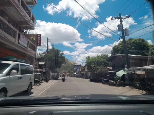
- Street-level photo, ericb1983, CC BY-SA 4.0
- Street-level photo, ericb1983, CC BY-SA 4.0
Page built November 7, 2026. Spotted a mistake? Tell us or suggest a place.