


Motiong, Philippines
Motiong is a town of 2,507 people in Eastern Visayas, Philippines, founded in 1948.
Why visit Motiong
Townapedia lists 3 museums and landmarks, 7 parks and trails, 5 places to eat and 1 place to stay in and around town.
Weather in Motiong
Forecast from MET Norway (CC BY 4.0). Full forecast
About Motiong
Motiong, officially the Municipality of Motiong (Waray: Bungto han Motiong; Tagalog: Bayan ng Motiong), is a municipality in the province of Samar, Philippines. According to the 2024 census, it has a population of 15,887 people.
From the Wikipedia article Motiong (this version), under CC BY-SA 4.0.
Museums and landmarks3

Parks, trails and playgrounds7




Restaurants and cafes5





Where to stay1

History
Long before the coming of the Americans, there were already local folks inhabited in Motiong, wherein the place was unnamed at that time.
Some of these people went on sea diving to gather oyster for their daily consumption and the rest barter goods such as rice, corn, cassava, taro, yam tubers, sea foods and abaca fibers to other neighboring barrios and municipalities. There were only few local caravans who are traveling in groups aided in defense against bandits as well as helped to improve economies of scale in trade although, only few people have the means to buy commodities.
One man tried to open one oyster and with great astonishment, he found a lustrous pearl where he called “Mutya”. Believing that the place was full of treasure, the settlers started to name the place “Mutya” which to means “Land of Treasure”.
The bridge near Motiong was once used to ambush the Japanese in World War II.
From the History section of Motiong on Wikipedia, under CC BY-SA 4.0.
Churches and places of worship7
Shopping1
Gas and EV charging2
Schools, colleges and libraries80
Healthcare1
Map of Motiong
107 places. The map loads OpenStreetMap tiles when you open it.
Getting there and nearby towns
Calbayog Airport (CYP) is the nearest airport with scheduled flights listed in OpenStreetMap, 59 km away.
- Catbalogan 12 km west, about 12 min by car
- Calbiga 17 km south, about 17 min by car
- Gandara 33 km northwest, about 33 min by car
- Santa Rita 37 km south, about 37 min by car
- Santa Margarita 47 km northwest, about 47 min by car
- Borongan 51 km east, about 51 min by car
- Calbayog City 54 km northwest, about 54 min by car
- Basey 56 km south, about 56 min by car
- Barugo 58 km southwest, about 58 min by car
- Tacloban 60 km south, about 1 h by car
Drive times are estimates from straight-line distance, not routes.
Local news
Headlines from INDB.
Reviews, tips and questions
Loading what members have shared...
Sources and licences
- GeoNames (CC BY 4.0): population, coordinates, regions and time zone
- Mapillary (see each image): photos
- OpenStreetMap contributors (ODbL 1.0): places, airports, map data
- Wikidata (CC0 1.0): elevation, founding date, time zone, website, landmarks and historic places
- Wikimedia Commons (see each image): photos
- Wikipedia (CC BY-SA 4.0): overview and history text
Photo credits
- ISS030-E-30734 - View of Earth, Earth Science and Remote Sensing Unit , Lyndon B. Johnson Space Center, Public domain
- ISS047-E-87431 - View of Earth, Earth Science and Remote Sensing Unit , Lyndon B. Johnson Space Center, Public domain
- ISS006-E-32126 - View of atmospheric limb, Earth Science and Remote Sensing Unit , Lyndon B. Johnson Space Center, Public domain
- ISS022-E-24035 - View of Earth, Earth Science and Remote Sensing Unit , Lyndon B. Johnson Space Center, Public domain
- Sybra biguttulata samarensis Breuning, 1964 (2903706407), Udo Schmidt from Deutschland, CC BY-SA 2.0
- Sybra ochreovittipennis Breuning, 1964 (2904551284), Udo Schmidt from Deutschland, CC BY-SA 2.0
- Sybra subfortipes Breuning, 1964 (2912080433), Udo Schmidt from Deutschland, CC BY-SA 2.0
- ISS047-E-87432 - View of Earth, Earth Science and Remote Sensing Unit , Lyndon B. Johnson Space Center, Public domain
- ISS047-E-87433 - View of Earth, Earth Science and Remote Sensing Unit , Lyndon B. Johnson Space Center, Public domain
- ISS047-E-87434 - View of Earth, Earth Science and Remote Sensing Unit , Lyndon B. Johnson Space Center, Public domain
- ISS022-E-24034 - View of Earth, Earth Science and Remote Sensing Unit , Lyndon B. Johnson Space Center, Public domain
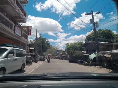
- Street-level photo, ericb1983, CC BY-SA 4.0
- Street-level photo, ericb1983, CC BY-SA 4.0


Page built November 7, 2026. Spotted a mistake? Tell us or suggest a place.