


Riverdale, New Jersey
Riverdale is a borough of 4,112 people in Morris County, New Jersey, founded in April 17, 1923.
Why visit Riverdale
Townapedia lists 30 museums and landmarks, 21 parks and trails, 70 places to eat, 2 places to stay and 3 attractions in and around town.
Highlights include Federal Hill, Butler, Martin Berry House and Friendship Park.
July is the warmest month, with average highs of 84°F; January lows average 20°F.
Weather in Riverdale
Forecast from the National Weather Service. Full forecast
About Riverdale
Riverdale is a borough in Morris County, in the U.S. state of New Jersey. As of the 2020 United States census, the borough's population was 4,107, an increase of 548 (+15.4%) from the 2010 census count of 3,559, which in turn reflected an increase of 1,061 (+42.5%) from the 2,498 counted in the 2000 census.
From the Wikipedia article Riverdale, New Jersey (this version), under CC BY-SA 4.0.
Things to do3


StageWorks at Studio 237
Cinema and theater · Catholic · 1.4 mi
237 Paterson-Hamburg Turnpike, Pompton Lakes
Museums and landmarks30

Butler
Monument and historic site · National Register of Historic Places · 1.5 mi
NYS&W station

Martin Berry House
Monument and historic site · National Register of Historic Places · 2.4 mi
Historic house in Morris County, New Jersey

Pompton Plains
Monument and historic site · National Register of Historic Places · 2.1 mi
Railway station in Pequannock Township, the United States of America
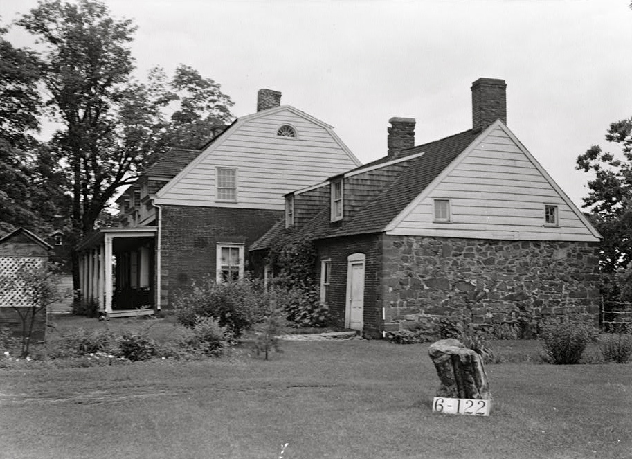


Schuyler-Colfax House
Monument and historic site · National Register of Historic Places · 1.9 mi
Historic house in New Jersey, United States


Ironworker's Cottage
Monument and historic site · 1.6 mi
1238 Lincoln Avenue, Pompton Lakes
Pompton Lakes Train Station
Monument and historic site · 1.5 mi
1 Station Plaza, Pompton Lakes
Queen Anne Style Home
Monument and historic site · 1.5 mi
33 Ramapo Avenue, Pompton Lakes
Second Empire Building
Monument and historic site · 1.4 mi
227 Paterson-Hamburg Turnpike, Pompton Lakes
The Outlook
Monument and historic site · 1.7 mi
233 Bartholf Avenue, Pompton Lakes
Van Ness House
Monument and historic site · 1.3 mi
350 Riverdale Road, Pompton Lakes
18 more on the map.
Parks, trails and playgrounds21

Friendship Park
Park · 1.4 mi
Park in New Jersey, United States of America
Pompton Aquatic Park
Park · 1.9 mi
Park in New Jersey, United States of America

Pompton Valley Rail Trail - River Drive Trailhead
Hiking and trails · 1.3 mi
River Drive, Pequannock Township
9 more on the map.
Restaurants and cafes70


Cinco De Mayo Grill
Restaurant · Mexican · 1.6 mi
125 Paterson-Hamburg Turnpike, Bloomingdale
Mo-Su 11:00-22:00



Axton's by Chef Anton Testino
Restaurant · Italian · 1.3 mi
437 Ringwood Avenue, Pompton Lakes
Black Bull Steakhouse & Seafood
Restaurant · Steak House · 0.8 mi
88 Newark-Pompton Turnpike, Riverdale

58 more on the map.
Where to stay2
Churches and places of worship12
Christ Episcopal Church
Church · Episcopal · 1.5 mi
400 Ramapo Avenue, Pompton Lakes
Kingdom Hall of Jehovah's Witnesses
Church · Jehovahs Witness · 1.4 mi
146 Willow Avenue, Pompton Lakes
Pompton Reformed Church
Church · Reformed · 1.0 mi
59 Paterson-Hamburg Turnpike, Pompton Lakes
St Mary's Roman Catholic Church
Church · Catholic · 1.4 mi
17 Pompton Avenue, Pompton Lakes
Al-Mustafa Islamic Center
Place of worship · 1.4 mi
21 Passaic Avenue, Pompton Lakes
The Journey Within (Spiritualists' National Union Church)
Place of worship · 1.5 mi
Shopping23
Home Field Advantage Sporting Goods
Shop · 1.4 mi
219 Wanaque Avenue, Pompton Lakes
Gas and EV charging13
Schools, colleges and libraries47
Map of Riverdale
221 places. The map loads OpenStreetMap tiles when you open it.
Climate by month
Monthly table
| Month | High | Low | Rain |
|---|---|---|---|
| Jan | 38°F | 20°F | 3.4 in |
| Feb | 40°F | 20°F | 2.7 in |
| Mar | 48°F | 29°F | 3.9 in |
| Apr | 60°F | 39°F | 4.2 in |
| May | 71°F | 50°F | 3.6 in |
| Jun | 79°F | 58°F | 5.1 in |
| Jul | 84°F | 64°F | 4.7 in |
| Aug | 83°F | 63°F | 4.6 in |
| Sep | 76°F | 56°F | 4.0 in |
| Oct | 64°F | 43°F | 4.4 in |
| Nov | 53°F | 35°F | 3.8 in |
| Dec | 43°F | 27°F | 4.0 in |
U.S. Climate Normals 1991-2020 for Wanaque Raymond Dam (4 mi away), NOAA NCEI.
People and cost of living
American Community Survey 5-year estimates, 2020-2024, U.S. Census Bureau. Estimates have margins of error, larger for small towns.
Disaster history
Morris County has had 22 federal disaster declarations since 2000, most often for hurricanes.
- 2021-09-05: Remnants Of Hurricane Ida (Hurricane)
- 2021-09-02: Remnants Of Hurricane Ida (Hurricane)
- 2021-04-28: Severe Winter Storm And Snowstorm (Snowstorm)
- 2020-12-11: Tropical Storm Isaias (Hurricane)
- 2020-03-25: Covid-19 Pandemic (Biological)
- 2020-03-13: Covid-19 (Biological)
OpenFEMA disaster declarations summaries.
Getting there and nearby towns
Essex County Airport (CDW) is the nearest airport with scheduled flights listed in OpenStreetMap, 9 miles away.
- Pompton Lakes 2 mi east, about 2 min by car
- Butler 2 mi west, about 3 min by car
- Pompton Plains 2 mi south, about 3 min by car
- Pines Lake 3 mi east, about 4 min by car
- Bloomingdale 3 mi north, about 5 min by car
- Wanaque 3 mi northeast, about 6 min by car
- Kinnelon 4 mi west, about 6 min by car
- Macopin 4 mi northwest, about 6 min by car
- Oakland 5 mi northeast, about 7 min by car
- Lincoln Park 5 mi south, about 8 min by car
Drive times are estimates from straight-line distance, not routes.
Local news
Headlines from INDB, the NEMICO news database.
Reviews, tips and questions
Loading what members have shared...
Sources and licences
- NCES EDGE (Public domain): public schools
- NOAA NCEI U.S. Climate Normals 1991-2020 (Public domain): climate by month
- OpenFEMA (Public domain): disaster declarations
- OpenStreetMap contributors (ODbL 1.0): places, airports, map data
- U.S. Census Bureau (Public domain): population, income, housing, education, commute
- Wikidata (CC0 1.0): elevation, founding date, time zone, website, landmarks and historic places
- Wikimedia Commons (see each image): photos
- Wikipedia (CC BY-SA 4.0): overview and history text
Photo credits
- SLATER'S MILL, RIVERDALE, MORRIS COUNTY, Jerrye & Roy Klotz, MD, CC BY-SA 3.0
- 2018-07-28 08 26 47 View south along Interstate 287 between Exit 53 and Exit 52 in Riverdale, Morris County, New Jersey, Famartin, CC BY-SA 4.0
- 2020-07-08 13 58 32 View north along Interstate 287 at Exit 53 (Morris County Route 694, Morris County Route 511 Alternate, Bloomingdale, Pompton Lakes) in Riverdale, Morris County, New Jersey, Famartin, CC BY-SA 4.0
- 2020-07-13 08 07 03 View south along Interstate 287 at Exit 52 (New Jersey State Route 23, Riverdale, Wayne, Butler) in Riverdale, Morris County, New Jersey, Famartin, CC BY-SA 4.0
- 2020-09-09 14 22 04 View south along New Jersey State Route 23 at the exit for Interstate 287 SOUTH (Morristown) in Riverdale, Morris County, New Jersey, Famartin, CC BY-SA 4.0
- 2020-07-13 08 04 07 View south along Interstate 287 at Exit 53 (Morris County Route 694, Morris County Route 511 Alternate, Bloomingdale, Pompton Lakes) in Riverdale, Morris County, New Jersey, Famartin, CC BY-SA 4.0
- 2018-07-28 15 21 38 View south along Morris County Route 511 Alternate (Newark-Pompton Turnpike) just south of Morris County Route 694 (Hamburg Turnpike) in Riverdale, Morris County, New Jersey, Famartin, CC BY-SA 4.0
- 2020-09-09 11 22 55 View north along New Jersey State Route 23 at the exit for Interstate 287 SOUTH (Morristown) in Riverdale, Morris County, New Jersey, Famartin, CC BY-SA 4.0
- 2018-07-28 15 14 25 View north along Morris County Route 511 Alternate (Hamburg Turnpike) just north of the Newark-Pompton Turnpike in Riverdale, Morris County, New Jersey, Famartin, CC BY-SA 4.0
- CR 511 Alt sb, Riverdale, NJ, Nov. 2024, Mr. Matté (if there is an issue with this image, contact me using this image's Commons talk page , my Commons user talk page , or my English Wikipedia user talk page ; I'll know about it a lot faster), CC BY-SA 4.0
- 2021-07-06 12 43 11 View north along Interstate 287 from the overpass for New Jersey State Route 23 in Riverdale, Morris County, New Jersey, Famartin, CC BY-SA 4.0
- 2021-07-06 12 36 13 View south along Interstate 287 from the overpass for New Jersey State Route 23 in Riverdale, Morris County, New Jersey, Famartin, CC BY-SA 4.0
- Riverdale, NJ public school, Nov. 2024, Mr. Matté (if there is an issue with this image, contact me using this image's Commons talk page , my Commons user talk page , or my English Wikipedia user talk page ; I'll know about it a lot faster), CC BY-SA 4.0
- 2020-07-08 13 56 26 View north along Interstate 287 at Exit 52B (New Jersey State Route 23 NORTH, Butler) in Riverdale, Morris County, New Jersey, Famartin, CC BY-SA 4.0
- 2020-09-09 14 29 44 View south along New Jersey State Route 23 at the exit for Interstate 287 NORTH (Mahwah, TO Morris County Route 694, Bloomingdale, Pompton Lakes) in Riverdale, Morris County, New..., Famartin, CC BY-SA 4.0
- Riverdale, NJ borough hall, Nov. 2024, Mr. Matté (if there is an issue with this image, contact me using this image's Commons talk page , my Commons user talk page , or my English Wikipedia user talk page ; I'll know about it a lot faster), CC BY-SA 4.0
- 2020-09-09 11 17 16 View north along New Jersey State Route 23 at the exit for Interstate 287 NORTH (Mahwah, TO Morris County Route 694, Bloomingdale, Pompton Lakes) in Riverdale, Morris County, New..., Famartin, CC BY-SA 4.0
- Riverdale, NJ municipal building, Nov. 2025, Mr. Matté (if there is an issue with this image, contact me using this image's Commons talk page , my Commons user talk page , or my English Wikipedia user talk page ; I'll know about it a lot faster), CC BY-SA 4.0
- 2018-07-28 10 29 13 View north along Interstate 287 at Exit 52A (New Jersey State Route 23 SOUTH, Riverdale, Wayne) in Riverdale, Morris County, New Jersey, Famartin, CC BY-SA 4.0
- 2020-07-08 13 54 40 View north along Interstate 287 at Exit 52A (New Jersey State Route 23 SOUTH, Riverdale, Wayne) in Riverdale, Morris County, New Jersey, Famartin, CC BY-SA 4.0
- 2018-07-28 15 17 32 View south along Morris County Route 511 Alternate (Hamburg Turnpike) just south of Morris Avenue and Post Lane in Riverdale, Morris County, New Jersey, Famartin, CC BY-SA 4.0
- 2018-07-24 17 40 50 View north along New Jersey State Route 23 just north of Morris County Route 511 Alternate (Newark-Pompton Turnpike) in Riverdale, Morris County, New Jersey, Famartin, CC BY-SA 4.0
- 2018-07-28 15 10 55 View north along Morris County Route 511 Alternate (Newark-Pompton Turnpike) just north of New Jersey State Route 23 in Riverdale, Morris County, New Jersey, Famartin, CC BY-SA 4.0
- MARTIN BERRY HOUSE, POMPTON PLAINS, MORRIS COUNTY, Jerrye & Roy Klotz, MD, CC BY-SA 3.0
- Schuyler-Colfax House, Nathaniel R. Ewan, Public domain
- Pompton Plains Station - September 2014, Adam Moss, CC BY-SA 2.0
- Butler station - August 2011, Adam Moss, CC BY-SA 2.0
- 2018-07-25 16 55 40 View south along Interstate 287 between Exit 55 and Exit 53 in Bloomingdale, Passaic County, New Jersey, Famartin, CC BY-SA 4.0
- 2018-07-25 14 51 59 View north along Interstate 287 between Exit 53 and Exit 55 in Bloomingdale, Passaic County, New Jersey, Famartin, CC BY-SA 4.0
- 2018-07-25 17 37 29 View north along Passaic County Route 511 (Union Avenue) just north of Passaic County Route 694 (Paterson-Hamburg Turnpike) in Bloomingdale, Passaic County, New Jersey, Famartin, CC BY-SA 4.0
- 2018-07-25 18 58 08 View south along Passaic County Route 511 (Main Street) just south of Passaic County Route 694 (Paterson-Hamburg Turnpike) in Bloomingdale, Passaic County, New Jersey, Famartin, CC BY-SA 4.0
- CR 511 nb at CR 694, Bloomingdale, NJ, July 2023, Mr. Matté (if there is an issue with this image, contact me using this image's Commons talk page , my Commons user talk page , or my English Wikipedia user talk page ; I'll know about it a lot faster), CC BY-SA 4.0
- 2018-07-25 18 58 58 View south along Passaic County Route 511 (Union Avenue) between Orchard Street and Hamilton Street in Bloomingdale, Passaic County, New Jersey, Famartin, CC BY-SA 4.0
- ISS002-E-6278 - View of New York, Earth Science and Remote Sensing Unit , Lyndon B. Johnson Space Center, Public domain
- ISS023-E-18521 - View of Earth, Earth Science and Remote Sensing Unit , Lyndon B. Johnson Space Center, Public domain
- ISS040-E-33240 - View of Earth, Earth Science and Remote Sensing Unit , Lyndon B. Johnson Space Center, Public domain
- ISS040-E-33239 - View of Earth, Earth Science and Remote Sensing Unit , Lyndon B. Johnson Space Center, Public domain
- ISS040-E-33243 - View of Earth, Earth Science and Remote Sensing Unit , Lyndon B. Johnson Space Center, Public domain
- ISS045-E-13941 - View of Earth, Earth Science and Remote Sensing Unit , Lyndon B. Johnson Space Center, Public domain
- ISS040-E-33242 - View of Earth, Earth Science and Remote Sensing Unit , Lyndon B. Johnson Space Center, Public domain


Page built October 30, 2026. Spotted a mistake? Tell us or suggest a place.