



Rosemont, Pennsylvania
Rosemont is a community of 3,421 people in Delaware County, Pennsylvania.
Why visit Rosemont
Townapedia lists 33 museums and landmarks, 25 parks and trails, 39 places to eat and 10 attractions in and around town.
Highlights include Bridge in Radnor Township No. 2, Bryn Mawr Film Institute, Old Library and Allgates.
July is the warmest month, with average highs of 89°F; January lows average 23°F, and about 25 inches of snow fall in a normal year.
Weather in Rosemont
Forecast from the National Weather Service. Full forecast
About Rosemont
Rosemont is a neighborhood and census-designated place in Pennsylvania, United States. Partly in Lower Merion Township in Montgomery County and partly in Radnor Township in Delaware County, it is on the Philadelphia Main Line. It is best known as the home of Rosemont College. It is the location of the 1894 gothic-revival Anglo-Catholic Church of the Good Shepherd.
From the Wikipedia article Rosemont, Pennsylvania (this version), under CC BY-SA 4.0.
Things to do10

Bridge in Radnor Township No. 2
Bridge · National Register of Historic Places · 1.6 mi
Bridge in United States of America


Bryn Mawr College
School · 0.8 mi
Liberal arts college in Pennsylvania, US
Villanova University
School · 0.7 mi
Catholic university near Philadelphia, Pennsylvania
Eastern University
School · 2.7 mi
Christian educational institution in Pennsylvania, U.S.

Fayette Street Bridge
Bridge · 2.9 mi
Road bridge over the Schuylkill River in Montgomery County, Pennsylvania
Pearl Harbor Memorial Bridge
Bridge · 3.3 mi
Bridge in West Conshohocken and Connaughtown
Museums and landmarks33

Old Library
Monument and historic site · National Register of Historic Places · 0.7 mi
Historic building on Bryn Mawr College Campus

Allgates
Monument and historic site · National Register of Historic Places · 2.2 mi
House in Haverford Township, Pennsylvania

Baldwin School
Monument and historic site · National Register of Historic Places · 0.9 mi
Private school for girls in Bryn Mawr, Pennsylvania, United States

Bridge in Radnor Township No. 1
Bridge · National Register of Historic Places · 3.0 mi
Bridge in United States of America

Bridge in Upper Merion Township
Monument and historic site · National Register of Historic Places · 2.7 mi
Bridge in Pennsylvania, United States

Camp-Woods
Monument and historic site · National Register of Historic Places · 2.0 mi
Building in Pennsylvania, United States

Chanticleer Garden
Monument and historic site · National Register of Historic Places · 3.1 mi
Historic house in Pennsylvania, United States

Downtown Wayne Historic District
Monument and historic site · National Register of Historic Places · 3.2 mi
Historic district in Pennsylvania, United States

Federal School
Monument and historic site · National Register of Historic Places · 2.3 mi
Human settlement in Pennsylvania, United States of America


Gladwyne Historic District
Monument and historic site · National Register of Historic Places · 2.5 mi
Historic district in Pennsylvania, United States
Glenays
Monument and historic site · National Register of Historic Places · 1.3 mi
Historic house in Pennsylvania, United States
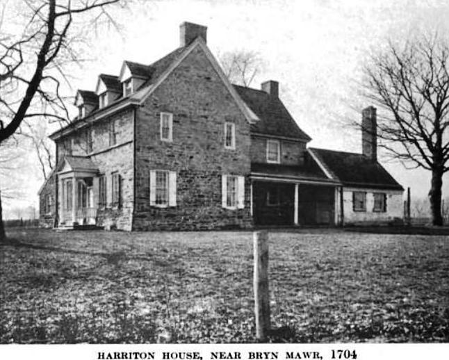
Harriton House
Monument and historic site · National Register of Historic Places · 0.9 mi
Originally Bryn Mawr, historic house in Bryn Mawr, Pennsylvania, United States
21 more on the map.
Parks, trails and playgrounds25

Stoneleigh Natural Garden
Park · 1.0 mi
1829 East County Line Road, Villanova
Tu-Su 10:00-17:00; Mo closed


13 more on the map.
Restaurants and cafes39

First Watch
Restaurant · American, Breakfast · 1.4 mi
775 East Lancaster Avenue, Villanova
07:00-14:30


La Colombe Coffee Roasters
Cafe · Coffee Shop · 0.6 mi
915 West Lancaster Avenue
Mo-Fr 06:30-18:00; Sa-Su 07:00-18:00
Little Basil
Restaurant · Asian · 0.7 mi
906 Conestoga Road, Rosemont
Tu-Sa 11:00-22:00; Su 12:00-22:00
Snap Custom Pizza
Restaurant · Pizza · 0.4 mi
1125 West Lancaster Avenue
Mo-Th,Su 11:00-22:00; Fr-Sa 11:00-23:00
Starbucks
Cafe · Coffee Shop · 0.9 mi
766 Lancaster Avenue, Bryn Mawr
Mo-Fr 05:00-20:00; Sa-Su 05:30-20:00
Sub Valley Pizza and Catering
Restaurant · Pizza · 1.2 mi
602 Lancaster Avenue, Bryn Mawr
Mo-Sa 10:00-19:00; Su 11:30-19:00
27 more on the map.
History
The Joseph Sinnott Mansion was listed on the National Register of Historic Places in 1980.
The neighborhood of "Beaupre" in Rosemont was once the 200-acre estate of the same name, built for Alexander Cassatt's son, Robert. The original mansion now is part of The Mansion at Rosemont, a senior living community that is part of the nonprofit organization Human Good. The original French iron gates flank entrances from Conestoga Road and South Ithan Avenue.
From the History section of Rosemont, Pennsylvania on Wikipedia, under CC BY-SA 4.0.
Churches and places of worship15
Radnor Friends Meetinghouse
Church · National Register of Historic Places · 2.0 mi
Proclamation Presbyterian Church
Church · Presbyterian · 0.9 mi
278 South Bryn Mawr Avenue, Bryn Mawr
Haverford Friends Meeting House
Church · Quaker · 1.5 mi
855 Buck Lane, Haverford
Saint Luke United Methodist Church
Church · United Methodist · 1.2 mi
568 Montgomery Avenue, Bryn Mawr
Shopping9
Gas and EV charging5
Schools, colleges and libraries65
Healthcare7
StarkMD Plastic Surgery & Aesthetic Center
Clinic and pharmacy · 0.9 mi
135 South Bryn Mawr Avenue, Bryn Mawr
Claytor Noone Plastic Surgery: Dr. R. Brannon Claytor
Clinic and pharmacy · 0.9 mi
135 South Bryn Mawr Avenue, Bryn Mawr
Parvin's Pharmacy
Clinic and pharmacy · 0.8 mi
30 North Bryn Mawr Avenue, Bryn Mawr
Map of Rosemont
208 places. The map loads OpenStreetMap tiles when you open it.
Climate by month
Monthly table
| Month | High | Low | Rain | Snow |
|---|---|---|---|---|
| Jan | 42°F | 23°F | 3.7 in | 6.8 in |
| Feb | 44°F | 25°F | 3.0 in | 10.9 in |
| Mar | 52°F | 32°F | 4.4 in | 3.0 in |
| Apr | 65°F | 42°F | 3.9 in | 0.2 in |
| May | 75°F | 52°F | 4.2 in | 0.0 in |
| Jun | 84°F | 62°F | 4.2 in | 0.0 in |
| Jul | 89°F | 67°F | 4.7 in | 0.0 in |
| Aug | 86°F | 65°F | 5.0 in | 0.0 in |
| Sep | 80°F | 58°F | 4.9 in | 0.0 in |
| Oct | 68°F | 45°F | 4.3 in | 0.1 in |
| Nov | 57°F | 35°F | 3.6 in | 0.1 in |
| Dec | 46°F | 28°F | 4.7 in | 4.2 in |
U.S. Climate Normals 1991-2020 for Norristown (5 mi away), NOAA NCEI.
People and cost of living
American Community Survey 5-year estimates, 2020-2024, U.S. Census Bureau. Estimates have margins of error, larger for small towns.
Disaster history
Delaware County has had 15 federal disaster declarations since 2000, most often for hurricanes.
- 2021-09-10: Remnants Of Hurricane Ida (Hurricane)
- 2020-03-30: Covid-19 Pandemic (Biological)
- 2020-03-13: Covid-19 (Biological)
- 2014-02-06: Severe Winter Storm (Severe Ice Storm)
- 2012-10-29: Hurricane Sandy (Hurricane)
- 2011-09-12: Tropical Storm Lee (Flood)
OpenFEMA disaster declarations summaries.
Getting there and nearby towns
Wings Field (BBX) is the nearest airport with scheduled flights listed in OpenStreetMap, 8 miles away.
- Bryn Mawr 1 mi southeast, about 1 min by car
- Haverford College 2 mi southeast, about 3 min by car
- Ardmore 3 mi southeast, about 4 min by car
- West Conshohocken 3 mi north, about 4 min by car
- Narberth 4 mi southeast, about 6 min by car
- Penn Wynne 4 mi southeast, about 7 min by car
- Swedeland 4 mi north, about 6 min by car
- Merion Station 4 mi southeast, about 7 min by car
- Broomall 5 mi south, about 7 min by car
- King of Prussia 5 mi northwest, about 9 min by car
Drive times are estimates from straight-line distance, not routes.
Local news
Headlines from INDB, the NEMICO news database.
Reviews, tips and questions
Loading what members have shared...
Sources and licences
- NCES EDGE (Public domain): public schools
- NOAA NCEI U.S. Climate Normals 1991-2020 (Public domain): climate by month
- OpenFEMA (Public domain): disaster declarations
- OpenStreetMap contributors (ODbL 1.0): places, airports, map data
- U.S. Census Bureau (Public domain): population, income, housing, education, commute
- Wikidata (CC0 1.0): landmarks and historic places
- Wikimedia Commons (see each image): photos
- Wikipedia (CC BY-SA 4.0): overview and history text
Photo credits
- Rosemont81, Midnightdreary at en.wikipedia, Public domain
- Bryn Mawr College Cloisters, Jeffrey M. Vinocur, CC BY 2.5
- Glenays, User:Smallbones on English Wikipedia., Public domain
- 750 Mill Creek Rd MontCo PA, Smallbones, CC BY-SA 3.0
- Harriton House 1919, John Thomson Faris, Public domain
- Bridge in Upper Merion Township 01, Shuvaev, CC BY-SA 3.0
- Bridge2Radnor, User:Smallbones at English Wikipedia., Public domain
- Wayne Hotel Wayne PA b, Smallbones, CC0
- FederalSchool, User:Smallbones on English Wikipedia., Public domain
- 42x Midland Wayne PA Priceq, Smallbones, CC0
- GoshenRoadBridge, User:Smallbones ., Public domain
- Camp-Woods, Fearless LeChien, CC BY-SA 4.0
- SaturdayClubWaynePA, User:Smallbones on English Wikipedia., Public domain
- CabriniWoodruff, User:Smallbones on English Wikipedia., Public domain
- Allgates, User:Smallbones on English Wikipedia., Public domain
- Wayne Theater from SW Wayne PA, Smallbones, CC0
- Poplar Lane 1, Hshuvaeva, CC BY-SA 3.0
- Seville Theater exterior, Smallbones, Public domain
- RadnorFriendsMeetinghouse, User:Smallbones on English Wikipedia., Public domain
- Merion 1, Mark E. Wangerin on English Wikipedia., Public domain
- Pont Reading133671pu, HABS, Public domain
- Wayne-Station-Pennsylvania-08.27.2010, Greg Prichard, CC BY-SA 3.0
- Whitehall PA apartments NRHP, Smallbones, Public domain
- Gladwyne HD 1 Guard House, Hshuvaeva, CC BY-SA 3.0
- Chanticleer Gardens Main House Springtime 2892px, Photo by and (c)2007 Derek Ramsey ( Ram-Man ). Co-attribution must be given to the Chanticleer Garden. Both parties have shared, contractual copyright control., CC BY-SA 3.0
- Idlewild 1 MontCo PA, Smallbones, CC BY-SA 3.0
- Washington Hose Montco PA, Smallbones, CC0


Page built October 30, 2026. Spotted a mistake? Tell us or suggest a place.