


Ban Chang, Thailand
อำเภอบ้านฉาง
Ban Chang is a town of 28,204 people in Rayong, Thailand.
Why visit Ban Chang
Townapedia lists 3 museums and landmarks, 21 parks and trails, 318 places to eat, 29 places to stay and 4 attractions in and around town.
Highlights include Viharn Sien, Ramayana Water Park and BAAN MAE pool villa.
Weather in Ban Chang
Forecast from MET Norway (CC BY 4.0). Full forecast
About Ban Chang
Ban Chang (Thai: บ้านฉาง, pronounced [bâːn t͡ɕʰǎːŋ]) is the westernmost district (amphoe) of Rayong province, eastern Thailand.
From the Wikipedia article Ban Chang district (this version), under CC BY-SA 4.0.
Photos of Ban Chang


Things to do4


Museums and landmarks3


Parks, trails and playgrounds21




9 more on the map.
Restaurants and cafes318
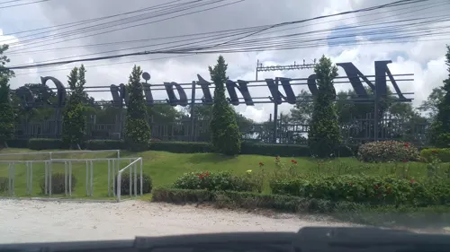
Mountain Coffee @ Zoo
Cafe · Thai, International · 10.7 km
Mo-Su 08:00-20:00
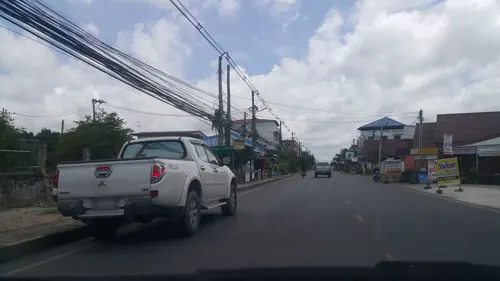
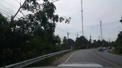
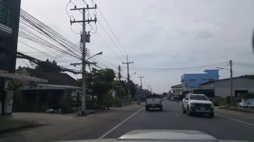


Bua Terrace
Restaurant · 5.4 km
6 Thanon Pla, Ban Chang
Mo-Su 09:00-23:00
306 more on the map.
History
The area originally was Tambon Phala of Mueang Rayong district. From 1963 on the US military used the U-Tapao Royal Thai Navy Airfield, thus the community grew bigger.
The government created Ban Chang minor district (king amphoe) on 7 May 1976 by splitting two tambons from Mueang District. It was upgraded to be full district on 16 March 1985.
From the History section of Ban Chang district on Wikipedia, under CC BY-SA 4.0.
More about Ban Chang
Geography
Neighbouring districts are (from the west clockwise) Sattahip, Bang Lamung of Chonburi province, Nikhom Phatthana and Mueang Rayong of Rayong Province. To the south is the Gulf of Thailand. Ban Chang also features three beaches with Phala Beach to the west, Phayun Beach in the center and Nam Rin Beach on the eastern side of the district, with Nam Rin being the longer beach of the three
From the Wikipedia article Ban Chang district, under CC BY-SA 4.0.
Where to stay29
Churches and places of worship14
Shopping8
Gas and EV charging15
Schools, colleges and libraries15
Healthcare13
Map of Ban Chang
250 places. The map loads OpenStreetMap tiles when you open it.
Getting there and nearby towns
U-Tapao - Pattaya International airport (UTP) is the nearest airport with scheduled flights listed in OpenStreetMap, 7 km away.
- Sattahip 18 km west, about 18 min by car
- Rayong 23 km east, about 23 min by car
- Pattaya 30 km northwest, about 30 min by car
- Ban Ko Lan 36 km northwest, about 36 min by car
- Bang Lamung 38 km north, about 38 min by car
- Ban Talat Bueng 39 km north, about 39 min by car
- Ban Phe 43 km east, about 43 min by car
- Laem Chabang 44 km northwest, about 44 min by car
- Si Racha 52 km north, about 52 min by car
- Chon Buri 71 km north, about 1 h 15 min by car
Drive times are estimates from straight-line distance, not routes.
Towns near Ban Chang


Keep exploring
Local news
Headlines from INDB.
Reviews, tips and questions
Loading what members have shared...
Sources and licences
- GeoNames (CC BY 4.0): population, coordinates, regions and time zone
- Mapillary (see each image): photos
- OpenStreetMap contributors (ODbL 1.0): places, airports, map data
- Wikidata (CC0 1.0): elevation, founding date, time zone, website, landmarks and historic places
- Wikimedia Commons (see each image): photos
- Wikipedia (CC BY-SA 4.0): overview and history text
Photo credits
- นักเรียนบ้านฉางกาญจนกุลวิทยาแปรอักษร ๙ 2559, Bushedo, CC BY-SA 4.0
- Viharnra Sien, Meow2021, CC BY-SA 4.0
- RWP-Overview, Ramayana Water Park, CC BY-SA 3.0
- คิวรถสองแถวสัตหีบ-บ้านฉาง (สีส้ม) บ้านฉาง, SPIYE, CC0
- DSC 8379 Two people ride a motorbike with a sidecar across a quiet brightly lit city intersection at night, PattayaPatrol, CC BY-SA 4.0
- รถสองแถวสัตหีบ-บ้านฉาง (สีส้ม), SPIYE, CC0
- DSC 8376 A quiet well-lit city street at night with rows of streetlights and a few buildings lining the roadway, PattayaPatrol, CC BY-SA 4.0
- DSC 8401 A lone motorbike with a sidecar crosses a quiet well-lit city intersection at night as cars wait at the distant red traffic light, PattayaPatrol, CC BY-SA 4.0
- DSC 8397 A quiet nighttime street market stall with stacked crates and a colorful awning a pickup truck passing by under dim streetlights, PattayaPatrol, CC BY-SA 4.0
- DSC 8399 A cozy street-side bakery glowing with star-shaped lights and display cases of sweet treats at night, PattayaPatrol, CC BY-SA 4.0
- DSC 8394 Quiet city street at night with colorful neon lights glowing from closed shops and potted plants lining the sidewalk, PattayaPatrol, CC BY-SA 4.0
- DSC 8396 Late-night street scene motorbikes parked outside a row of lit storefronts with empty sidewalks and a quiet road stretching into the distance, PattayaPatrol, CC BY-SA 4.0
- DSC 6759 A rainy street view from a cozy hostel porch - a purple rabbit plush watches cars pass by as pedestrians duck under awnings, PattayaPatrol, CC BY-SA 4.0
- DSC 6758 A person wearing glasses and a denim jacket writes on a notepad at a dimly lit bar with colorful lights and TV screens glowing in the background, PattayaPatrol, CC BY-SA 4.0
- DSC 6754 Club sandwich stacked with layers of ham cheese and greens served with crispy fries and a hot drink on a wooden board in a cozy bar setting, PattayaPatrol, CC BY-SA 4.0
- DSC 6751 A blue-and-white billiard ball sits on a red felt pool table soft bar lights and a TV blurred in the background, PattayaPatrol, CC BY-SA 4.0
- DSC 8388 A quiet street at night with neon-lit storefronts casting pink and blue glows parked scooters near a zebra crossing and distant headlights approaching, PattayaPatrol, CC BY-SA 4.0
- DSC 9654 Crispy stir-fried chicken tossed in a spicy chili-garlic sauce with scallions and dried red chilies, PattayaPatrol, CC BY-SA 4.0
- DSC 9650 A street-food cook in a red shirt and black apron scoops rice into a bowl amid woks pans and green gas cylinders in a busy market kitchen, PattayaPatrol, CC BY-SA 4.0
- DSC 8313 Fishing boats bob at dawn along a tranquil beach as soft pastel light washes the horizon, PattayaPatrol, CC BY-SA 4.0
- DSC 8312 Quiet twilight on a deserted beach - small boats bobbing on calm water as the last light slips below the horizon, PattayaPatrol, CC BY-SA 4.0
- DSC 8314 Twilight calm fishing boats rest off the shore as the last colors of sunset fade into evening, PattayaPatrol, CC BY-SA 4.0
- DSC 8387 Quiet neon-lit street at night with a few motorbikes passing and small shops and bars glowing along the sidewalk, PattayaPatrol, CC BY-SA 4.0
- DSC 8385 Quiet main street at night lined with small shops and lit storefronts, PattayaPatrol, CC BY-SA 4.0
- DSC 8386 A cozy neon-lit street café at night with people chatting inside and shoppers browsing clothes at a nearby stall, PattayaPatrol, CC BY-SA 4.0
- DSC 8383 Two people chat beside a row of parked motorbikes on a quiet well-lit street at night with shops and scooters lining the sidewalk, PattayaPatrol, CC BY-SA 4.0
- DSC 6635 A quiet street in a small town with parked boats tangled overhead power lines and a cloudy sky looming above, PattayaPatrol, CC BY-SA 4.0
- DSC 6634 Quiet street scene in a small town with tangled overhead power lines low storefronts and a lone motorcyclist riding down the road, PattayaPatrol, CC BY-SA 4.0
- DSC 6630 A small street-side beverage stall with colorful drink posters on the front and a vendor standing inside set up along a roadside under a canopy, PattayaPatrol, CC BY-SA 4.0
- DSC 6763 A woman reaches for containers of condiments and ingredients on the counter of a small roadside food stall, PattayaPatrol, CC BY-SA 4.0
- DSC 8402 Empty neighborhood street at night the yellow center line leading toward distant streetlights and quiet storefronts, PattayaPatrol, CC BY-SA 4.0
- DSC 6764 Mechanics work together under a raised pickup truck in a busy garage inspecting and repairing the suspension and brakes, PattayaPatrol, CC BY-SA 4.0
- DSC 6626 Smiling vendor serving customers from her colorful outdoor drink stall surrounded by jars blenders and ingredients, PattayaPatrol, CC BY-SA 4.0
- DSC 6623 Quiet residential street with small market stalls and parked cars under overcast skies, PattayaPatrol, CC BY-SA 4.0
- DSC 6624 Quiet residential street under a cloudy sky with low-town houses and parked cars lining the road, PattayaPatrol, CC BY-SA 4.0
- DSC 6745 A mechanic sitting on a small wooden stool working on the front suspension of a raised pickup truck in a garage, PattayaPatrol, CC BY-SA 4.0
- DSC 6744 Busy tire shop with stacks of tires service benches and automotive equipment ready for repairs, PattayaPatrol, CC BY-SA 4.0
- DSC 6748 A shop display of new aftermarket wheels and stacked tires with bright sale tags and a worker inspecting stock in the background, PattayaPatrol, CC BY-SA 4.0
- DSC 6622 Cozy modern hotel room with a large king bed colorful wall art and a minimalist seating area, PattayaPatrol, CC BY-SA 4.0
- DFC 0772 Ornate illuminated Thai spirit houses glowing at night beside a busy street, PattayaPatrol, CC BY-SA 4.0
- Street-level photo, pasit, CC BY-SA 4.0
- Street-level photo, jrcarlsen, CC BY-SA 4.0
- Street-level photo, kaart_3, CC BY-SA 4.0
- Street-level photo, kaart_3, CC BY-SA 4.0
- Street-level photo, poramet, CC BY-SA 4.0
- Street-level photo, jrcarlsen, CC BY-SA 4.0
- Street-level photo, jrcarlsen, CC BY-SA 4.0
- Street-level photo, jrcarlsen, CC BY-SA 4.0
- Street-level photo, jrcarlsen, CC BY-SA 4.0
- Street-level photo, jrcarlsen, CC BY-SA 4.0
- Street-level photo, jrcarlsen, CC BY-SA 4.0


Page built November 10, 2026. Spotted a mistake? Tell us or suggest a place.