
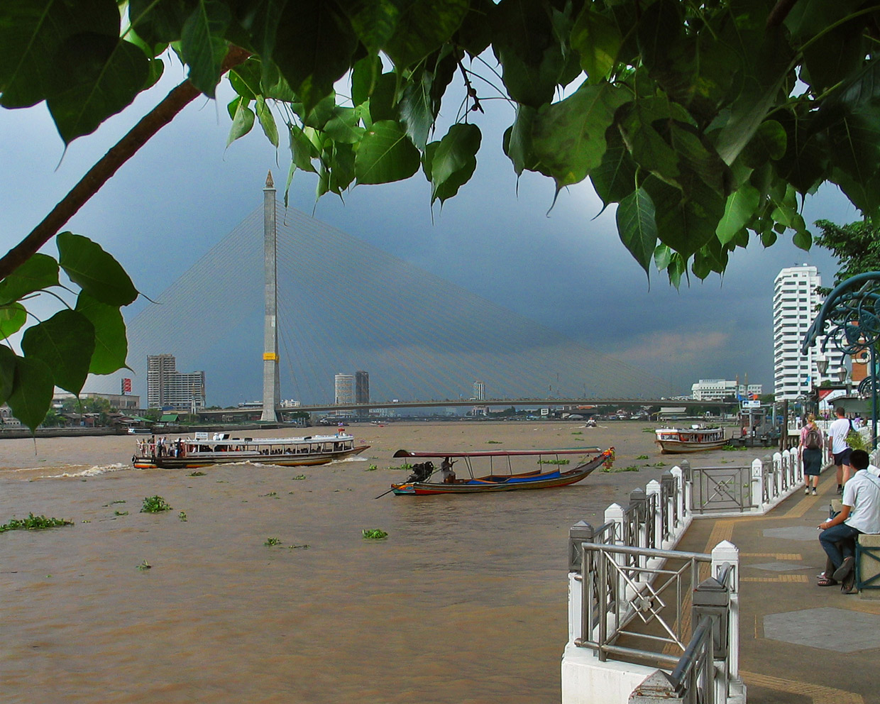


Bang Phlat, Thailand
เขตบางพลัด
Bang Phlat is a town of 92,325 people in Bangkok, Thailand, founded in November 9, 1989.
Why visit Bang Phlat
Townapedia lists 72 museums and landmarks, 34 parks and trails, 193 places to eat, 93 places to stay and 34 attractions in and around town.
Highlights include Chaliam La 56 bridge, Chamai Maru Chet Bridge, Bank of Thailand Museum and Phra Sumen Fort.
Weather in Bang Phlat
Forecast from MET Norway (CC BY 4.0). Full forecast
About Bang Phlat
Bang Phlat (Thai: บางพลัด, pronounced [bāːŋ pʰlát]) is one of the 50 districts (khet) of Bangkok, Thailand. Its neighboring districts, clockwise from the north, are Bang Kruai district, Bang Sue, Dusit, Phra Nakhon, Bangkok Noi, and Taling Chan.
From the Wikipedia article Bang Phlat district (this version), under CC BY-SA 4.0.
Things to do34


Memorial Bridge
Bridge · 6.2 km
Bridge crossing Chao Phraya River, Thailand

Chaloem Wan Chat bridge
Bridge · 3.9 km
Bridge and road intersection in Bangkok, Thailand
Chaturaphak Rangsarit Bridge
Bridge · 4.4 km
Bridge in Bangkok, Thailand
22 more on the map.
Museums and landmarks72


Phra Sumen Fort
Monument and historic site · 3.5 km
ถนนพระอาทิตย์
Mo-Su 08:00-23:00


14 October 1973 Memorial
Monument and historic site · 4.2 km
Memorial in Thailand


Bangkok Art and Culture Centre
Museum · 6.0 km
Art museum and cultural center in Bangkok


Berlin Pharmaceutical Museum
Museum · 5.6 km
Medical museum in Bangkok, Thailand

Democracy Monument
Monument and historic site · 4.2 km
Monument in Bangkok, Thailand


Grand Palace
Museum · 5.1 km
Official residence of the King of Thailand since 1782

Baan Kao Lao Rueng Museum
Museum · 5.8 km
History museum in Bangkok, Thailand
60 more on the map.
Parks, trails and playgrounds34


Chao Phraya Sky Park
Park · 6.2 km
Elevated park in Bangkok, Thailand

Chatuchak Park
Park · 5.7 km
Public park just north of Chatuchak Weekend Market

Chulalongkorn University Centenary Park
Park · 6.5 km
Public park in Bangkok


Princess Mother Memorial Park
Park · 6.4 km
Park in Bangkok, Thailand
22 more on the map.
Restaurants and cafes193

500 Cafe
Cafe · Coffee Shop, Cafe, ิbakery, Cocktail · 3.2 km
500 Cafe by FORFUN Bangkok, Thailand
500 ซอยแซมมี่
Fr-Sa 13:00-00:00


181 more on the map.
History
Bang Phlat was one of the 25 districts created in 1915, when the inner districts of Bangkok were reorganized. In 1938 the district was abolished and added to Bangkok Noi.
Bang Phlat district was again set up in 1989 by taking four sub-districts from Bangkok Noi. The west side of Borommaratchachonnani Road and Somdet Phra Pin Klao Road were moved back to Bangkok Noi in 1991, creating the new Arun Amarin Sub-district.
Bang Phlat has a number of transliteration spellings that are visible across the district including: Bang Phlat, Bang Phlad, Bang Plat, Bang Plad. It is likely that this spelling will become unified as the new MRT station stop has been titled "Bang Phlat".
The term "Bang Phlat" literally means "lost place". It is believed that in the past, the area was covered with canals and dense vegetation, making it easy for outsiders to get lost.
From the History section of Bang Phlat district on Wikipedia, under CC BY-SA 4.0.
Where to stay93
Churches and places of worship78
Wat Benchamabophit Dusit Wanaram Ratchaworawihan
Place of worship · Thai Mahanikaya · 3.3 km
69 ถนนพระรามที่ 5
Wat Iam Woranut
Place of worship · Thai Mahanikaya · 3.1 km
178 ถนนสามเสน
Wat Khema Phirataram Ratchaworawihan
Place of worship · Thai Thammayut · 3.0 km
Wat Rachathiwat Ratchaworawihan
Place of worship · Thai Thammayut · 2.1 km
3 ซอยสามเสน 9
Wat Thephakon
Place of worship · Thai Mahanikaya · 0.9 km
ซอยชุมชนวัดเทพากร 10
Wat Kho Non Bang Si Thong
Place of worship · Thai Mahanikaya · 3.3 km
Shopping32
Gas and EV charging13
Schools, colleges and libraries85
King Mongkut's University of Technology North Bangkok
School · 3.1 km
Healthcare15
Map of Bang Phlat
250 places. The map loads OpenStreetMap tiles when you open it.
Getting there and nearby towns
Don Mueang International Airport (DMK) is the nearest airport with scheduled flights listed in OpenStreetMap, 17 km away.
- Dusit 3 km southeast, about 3 min by car
- Bang Sue 3 km northeast, about 3 min by car
- Bang Kruai 4 km west, about 4 min by car
- Bangkok 4 km south, about 4 min by car
- Pom Prap Sattru Phai 4 km south, about 4 min by car
- Bangkok Noi 5 km southwest, about 5 min by car
- Taling Chan 6 km west, about 6 min by car
- Chatuchak 7 km northeast, about 7 min by car
- Samphanthawong 6 km south, about 6 min by car
- Din Daeng 7 km east, about 7 min by car
Drive times are estimates from straight-line distance, not routes.
Towns near Bang Phlat


Keep exploring
Local news
Headlines from INDB.
Reviews, tips and questions
Loading what members have shared...
Sources and licences
- GeoNames (CC BY 4.0): population, coordinates, regions and time zone
- Mapillary (see each image): photos
- OpenStreetMap contributors (ODbL 1.0): places, airports, map data
- Wikidata (CC0 1.0): elevation, founding date, time zone, website, landmarks and historic places
- Wikimedia Commons (see each image): photos
- Wikipedia (CC BY-SA 4.0): overview and history text
Photo credits
- Bkkchaophraya0804a, Fotograf / Photographer: Heinrich Damm ( User:Hdamm , Hdamm at de.wikipedia.org ), CC BY-SA 3.0
- สะพานเฉลิมหล้า 56 เขตปทุมวัน กรุงเทพมหานคร (4), กสิณธร ราชโอรส, CC BY-SA 4.0
- BKK Saphan Chamai Maruchet, Hdamm, CC BY-SA 3.0
- สะพานช้างโรงสี Saphan Chang Rong Si Bridge (October 2021) - img 01, Chainwit., CC BY-SA 4.0
- สะพานเจริญราษฎร์ 32, Dharmadana, CC BY-SA 4.0
- สะพานเจริญรัช 31, BerryJ, CC BY-SA 3.0
- Krung Thong Bridge 05499, dsin_travel, CC BY 2.0
- สะพานดำรงสถิต969, CKasa, CC BY-SA 3.0
- Bkksaphanphut0609, Heinrich Damm ( User:Hdamm , Hdamm at de.wikipedia.org ), CC BY 2.0
- Vimanmek Mansion, Gisling, CC BY-SA 3.0
- อนุสรณ์สถาน 14 ตุลา ถ่ายเมื่อกันยายน 2563 14 October 1973 Memorial 02, Chainwit., CC BY-SA 4.0
- Baan Kudichin Museum (2026) 01, Medelam, CC BY-SA 4.0
- Bangkok Art and Culture Centre building, Cush2k, CC BY-SA 3.0
- Bangkok National Museum, This Photo was taken by Supanut Arunoprayote . Feel free to use any of my images, but please mention me as the author and may send me a message. (สามารถใช้ภาพได้อิสระ..., CC BY 4.0
- 010-Democracy Monument, Nawit science, CC BY-SA 4.0
- 0005574-พระบรมมหาราชวังและวัดพระศรีรัตนราศดาราม, Preecha.MJ, CC BY-SA 4.0
- Chatuchak park, Lerdsuwa, CC BY-SA 3.0
- CU100YearsPark2018, BunBn, CC BY-SA 4.0
- Dusit Zoo bear statue, Ahoerstemeier, CC BY-SA 3.0
- A gate of King Rama IX Memorial Park 20221016 165652, Xiengyod~commonswiki, CC BY-SA 4.0
- Pata Zoo - panoramio, mohigan, CC BY-SA 3.0
- Парк Патхумвананурак (20250319120345), MikSed, CC BY-SA 4.0
- NarongchaiV 1018-02-0008, Narongchaiv, CC BY-SA 3.0
- Tampak Depan Gereja Santa Cruz Kudi Chin (2026) 02, Medelam, CC BY-SA 4.0
- Bkkwangthaphra0603e, Hdamm, CC BY-SA 3.0
- สวนหลวงพระราม 8 ๘, Phoebus 28, CC BY-SA 4.0
- National Library of Thailand, December 2024, Paul_012, CC BY-SA 4.0
- Ubosot of Wat Rachathiwat, This Photo was taken by Supanut Arunoprayote . Feel free to use any of my images, but please mention me as the author and may send me a message. (สามารถใช้ภาพได้อิสระ..., CC BY 4.0
- วัดเขมาภิตาราม, Warin~commonswiki, CC BY-SA 4.0
- พิพิธภัณท์เหรียญ, Bntofficial, CC BY-SA 4.0
- Conception Church, Bangkok, Supanut Arunoprayote, CC BY-SA 4.0
- โรงพยาบาลยันฮี 01, Dharmadana, CC BY-SA 4.0
- Phra Sumen Fort Bangkok - Day, Supanut Arunoprayote, CC BY-SA 4.0
- Bangkokphrasumenfort03, Fotograf / Photographer: Heinrich Damm ( User:Hdamm , Hdamm at de.wikipedia.org ), CC BY 2.0
- Building 8 Samsenwittayalai, JasperVanHelpe, CC BY-SA 4.0
- วังเทวะเวสม์ เขตพระนคร กรุงเทพมหานคร (2), กสิณธร ราชโอรส, CC BY-SA 4.0
- วัดอมรคีรี, Dharmadana, CC BY-SA 4.0
- วัดอาวุธวิกสิตาราม เขตบางพลัด กรุงเทพมหานคร (10), กสิณธร ราชโอรส, CC BY-SA 4.0
- วัดเทพากร (กรุงเทพมหานคร) 02, Dharmadana, CC BY-SA 4.0
- วัดอัมพวัน เขตดุสิต กรุงเทพมหานคร (16), กสิณธร ราชโอรส, CC BY-SA 4.0
- วัดเอี่ยมวรนุช เขตพระนคร กรุงเทพมหานคร (17), กสิณธร ราชโอรส, CC BY-SA 4.0
- วัดตึก นนทบุรี, Dharmadana, CC BY-SA 4.0
- โรงพยาบาลบางโพ, Dharmadana, CC BY-SA 4.0
- สะพานหัน 2564 Saphan Han (October 2021) - img 01, Chainwit., CC BY-SA 4.0
- Bangkok 2014 PD 087, Bin im Garten, CC BY 3.0
- Chao Phraya Sky Park เจ้าพระยาสกายปาร์ค สวนลอยฟ้าเจ้าพระยา (October 2021) - img 19, Chainwit., CC BY-SA 4.0
- Berlin Pharmaceutical Museum, Bangkok, Thailand, C411978, CC0
- Kiakkai Bridge - 2026 08 21 - 01, Anna Frodesiak, CC0
- พระอุโบสถวัดเบญจมบพิตรดุสิตวนารามราชวรวิหาร4, Mastertongapollo, CC BY-SA 4.0
- Bodindecha (Sing Singhaseni) Nonthaburi School Emblem, Cocoman1456, CC0
- อาคารพระพุทธเจ้าหลวง, Unknown author Unknown author, Public domain
- Street-level photo, ThailandCambodia, CC BY-SA 4.0
- Street-level photo, ratirat, CC BY-SA 4.0
- Street-level photo, ratirat, CC BY-SA 4.0
- Street-level photo, ThailandCambodia, CC BY-SA 4.0
- Street-level photo, geocruizer, CC BY-SA 4.0
- Street-level photo, geocruizer, CC BY-SA 4.0
- Street-level photo, geocruizer, CC BY-SA 4.0
- Street-level photo, mishari, CC BY-SA 4.0
- Street-level photo, ratirat, CC BY-SA 4.0
- Street-level photo, rusmanoon, CC BY-SA 4.0
- Street-level photo, ThailandCambodia, CC BY-SA 4.0
- Street-level photo, naaao5228, CC BY-SA 4.0
- Street-level photo, km2bp, CC BY-SA 4.0
- Street-level photo, km2bp, CC BY-SA 4.0
- Street-level photo, ThailandCambodia, CC BY-SA 4.0
- Street-level photo, kasetitkml_pipitchai, CC BY-SA 4.0
- Street-level photo, lin_wang, CC BY-SA 4.0
- Street-level photo, ratirat, CC BY-SA 4.0


Page built November 10, 2026. Spotted a mistake? Tell us or suggest a place.