


Pak Kret, Thailand
เทศบาลนครปากเกร็ด
Pak Kret is a city of 190,272 people in Nonthaburi, Thailand, founded in September 17, 1955.
Why visit Pak Kret
Townapedia lists 8 museums and landmarks, 16 parks and trails, 174 places to eat, 14 places to stay and 5 attractions in and around town.
Highlights include Maha Chesadabodindranusorn Bridge, Phra Nang Klao Bridge, Thunderdome Stadium and สวนส่งเสริมสุขภาพ GLO Park.
Weather in Pak Kret
Forecast from MET Norway (CC BY 4.0). Full forecast
About Pak Kret
Pak Kret (Thai: ปากเกร็ด, pronounced [pàːk krèt]) is a city (thesaban nakhon) in Nonthaburi province, Thailand. It lies in the Central Thailand plains on the east bank of the lower Chao Phraya River, bordering Bangkok to the east, Mueang Nonthaburi district of Nonthaburi province to the south, and Pathum Thani province to the north. It is part of the Bangkok Metropolitan Region megalopolis. With a registered population of 190,272, Pak Kret is the third most populous city municipality (thesaban nakhon) in Thailand.
From the Wikipedia article Pak Kret (this version), under CC BY-SA 4.0.
Photos of Pak Kret


Things to do5




Museums and landmarks8


Parks, trails and playgrounds16




4 more on the map.
Restaurants and cafes174
บ้านริมน้ำ โฮมคาเฟ่ เกาะเกร็ด
Cafe · Coffee Shop, Burger, Regional · 0.7 km
บ้านริมน้ำบนเกาะเกร็ด นั่งชิลชิลชมวิวเจ้าพระยา กับกาแฟ เครื่องดื่มและของหวานอร่อยๆ ชิคๆ ชิลๆ
11 หมู่ ถนนสุขาประชาสรรค์, ตำบลเกาะเกร็ด
Mo-Sa 09:00-18:00
ร้านโจ๊กซูบะห์ ฮาลาล
Restaurant · Sandwich, Tea, Breakfast · 3.3 km
ซอยท่าอิฐ 21
05:30-09:30

Chitbeer
Bar and pub · 0.8 km
Homebrew microbrew craft beer
หมู่ 1 ทางรอบเกาะ, ตำบลเกาะเกร็ด
Sa,Su 12:00-21:00

Let's Chill Music & Restaurant
Restaurant · Pizza, Thai, International · 3.7 km
8/9 ถนนชัยพฤกษ์, ตำบลบางพลับ
Mo-Su 11:00-24:00

OiC Keto Cafe By Cherry
Cafe · Coffee Shop, Keto · 4.6 km
50/924 เมืองทองธานีโครงการ 6 ซอย A3
Mo-Su 10:00-21:00
Smallbar Coffee
Cafe · Coffee Shop, Tea, Cake, Juice · 3.2 km
245/1 ถนนสนามบินน้ำ
Mo-Su 07:00-16:00
หอมฟุ้งปังนม ณ เกาะเกร็ด
Cafe · Coffee Shop, Dessert, Cake · 1.2 km
11/3
10.00-16.00
162 more on the map.
History
The Pak Kret area has been inhabited since at least the 18th century, under the rule of the Ayutthaya Kingdom. The portion of the Chao Phraya River to the west of Pak Kret city centre was excavated c. 1721–1722 to bypass a bend in the river, forming the island of Ko Kret. The settlements on the bank of the bypass canal and at its mouth became known as Ban Tret Noi (บ้านเตร็ดน้อย) and Ban Pak Tret Noi (บ้านปากเตร็ดน้อย), meaning 'village on the lesser bypass' and 'village on the mouth of the lesser bypass', respectively (the "greater bypass" is further upriver in what is now Mueang Pathum Thani District.) Many ethnic Mon communities settled in the area during the Ayutthaya to early-Rattanakosin periods.
Pak Kret was established as a sanitation district (sukhaphiban) on 31 August 1955. It covers the portion of Pak Kret District east of the river, namely the areas of Pak Kret, Bang Phut, Ban Mai, Bang Talat, and Khlong Kluea Subdistricts. It was incorporated as a subdistrict municipality (thesaban tambon) on 1 January 1992 and was later upgraded to town and then city status on 5 February 1996 and 20 April 2000. As Bangkok rapidly expanded during the late 20th century, so too did Pak Kret, its paddies and orchards being converted to housing estates and other residential areas.
From the History section of Pak Kret on Wikipedia, under CC BY-SA 4.0.
More about Pak Kret
Geography
Most of Pak Kret is low-density residential development. The city centre, sometimes known as Pak Kret Market, lies on the east bank of the Chao Phraya, at the northern branching between the old river course and the new bypass, across from Ko Kret. The municipality and district offices are found here. Two major thoroughfares serve the area: Chaeng Watthana Road runs east–west, linking the city centre to Bangkok's Lak Si District in the east, and Tiwanon Road links Pak Kret to Pathum Thani Province in the north and Nonthaburi in the south, the two crossing at Pak Kret intersection. The viaduct that leads to Rama IV Bridge runs above Chaeng Watthana Road through the city centre, crossing the river toward Khlong Phra Udom Subdistrict. The second-stage expressway links Chaeng Watthana Road southward to downtown Bangkok and northward to Bang Pa-in.
Muang Thong Thani is the largest housing estate in Pak Kret. It is the site of Sukhothai Thammathirat Open University and Impact, Muang Thong Thani, a large exhibition centre complex. Srinagarindra Park and the CentralPlaza Chaengwattana shopping centre are also within the city. The MRT Pink Line, which opened in 2023, runs along Chaeng Watthana and Tiwanon roads. The line links Pak Kret and Muang Thong Thani to Lak Si and Nonthaburi.
From the Wikipedia article Pak Kret, under CC BY-SA 4.0.
Where to stay14
Audrey's Residence
Motel and hotel · 4.5 km
29/353 เมืองทองธานีโครงการ 2 ซอย 10, ปากเกร็ด
Churches and places of worship50
Shopping37
Amor Village at Ratchaphruek
Shopping center · 5.0 km
46/6 หมู่ 2 ซอยบางพลับ ตำบลบางพลับ ถนนราชพฤกษ์, อำเภอปากเกร็ด จังหวัดนนทบุรี
Gas and EV charging20
Schools, colleges and libraries33
Rajamangala University of Technology Suvarnabhumi Nonthaburi North Campus
School · 5.1 km
144 นนทบุรี
Healthcare17
Ban Wat Daeng Subdistrict Health Promoting Hospital
Clinic and pharmacy · 3.3 km
89/1 หมู่ 1
Siamese Clinic สยามเมสคลินิก
Clinic and pharmacy · 4.6 km
16/7 ซอย เมืองทองธานี Bang Phut Sub-district, Pak Kret District, Nonthaburi 11120, ตำบลบางพูด
Map of Pak Kret
250 places. The map loads OpenStreetMap tiles when you open it.
Getting there and nearby towns
Don Mueang International Airport (DMK) is the nearest airport with scheduled flights listed in OpenStreetMap, 11 km away.
- Mueang Nonthaburi 6 km south, about 6 min by car
- Bang Bua Thong 8 km west, about 8 min by car
- Lak Si 9 km east, about 9 min by car
- Chatuchak 11 km southeast, about 11 min by car
- Taling Chan 16 km south, about 16 min by car
- Bangkok 18 km south, about 18 min by car
- Thon Buri 21 km south, about 21 min by car
- Phasi Charoen 23 km south, about 23 min by car
- Nong Khaem 28 km southwest, about 28 min by car
- Samut Prakan 37 km south, about 37 min by car
Drive times are estimates from straight-line distance, not routes.
Towns near Pak Kret


Keep exploring
Local news
Headlines from INDB.
Reviews, tips and questions
Loading what members have shared...
Sources and licences
- GeoNames (CC BY 4.0): population, coordinates, regions and time zone
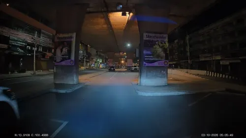
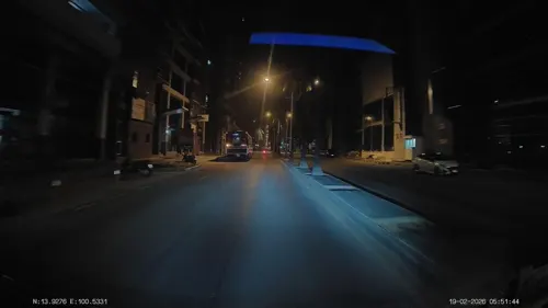
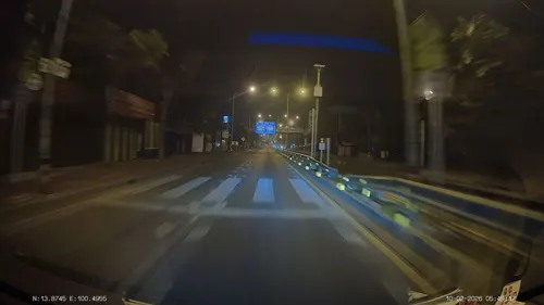
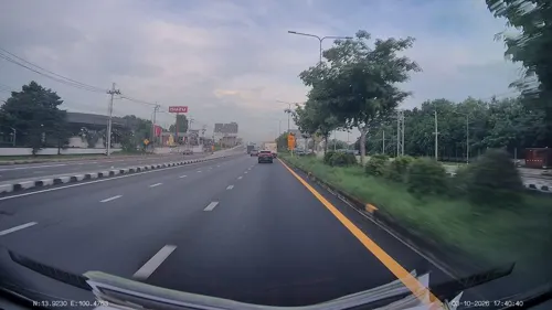
- Mapillary (see each image): photos
- OpenStreetMap contributors (ODbL 1.0): places, airports, map data
- Wikidata (CC0 1.0): elevation, founding date, time zone, website, landmarks and historic places
- Wikimedia Commons (see each image): photos
- Wikipedia (CC BY-SA 4.0): overview and history text
Photo credits
- Aerial view of Pak Kret, May 2010, Paul_012, CC BY-SA 3.0
- Pak Kret, Pak Kret District, Nonthaburi 11120, Thailand - panoramio (3), mohigan, CC BY-SA 3.0
- Pak Kret Pier2 - panoramio, ::::=UT=::::, CC BY-SA 3.0
- Pak Kret Pier - panoramio, ::::=UT=::::, CC BY-SA 3.0
- Pak Kret, Pak Kret District, Nonthaburi 11120, Thailand - panoramio (1), mohigan, CC BY-SA 3.0
- Pak Kret, Pak Kret District, Nonthaburi 11120, Thailand - panoramio, mohigan, CC BY-SA 3.0
- Pak Kret waterfront panorama, Paul_012, CC BY-SA 3.0
- Pak Kret, Pak Kret District, Nonthaburi 11120, Thailand - panoramio (2), mohigan, CC BY-SA 3.0
- Ko Kret, Pak Kret District, Nonthaburi 11120, Thailand - panoramio (13), mohigan, CC BY-SA 3.0
- Ko Kret, Pak Kret District, Nonthaburi 11120, Thailand - panoramio (12), mohigan, CC BY-SA 3.0
- Ko Kret, Pak Kret District, Nonthaburi 11120, Thailand - panoramio (11), mohigan, CC BY-SA 3.0
- Ko Kret, Pak Kret District, Nonthaburi 11120, Thailand - panoramio (10), mohigan, CC BY-SA 3.0
- Ko Kret, Pak Kret District, Nonthaburi 11120, Thailand - panoramio, mohigan, CC BY-SA 3.0
- Bridge at Nonthaburi 1 Road, Paul_012, CC BY-SA 4.0
- New Pranangklao Bridge, 2T, CC BY-SA 3.0
- Rama 4 bridge, 2T, CC BY-SA 3.0
- Sukhothai Thammathirat Open University, Pakkret, Nonthaburi 07.11.2025 (03), Tvcccp, CC0
- DPU1, Mrapisit, CC BY-SA 3.0
- Thunderdome, www.thai-fussball.com, CC BY 3.0
- Chompoo-Veth-(1), Archy36, CC BY-SA 3.0
- 0000226 - Wat Poramaiyikawas Worawihan 001, Preecha.MJ, CC BY-SA 4.0
- ศูนย์การแพทย์ปัญญานันทภิกขุ ชลประทาน (โรงพยาบาลชลประทาน) 2566, Chainwit., CC BY 4.0
- วัดบ่อ ปากเกร็ด, Bookkkk, CC BY-SA 4.0
- Chim-Pee, Archy36, CC BY-SA 3.0
- Wat Klang Kret (I), This Photo was taken by Supanut Arunoprayote . Feel free to use any of my images, but please mention me as the author and may send me a message. (สามารถใช้ภาพได้อิสระ..., CC BY 4.0
- Nonthaburi - พุทธสถานเชิงท่า-หน้าโบสถ์ Choeng Tha - Na Bot Temple - image 06, Chainwit., CC BY-SA 4.0
- วัดแจ้งศิริสัมพันธ์, Dharmadana, CC BY-SA 4.0
- InChaeng, Ndsman, CC BY-SA 3.0
- Suankularb Wittayalai Nonthaburi School - Building 9 & Football Field, Skn wiki, CC BY-SA 4.0
- วัดปรมัยยิกาวาสวรวิหาร อ.ปากเกร็ด จ.นนทบุรี (32), กสิณธร ราชโอรส, CC BY-SA 4.0
- เรือพาย - panoramio, ::::=UT=::::, CC BY-SA 3.0
- Sunset at pakkred - panoramio, มะเดื่อ แสลงหลวง, CC BY 3.0
- ศาลพระภูมิ , Shine of the household spirit. - panoramio, ::::=UT=::::, CC BY-SA 3.0
- เฉาก๊วยพร้อมทาน - panoramio, ::::=UT=::::, CC BY-SA 3.0
- Black Jelly with Syrup, เฉาก๊วยครับเฉาก๊วย หวาน หอม เย็น ชื่นใจ - panoramio, ::::=UT=::::, CC BY-SA 3.0
- อีฟากหนึ่งมองจากเกาะเกร็ด - panoramio, ::::=UT=::::, CC BY-SA 3.0
- Panoramic Rama V Bridge, Supanut Arunoprayote, CC BY 4.0
- Wat Paramai Yikawat (I), This Photo was taken by Supanut Arunoprayote . Feel free to use any of my images, but please mention me as the author and may send me a message. (สามารถใช้ภาพได้อิสระ..., CC BY 4.0
- Ko Kret leaning chedi - panoramio, Andreas Hörstemeier, CC BY-SA 3.0
- ท่าน้ำ - panoramio (1), ::::=UT=::::, CC BY-SA 3.0
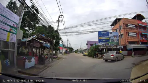
- Street-level photo, ThailandCambodia, CC BY-SA 4.0
- Street-level photo, ThailandCambodia, CC BY-SA 4.0
- Street-level photo, ThailandCambodia, CC BY-SA 4.0
- Street-level photo, ThailandCambodia, CC BY-SA 4.0
- Street-level photo, poramet, CC BY-SA 4.0
- Street-level photo, ThailandCambodia, CC BY-SA 4.0
- Street-level photo, korawichkavee, CC BY-SA 4.0
- Street-level photo, bewzty, CC BY-SA 4.0
- Street-level photo, ozflor, CC BY-SA 4.0
- Street-level photo, ThailandCambodia, CC BY-SA 4.0


Page built November 10, 2026. Spotted a mistake? Tell us or suggest a place.