


Chom Thong, Thailand
เขตจอมทอง
Chom Thong is a city of 158,005 people in Bangkok, Thailand, founded in November 9, 1989.
Why visit Chom Thong
Townapedia lists 24 museums and landmarks, 23 parks and trails, 183 places to eat, 16 places to stay and 18 attractions in and around town.
Highlights include Bhumibol Bridge, Chaloem Phan 53 Bridge, Baan Kao Lao Rueng Museum and Baan Kudichin Museum.
Weather in Chom Thong
Forecast from MET Norway (CC BY 4.0). Full forecast
About Chom Thong
Chom Thong (Thai: จอมทอง, pronounced [t͡ɕɔ̄ːm tʰɔ̄ːŋ]) is one of the 50 districts (khet) of Bangkok, Thailand. The district is bounded by the districts (clockwise from north) Phasi Charoen, Thon Buri, Rat Burana, Thung Khru, Bang Khun Thian, and Bang Bon.
From the Wikipedia article Chom Thong district, Bangkok (this version), under CC BY-SA 4.0.
Photos of Chom Thong


Things to do18


Kanchanaphisek Bridge
Bridge · 7.6 km
Thai road bridge over the Chao Phraya

Memorial Bridge
Bridge · 7.1 km
Bridge crossing Chao Phraya River, Thailand


Phra Pok Klao Bridge
Bridge · 7.0 km
Road bridge in Bangkok, Thailand

6 more on the map.
Museums and landmarks24
Baan Kao Lao Rueng Museum
Museum · 7.8 km
History museum in Bangkok, Thailand




Museum of Counterfeit Goods
Museum · 6.9 km
Museum in Bangkok, Thailand


The Museum of Siam
Museum · 7.5 km
Discovery museum in Phra Nakhon District, Bangkok

Yaowarat Chinatown Heritage Center
Museum · 7.3 km
Contemporary art centre in Thailand

Tang's Gallery
Museum · 6.7 km
Commercial art gallery with branches in China, Hong Kong and Thailand
12 more on the map.
Parks, trails and playgrounds23


Chao Phraya Sky Park
Park · 7.0 km
Elevated park in Bangkok, Thailand

Khlong Chong Nonsi Public Park
Park · 7.2 km
Park in Bangkok, Thailand


Princess Mother Memorial Park
Park · 6.8 km
Park in Bangkok, Thailand

11 more on the map.
Restaurants and cafes183
ซือหวังสุกี้หม่าล่า สาขาพุทธบูชา-บางมด
Restaurant · Chinese, Grill · 3.0 km
ร้านสุกี้หม่าล่าสายพานสูตรพิเศษ เพิ่มเตาปิ้งย่างฟรี บุฟเฟ่ต์น้ำจิ้งด้วยนะ คัดสรรค์มาเพื่อลูกค้าโดยเฉพาะ...
266/4 ถนนพุทธบูชา, บางมด
Mo-Su 11:00-02:00
Baan Pakistan
Restaurant · 3.9 km
Charming little restaurant in a beautifully renovated wooden boat with Mediterranean, Indian, and Thai dishes
Mo-Su 10:00-21:00
Cocoa Village by Heart Village
Cafe · 3.0 km
Cocoa café and art studio
Mo, Tu, Th, Fr 12:00-20:00; Sa, Su 09:00-18:00

BBQ house & Hotpot
Restaurant · 3.9 km
All-you-can-eat buffet of grill and/or hot pot
2128/10-11 Charoenkrung Road Wat Prayakrai Bangkorleam
Mo-Su 16:00-23:00

กาโตว์ เฮ้าส์ ปั๊มซัสโก้ วัดยายร่ม
Cafe · Bakery · 2.0 km
595 ถนนพระรามที่ 2, แขวงบางมด
Mo-Su 08:00-19:00

On a Cloud Cafe
Cafe · 1.4 km
Cafe and bistro with selection of pasta, Korean, and Thai food and a great selection of desserts and drinks
Mo, Tu, Th-Su 09:30-21:00
171 more on the map.
History
Chom Thong was included in Bang Khun Thien District until an announcement on November 9, 1989. On 14 October 1997, parts of Bang Pakok sub-district of Rat Burana and parts of Bukkhalo Sub-district of Thon Buri were transferred to Chom Thong during the administrative reform which rearranged the 38 Bangkok districts into 50 districts.
Historically, Chom Thong area is the original residence of King Nangklao (Rama III)'s relatives.
From the History section of Chom Thong district, Bangkok on Wikipedia, under CC BY-SA 4.0.
More about Chom Thong
Economy
The district, together with Thung Khru, is well known for its tangerines, the Bang Mot tangerine. There is a giant tangerine sculpture at the junction between Rama II Road and Suk Sawat Road where Rama II Road originate. The district is also the home of the Poomjai Garden lychee farm, Bangkok's last lychee plantation.
From the Wikipedia article Chom Thong district, Bangkok, under CC BY-SA 4.0.
Where to stay16
Ramada Plaza Bangkok Menam Riverside
Motel and hotel · 4.1 km
2074 Soi Charoenkrung 72/4, Bangkorlaem, Bangkok
Yu ga Chan Guest House
Motel and hotel · 3.6 km
513/97 Pradu 31 Alley, uni villa soi 9
Churches and places of worship73
Wat Bang Khun Thian Nok
Place of worship · Thai Mahanikaya · 2.9 km
1 หมู่ 7 Chom Thong 19
Wat Kiat Pradit
Place of worship · Thai Mahanikaya · 1.2 km
30/68 ซอยสุขสวัสดิ์ 11
Wat Nang Ratchaworawihan
Place of worship · Thai Mahanikaya · 3.7 km
ซอยวุฒากาศ 42
Wat Ratcha-orasaram Ratchaworawihan
Place of worship · Thai Mahanikaya · 3.5 km
เอกชัย, จอมทอง
Wat Yai Rom
Place of worship · Thai Mahanikaya · 2.1 km
24 ซอยพระรามที่ 2 ซอย 33
Wat Bang Khun Thian Klang
Place of worship · Thai Mahanikaya · 2.8 km
Shopping95
Big C
Grocery · 2.4 km
1050 แขวงบุคคโล เขตธนบุรี สมเด็จพระเจ้าตากสิน, กรุงเทพมหานคร
Gas and EV charging25
Schools, colleges and libraries45
Healthcare22
Map of Chom Thong
250 places. The map loads OpenStreetMap tiles when you open it.
Getting there and nearby towns
Suvarnabhumi Airport (BKK) is the nearest airport with scheduled flights listed in OpenStreetMap, 29 km away.
- Thon Buri 5 km north, about 5 min by car
- Bang Khun Thian 6 km west, about 6 min by car
- Phasi Charoen 7 km northwest, about 7 min by car
- Bangkok 9 km north, about 9 min by car
- Bang Khae 8 km west, about 8 min by car
- Bangkok Noi 10 km north, about 10 min by car
- Khlong Toei 11 km east, about 11 min by car
- Taling Chan 11 km north, about 11 min by car
- Dusit 12 km north, about 12 min by car
- Samut Prakan 15 km southeast, about 15 min by car
Drive times are estimates from straight-line distance, not routes.
Towns near Chom Thong


Keep exploring
Local news
Headlines from INDB.
Reviews, tips and questions
Loading what members have shared...
Sources and licences
- GeoNames (CC BY 4.0): population, coordinates, regions and time zone
- Mapillary (see each image): photos
- OpenStreetMap contributors (ODbL 1.0): places, airports, map data
- Wikidata (CC0 1.0): elevation, founding date, time zone, website, landmarks and historic places
- Wikimedia Commons (see each image): photos
- Wikipedia (CC BY-SA 4.0): overview and history text
Photo credits
- Wat raja orasaram a05, Fotograf / Photographer: Heinrich Damm ( User:Hdamm , Hdamm at de.wikipedia.org ), CC BY 2.0
- 2026 Thai general election (Early voting day) Central Rama II To Chom Thong Bangkok 01.02.2026 01, Tvcccp, CC0
- 2026 Thai general election (Early voting day) Central Rama II To Chom Thong Bangkok 01.02.2026 03, Tvcccp, CC0
- 2026 Thai General Election and Referendum, Chom Thong, Bangkok 08.02.2026 (04), Tvcccp, CC0
- 2026 Thai general election (Early voting day) Central Rama II To Chom Thong Bangkok 01.02.2026 02, Tvcccp, CC0
- 2026 Thai general election (Early voting day) Central Rama II To Chom Thong Bangkok 01.02.2026 10, Tvcccp, CC0
- 2026 Thai General Election and Referendum, Chom Thong, Bangkok 08.02.2026 (03), Tvcccp, CC0
- 2026 Thai General Election and Referendum, Chom Thong, Bangkok 08.02.2026 (02), Tvcccp, CC0
- 2026 Thai General Election and Referendum, Chom Thong, Bangkok 08.02.2026 (05), Tvcccp, CC0
- 2026 Thai General Election and Referendum, Chom Thong, Bangkok 08.02.2026 (01), Tvcccp, CC0
- 2026 Thai general election (Early voting day) Central Rama II To Chom Thong Bangkok 01.02.2026 12, Tvcccp, CC0
- 2026 Thai general election (Early voting day) Central Rama II To Chom Thong Bangkok 01.02.2026 11, Tvcccp, CC0
- Bhumibol 2020, Jean pierre Grosset, CC BY-SA 4.0
- สะพานเฉลิมพันธุ์ ๕๓ มกราคม 2563 01, Chainwit., CC BY-SA 4.0
- Charoenpadana bridge, Sry85, CC BY-SA 4.0
- สะพานเจริญรัช 31, BerryJ, CC BY-SA 3.0
- Kan0424, Toneder, Public domain
- Bkksaphanphut0609, Heinrich Damm ( User:Hdamm , Hdamm at de.wikipedia.org ), CC BY 2.0
- Chai Phatthanasilp ชัยพัฒนศิลป์ 01, Chainwit., CC BY-SA 4.0
- 2022 January - Phra Pokklao Bridge, Chainwit., CC BY-SA 4.0
- Rama IX Bridge-2, Chalit Manipalviratn from Bangkok, Thailand, CC BY-SA 2.0
- Baan Kudichin Museum (2026) 01, Medelam, CC BY-SA 4.0
- Bangkok Kunsthalle - exterior (2026) - img 02, Chainwit., CC BY 4.0
- M.R. Kukrit’s Heritage Home (6980958709), Johan Fantenberg from Melbourne, Australia, CC BY-SA 2.0
- Media Museum of Counterfeit Goods, PPun, CC BY-SA 3.0
- พิพิธภัณฑ์พัฒน์พงศ์, พิพิธภัณฑ์พัฒน์พงศ์, CC BY-SA 4.0
- มิวเซียมสยาม พิพิธภัณฑ์การเรียนรู้ 3, Yakuzakorat, CC BY-SA 3.0
- สวนสาธารณะคลองช่องนนทรี 01, Dharmadana, CC BY-SA 4.0
- NarongchaiV 1018-02-0008, Narongchaiv, CC BY-SA 3.0
- Samray Church, Bangkok 1 2, dahlfred, CC BY-SA 3.0
- Assumption Cathedral Bangkok 2023-10 อาสนวิหารอัสสัมชัญ, Chainwit., CC BY-SA 4.0
- คริสตจักรไครสต์เชิร์ช เขตบางรัก กรุงเทพมหานคร (6), กสิณธร ราชโอรส, CC BY-SA 4.0
- Wat Karawah (cropped), Supanut Arunoprayote, CC BY 4.0
- Tampak Depan Gereja Santa Cruz Kudi Chin (2026) 02, Medelam, CC BY-SA 4.0
- NV 1035-02-0011, Narongchaiv, CC BY-SA 3.0
- Asiatique The Riverfront - A wharf02, Wakorinda, CC BY-SA 4.0
- พระอุโบสถ วัดหนังราชวรวิหาร (1), กสิณธร ราชโอรส, CC BY-SA 3.0
- วัดบางขุนเทียนนอก เขตจอมทอง กรุงเทพมหานคร (23), กสิณธร ราชโอรส, CC BY-SA 4.0
- วัดบางขุนเทียนกลาง เขตจอมทอง กรุงเทพมหานคร (6), กสิณธร ราชโอรส, CC BY-SA 4.0
- วัดเกียรติประดิษฐ์ 02, Dharmadana, CC BY-SA 4.0
- วัดบางโคล่นอก เขตบางคอแหลม กรุงเทพมหานคร, กสิณธร ราชโอรส, CC BY-SA 4.0
- วัดยายร่ม, Dharmadana, CC BY-SA 4.0
- โรงพยาบาลสมเด็จพระปิ่นเกล้า, Dharmadana, CC BY-SA 4.0
- Thonburirompark1, Chanada.tham, CC BY-SA 4.0
- สะพานหัน 2564 Saphan Han (October 2021) - img 01, Chainwit., CC BY-SA 4.0
- Bangkok 2014 PD 087, Bin im Garten, CC BY 3.0
- Wat Traimit - 2017-05-12 (035), Iudexvivorum, CC0
- Chao Phraya Sky Park เจ้าพระยาสกายปาร์ค สวนลอยฟ้าเจ้าพระยา (October 2021) - img 19, Chainwit., CC BY-SA 4.0
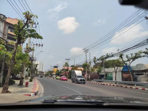
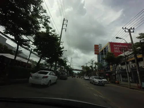
- Street-level photo, kasetitkml_pipitchai, CC BY-SA 4.0
- Street-level photo, kasetitkml_pipitchai, CC BY-SA 4.0
- Street-level photo, kasetitkml_pipitchai, CC BY-SA 4.0
- Street-level photo, kasetitkml_pipitchai, CC BY-SA 4.0
- Street-level photo, noonishere, CC BY-SA 4.0
- Street-level photo, mishari, CC BY-SA 4.0
- Street-level photo, kasetitkml_pipitchai, CC BY-SA 4.0
- Street-level photo, jetman11, CC BY-SA 4.0
- Street-level photo, koki2529, CC BY-SA 4.0
- Street-level photo, kasetitkml_pipitchai, CC BY-SA 4.0
- Street-level photo, mishari, CC BY-SA 4.0
- Street-level photo, kasetitkml_pipitchai, CC BY-SA 4.0
- Street-level photo, noonishere, CC BY-SA 4.0
- Street-level photo, ratirat, CC BY-SA 4.0


Page built November 10, 2026. Spotted a mistake? Tell us or suggest a place.