


Laem Chabang, Thailand
เทศบาลนครแหลมฉบัง
Laem Chabang is a town of 88,271 people in Chon Buri, Thailand.
Why visit Laem Chabang
Townapedia lists 2 museums and landmarks, 9 parks and trails, 34 places to eat, 3 places to stay and 1 attraction in and around town.
Weather in Laem Chabang
Forecast from MET Norway (CC BY 4.0). Full forecast
About Laem Chabang
Laem Chabang (Thai: แหลมฉบัง, pronounced [lɛ̌ːm tɕʰābāŋ]) is a port city municipality (thesaban nakhon) in Si Racha and Bang Lamung districts of Chonburi Province, Thailand. It includes Thung Sukhla subdistrict (tambon) and parts of subdistricts Bueng, Nong Kham and Surasak of Si Racha District and part of Bang Lamung township of Bang Lamung District. As of 2019 it had a population of 88,271. The city has grown up around the port, but also serves as a major stop on the coastal highway linking Pattaya and Bangkok via Sukhumvit Road (Hwy 3).
From the Wikipedia article Laem Chabang (this version), under CC BY-SA 4.0.
Travel tips from other travellers: Laem Chabang on Wikivoyage (CC BY-SA 4.0).
Photos of Laem Chabang


Things to do1

Museums and landmarks2


Parks, trails and playgrounds9




Restaurants and cafes34
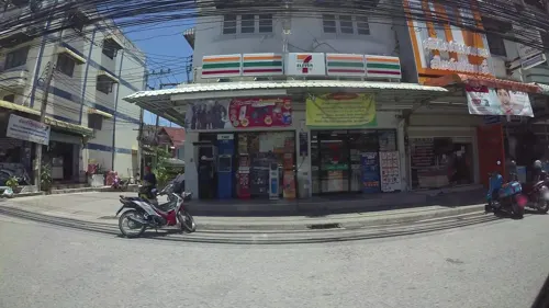
In-Chon taebuk
Restaurant · Korean, Chicken, Thai, ไก่ทอด, อาหารเกาหลี · 5.3 km
209/105 ถนนทุ่งสุขลา, ศรีราชา
Mo-Su 10:30-21:30
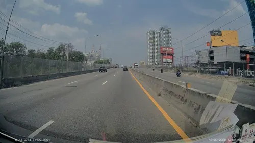

LESS cofee and drink
Cafe · 5.8 km
62/164 ม.10 ต.ศรีราชา อ.ศรีราชา ชลบุรี
Mo-Su 09:00-17:00

กาแฟสดคุณยาย - Grandmom coffee
Cafe · Coffee Shop, Drinks · 4.5 km
174/4 หมู่ 7 ต.ทุ่งสุขลา อ.ศรีราชา อ่าวอุดม, ชลบุรี
22 more on the map.
History
Since 1981 the National Economic and Social Development Board (NESDB) has defined Laem Chabang as a target area for the development into a new urban community by constructing and developing infrastructure and public utilities to support the expansion of the community resulting from the development. Industry by carrying out the construction of an international deep sea port. Industrial estates for export. Construction of the Laem Chabang Port. Railway to connect with the Bangkok-Sattahip Port Railway. Realisation of Laem Chabang Community Housing Building.
Read more of the history
According to the Eastern Seaboard Development Project the area consists of the whole Thung Sukhla subdistrict and some areas of Surasak subdistrict, Nong Kham subdistrict, Bueng subdistrict and Bang Lamung subdistrict. Development of the port complex started in 1988. The container port was completed in 1991.By raising the status of some areas of Ao Udom sanitation district (sukhaphiban), Laem Chabang subdistrict municipality (thesaban tambon), Si Racha district and Bang Lamung district, Chonburi province was established, announced in the Government Gazette, book 108, issue 211, dated 4 December 1991, effective from 3 January 1992. To be a local government organization that controls and enforces the urban development plan. As well as being an agency that provides social services to the community. Conduct business of various industries with the people to rule and take care. Upholding their localities according to the municipal system.Subsequently Laem Chabang city municipality (thesaban nakhon) was established on 24 May 2010.
The port is part of the Belt and Road Initiative that runs from the Chinese coast to the south via Singapore through the Strait of Malacca towards the southern tip of India, via Mombasa through the Suez Canal to the Mediterranean, there to the Upper Adriatic region to the northern Italian hub of Trieste with its rail connections to Central Europe and the North Sea.
From the History section of Laem Chabang on Wikipedia, under CC BY-SA 4.0.
More about Laem Chabang
Geography
The area of Laem Chabang city municipality is generally coastal and is located on the east of Gulf of Thailand about 120 km (75 mi) from Suvarnabhumi Airport, 30 km (19 mi) south of Chonburi, 25 km (16 mi) north of Pattaya and 60 km (37 mi) from Map Ta Phut and covers an area of 109.65 km2 (42.34 sq mi) of which 88.59 km2 (34.20 sq mi) land area and 21.06 km2 (8.13 sq mi) water surface (sea). It is in the development zone under the Eastern Seaboard Development Project, consists of a commercial port, industrial estate centers, playgrounds, sports fields, etc.
Laem Chabang borders to the north: Surasak subdistrict (tambon), Si Racha district (amphoe), Chonburi province (changwat), east: subdistricts Nong Kham and Bueng, Si Racha district, Chonburi province, south: Bang Lamung subdistrict, Bang Lamung district, Chonburi province, west: Gulf of Thailand.
Economy
Economic conditions within Laem Chabang city municipality largely depend on industry. Industrial factories operate more than 200 companies. They employ the largest number of workers in Chonburi province.
It is one of the main development activities in Laem Chabang, located on an area of 569 ha (1,406 acres) between the harbor and Sukhumvit Road, Thung Sukhla subdistrict, divided into:
General industrial zone, 292 ha (721 acres) with approximately 80 companies, among which Mitsubishi car factory and engine factory, Fujitsu General (Thailand), Michelin Siam Company and Meyer Group Company.[1] Archived 2020-09-27 at the Wayback Machine
Free business zone, 157 ha (387 acres) with approximately 26 companies in the first phase and 40 companies in the second phase.
Government and Public utility zone, 121 ha (298 acres) with branches of TOT Public Company, Eastern Investment Economic Center (BOI) and CAT Telecom Public Company Limited.
A private project established in 1977 located West of Motorway 7 at Nong Kham subdistrict, on an area of approximately 208 ha (514 acres), comprising about 80 industrial factories with at least 20,000 employees.
Thailand's largest port occupies 10.41 km2 (4 sq.mi) and is capable of handling the largest (Post-Panamax) vessels.
Education
There is one university: Kasetsart University Sriracha Campus
Twelve primary/secondary schools under the Chonburi Educational Service Area Office 3:
There are also eight child development centers in Laem Chabang city municipality
From the Wikipedia article Laem Chabang, under CC BY-SA 4.0.
Where to stay3
Churches and places of worship5
Shopping3
Gas and EV charging14
Schools, colleges and libraries12
Healthcare4
Map of Laem Chabang
87 places. The map loads OpenStreetMap tiles when you open it.
Getting there and nearby towns
U-Tapao - Pattaya International airport (UTP) is the nearest airport with scheduled flights listed in OpenStreetMap, 47 km away.
- Si Racha 11 km northeast, about 11 min by car
- Pattaya 17 km south, about 17 min by car
- Chon Buri 32 km north, about 32 min by car
- Ban Chang 44 km southeast, about 44 min by car
- Rayong 61 km southeast, about 1 h by car
- Samut Prakan 65 km northwest, about 1 h by car
- Bang Na 70 km north, about 1 h 15 min by car
- Lat Krabang 71 km north, about 1 h 15 min by car
- Thung Khru 73 km northwest, about 1 h 15 min by car
- Bangkok 85 km northwest, about 1 h 30 min by car
Drive times are estimates from straight-line distance, not routes.
Towns near Laem Chabang


Keep exploring
Local news
Headlines from INDB.
Reviews, tips and questions
Loading what members have shared...
Sources and licences
- GeoNames (CC BY 4.0): population, coordinates, regions and time zone
- Mapillary (see each image): photos
- OpenStreetMap contributors (ODbL 1.0): places, airports, map data
- Wikidata (CC0 1.0): elevation, founding date, time zone, website
- Wikimedia Commons (see each image): photos
- Wikipedia (CC BY-SA 4.0): overview and history text
Photo credits
- Laem Chabang, Lokomotive74, CC BY 2.5
- Phylloscopus inornatus 456140817, Wich’yanan (Jay) Limparungpatthanakij, CC BY 4.0
- ภาพคลังสินค้า, เจดับเบิ้ลยูดี, CC BY-SA 4.0
- ตุ้คอนเทนเนอร์, Tasawriter, CC BY-SA 4.0
- Thung Suk La, Si Racha District, Chon Buri, Thailand - panoramio (3), Mozhar, CC BY-SA 3.0
- Thung Suk La, Si Racha District, Chon Buri, Thailand - panoramio (8), Mozhar, CC BY-SA 3.0
- Thung Suk La, Si Racha District, Chon Buri, Thailand - panoramio (16), Mozhar, CC BY-SA 3.0
- Thung Suk La, Si Racha District, Chon Buri, Thailand - panoramio (2), Mozhar, CC BY-SA 3.0
- Thung Suk La, Si Racha District, Chon Buri, Thailand - panoramio (6), Mozhar, CC BY-SA 3.0
- Thung Suk La, Si Racha District, Chon Buri, Thailand - panoramio (7), Mozhar, CC BY-SA 3.0
- Thung Suk La, Si Racha District, Chon Buri, Thailand - panoramio (14), Mozhar, CC BY-SA 3.0
- Thung Suk La, Si Racha District, Chon Buri, Thailand - panoramio (19), Mozhar, CC BY-SA 3.0
- Thung Suk La, Si Racha District, Chon Buri, Thailand - panoramio (17), Mozhar, CC BY-SA 3.0
- Thung Suk La, Si Racha District, Chon Buri, Thailand - panoramio (13), Mozhar, CC BY-SA 3.0
- Thung Suk La, Si Racha District, Chon Buri, Thailand - panoramio (4), Mozhar, CC BY-SA 3.0
- Thung Suk La, Si Racha District, Chon Buri, Thailand - panoramio (18), Mozhar, CC BY-SA 3.0
- Thung Suk La, Si Racha District, Chon Buri, Thailand - panoramio (10), Mozhar, CC BY-SA 3.0
- Thung Suk La, Si Racha District, Chon Buri, Thailand - panoramio (12), Mozhar, CC BY-SA 3.0
- Thung Suk La, Si Racha District, Chon Buri, Thailand - panoramio (5), Mozhar, CC BY-SA 3.0
- Thung Suk La, Si Racha District, Chon Buri, Thailand - panoramio (15), Mozhar, CC BY-SA 3.0
- พระอาทิตย์ตกดินที่ทะเล, อภิชญา ฝาระมี, CC BY-SA 4.0
- Pattaya -N.V.S 10 - panoramio, Navid Bostan, CC BY-SA 3.0
- Amazing Thailand - panoramio (20), likeacat, CC BY-SA 3.0
- Amazing Thailand - panoramio (23), likeacat, CC BY-SA 3.0
- Sunset Sky Jpg, Onuyacha Nu, CC BY 3.0
- Amazing Thailand - panoramio (22), likeacat, CC BY-SA 3.0
- Amazing Thailand - panoramio (21), likeacat, CC BY-SA 3.0
- Thung Suk La, Si Racha District, Chon Buri, Thailand - panoramio (1), Mozhar, CC BY-SA 3.0
- Thung Suk La, Si Racha District, Chon Buri, Thailand - panoramio, Mozhar, CC BY-SA 3.0
- Pattaya -N.V.S 11 - panoramio, Navid Bostan, CC BY-SA 3.0
- 202307 Interior of the Sanctuary of Truth 03, Jonashtand, CC BY-SA 4.0
- Street-level photo, kaart_3, CC BY-SA 4.0
- Street-level photo, ThailandCambodia, CC BY-SA 4.0
- Street-level photo, kaart_3, CC BY-SA 4.0
- Street-level photo, jrcarlsen, CC BY-SA 4.0
- Street-level photo, kaart_3, CC BY-SA 4.0
- Street-level photo, kaart_3, CC BY-SA 4.0
- Street-level photo, ThailandCambodia, CC BY-SA 4.0
- Street-level photo, kaartcam, CC BY-SA 4.0
- Street-level photo, kaart_3, CC BY-SA 4.0
- Street-level photo, ThailandCambodia, CC BY-SA 4.0


Page built November 10, 2026. Spotted a mistake? Tell us or suggest a place.