


Lat Krabang, Thailand
เขตลาดกระบัง
Lat Krabang is a city of 163,175 people in Bangkok, Thailand.
Why visit Lat Krabang
Townapedia lists 3 museums and landmarks, 18 parks and trails, 249 places to eat, 55 places to stay and 2 attractions in and around town.
Highlights include Lucky container, Lad Krabang 54 Stadium and Her Majesty the Queen's 60th Birthday Park.
Weather in Lat Krabang
Forecast from MET Norway (CC BY 4.0). Full forecast
About Lat Krabang
Lat Krabang (Thai: ลาดกระบัง, pronounced [lâːt krā.bāŋ]) is one of the eastern districts of Bangkok.
From the Wikipedia article Lat Krabang district (this version), under CC BY-SA 4.0.
Photos of Lat Krabang


Things to do2

Lucky container
Farm and orchard · 5.2 km
Container service
2/1 ซอยร่วมบุญ ถนนเจ้าคุณทหาร, แขวงคลองสามประเวศ
Mo-Su 08:00-18:00

Museums and landmarks3

Parks, trails and playgrounds18




6 more on the map.
Restaurants and cafes249
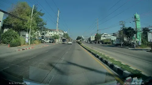
เจอนี่ journey.café.eatery.bar
Restaurant · International · 2.2 km
1533/8 ถนนลาดกระบัง, ลาดกระบัง
Mo-Su 07:00-24:00
Ardente Il Ristorante Italiano
Restaurant · Italian, Italian Pizza · 8.7 km
65/2 Sukhaphiban 2, Khwaeng Prawet, Khet Prawet, Krung Thep Maha Nakhon 10250
Mo-Su 17:00-23:30
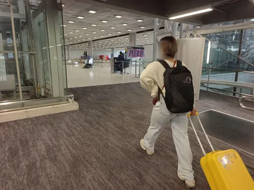
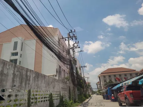
BT Steak Billion
Restaurant · Steak House · 2.2 km
Mo-Su 16:00-23:00

Coffee Company - RK Biz Center
Cafe · Coffee Shop · 5.7 km
Coffee Change The World
36/54 ถนนกรุงเทพฯ-ชลบุรี
Mo-Fr 07:30-16:00; Sa-Su 08:00-16:00

ก๋วยเตี๋ยวเรือสุวรรณ์
Restaurant · Noodle, Breakfast, Hotpot, Soup · 1.4 km
1566/11 ถนนลาดกระบัง, ก๋วยเตี๋ยวใกล้ฉัน
Mo-Su 09:00-21:00
ฮ้านข้าวซอยเจียงใหม่ Kaosoi CNX
Restaurant · Thai · 1.8 km
1544 ซอยลาดกระบัง 42/3 ถนนลาดกระบัง, กรุงเทพมหานคร
Mo-Su 11:00-23:00
Swan Cafe พัฒนาชนบท4
Cafe · Thai, Coffee · 5.8 km
6/2 ถนนพัฒนาชนบท ๔, แขวงคลองสองต้นนุ่น
Mo-Fr 09:00-16:30

เชลล์คาเฟ่ร่มเกล้า
Cafe · Coffee Shop · 4.6 km
197/1 ร่มเกล้า
Mo-Su 06:00-18:00
237 more on the map.
More about Lat Krabang
Geography
Lat Krabang (lit. 'slope of shield') is the second largest district of Bangkok (the largest being its neighbour, Nong Chok). The meaning of the name is uncertain. One hypothesis suggests that it refers to a "field of krabang". The word krabang can also mean a type of fishing device once used by local people.
Neighbouring districts are (from the south clockwise): Bang Bo, Bang Sao Thong and Bang Phli (Samut Prakan province); Prawet, Saphan Sung, Min Buri and Nong Chok (Bangkok) and Mueang Chachoengsao (Chachoengsao province).
About two-thirds of the district is farmland. Other areas include industrial parks and residential neighbourhoods. As a result, the landscape is dotted with ditches and canals. One of the main waterways is Khlong Prawet Burirom. The district is known for its strong local identity and a way of life shaped by canal culture, especially in areas that remain inaccessible by road. In some places, people still use boats and walkways along the canal banks.
From the Wikipedia article Lat Krabang district, under CC BY-SA 4.0.
Notable people from Lat Krabang
- Ryan KatbunditThai singer
Born in Lat Krabang, according to Wikidata (CC0). Each name links to its Wikipedia article.
Where to stay55
Churches and places of worship30
Watsuvarnabhumi Buddhachayanti
Place of worship · Thai Mahanikaya · 4.0 km
Shopping30
Gas and EV charging41
Schools, colleges and libraries31
Healthcare13
Map of Lat Krabang
250 places. The map loads OpenStreetMap tiles when you open it.
Getting there and nearby towns
Suvarnabhumi Airport (BKK) is the nearest airport with scheduled flights listed in OpenStreetMap, 6 km away.
- Bueng Kum 14 km northwest, about 14 min by car
- Bang Kapi 16 km west, about 16 min by car
- Nong Chok 17 km northeast, about 17 min by car
- Samut Prakan 25 km southwest, about 25 min by car
- Din Daeng 24 km west, about 24 min by car
- Bang Sue 29 km west, about 29 min by car
- Dusit 29 km west, about 29 min by car
- Bangkok 31 km west, about 31 min by car
- Mueang Nonthaburi 33 km northwest, about 33 min by car
- Thon Buri 32 km west, about 32 min by car
Drive times are estimates from straight-line distance, not routes.
Towns near Lat Krabang


Keep exploring
Local news
Headlines from INDB.
Reviews, tips and questions
Loading what members have shared...
Sources and licences
- GeoNames (CC BY 4.0): population, coordinates, regions and time zone
- Mapillary (see each image): photos
- OpenStreetMap contributors (ODbL 1.0): places, airports, map data
- Wikidata (CC0 1.0): elevation, founding date, time zone, website, landmarks and historic places
- Wikimedia Commons (see each image): photos
- Wikipedia (CC BY-SA 4.0): overview and history text
Photo credits
- สถาบันเทคโนโลยีพระจอมเกล้าเจ้าคุณทหารลาดกระบัง001, Teeradondon, CC BY-SA 3.0
- CMKL Building, CMKLUniversity, CC BY-SA 4.0
- Chirdjermsil, Kungcho, Public domain
- วัดหัวคู้ (Wat Hua Ku) - panoramio, ::::=UT=::::, CC BY-SA 3.0
- Wat Kingkeaw-6, Battery2029, CC BY-SA 3.0
- Wat Lat Krabang, Bangkok54, Wolfgang Holzem / https://ehalal.io/, CC BY-SA 4.0
- Road in Wat Lanboon - panoramio, ::::=UT=::::, CC BY-SA 3.0
- Ladkrabang54 Stadium, User: Nakhungai, CC BY 3.0
- ตราพระเกี้ยวประจำโรงเรียนเตรียมอุดมศึกษาพัฒนาการ, โรงเรียนเตรียมอุดมศึกษาพัฒนาการ, CC BY-SA 4.0
- Ladkrabang morning - panoramio, ::::=UT=::::, CC BY-SA 3.0
- Ladkrabang morning2 - panoramio, ::::=UT=::::, CC BY-SA 3.0
- รูปอะไร - panoramio, ::::=UT=::::, CC BY-SA 3.0
- สวนสาธารณะลาดกระบัง - panoramio, ::::=UT=::::, CC BY-SA 3.0
- ตลาดหัวตะเข้ - panoramio, ::::=UT=::::, CC BY-SA 3.0
- เรือท่าทางจะแรงส์ แกเอามือปิดหน้าฝากทำไม - panoramio, ::::=UT=::::, CC BY-SA 3.0
- ตลาดเช้าหัวตะเข้ - panoramio, ::::=UT=::::, CC BY-SA 3.0
- หัวตะเข้ - panoramio, ::::=UT=::::, CC BY-SA 3.0
- ลานจอดรถหลังตลาดสด - panoramio, ::::=UT=::::, CC BY-SA 3.0
- ห้องสมุดเพื่อการเรียนรู้ลาดกระบัง - panoramio, ::::=UT=::::, CC BY-SA 3.0
- คลอง-เรือ หลังร้านขายปลา - panoramio, ::::=UT=::::, CC BY-SA 3.0
- คลองหลังตลาด - panoramio, ::::=UT=::::, CC BY-SA 3.0
- คลองหลังตลาด2 - panoramio, ::::=UT=::::, CC BY-SA 3.0
- คลองหลังตลาด - panoramio (1), ::::=UT=::::, CC BY-SA 3.0
- คลองหลังตลาดหัวตะเข้ - panoramio, ::::=UT=::::, CC BY-SA 3.0
- สวนพระนคร - panoramio, ::::=UT=::::, CC BY-SA 3.0
- เห็นลิงไหม - panoramio, ::::=UT=::::, CC BY-SA 3.0
- ทางเดินในตลาดเก่า - panoramio, ::::=UT=::::, CC BY-SA 3.0
- ตรอก ซอก ซอย เรียกอะไรดี - panoramio, ::::=UT=::::, CC BY-SA 3.0
- จักรยานใครหว่า..มีท่อด้วย - panoramio, ::::=UT=::::, CC BY-SA 3.0
- บ้านริมคลอง - panoramio, ::::=UT=::::, CC BY-SA 3.0
- Railway near KMITL - panoramio, ::::=UT=::::, CC BY-SA 3.0
- Railway@KMITL - panoramio, ::::=UT=::::, CC BY-SA 3.0
- Protpittayapaya Monument, Kungcho, CC BY-SA 3.0
- Loung Protpittayapaya Sir. Leam Bunnark Park, Kungcho, CC BY-SA 3.0
- Ladkrabang morning3 - panoramio, ::::=UT=::::, CC BY-SA 3.0
- King Mongkut's Building, School of Science, KMITL, Wutkh, CC BY 4.0
- Tampak Belakang Gereja Our Lady of Lourdes Hua Takhe (2026) 01, Medelam, CC BY-SA 4.0
- Tampak Depan Gereja Our Lady of Lourdes Hua Takhe (2026) 03, Medelam, CC BY-SA 4.0
- Prasasti Peletakan Batu Pertama Gereja Our Lady of Lourdes Hua Takhe (2026), Medelam, CC BY-SA 4.0
- Tampak Belakang Gereja Our Lady of Lourdes Hua Takhe (2026) 02, Medelam, CC BY-SA 4.0
- Street-level photo, ThailandCambodia, CC BY-SA 4.0
- Street-level photo, kasetitkml_pipitchai, CC BY-SA 4.0
- Street-level photo, ratirat, CC BY-SA 4.0
- Street-level photo, mishari, CC BY-SA 4.0
- Street-level photo, kasetitkml_pipitchai, CC BY-SA 4.0
- Street-level photo, ThailandCambodia, CC BY-SA 4.0
- Street-level photo, latenightdef, CC BY-SA 4.0
- Street-level photo, ThailandCambodia, CC BY-SA 4.0
- Street-level photo, ThailandCambodia, CC BY-SA 4.0
- Street-level photo, latenightdef, CC BY-SA 4.0
- Street-level photo, latenightdef, CC BY-SA 4.0
- Street-level photo, ThailandCambodia, CC BY-SA 4.0
- Street-level photo, latenightdef, CC BY-SA 4.0
- Street-level photo, ThailandCambodia, CC BY-SA 4.0
- Street-level photo, kasetitkml_pipitchai, CC BY-SA 4.0
- Street-level photo, ratirat, CC BY-SA 4.0


Page built November 10, 2026. Spotted a mistake? Tell us or suggest a place.