


Lat Phrao, Thailand
เขตลาดพร้าว
Lat Phrao is a city of 122,182 people in Bangkok, Thailand, founded in September 4, 1989.
Why visit Lat Phrao
Townapedia lists 17 museums and landmarks, 13 parks and trails, 256 places to eat, 45 places to stay and 6 attractions in and around town.
Highlights include Bangkok Aquarium, Dan Neramit, Museum of Contemporary Art and Thai Bank Museum.
Weather in Lat Phrao
Forecast from MET Norway (CC BY 4.0). Full forecast
About Lat Phrao
Lat Phrao (Thai: ลาดพร้าว, RTGS: Lat Phrao, pronounced [lâːt pʰráːw]) is one of the 50 districts (khets) of Bangkok, Thailand. The district is bounded by six other districts (from north clockwise): Bang Khen, Bueng Kum, Bang Kapi, Wang Thonglang, and Chatuchak.
From the Wikipedia article Lat Phrao district (this version), under CC BY-SA 4.0.
Photos of Lat Phrao


Things to do6

Bangkok Aquarium
Monument and historic site · 5.5 km
Public aquarium in Bangkok, Thailand

Dan Neramit
Monument and historic site · 4.9 km
Amusement park in Thailand

Happyland
Monument and historic site · 4.5 km
Former amusement park in Bangkok, Thailand



Museums and landmarks17

Museum of Contemporary Art
Museum · 7.2 km
Contemporary Art, museum in Chatuchak, Bangkok



Children's Discovery Museum
Museum · 6.0 km
Museum in Bangkok, Thailand
Baan Kusuma
Monument and historic site · 0.6 km
31/11 ถนนนาคนิวาส
Mo, We, Fr 17:00-20:00
ณ สยาม แกลเลอรี่
Museum · 3.6 km
2452-2456 ซอยลาดพร้าว 122-124 ถนนลาดพร้าว, แขวงพลับพลา
5 more on the map.
Parks, trails and playgrounds13

Chatuchak Park
Park · 5.6 km
Public park just north of Chatuchak Weekend Market


Chak Phupha Su Maha Nathee Park
Park · 5.9 km
Park in Bangkok, Thailand

1 more on the map.
Restaurants and cafes256
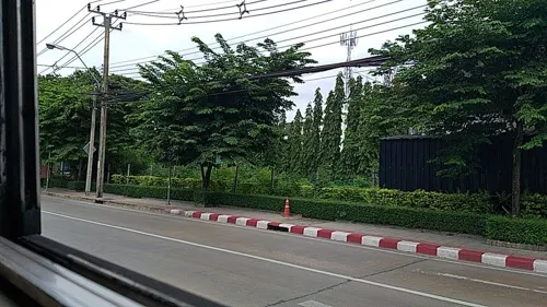
amphawa นาคนิวาส
Restaurant · Thai, Regional · 0.9 km
ร้านอาหารไทย วิถีพื้นบ้าน
45, 48 ซอยนาคนิวาส 1, แขวงลาดพร้าว
Mo-Su 10:00-22:00
Lively Machine Ratchadapisek 24
Cafe · Coffee Shop, International · 3.5 km
44-45 Ratchadapisek
Mo-Su 07:00-17:00
Mama Bingsu , Bangkok 10310, Thaïlande
Cafe · Bingsu, Coffee Shop, Ice Cream · 4.1 km
999/166 Condo Than Living Ratchada-Prachauthit Ramkhamhaeng Soi, 39, Prachauthit Road, whangthonglang, Wang Thonglang
10:00-22:30

Kyuka Izakaya
Restaurant · Japanese · 1.4 km
KYUKA Izakaya (きゅうか ) is not a regular Japanese restaurant, but space for people to gather up and share delicious eats and happiness.
Lat Phrao District
18:00-01:00
นั่งดื่ม Craft Beer & Chicken
Restaurant · Thai · 3.3 km
ร้านไก่ทอดรสเด็ดที่มีเบียร์คราฟสดๆ พร้อมให้คุณได้ลองชิม (ไก่ทอดกับเบียร์) เนื้อไก่หมักด้วยสูตรลับของร้านเรา ทอดกรอบๆ เสริฟพร้อมซอส 3...
317 ถนนเสนานิคม 1, แขวงลาดพร้าว
Mo-Sa 17:00 - 01:00

BAR BURRER " Slow bar "
Cafe · Burger, Coffee Shop, Fast Food, Drinks · 3.3 km
372 ดีพร้อมเพลส ซอยรัชดาภิเษก 36 แยก 9-3-4, แขวงจันทรเกษม
Mo-Su 09:00-21:00
BEANHOUND by Greyhound Cafe - แม็คโคร ประดิษฐ์มนูธรรม
Cafe · Coffee Shop · 1.3 km
BEANHOUND by Greyhound Cafe - แม็คโคร ประดิษฐ์มนูธรรม เลขที่ 173 ถนนประดิษฐ์มนูธรรม, กรุงเทพมหานคร
Mo-Su 07:00-21:00

Choc' Chip Homemade Bakery
Bakery · 3.5 km
Choc' Chip Homemade Bakery, an insanely good homemade bakery since 1992 จำหน่าย Homemade Bakery ทำสดใหม่ ร้านเปิดมาตั้งแต่ปี พ.ศ. 2535
35/121 ซอยรัชดาภิเษก 36 แยก 15, กรุงเทพมหานคร
Mo-Sa 08:00-19:00
EP.1 COFFEE & ROASTERY
Cafe · Coffee Shop · 4.3 km
222 ถนนคลองลำเจียก, แขวงนวลจันทร์
Mo-Sa 08:00-18:00
Gatta Café
Cafe · Coffee Shop · 0.8 km
69/3, FL.1 ถนนประดิษฐ์มนูธรรม
Mo-Fr 10:30-21:30; Sa-Su 10:00-21:30
Kuaytiew LaapMueng Krungthep Mahanakorn
Restaurant · Burger, Chicken · 3.8 km
81 ซอยวิภาวดีรังสิต 16/35 ( MRt รัชดา 19), แขวงดินแดง
Mo-Su 09:30-20:00
244 more on the map.
History
Formerly, Lat Phrao was a tambon of Bang Kapi district, in what was then Phra Nakhon province, before the unification of Thonburi and Phra Nakhon into the single administrative area of Krung Thep (Bangkok). Later it was a sub-district (tambon) of the Bang Kapi District (amphoe), after naming conventions were changed for administrative districts of Bangkok.
On 4 September 1989, Lat Phrao was split off from Bang Kapi along with Bueng Kum as new districts.
In 1997, the boundaries of Lat Phrao District were modified to balance the size and population of Bangkok's districts. The portion of Chorake Bua sub-district north of Khok Khram and Ta Reng canals was reassigned to Bang Khen district, and portions of the Lat Phrao sub-district were added to Wang Thonglang district.
On 24 January 2002, portions of Wang Thonglang District were reassigned to Lat Phrao Sub-district.
The word "Lat Phrao" literally means "slope of coconut". However, the true origin or intended meaning of the name remains uncertain. The district seal features a coconut tree sprouting two fresh leaves, suggesting that the area may once have been filled with coconut orchards.
From the History section of Lat Phrao district on Wikipedia, under CC BY-SA 4.0.
Where to stay45
1989 Hostel & Café
Motel and hotel · 4.0 km
19 65/2 Ratchada Soi 19 Road Din Daeng
Churches and places of worship13
Wat Sakhon Sun Pracha San
Place of worship · Thai Mahanikaya · 2.8 km
อาจารย์พุทธประตูน้ำ ซอยมหาดไทย
Place of worship · 4.1 km
187 95 ซอยลาดพร้าว 122 แยก 13
Shopping47
Growpets โกรว์เพ็ทช็อป สาขาลาดพร้าววังหิน
Grocery · 1.6 km
99/188 ซอยลาดพร้าววัังหิน 13
Gas and EV charging24
Schools, colleges and libraries33
Healthcare28
สถานพยาบาลแพทย์แผนจีน มหาวิทยาลัยราชภัฏจันทรเกษม
Hospital · 3.8 km
39/1 ถนนรัชดาภิเษก
Map of Lat Phrao
250 places. The map loads OpenStreetMap tiles when you open it.
Getting there and nearby towns
Don Mueang International Airport (DMK) is the nearest airport with scheduled flights listed in OpenStreetMap, 12 km away.
- Din Daeng 4 km west, about 4 min by car
- Chatuchak 6 km northwest, about 6 min by car
- Bang Kapi 6 km southeast, about 6 min by car
- Bueng Kum 7 km east, about 7 min by car
- Bang Sue 8 km west, about 8 min by car
- Dusit 10 km west, about 10 min by car
- Khlong Toei 11 km south, about 11 min by car
- Mueang Nonthaburi 12 km northwest, about 12 min by car
- Bangkok 13 km southwest, about 13 min by car
- Bangkok Noi 15 km west, about 15 min by car
Drive times are estimates from straight-line distance, not routes.
Towns near Lat Phrao


Keep exploring
Local news
Headlines from INDB.
Reviews, tips and questions
Loading what members have shared...
Sources and licences
- GeoNames (CC BY 4.0): population, coordinates, regions and time zone
- Mapillary (see each image): photos
- OpenStreetMap contributors (ODbL 1.0): places, airports, map data
- Wikidata (CC0 1.0): elevation, founding date, time zone, website, landmarks and historic places
- Wikimedia Commons (see each image): photos
- Wikipedia (CC BY-SA 4.0): overview and history text
Photo credits
- Sunflower field@Bangkok - panoramio, ::::=UT=::::, CC BY-SA 3.0
- Central Eastville, Bangkok - Lat Phrao (2025) - img 01, Chainwit., CC BY 4.0
- Central Eastville, Bangkok - Lat Phrao (2025) - img 02, Chainwit., CC BY 4.0
- Central Eastville, Bangkok - Lat Phrao (2025) - img 03, Chainwit., CC BY 4.0
- Central Eastville, Bangkok - Lat Phrao (2025) - img 04, Chainwit., CC BY 4.0
- สถานแสดงพันธุ์สัตว์น้ำกรุงเทพ, ยุทธนาสาระขันธ์, CC BY-SA 4.0
- Museum of Contemporary Art (MOCA), Bangkok, Thailand - 20161201-05, Smuconlaw, CC BY-SA 4.0
- Exterior of Thai Bank Museum (2026) 01, Medelam, CC BY-SA 4.0
- Postal scale, Lerdsuwa, CC BY-SA 3.0
- Chatuchak park, Lerdsuwa, CC BY-SA 3.0
- สวนวชิรเบญจทัศ (สวนรถไฟ) IMG 7315, PEAK99, CC BY-SA 4.0
- Kasetsart University Auditorium, David Supervid, CC BY-SA 4.0
- UTCC 2, Mx. Granger, CC0
- ฟู้ดแลนด์ สาขาจรัญสนิทวงศ์, Dharmadana, CC BY-SA 4.0
- NMR 1536, Noobythailand, CC BY-SA 4.0
- Luangpoopuk, Raphind, CC BY-SA 3.0
- เมรุวัดลาดพร้าว2562, Mythorn, CC BY-SA 4.0
- Dan Neramit castle in 2005, ong from Seattle, USA, CC BY 2.0
- วัดบึงทองหลาง, Dektonk, CC BY-SA 4.0
- ISS067-E-211595 - View of Earth, Earth Science and Remote Sensing Unit , Lyndon B. Johnson Space Center, Public domain
- ISS047-E-6207 - View of Earth, Earth Science and Remote Sensing Unit , Lyndon B. Johnson Space Center, Public domain
- ISS047-E-6208 - View of Earth, Earth Science and Remote Sensing Unit , Lyndon B. Johnson Space Center, Public domain
- ISS018-E-46358 - View of Earth, Earth Science and Remote Sensing Unit , Lyndon B. Johnson Space Center, Public domain
- ISS067-E-211594 - View of Earth, Earth Science and Remote Sensing Unit , Lyndon B. Johnson Space Center, Public domain
- ISS067-E-211593 - View of Earth, Earth Science and Remote Sensing Unit , Lyndon B. Johnson Space Center, Public domain
- ISS067-E-211596 - View of Earth, Earth Science and Remote Sensing Unit , Lyndon B. Johnson Space Center, Public domain
- ISS018-E-46359 - View of Earth, Earth Science and Remote Sensing Unit , Lyndon B. Johnson Space Center, Public domain
- Bodin3– 18072024, Noobythailand, CC0
- View Bangkok from ban Manos - panoramio - CHAMRAT CHAROENKHET (7), CHAMRAT CHAROENKHET, CC BY 3.0
- View Bangkok from ban Manos - panoramio - CHAMRAT CHAROENKHET (3), CHAMRAT CHAROENKHET, CC BY 3.0
- View Bangkok from ban Manos - panoramio, CHAMRAT CHAROENKHET, CC BY 3.0
- View Bangkok from ban Manos - panoramio - CHAMRAT CHAROENKHET (1), CHAMRAT CHAROENKHET, CC BY 3.0
- View Bangkok from ban Manos - panoramio - CHAMRAT CHAROENKHET, CHAMRAT CHAROENKHET, CC BY 3.0
- View Bangkok from ban Manos - panoramio - CHAMRAT CHAROENKHET (4), CHAMRAT CHAROENKHET, CC BY 3.0
- View Bangkok from ban Manos - panoramio - CHAMRAT CHAROENKHET (6), CHAMRAT CHAROENKHET, CC BY 3.0
- View Bangkok from ban Manos - panoramio - CHAMRAT CHAROENKHET (5), CHAMRAT CHAROENKHET, CC BY 3.0
- View Bangkok from ban Manos - panoramio - CHAMRAT CHAROENKHET (2), CHAMRAT CHAROENKHET, CC BY 3.0
- ASUS RT-AC66U 20130630, KniBaron, CC BY 2.0
- DAEWOO BH115 73 (2-46) 8-67042, Khxwklong, CC BY-SA 4.0
- (2023) วัดบึงทองหลาง เขตบางกะปิ กรุงเทพมหานคร (12), กสิณธร ราชโอรส, CC BY-SA 4.0
- Street-level photo, ozflor, CC BY-SA 4.0
- Street-level photo, kasetitkml_pipitchai, CC BY-SA 4.0
- Street-level photo, kasetitkml_pipitchai, CC BY-SA 4.0
- Street-level photo, ThailandCambodia, CC BY-SA 4.0
- Street-level photo, ozflor, CC BY-SA 4.0
- Street-level photo, mishari, CC BY-SA 4.0
- Street-level photo, kasetitkml_pipitchai, CC BY-SA 4.0
- Street-level photo, jrcarlsen, CC BY-SA 4.0
- Street-level photo, ozflor, CC BY-SA 4.0
- Street-level photo, mishari, CC BY-SA 4.0
- Street-level photo, mishari, CC BY-SA 4.0
- Street-level photo, ozflor, CC BY-SA 4.0


Page built November 10, 2026. Spotted a mistake? Tell us or suggest a place.