



Why visit Ağva
Townapedia lists 1 museum or landmark, 6 parks and trails, 19 places to eat, 14 places to stay and 2 attractions in and around town.
Highlights include Psilion.
Weather in Ağva
Forecast from MET Norway (CC BY 4.0). Full forecast
About Ağva
Ağva is a neighbourhood and resort town in the municipality and district of Şile, Istanbul Province, Turkey. Its population is 2,150 (2022).
From the Wikipedia article Ağva (this version), under CC BY-SA 4.0.
Things to do2

Museums and landmarks1

Psilion
Monument and historic site · 0.9 km
Ancient river settlement in Bithynia
Parks, trails and playgrounds6


Restaurants and cafes19

Şengül çiftliği kahvaltı et balık
Restaurant · Turkish · 0.8 km
5 Nehirboyu cad . no:5 AĞVA


7 more on the map.
History
It was an independent municipality until it was merged into the municipality of Şile in 2008.
From the History section of Ağva on Wikipedia, under CC BY-SA 4.0.
Where to stay14
Ağva Temmuz Motel
Motel and hotel · 1.4 km
260 ağva merkez mahallesi , yakuplu cad.
Ağva Kilimli Bungalow
Motel and hotel · 1.4 km
23/3 Bucaklı Caddesi, Bucaklı Mahallesi
Churches and places of worship4
Shopping9
Gas and EV charging1
Schools, colleges and libraries3
Healthcare3
Şile Devlet Hastanesi Ağva Semt Polikliniği
Clinic and pharmacy
4 Deniz Cd., İstanbul
Map of Ağva
62 places. The map loads OpenStreetMap tiles when you open it.
Getting there and nearby towns
Cengiz Topel Havaalanı (KCO) is the nearest airport with scheduled flights listed in OpenStreetMap, 49 km away.
- Kandıra 26 km east, about 26 min by car
- Kaynarca 40 km east, about 40 min by car
- İzmit 42 km south, about 42 min by car
- Körfez 42 km south, about 42 min by car
- Derince 43 km south, about 43 min by car
- Gölcük 47 km south, about 47 min by car
- Diliskelesi 49 km southwest, about 49 min by car
- Gebze 52 km southwest, about 52 min by car
- Karamürsel 54 km south, about 54 min by car
- Sancaktepe 55 km west, about 55 min by car
Drive times are estimates from straight-line distance, not routes.
Local news
Headlines from INDB.
Reviews, tips and questions
Loading what members have shared...
Sources and licences
- GeoNames (CC BY 4.0): population, coordinates, regions and time zone
- OpenStreetMap contributors (ODbL 1.0): places, airports, map data
- Wikidata (CC0 1.0): elevation, founding date, time zone, website, landmarks and historic places
- Wikimedia Commons (see each image): photos
- Wikipedia (CC BY-SA 4.0): overview and history text
Photo credits
- Ağva Yeşilçay İstanbul Province, Nedim Ardoğa, CC BY-SA 3.0
- The Seagulls - panoramio, Tevfik Teker, CC BY 3.0
- On Agva Coast - panoramio, Tevfik Teker, CC BY 3.0
- Istanbul sile agva - panoramio, Azem sönmez, CC BY-SA 3.0
- The Lighthouse - panoramio, Tevfik Teker, CC BY 3.0
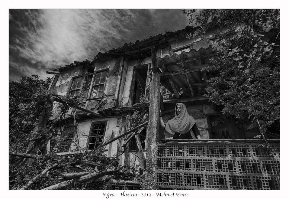
- Woman In Village, Mehmet Emre, CC BY 3.0
- The Old Bag, Orchun A, CC BY-SA 3.0
- Kilimli Koyu, Emregulerx, CC BY-SA 4.0
- Wineport Lodge Agva - Silence - panoramio, Wineport Lodge Agva, CC BY 3.0
- Wineport Lodge Agva - panoramio (10), Wineport Lodge Agva, CC BY 3.0
- Wineport Lodge Agva - panoramio (22), Wineport Lodge Agva, CC BY 3.0
- Wineport Lodge Agva - panoramio (12), Wineport Lodge Agva, CC BY 3.0
- Wineport Lodge Agva - panoramio (21), Wineport Lodge Agva, CC BY 3.0
- Agva Wineport Otel - panoramio, Wineport Lodge Agva, CC BY 3.0
- Wineport Lodge Agva - panoramio (4), Wineport Lodge Agva, CC BY 3.0
- Wineport Lodge Agva - panoramio (9), Wineport Lodge Agva, CC BY 3.0
- Wineport Lodge Agva - panoramio (11), Wineport Lodge Agva, CC BY 3.0
- Wineport Lodge Agva - panoramio (7), Wineport Lodge Agva, CC BY 3.0
- Wineport Lodge Agva - panoramio (5), Wineport Lodge Agva, CC BY 3.0
- Wineport Lodge Agva - panoramio (3), Wineport Lodge Agva, CC BY 3.0
- Wineport Lodge Agva - panoramio (19), Wineport Lodge Agva, CC BY 3.0
- Agva Wineport Otel - panoramio (1), Wineport Lodge Agva, CC BY 3.0
- Wineport Lodge Agva - panoramio, Wineport Lodge Agva, CC BY 3.0
- Wineport Lodge Agva - panoramio (17), Wineport Lodge Agva, CC BY 3.0
- Wineport Lodge Agva - panoramio (18), Wineport Lodge Agva, CC BY 3.0
- Wineport Lodge Agva - panoramio (1), Wineport Lodge Agva, CC BY 3.0
- Wineport Lodge Agva - panoramio (23), Wineport Lodge Agva, CC BY 3.0
- Wineport Lodge Agva - panoramio (8), Wineport Lodge Agva, CC BY 3.0
- Wineport Lodge Agva - panoramio (24), Wineport Lodge Agva, CC BY 3.0
- Wineport Lodge Agva - panoramio (6), Wineport Lodge Agva, CC BY 3.0
- Wineport Lodge Agva - panoramio (20), Wineport Lodge Agva, CC BY 3.0
- Wineport Lodge Agva - panoramio (2), Wineport Lodge Agva, CC BY 3.0
- Wineport Lodge Agva - panoramio (16), Wineport Lodge Agva, CC BY 3.0
- Wineport Lodge Agva - panoramio (14), Wineport Lodge Agva, CC BY 3.0
- Wineport Lodge Agva - panoramio (13), Wineport Lodge Agva, CC BY 3.0
- Wineport Lodge Agva - panoramio (15), Wineport Lodge Agva, CC BY 3.0
- Wineport Lodge Agv - panoramio, Wineport Lodge Agva, CC BY 3.0
- Agva wineport otel - panoramio (3), Wineport Lodge Agva, CC BY 3.0


Page built November 8, 2026. Spotted a mistake? Tell us or suggest a place.