


Why visit Eceabat
Townapedia lists 12 museums and landmarks, 2 parks and trails, 11 places to eat and 7 places to stay in and around town.
Highlights include Abydos, Çanakkale Naval Museum and Gallipoli Peninsula Historic Site.
Weather in Eceabat
Forecast from MET Norway (CC BY 4.0). Full forecast
About Eceabat
Eceabat (Turkish: [eˈdʒeːabat]), formerly Maydos (Greek: Μάδυτος, romanized: Mádytos; now usually Ετζέαμπατ, Etzéampat), is a small town in Çanakkale Province in the Marmara region of Turkey, located on the eastern shore of the Gallipoli Peninsula, facing the Dardanelles Strait. It is the seat of Eceabat District. Its population is 5,636 (2021). The town lies at sea level.
From the Wikipedia article Eceabat (this version), under CC BY-SA 4.0.
Travel tips from other travellers: Eceabat on Wikivoyage (CC BY-SA 4.0).
Museums and landmarks12

Abydos
Monument and historic site · 4.2 km
Ancient city of Mysia in modern-day Turkey

Koila
Monument and historic site · 2.7 km
Roman-period port of the Thracian Chersonnese
Madytos
Monument and historic site
Ancient city of Thrace in modern-day Turkey

Parks, trails and playgrounds2

Gallipoli Peninsula Historic Site
Park · 1.8 km
Historic site in Turkey

Restaurants and cafes11




Where to stay7



Churches and places of worship2
Shopping5
Gas and EV charging1
Schools, colleges and libraries1
Healthcare5
Map of Eceabat
46 places. The map loads OpenStreetMap tiles when you open it.
Getting there and nearby towns
Çanakkale Airport (CKZ) is the nearest airport with scheduled flights listed in OpenStreetMap, 8 km away.
- Çanakkale 6 km southeast, about 6 min by car
- Lapseki 33 km northeast, about 33 min by car
- Gelibolu 36 km northeast, about 36 min by car
- Gökçeada 38 km west, about 38 min by car
- Ezine 44 km south, about 44 min by car
- Bozcaada 46 km southwest, about 46 min by car
- Altınoluk 75 km southeast, about 1 h 15 min by car
- Biga 75 km east, about 1 h 15 min by car
- Keşan 78 km north, about 1 h 15 min by car
- Edremit 87 km southeast, about 1 h 30 min by car
Drive times are estimates from straight-line distance, not routes.
Local news
Headlines from INDB.
Reviews, tips and questions
Loading what members have shared...
Sources and licences
- GeoNames (CC BY 4.0): population, coordinates, regions and time zone
- Mapillary (see each image): photos
- OpenStreetMap contributors (ODbL 1.0): places, airports, map data
- Wikidata (CC0 1.0): elevation, founding date, time zone, website, landmarks and historic places
- Wikimedia Commons (see each image): photos
- Wikipedia (CC BY-SA 4.0): overview and history text
Photo credits
- Eceabat Kilitbahir Fortress, Julian Nyča, CC BY-SA 4.0
- Eceabat - panoramio (3), Gürsoy Tokgöz, CC BY 3.0
- Eceabat - panoramio, Gürsoy Tokgöz, CC BY 3.0
- Eceabat - panoramio (1), Gürsoy Tokgöz, CC BY 3.0
- Eceabat - panoramio (4), Gürsoy Tokgöz, CC BY 3.0
- Eceabat - panoramio (6), Gürsoy Tokgöz, CC BY 3.0
- Eceabat - panoramio (5), Gürsoy Tokgöz, CC BY 3.0
- Eceabat - panoramio (2), Gürsoy Tokgöz, CC BY 3.0
- Istanbul to Izmir FTT banner Eceabat ferry, Tutku Çetinel, CC BY 3.0
- Eceabat, 17900 Eceabat-Çanakkale, Turkey - panoramio, Tutku Çetinel, CC BY 3.0
- Eceabat Memorial, Julian Nyča, CC BY-SA 4.0
- Eceabat... - panoramio, Sinan Şahin, CC BY 3.0
- Eceabat - panoramio (7), Gürsoy Tokgöz, CC BY 3.0
- Eceabat banner Ferry jetty, Julian Nyča, CC BY-SA 4.0
- Eceabat Seaside 2, Julian Nyča, CC BY-SA 4.0
- Eceabat Seaside 1, Julian Nyča, CC BY-SA 4.0
- Eceabat from the Dardanelles ferry (May 2026), Ben1152000, CC BY-SA 4.0
- Eceabat turkey - panoramio, bynyalcin, CC BY 3.0
- Çanakkale Deniz Müzesi 2026-09-13 13.21.49 1789588778, Emirhan Sağdır, CC BY-SA 4.0
- Azmak Cemetery, Gallipoli Peninsula, en:User:Jll, CC BY-SA 3.0
- Turkije2014 1 009 (15692226381), rob Stoeltje from loenen, netherlands, CC BY 2.0
- Turkije2014 1 007 (15670421256), rob Stoeltje from loenen, netherlands, CC BY 2.0
- Ecebaat ta gün doğumu - panoramio, by rock, CC BY 3.0
- Suvla 1180804, Nevit Dilmen ( talk ), CC BY-SA 3.0
- Suvla 1180802, Nevit Dilmen ( talk ), CC BY-SA 3.0
- Suvla 1180791, Nevit Dilmen ( talk ), CC BY-SA 3.0
- Suvla 1180801, Nevit Dilmen ( talk ), CC BY-SA 3.0
- Suvla 1180792, Nevit Dilmen ( talk ), CC BY-SA 3.0
- Suvla 1180795, Nevit Dilmen ( talk ), CC BY-SA 3.0
- Suvla 1180807, Nevit Dilmen ( talk ), CC BY-SA 3.0
- Suvla 1180790a, Nevit Dilmen ( talk ), CC BY-SA 3.0
- Suvla 1180889, Nevit Dilmen ( talk ), CC BY-SA 3.0
- Suvla 1180820, Nevit Dilmen ( talk ), CC BY-SA 3.0
- Suvla 1180847, Nevit Dilmen ( talk ), CC BY-SA 3.0
- Suvla 1180881, Nevit Dilmen ( talk ), CC BY-SA 3.0
- Suvla 1180903, Nevit Dilmen ( talk ), CC BY-SA 3.0
- Suvla 1180899, Nevit Dilmen ( talk ), CC BY-SA 3.0
- Suvla 1180902, Nevit Dilmen ( talk ), CC BY-SA 3.0
- Suvla 1180875, Nevit Dilmen ( talk ), CC BY-SA 3.0
- Suvla 1180906, Nevit Dilmen ( talk ), CC BY-SA 3.0
- Suvla 1180790, Nevit Dilmen ( talk ), CC BY-SA 3.0
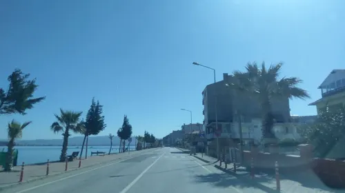
- Street-level photo, ozkanilyasaksu, CC BY-SA 4.0
- Street-level photo, ozkanilyasaksu, CC BY-SA 4.0
- Street-level photo, ozkanilyasaksu, CC BY-SA 4.0
- Street-level photo, ozkanilyasaksu, CC BY-SA 4.0
- Street-level photo, ozkanilyasaksu, CC BY-SA 4.0
- Street-level photo, ozkanilyasaksu, CC BY-SA 4.0
- Street-level photo, ozkanilyasaksu, CC BY-SA 4.0
- Street-level photo, ozkanilyasaksu, CC BY-SA 4.0
- Street-level photo, ozkanilyasaksu, CC BY-SA 4.0


Page built November 8, 2026. Spotted a mistake? Tell us or suggest a place.