


Why visit Perşembe
Townapedia lists 10 museums and landmarks, 9 parks and trails, 33 places to eat, 16 places to stay and 41 attractions in and around town.
Highlights include Boztepe, Çamburnu Feneri, Boon and Genetes.
Weather in Perşembe
Forecast from MET Norway (CC BY 4.0). Full forecast
About Perşembe
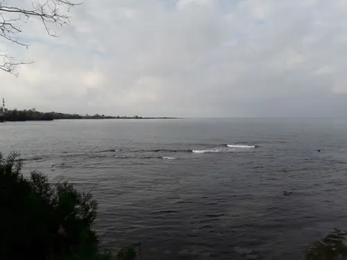
Perşembe (originated from Persian word پنجشنبه [pændʒʃænˈbe] meaning "Thursday"), also Heneti (Laz and Georgian: ჰენეთი) and formerly Vona (Ancient Greek: Βόνη, romanized: Bónē), is a municipality and district of Ordu Province, Turkey. Its area is 217 km2, and its population is 30,101 (2022). The town lies on the Black Sea coast at an elevation of 20 m (66 ft).
From the Wikipedia article Perşembe (this version), under CC BY-SA 4.0.
Things to do41



29 more on the map.
Museums and landmarks10

Boon
Monument and historic site · 1.0 km
Ancient city of Pontus in modern-day Turkey
Genetes
Monument and historic site · 7.3 km
Ancient river port on the Black Sea

Jasonia (Pontus)
Monument and historic site · 10.8 km
Ancient city of Pontus in modern-day Turkey

Parks, trails and playgrounds9



Restaurants and cafes33






Ordu Boztepe Vali Kemal Yazıcıoğlu Turistik Tesisleri
Restaurant · Turkish, Regional · 11.0 km
21 more on the map.
Where to stay16
Churches and places of worship20
Shopping6
Gas and EV charging5
Schools, colleges and libraries7
Healthcare9
Map of Perşembe
156 places. The map loads OpenStreetMap tiles when you open it.
Getting there and nearby towns
Ordu Giresun Havalimanı (OGU) is the nearest airport with scheduled flights listed in OpenStreetMap, 29 km away.
- Ordu 14 km southeast, about 14 min by car
- Turnasuyu 21 km southeast, about 21 min by car
- Fatsa 23 km west, about 23 min by car
- Ulubey 22 km south, about 22 min by car
- Ayazlı 25 km west, about 25 min by car
- Kabadüz 25 km southeast, about 25 min by car
- Ünye 41 km west, about 41 min by car
- Giresun 54 km east, about 54 min by car
- Terme 69 km west, about 1 h 15 min by car
- Tirebolu 88 km east, about 1 h 30 min by car
Drive times are estimates from straight-line distance, not routes.
Local news
Headlines from INDB.
Reviews, tips and questions
Loading what members have shared...
Sources and licences
- GeoNames (CC BY 4.0): population, coordinates, regions and time zone
- Mapillary (see each image): photos
- OpenStreetMap contributors (ODbL 1.0): places, airports, map data
- Wikidata (CC0 1.0): elevation, founding date, time zone, website, landmarks and historic places
- Wikimedia Commons (see each image): photos
- Wikipedia (CC BY-SA 4.0): overview and history text
Photo credits
- 52750 Ramazan-Perşembe-Ordu, Turkey - panoramio, Yılmaz Kilim, CC BY 3.0
- Ordu Boztepe Ropeway, „Batumi“ cabin, Giorgi Balakhadze, CC BY-SA 3.0
- Taşbaşı Kilise'sinin genel görünümü, Demir dude, CC BY-SA 4.0
- Pont localisation, TRBZ1461, Public domain
- 2009.05.23 - Iason Church - by Kerem Koç, Nisankoc, CC BY 3.0
- Taşbaşı Church, Panegyrics of Granovetter, CC BY-SA 2.0
- CAKA -BALIKÇILAR -KARADENİZ - panoramio, HALUK COMERTEL, CC BY 3.0
- Efirli Plajı, Agiral, CC BY-SA 3.0
- Hoynat adası ordu, Denizgör, CC BY-SA 4.0
- ISS047-E-118713 - View of Earth, Earth Science and Remote Sensing Unit , Lyndon B. Johnson Space Center, Public domain
- ISS047-E-118714 - View of Earth, Earth Science and Remote Sensing Unit , Lyndon B. Johnson Space Center, Public domain
- ISS047-E-118715 - View of Earth, Earth Science and Remote Sensing Unit , Lyndon B. Johnson Space Center, Public domain
- ISS030-E-5753 - View of Earth, Earth Science and Remote Sensing Unit , Lyndon B. Johnson Space Center, Public domain
- ISS047-E-118717 - View of Earth, Earth Science and Remote Sensing Unit , Lyndon B. Johnson Space Center, Public domain
- ISS047-E-118718 - View of Earth, Earth Science and Remote Sensing Unit , Lyndon B. Johnson Space Center, Public domain
- ISS061-E-140758 - View of Earth, Earth Science and Remote Sensing Unit, NASA Johnson Space Center, Public domain
- ISS061-E-140757 - View of Earth, Earth Science and Remote Sensing Unit, NASA Johnson Space Center, Public domain
- ISS047-E-118716 - View of Earth, Earth Science and Remote Sensing Unit , Lyndon B. Johnson Space Center, Public domain
- ISS034-E-62714 - View of Earth, Earth Science and Remote Sensing Unit , Lyndon B. Johnson Space Center, Public domain
- Yason burnu ordu 2, Denizgör, CC BY-SA 4.0
- Street-level photo, orducbs, CC BY-SA 4.0
- Street-level photo, orducbs, CC BY-SA 4.0


Page built November 8, 2026. Spotted a mistake? Tell us or suggest a place.