


Why visit Tavşancıl
Townapedia lists 2 museums and landmarks, 2 parks and trails, 1 place to eat, 1 place to stay and 1 attraction in and around town.
Highlights include Osmangazi Bridge, Charax and Libyssa.
Weather in Tavşancıl
Forecast from MET Norway (CC BY 4.0). Full forecast
About Tavşancıl
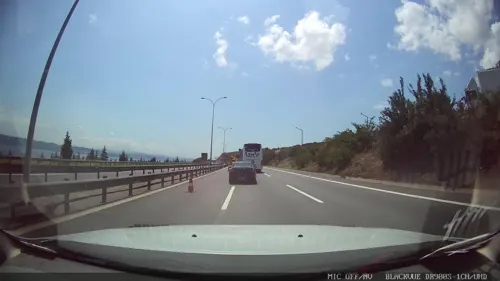
Tavşancıl is a neighborhood in Dilovası District, Kocaeli Province, Turkey. It is located on the north shore of the Gulf of İzmit, a few kilometers east of the Osman Gazi Bridge. Its population is 2,501 (2025).
From the Wikipedia article Tavşancıl (this version), under CC BY-SA 4.0.
Things to do1

Osmangazi Bridge
Bridge · 5.1 km
Suspension bridge between Yalova and Kocaeli
Museums and landmarks2

Charax
Monument and historic site · 4.1 km
Roman and Byzantine town in Bithynia

Libyssa
Monument and historic site · 2.7 km
Ancient city of Bithynia in modern-day Turkey
Parks, trails and playgrounds2


Restaurants and cafes1


History
The Tavşancıl region was conquered by the Ottomans in the early 1300s. A village called Gemiciler (“shipbuilders”) was established in the area for shipbuilding. The region was returned to the Byzantines by Süleyman Çelebi in 1403, but was then reconquered by Mehmet II in the mid-1400s. The village of Tavşancıl, also known as Kırkık, was established to support Selim I’s mosque and imaret in Istanbul.
A Tavşancıl Village Mosque existed in the 18th century (but was probably not the same as either of the two current mosques in Tavşancıl).
In 1841, the village included 141 households, with a male population of 393. The village had one imam at that time. One villager owned a black slave named Abedan.
From the History section of Tavşancıl on Wikipedia, under CC BY-SA 4.0.
Where to stay1
Churches and places of worship1
Schools, colleges and libraries4
Healthcare1
Map of Tavşancıl
13 places. The map loads OpenStreetMap tiles when you open it.
Getting there and nearby towns
Sabiha Gökçen International Airport (SAW) is the nearest airport with scheduled flights listed in OpenStreetMap, 25 km away.
- Diliskelesi 4 km west, about 4 min by car
- Karamürsel 10 km southeast, about 10 min by car
- Gebze 12 km west, about 12 min by car
- Körfez 18 km east, about 18 min by car
- Derince 21 km east, about 21 min by car
- Gölcük 22 km east, about 22 min by car
- Yalova 28 km southwest, about 28 min by car
- İzmit 30 km east, about 30 min by car
- Sancaktepe 38 km northwest, about 38 min by car
- Ümraniye 46 km northwest, about 46 min by car
Drive times are estimates from straight-line distance, not routes.
Local news
Headlines from INDB.
Reviews, tips and questions
Loading what members have shared...
Sources and licences
- GeoNames (CC BY 4.0): population, coordinates, regions and time zone
- Mapillary (see each image): photos
- OpenStreetMap contributors (ODbL 1.0): places, airports, map data
- Wikidata (CC0 1.0): elevation, founding date, time zone, website, landmarks and historic places
- Wikimedia Commons (see each image): photos
- Wikipedia (CC BY-SA 4.0): overview and history text
Photo credits
- Osman Gazi Bridge1, Glabb, CC BY-SA 3.0
- Hanibal's Tomb (7471635270), William Neuheisel from DC, US, CC BY 2.0
- Körfezde Kasvet... - panoramio, hüsamettin_alpaslan, CC BY 3.0
- Yahya Kaptan Anıtı ve Mezarı, Thehun2001, CC0
- BATIDAN YUKARI HEREKEYE BAKIŞ *©Abdullah Kiyga - panoramio, Abdullah kıyga, CC BY 3.0
- Street-level photo, lutfullah, CC BY-SA 4.0
- Street-level photo, asturksever, CC BY-SA 4.0
Page built November 8, 2026. Spotted a mistake? Tell us or suggest a place.