


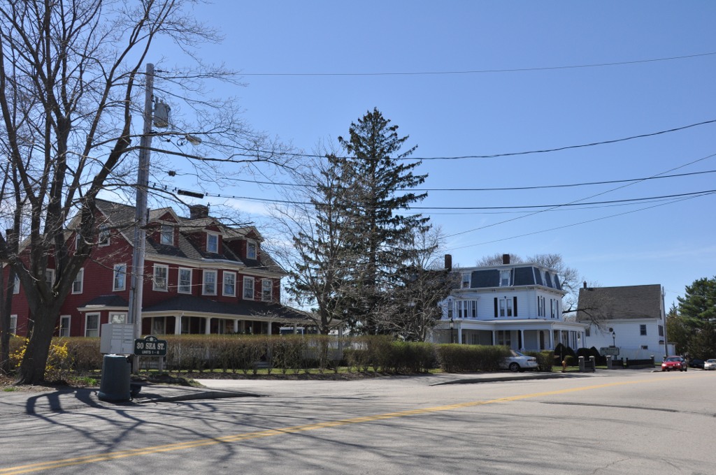
Weymouth Town, Massachusetts
Weymouth Town is a city of 58,505 people in Norfolk County, Massachusetts, founded in 1623.
Why visit Weymouth Town
Townapedia lists 136 museums and landmarks, 170 parks and trails, 114 places to eat, 1 place to stay and 17 attractions in and around town.
Highlights include Cameo, Curtain Call Theater, Tomb and Veteran Memorial Plaque.
July is the warmest month, with average highs of 83°F; January lows average 22°F, and about 51 inches of snow fall in a normal year.
Weather in Weymouth Town
Forecast from the National Weather Service. Full forecast
About Weymouth Town
Weymouth is a city in Norfolk County, Massachusetts, United States. It is one of 13 municipalities in the state to have city forms of government while retaining "town of" in their official names. It is named after Weymouth, Dorset, a coastal town in England, and is the second-oldest settlement in Massachusetts, second only to Plymouth. Weymouth is one of the more affordable towns relative to the South Shore and offers a short commute into Boston, MBTA bus and rail service, and a town beach.
From the Wikipedia article Weymouth, Massachusetts (this version), under CC BY-SA 4.0.
Things to do17


5 more on the map.
Museums and landmarks136


Thayer Public Library
Monument and historic site · National Register of Historic Places · 3.0 mi
Library
798 Washington Street, Braintree
Washington School
Monument and historic site · National Register of Historic Places · 1.3 mi
Listed on the NRHP in Norfolk County
8 School Street
Adams National Historical Park
Monument and historic site · National Register of Historic Places · 4.8 mi
Park commemerating the Adams political family
Alfred H. Richards House
Monument and historic site · National Register of Historic Places · 5.4 mi
House in Quincy, Massachusetts

All Souls Church
Monument and historic site · National Register of Historic Places · 3.0 mi
Church in Braintree, Massachusetts, United States
Baxter Street Historic District
Monument and historic site · National Register of Historic Places · 3.9 mi
Historic district in Massachusetts, United States
Baxter–King House
Monument and historic site · National Register of Historic Places · 4.8 mi
Historic house in Massachusetts, United States


Bethany Congregational Church
Monument and historic site · National Register of Historic Places · 4.2 mi
Church building in Massachusetts, United States of America
Brown-Hodgkinson House
Monument and historic site · National Register of Historic Places · 3.3 mi
Historic house in Massachusetts, United States
124 more on the map.
Parks, trails and playgrounds170

Bare Cove Park
Park · 2.5 mi
Park in Hingham, United States of America
Fort Hill Street, Hingham
Mo-Su 08:00-18:00



158 more on the map.
Restaurants and cafes114

El Sarape
Restaurant · Mexican · 1.5 mi
5 Commercial Street
Mo-Tu 15:00-22:00; We-Th 11:30-22:00; Fr 11:30-23:00; Sa...
Jake n JOES Sports Grille
Restaurant · Bar And Grill · 2.8 mi
551 John Mahar Highway
Su-We 11:30-24:00; Th-Sa 11:30-01:00
Olympic Pizza & Grill
Restaurant · Pizza, Salad, Wings, Sandwich · 2.3 mi
15 Union Street, Weymouth
Mo-Su 10:00-22:00
The Chateau
Restaurant · Italian · 2.9 mi
535 John Mahar Highway
Mo-Tu 11:30-21:00; We 11:30-21:30; Th-Sa 11:30-22:00; Su 11:30-20:30


Ma Reilly's Cafe
Cafe · Sandwich, Coffee Shop, Coffee, Breakfast, Eggs, Irish, New England, Bagel, Lunch, Fajita, Turkey, Beef, Deli, Greek, Antipasto, Espresso, Iced Coffee, Irish Tea, Tea, Lemonade, Salad · 2.7 mi
Vintage Building serving local style drinks and foods.
76;78;80;82;86;90 Pond Street
Banh Mi Hem
Restaurant · Vietnamese · 3.0 mi
904 Washington Street, Braintree
Mo-Su 11:00-21:00
102 more on the map.
Where to stay1
Churches and places of worship42
Faith Lutheran Church
Church · National Register of Historic Places · 4.1 mi
First Baptist Church of Wollaston
Church · National Register of Historic Places · 5.3 mi
Shopping33
Gas and EV charging26
Schools, colleges and libraries77
Healthcare14
Map of Weymouth Town
250 places. The map loads OpenStreetMap tiles when you open it.
Climate by month
Monthly table
| Month | High | Low | Rain | Snow |
|---|---|---|---|---|
| Jan | 38°F | 22°F | 4.5 in | 14.8 in |
| Feb | 40°F | 23°F | 4.0 in | 14.5 in |
| Mar | 47°F | 29°F | 5.4 in | 10.3 in |
| Apr | 58°F | 38°F | 4.6 in | 1.7 in |
| May | 68°F | 48°F | 3.8 in | 0.0 in |
| Jun | 77°F | 57°F | 4.0 in | 0.0 in |
| Jul | 83°F | 63°F | 3.6 in | 0.0 in |
| Aug | 82°F | 62°F | 3.8 in | 0.0 in |
| Sep | 74°F | 55°F | 3.9 in | 0.0 in |
| Oct | 63°F | 44°F | 5.2 in | 0.1 in |
| Nov | 52°F | 35°F | 4.4 in | 0.7 in |
| Dec | 43°F | 27°F | 5.1 in | 8.8 in |
U.S. Climate Normals 1991-2020 for Hingham (2 mi away), NOAA NCEI.
People and cost of living
American Community Survey 5-year estimates, 2020-2024, U.S. Census Bureau. Estimates have margins of error, larger for small towns.
Disaster history
Norfolk County has had 25 federal disaster declarations since 2000, most often for snowstorms.
- 2023-09-15: Hurricane Lee (Hurricane)
- 2022-04-18: Severe Winter Storm And Snowstorm (Snowstorm)
- 2020-03-27: Covid-19 Pandemic (Biological)
- 2020-03-13: Covid-19 (Biological)
- 2018-07-19: Severe Winter Storm And Snowstorm (Snowstorm)
- 2018-06-25: Severe Winter Storm And Flooding (Severe Storm)
OpenFEMA disaster declarations summaries.
Getting there and nearby towns
Logan International Airport (BOS) is the nearest airport with scheduled flights listed in OpenStreetMap, 11 miles away.
- Braintree Town 3 mi west, about 5 min by car
- Quincy 5 mi northwest, about 8 min by car
- Holbrook 5 mi southwest, about 9 min by car
- Randolph Town 6 mi west, about 9 min by car
- Abington 6 mi south, about 10 min by car
- Milton 7 mi west, about 12 min by car
- Boston 9 mi north, about 15 min by car
- Brockton 9 mi southwest, about 15 min by car
- Hull 10 mi north, about 16 min by car
- Brookline 13 mi northwest, about 21 min by car
Drive times are estimates from straight-line distance, not routes.
Local news
Headlines from INDB, the NEMICO news database.
Reviews, tips and questions
Loading what members have shared...
Sources and licences
- NCES EDGE (Public domain): public schools
- NOAA NCEI U.S. Climate Normals 1991-2020 (Public domain): climate by month
- OpenFEMA (Public domain): disaster declarations
- OpenStreetMap contributors (ODbL 1.0): places, airports, map data
- U.S. Census Bureau (Public domain): population, income, housing, education, commute
- Wikidata (CC0 1.0): elevation, founding date, time zone, website, landmarks and historic places
- Wikimedia Commons (see each image): photos
- Wikipedia (CC BY-SA 4.0): overview and history text
Photo credits
- Town Hall Weymouth, Marcbela (Marc N. Belanger), CC0
- Braintree Old Library, Marcbela (Marc N. Belanger), Public domain
- WeymouthMA WashingtonSchool, User:Magicpiano, CC BY-SA 4.0
- WeymouthMA JeffersonSchool, User:Magicpiano, CC BY-SA 4.0
- Edward Miller House, Sswonk, CC BY-SA 3.0
- WeymouthMA SeaStreet, User:Magicpiano, CC BY-SA 4.0
- Christ Church Quincy MA, Sswonk, CC BY-SA 3.0
- Thomas Curtis House, Sswonk, CC BY-SA 3.0
- Frank Burgess House Quincy MA, Jameslwoodward, CC BY-SA 3.0
- Across the street from the JQA Birthplace, National Park Service, Public domain
- Seth Spear Homestead Quincy MA 01, Jameslwoodward, CC BY-SA 3.0
- RocklandMA RocklandTrustBuilding, User:Magicpiano, CC BY-SA 4.0
- OldShipChurchExterior, Timothy Valentine, CC BY-SA 2.0
- Noah Curtis House, Sswonk, CC BY-SA 3.0
- Quincy Water Company Pumping Station Site, Jameslwoodward, CC BY-SA 3.0
- C. F. Pettengill House, Sswonk, CC BY-SA 3.0
- Bethany Congregational Church Quincy MA 01, Jameslwoodward, CC BY-SA 4.0
- WeymouthMA FirstChurch, User:Magicpiano, CC BY-SA 4.0
- S. H. Barnicoat Monuments Site Quincy MA, Jameslwoodward, CC BY-SA 3.0
- 210 East Street, Hingham MA, John Phelan, CC BY-SA 3.0
- Nightengale House, Sswonk, CC BY-SA 3.0
- Edward J Lennon House Quincy MA, Jameslwoodward, CC BY-SA 3.0
- Second Parish Church, South Hingham MA, John Phelan, CC BY 3.0
- Dr Frank Davis House, Sswonk, CC BY-SA 3.0
- Christ Church Burial Ground Quincy MA, Sswonk, CC BY-SA 3.0
- QuincyMA RailwayIncline 1, Magicpiano, CC BY-SA 3.0
- First Baptist Church of Wollaston Quincy MA 01, Jameslwoodward, CC BY-SA 3.0
- Salem Lutheran Church Quincy MA, Sswonk, CC BY-SA 3.0
- Quincy Point Fire Station, Sswonk, Public domain
- Solon Dogget House, Sswonk, CC BY-SA 3.0
- Edwin W. Marsh House, Sswonk, CC BY-SA 3.0
- North Abington Depot, Marcbela (Marc N. Belanger), Public domain
- All Souls Church, Braintree MA, John Phelan, CC BY-SA 3.0
- WeymouthMA ClappMemorialBuilding, User:Magicpiano, CC BY-SA 4.0
- Holbrook Town Hall, MA, John Phelan, CC BY 3.0
- HinghamMA ThomasChubbuckJrHouse, User:Magicpiano, CC BY-SA 4.0
- Roberts School, Holbrook MA, John Phelan, CC BY 3.0
- Quincy MA Central Fire Station, Sswonk, CC BY-SA 3.0
- House at 23-25 Prout Street, Sswonk, CC BY-SA 3.0
- Question Solomon Nightengale House Quincy MA, Jameslwoodward, CC BY-SA 3.0


Page built October 30, 2026. Spotted a mistake? Tell us or suggest a place.