


Why visit Großostheim
Townapedia lists 83 museums and landmarks, 26 parks and trails, 115 places to eat, 9 places to stay and 26 attractions in and around town.
Highlights include Hofladen Bioland Kapraun, Weilerhof Hofladen, Schloß Schönbusch and Wartturm.
Weather in Großostheim
Forecast from MET Norway (CC BY 4.0). Full forecast
About Großostheim
Großostheim (or Grossostheim) is a market municipality in the Aschaffenburg district in the Regierungsbezirk of Lower Franconia (Unterfranken) in Bavaria, Germany. The inhabitants call themselves Aistmer (ostheimers).
From the Wikipedia article Großostheim (this version), under CC BY-SA 4.0.
Things to do26

Hofladen Bioland Kapraun
Farm and orchard · 2.6 km
Hofladen mit Spargel und Erdbeeren
closed "nur zur Spargel- und Erdbeersaison geöffnet"
Weilerhof Hofladen
Farm and orchard · 1.0 km
9 Uhlandstraße, Großostheim
Mo-Fr 08:00-19:00; Sa 08:00-16:00; Su,PH off

Bauer Becker
Farm and orchard · 3.0 km
Hofladen Spargel, Erdbeeren, Gurken
Mo,We 14:00-18:00;Fr 09:00-12:00,14:00-18:00;Sa 09:00-13:00; Su...

14 more on the map.
Museums and landmarks83


Altes Rathaus Wenigumstadt
Monument and historic site · 3.9 km
16 Hauptstraße, Großostheim

ehem. Bunker 224
Monument and historic site · 4.8 km
Bunker 224 der Befestigungslinie - "Wetterau-Main-Tauber-Stellung"


museum Pompejanum
Museum · 7.7 km
Cultural heritage monument D-6-61-000-232 (0) in Aschaffenburg, Bavaria

Naturwissenschaftlichen Museum Aschaffenburg
Museum · 7.9 km
Museum in Bavaria, Germany

Schloss Johannisburg
Museum · 7.8 km
Palace in Aschaffenburg, Germany

Staatsgalerie Aschaffenburg
Museum · 7.8 km
Art museum in Schloss Johannisburg in Aschaffenburg

Altes Rathaus
Monument and historic site · 1.7 km
Pflaumheimer Rathaus aus dem Jahr 1548
71 more on the map.
Parks, trails and playgrounds26





14 more on the map.
Restaurants and cafes115

Kulinarischer Schönbusch
Restaurant · 5.3 km
1 Kleine Schönbuschallee, Aschaffenburg
Mo-Su 09:00-22:00

Biblioteek
Cafe · 5.5 km
Christlicher Buchladen und Begegnungsstätte e.V.
19 Langstädter Straße, Schaafheim
Mo,Tu,Th 08:00-12:00; Fr,Sa 09:00-12:00, Mo,We-Su 15:00-18:00
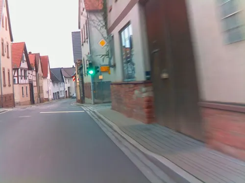
Bachgauer Hof
Restaurant · German · 3.6 km
52 Hauptstraße, Großostheim
Su 11:30-14:30,16:30-22:00; Mo,Tu,Fr,Sa 16:30-22:00

Blaue Adria
Restaurant · Balkan, German · 1.0 km
17 Wallstädter Weg, Großostheim
Tu-Sa 11:00-14:00,17:00-22:00; Su,PH 11:00-22:00
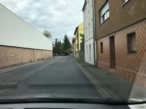
Eder Keller
Restaurant · Regional
3 Aschaffenburger Straße, Großostheim
Mo,Tu,Th,Fr 11:30-14:00,17:00-23:00; Sa 17:00-23:00; Su,PH 11:30-23:00
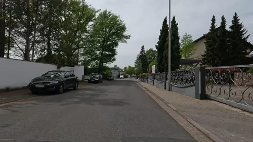
Familie Einzigartig
Cafe · Coffee Shop · 5.6 km
105 Bollenwaldstraße, Aschaffenburg
We-Fr 09:00-17:00; Sa-Su 09:00-18:00
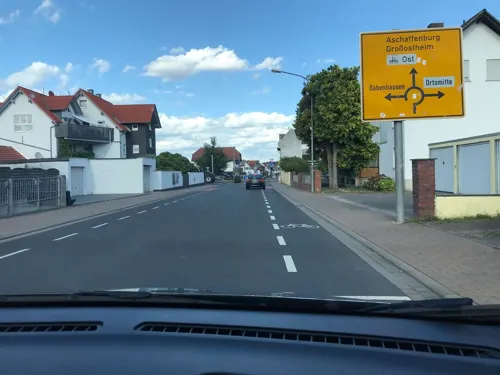
Kleinigkeit
Restaurant · German · 5.2 km
1 Friedensstraße, Schaafheim
Su,Mo 11:30-23:00; Tu-Th 15:00-23:00; Fr-Sa 15:00-01:00
La Casa
Restaurant · German, Italian · 5.6 km
10a Industriering, Schaafheim
Mo-Sa 11:00-14:30,17:00-23:00; Su,PH 11:00-22:00
Meteora
Restaurant · Greek
1 Breite Straße, Großostheim
Mo,We-Sa 11:30-14:00,17:30-22:00; Su 11:30-21:30


Picok
Restaurant · Croatian · 4.9 km
83 Mainwiesenweg
Mo-We, Fr 17:00-24:00; Sa 17:00-01:00; Su, PH 11:30-15:00, 17:00-22:00
Pizzeria Trullo
Restaurant · Pizza · 4.4 km
7 Römerstraße, Niedernberg
Mo,We-Fr 11:30-14:00, Mo,We-Sa 17:00-23:00, Su 17:00-22:00
Pizzeria am Markt
Restaurant · Pizza
4 Breite Straße, Großostheim
Mo,We,Th 17:00-23:00; Fr-Sa 17:00-01:00; Su 17:00-22:00
103 more on the map.
History
The market municipality of Großostheim, as a greater municipality, is made up of the Gemeindeteile of Großostheim, Ringheim, Pflaumheim and Wenigumstadt. While Ringheim has always been part of Großostheim, the other two places, Pflaumheim and Wenigumstadt, have only been as much since municipal reform on 1 May 1978.
Ostheim, called Großostheim since the 18th century – groß is German for “great” or “big” – had its first documentary mention in a document from the Fulda Abbey dating from sometime between 780 and 799.
Ostheim belonged from the time of its first documentary mention to various lordly domains, before it passed along with the whole Bachgau to the Electorate of Mainz.
The Gemeindeteil of Ringheim gets its name from an older village that died out in the early 16th century. The Ringheimer Mühle – a mill, formerly an inn and a farmhouse – seems to be the last piece of property from the old Ringheim. The new Ringheim arose after 1945 on the lands of the former Luftwaffe base, in whose barracks and other buildings Germans driven out of their homelands were housed. Quick growth with industries locating in the new settlement has made of the initially small Gemeindeteil a considerable settlement today, which has become a desirable place to live.
From the History section of Großostheim on Wikipedia, under CC BY-SA 4.0.
Where to stay9
Churches and places of worship37
Pfarrkirche St. Peter und Paul
Church · Roman Catholic
3 Markplatz, Großostheim
St. Cyriakus
Church · Roman Catholic · 4.8 km
11 Kirchgasse, Niedernberg
Shopping30
Gas and EV charging14
Schools, colleges and libraries23
Healthcare6
Map of Großostheim
250 places. The map loads OpenStreetMap tiles when you open it.
Getting there and nearby towns
Frankfurt Airport (FRA) is the nearest airport with scheduled flights listed in OpenStreetMap, 40 km away.
- Hösbach 13 km northeast, about 13 min by car
- Höchst im Odenwald 14 km south, about 14 min by car
- Mömbris 18 km north, about 18 min by car
- Groß-Zimmern 18 km west, about 18 min by car
- Roßdorf 23 km west, about 23 min by car
- Ober-Ramstadt 25 km southwest, about 25 min by car
- Rodenbach 26 km north, about 26 min by car
- Offenbach 30 km northwest, about 30 min by car
- Darmstadt 31 km west, about 31 min by car
- Frankfurt am Main 35 km northwest, about 35 min by car
Drive times are estimates from straight-line distance, not routes.
Local news
Headlines from INDB.
Reviews, tips and questions
Loading what members have shared...
Sources and licences
- GeoNames (CC BY 4.0): population, coordinates, regions and time zone
- Mapillary (see each image): photos
- OpenStreetMap contributors (ODbL 1.0): places, airports, map data
- Wikidata (CC0 1.0): elevation, founding date, time zone, website, landmarks and historic places
- Wikimedia Commons (see each image): photos
- Wikipedia (CC BY-SA 4.0): overview and history text
Photo credits
- Grossostheim 3, Dr. Bernd Gross, CC BY-SA 3.0
- Großostheim St. Peter und Paul 20110127, Rudolf Stricker, Attribution
- Petrus und Paulus Großostheim, Freak-Line-Community, CC BY-SA 4.0
- Großostheim, Haarstraße 3, Maskaron, KaiBorgeest, CC BY-SA 4.0
- Großostheim Altes Rathaus 20110127, Rudolf Stricker, Attribution
- Hexenturm Großostheim, Studentin1988, CC BY-SA 3.0
- Breite Straße 24 Großostheim, Freak-Line-Community, CC BY-SA 4.0
- Marktgasse 2 Großostheim, Freak-Line-Community, CC BY-SA 4.0
- Kanzleistraße 1 Großostheim, Freak-Line-Community, CC BY-SA 4.0
- Nöthighof Großostheim, Freak-Line-Community, CC BY-SA 4.0
- Großostheim Spitzer Turm 20110127, Rudolf Stricker, Attribution
- Marktplatz 8 Großostheim, Freak-Line-Community, CC BY-SA 4.0
- Marktplatz 9 Großostheim, Freak-Line-Community, CC BY-SA 4.0
- Spitzer Turm (Großostheim), Freak-Line-Community, CC BY-SA 4.0
- Kriegerdenkmal Großostheim, Freak-Line-Community, CC BY-SA 4.0
- Stumpfer Turm (Großostheim), Freak-Line-Community, CC BY-SA 4.0
- Großostheim, Bahnhofstraße 19, KaiBorgeest, CC BY-SA 4.0
- Bachgaubahn Großostheim, Freak-Line-Community, CC BY-SA 4.0
- Großostheim Rathaus 20110127, Rudolf Stricker, Attribution
- Welzbach in Großostheim, Freak-Line-Community, CC BY-SA 4.0
- Welzbach in Großostheim (2), Freak-Line-Community, CC BY-SA 4.0
- Großostheim, Bayrischer Stundenstein (2), Manfred Schröter, Berga This photo was taken with Samsung Galaxy A54 5G, CC BY-SA 4.0
- Großostheim, Bayrischer Stundenstein (1), Manfred Schröter, Berga This photo was taken with Garmin Oregon 550, CC BY-SA 4.0
- ORL 33 tab 02 pic 01 Grundriss, Unknown author Unknown author, Public domain
- Aschaffenburg - Pompejanum - 5396, Sven Teschke , Büdingen, CC BY-SA 3.0 de
- Aschaffenburg dum printempo Schönborner Hof 1, No machine-readable author provided. ThomasPusch assumed (based on copyright claims)., CC BY-SA 3.0
- Schloss Johannisberg (Aschaffenburg) II, Jörg Braukmann, CC BY-SA 4.0
- Schloss Johannisburg Aschaffenburg, Wladyslaw Sojka at German Wikipedia ( Original text: ? Wladyslaw [Disk.] ), CC BY-SA 3.0
- Stiftskirche Sankt Peter und Alexander Aschaffenburg, Johann H. Addicks - [email protected], CC BY-SA 3.0
- Nilkheim p 026, Peng ( talk ) 10:42, 28 June 2010 (UTC), CC BY-SA 3.0
- AB Obernau Kirche Hauptstraße 15 01, Lutz Hartmann, CC BY-SA 3.0
- Mosbach St Johannes Baptist 1, E-W, CC BY-SA 3.0
- Rathaus Pflaumheim, Erich Robbers, CC BY-SA 4.0
- Kirche von der Straße aus gesehen, Max Frey, CC BY-SA 4.0
- Wenigumstadt Rathaus Hauptstraße 18 (2), Honischboy, CC0
- Wenigumstadt St Sebastian, E-W, CC BY-SA 3.0
- St. Cyriakus Niedernberg 01, © JD (de.wikipedia.org), CC BY-SA 4.0
- Aussichtsturm Schönbusch-02, Muck, CC BY-SA 4.0
- Wartturm bei Radheim, Heiko Boll, CC BY-SA 3.0
- Wasserturm Niedernberg, Tilman AB, Public domain
- Schönbusch15 Aussichtsturm, Lutz Hartmann, CC BY-SA 3.0
- Schönbusch22 Schloss, Lutz Hartmann, CC BY-SA 3.0
- Bunker 224 Aschaffenburg, Freak-Line-Community, CC BY-SA 4.0
- Wenigumstadt Ottilienbildstock (2), Honischboy, CC0
- Schönbusch04 Wirtschaftsgebäude, Lutz Hartmann, CC BY-SA 3.0
- Alt-Heilig-Kreuz-Kapelle Hungersberg Großostheim, FF-11, CC0
- Wendelinuskapelle, Ekpah, CC BY-SA 3.0
- Sulzbach Kirche, Tilman AB, Public domain
- Schönbusch, Freak-Line-Community, CC BY-SA 4.0
- Street-level photo, oschn0r, CC BY-SA 4.0
- Street-level photo, chuck, CC BY-SA 4.0
- Street-level photo, ramap, CC BY-SA 4.0
- Street-level photo, ramap, CC BY-SA 4.0
- Street-level photo, ramap, CC BY-SA 4.0
- Street-level photo, oschn0r, CC BY-SA 4.0
- Street-level photo, Velo63739, CC BY-SA 4.0
- Street-level photo, m_groebs, CC BY-SA 4.0
- Street-level photo, oschn0r, CC BY-SA 4.0
- Street-level photo, oschn0r, CC BY-SA 4.0
- Street-level photo, oschn0r, CC BY-SA 4.0
- Street-level photo, dekarl, CC BY-SA 4.0


Page built November 8, 2026. Spotted a mistake? Tell us or suggest a place.