


Why visit Goldbach
Townapedia lists 100 museums and landmarks, 18 parks and trails, 104 places to eat, 10 places to stay and 21 attractions in and around town.
Highlights include Kinopolis Aschaffenburg, Attigsberg, Gentilhaus and Kippenburg.
Weather in Goldbach
Forecast from MET Norway (CC BY 4.0). Full forecast
About Goldbach
Goldbach (German pronunciation: [ˈɡɔltbax]) is a market municipality in the Aschaffenburg district in the Regierungsbezirk of Lower Franconia (Unterfranken) in Bavaria, Germany.
From the Wikipedia article Goldbach, Bavaria (this version), under CC BY-SA 4.0.
Things to do21





9 more on the map.
Museums and landmarks100


Kippenburg
Monument and historic site · 2.6 km
Künstlich errichtete Burganlage, 1839 von Adam Kipp
Jul

Gräfenberg Castle
Monument and historic site · 4.9 km
Former castle on Gräfenberg hill near Rottenberg, Germany


museum Pompejanum
Museum · 4.2 km
Cultural heritage monument D-6-61-000-232 (0) in Aschaffenburg, Bavaria

Naturwissenschaftlichen Museum Aschaffenburg
Museum · 3.9 km
Museum in Bavaria, Germany

Schloss Johannisburg
Museum · 4.0 km
Palace in Aschaffenburg, Germany

Staatsgalerie Aschaffenburg
Museum · 4.0 km
Art museum in Schloss Johannisburg in Aschaffenburg


88 more on the map.
Parks, trails and playgrounds18

Waldschwimmbad
Sports field and stadium · 1.3 km
Bei schlechtem Wetter nur von 09:00 Uhr - 13:00 Uhr und von 17:00 Uhr bis 19:00 Uhr geöffnet. Kassenschluss spätestens um 19:45 Uhr und...
179 Hauptstraße, Goldbach
Mo,Fr 07:00-20:30; Tu,We,Th,Sa,Su 09:00-20:30



Grillplatz am Mühlstück
Park · 1.7 km
Only usable with written permission of Hösbach city
6 more on the map.
Restaurants and cafes104

Zeughaus
Restaurant · German · 2.4 km
5 Bismarckallee, Aschaffenburg
Mo-Sa 17:30-23:00; Su 11:30-14:30,17:30-22:00
Aoki Sushi
Restaurant · Sushi · 0.7 km
9 Bayernstraße, Goldbach
Tu-Sa 11:30-15:00,17:30-22:30; Su 11:30-22:30
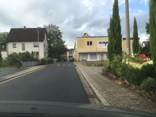
Gasthaus Post
Restaurant · Regional · 2.4 km
460 Hauptstraße, Goldbach
Mo-Tu off; We-Sa 16:00+; Su 16:00+
Indian Chilli Haus
Restaurant · Indian · 1.4 km
101 Hauptstraße, Hösbach
Mo-Fr 11:30-14:00,17:30-22:00; Sa 17:00-22:00; Su 11:30-14:00,17:00-22:00
Indian Heritage Haus
Restaurant · Indian · 3.3 km
1 Ernsthofstraße
Tu-Fr 11:30-14:00,17:30-22:00; Sa 17:00-22:00; Su 11:30-14:00,17:00-22:00
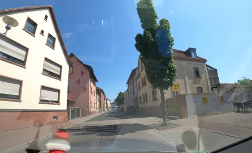
Indian Wirtshaus Westend
Restaurant · German, Italian, Indian · 0.6 km
26 Aschaffenburger Straße, Goldbach
Mo off; Tu-Sa 16:30-22:30; Su,PH 11:30-14:30,17:00-22:30
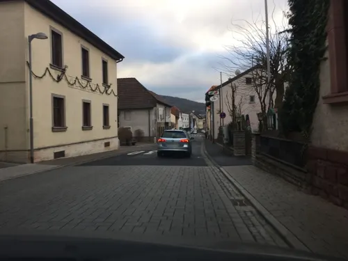
Landgasthaus Adler
Restaurant · Regional, German
43 Hauptstraße, Goldbach
Mo-Sa 16:00-23:00; Su 11:00-23:00
Ristorante Da Fabio
Restaurant · Italian, Pizza, Pasta · 0.7 km
4 Hauptstraße, Hösbach
Tu-Su 17:00-22:00; Mo off
Taste of India Goldbach
Restaurant · Indian
33 Hauptstraße, Goldbach
Mo-Fr,Su 11:30-14:30, 17:30-22:00; Sa 17:30-22:00
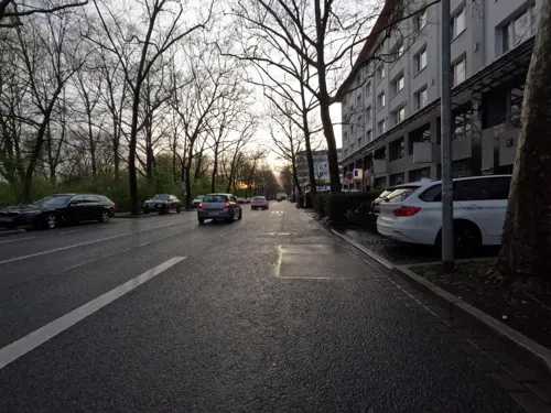
Terra Mea
Restaurant · Italian · 3.3 km
15 Platanenallee, Aschaffenburg
Mo-Sa 11:30-15:00, 17:00-22:00


92 more on the map.
History
In 1218, Goldbach had its first documentary mention. From the mid 15th century, Goldbach was under the authority of the Archbishop of Mainz. In 1814, Goldbach was transferred to Bavaria. On 26 May 1995, Goldbach was granted the designation Markt ("Market").
From the History section of Goldbach, Bavaria on Wikipedia, under CC BY-SA 4.0.
Where to stay10
Churches and places of worship20
Neuapostolische Kirche
Church · Catholic · 2.8 km
46 Glattbacher Straße, Aschaffenburg
Shopping34
Gas and EV charging8
Schools, colleges and libraries24
Healthcare9
Map of Goldbach
250 places. The map loads OpenStreetMap tiles when you open it.
Getting there and nearby towns
Frankfurt Airport (FRA) is the nearest airport with scheduled flights listed in OpenStreetMap, 46 km away.
- Hösbach 2 km northeast, about 2 min by car
- Mömbris 8 km north, about 8 min by car
- Großostheim 12 km southwest, about 12 min by car
- Rodenbach 20 km northwest, about 20 min by car
- Langenselbold 22 km northwest, about 22 min by car
- Höchst im Odenwald 26 km southwest, about 26 min by car
- Lohr am Main 28 km east, about 28 min by car
- Groß-Zimmern 29 km southwest, about 29 min by car
- Wächtersbach 30 km north, about 30 min by car
- Offenbach 32 km west, about 32 min by car
Drive times are estimates from straight-line distance, not routes.
Local news
Headlines from INDB.
Reviews, tips and questions
Loading what members have shared...
Sources and licences
- GeoNames (CC BY 4.0): population, coordinates, regions and time zone
- Mapillary (see each image): photos
- OpenStreetMap contributors (ODbL 1.0): places, airports, map data
- Wikidata (CC0 1.0): elevation, founding date, time zone, website, landmarks and historic places
- Wikimedia Commons (see each image): photos
- Wikipedia (CC BY-SA 4.0): overview and history text
Photo credits
- Goldbach - Einhausung, Maulaff at German Wikipedia, CC BY-SA 3.0
- Goldbach, Lorenz-Heim-Straße 3,5, KaiBorgeest, CC BY-SA 4.0
- Goldbach Aschaffenburger Str 91 Wayside Shrine, KaiBorgeest, CC BY-SA 4.0
- Übergang Goldbach in Flutgraben, Freak-Line-Community, CC BY-SA 3.0
- Goldbach Linsengraben Wayside Shrine, KaiBorgeest, CC BY-SA 4.0
- Ausgrabung-Kugelburg-Goldbach-12, Commander-pirx, CC BY-SA 4.0
- Gräfenberg Mauer, Freak-Line-Community, CC BY-SA 3.0
- Aschaffenburg - Pompejanum - 5396, Sven Teschke , Büdingen, CC BY-SA 3.0 de
- Aschaffenburg dum printempo Schönborner Hof 1, No machine-readable author provided. ThomasPusch assumed (based on copyright claims)., CC BY-SA 3.0
- Schloss Johannisberg (Aschaffenburg) II, Jörg Braukmann, CC BY-SA 4.0
- Schloss Johannisburg Aschaffenburg, Wladyslaw Sojka at German Wikipedia ( Original text: ? Wladyslaw [Disk.] ), CC BY-SA 3.0
- Stiftskirche Sankt Peter und Alexander Aschaffenburg, Johann H. Addicks - [email protected], CC BY-SA 3.0
- Fasanerie Aschaffenburg Apr 2017 8, Der Messer, CC BY-SA 4.0
- Gentilhaus, Lui1959, CC BY-SA 4.0
- HerzJesu001-2, HerzJesu001.jpg : ekpah. he ordered help with uploading derivative work: Rabanus Flavus ( talk ), CC0
- Kronberg-Gymnasium - Außenansicht, Benutzer:Maulaff, CC BY-SA 3.0
- StJosef01, ekpah. he ordered help with uploading, CC0
- Hasenkopf, Freak-Line-Community, CC BY-SA 4.0
- Klinikum Aschaffenburg und Gartenberg, Freak-Line-Community, CC BY-SA 4.0
- Goldbach with St. Nikolaus, KaiBorgeest, CC BY-SA 4.0
- Hösbach, Hauptstraße 93, Pfarrkirche St. Michael, 001, Tilman2007, CC BY-SA 3.0
- Sühnekreuz (Schmerlenbach), Kd6=dra, CC0
- Wenighösbach, St. Barbara, Prof. emeritus Hans Schneider (Geyersberg), CC BY-SA 3.0
- Aschaffenburg, Großmutterwiese, Brunnendenkmal für König Ludwig I.-20160924-020, Tilman2007, CC BY-SA 4.0
- AB Teufelskanzel, KaiBorgeest, CC BY-SA 4.0
- Stolperstein für Franziska Lederer (Hösbach), Christian Michelides, CC BY-SA 4.0
- AB Grünewaldstraße 20, Lutz Hartmann, CC BY-SA 3.0
- AB Kippenburg, KaiBorgeest, CC BY-SA 3.0
- BKahn, User:Ekpah, CC BY-SA 3.0
- BBaumann, User:Ekpah, CC BY-SA 3.0
- Glattbach Hauptstrasse 112, KaiBorgeest, CC BY-SA 4.0
- Unterafferbach, St. Wendelin, Prof. emeritus Hans Schneider (Geyersberg), CC BY-SA 3.0
- Aschaffenburg, Grünewaldstraße 18, Dalberg Gymnasium-009, Tilman2007, CC BY-SA 3.0
- Luftaufnahme des Fasaneriesee Aschaffenburg, Verbesserer7, CC BY-SA 4.0
- Gentilhaus01, Ekpah, CC BY-SA 3.0
- Hösbach Einhausung01 2009-04-12, KlausFoehl, CC BY-SA 3.0
- 德国法兰克福到慕尼黑路上 Frankfurt Germany on the way to Munich Chi - panoramio (1), 罗布泊, CC BY 3.0
- Hoesbach St. Michael, KaiBorgeest, CC BY-SA 4.0
- Pumpkin yellow, KaiBorgeest, CC BY-SA 4.0
- Hoesbach A3 Housing, KaiBorgeest, CC BY-SA 4.0
- AB Godelsberg Steinbank, KaiBorgeest, CC BY-SA 4.0
- Goldbacher Kanzel, Freak-Line-Community, CC BY-SA 4.0
- Kugelberg 01 turmhuegel-vorburg, Commander-pirx, CC BY-SA 4.0
- Street-level photo, m_groebs, CC BY-SA 4.0
- Street-level photo, m_groebs, CC BY-SA 4.0
- Street-level photo, atze02, CC BY-SA 4.0
- Street-level photo, m_groebs, CC BY-SA 4.0
- Street-level photo, Velo63739, CC BY-SA 4.0
- Street-level photo, Velo63739, CC BY-SA 4.0
- Street-level photo, m_groebs, CC BY-SA 4.0
- Street-level photo, m_groebs, CC BY-SA 4.0
- Street-level photo, atze02, CC BY-SA 4.0
- Street-level photo, heetENkoel, CC BY-SA 4.0
- Street-level photo, lhesse, CC BY-SA 4.0
- Street-level photo, Velo63739, CC BY-SA 4.0
- Street-level photo, m_groebs, CC BY-SA 4.0
- Street-level photo, m_groebs, CC BY-SA 4.0
- Street-level photo, ziltoidium, CC BY-SA 4.0
- Street-level photo, m_groebs, CC BY-SA 4.0
- Street-level photo, m_groebs, CC BY-SA 4.0
- Street-level photo, m_groebs, CC BY-SA 4.0
- Street-level photo, m_groebs, CC BY-SA 4.0
- Street-level photo, m_groebs, CC BY-SA 4.0
- Street-level photo, Velo63739, CC BY-SA 4.0


Page built November 8, 2026. Spotted a mistake? Tell us or suggest a place.