


Why visit Aurich
Townapedia lists 101 museums and landmarks, 42 parks and trails, 154 places to eat, 22 places to stay and 13 attractions in and around town.
Highlights include RÜCKER Hofladen, Ziegenmanufaktur Ostfriesland, Historisches Museum and Moormuseum Moordorf.
Weather in Aurich
Forecast from MET Norway (CC BY 4.0). Full forecast
About Aurich
Aurich (German pronunciation: [ˈaʊʁɪç] ; East Frisian Low Saxon: Auerk; Saterland Frisian: Aurk [ˈau̯ɐk]) is a town in the East Frisian region of Lower Saxony, Germany. It is the capital of the district of Aurich and is the second largest City in East Frisia, both in population, after Emden, and in area, after Wittmund.
From the Wikipedia article Aurich (this version), under CC BY-SA 4.0.
Travel tips from other travellers: Aurich on Wikivoyage (CC BY-SA 4.0).
Photos of Aurich


Things to do13
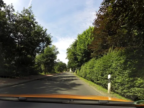
RÜCKER Hofladen
Farm and orchard · 2.1 km
- Hofladen mit E-Bike Ladestation - Dauerhaft geöffnet - Nur Barzahlung - Täglich frische Ware
113 Egelser Straße, Aurich
24/7

Ziegenmanufaktur Ostfriesland
Farm and orchard · 8.2 km
Ziegenmilch-Produkte, Ziegenfleisch, Ziegenfelle, Schnittblumen
37 Boßelstraße, Großefehn
Mo-Sa 08:00-20:00

Münkeboer Eier Nest
Farm and orchard · 9.2 km
24 Nordmeerer Weg
Mo-Su 08:00-20:00


1 more on the map.
Museums and landmarks101


Moormuseum Moordorf
Museum · 6.0 km
7a Victorburer Moor, Südbrookmerland
Mar 20-Oct 31 10:00-18:00; Nov Mo-Fr 09:00-13:00



Miraculum MitMachMuseum
Museum
25 Burgstraße, Aurich
Mo, PH off; Tu-Fr 13:00-17:00; Sa, Su 11:00-17:00
89 more on the map.
Parks, trails and playgrounds42






Schwimmbad Südbrookmerland
Sports field and stadium · 5.9 km
13 Schultrift, Südbrookmerland
30 more on the map.
Restaurants and cafes154
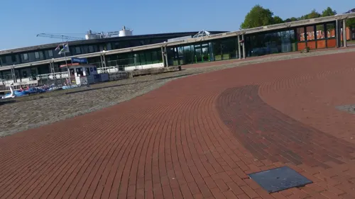
Hafenkiste
Restaurant · German, Burger, Pizza, Salad, Snack · 0.7 km
22 Hasseburger Straße, Aurich
Tu-Sa 17:00-18:00+; Su 12:00-18:00+; Mo off
Jugoslavija
Restaurant · Balkan · 0.8 km
25 Tannenbergstraße, Aurich
Mo,We-Sa 17:30-23:00, Su 11:30-14:30; Tu off, Su 17:30-23:00
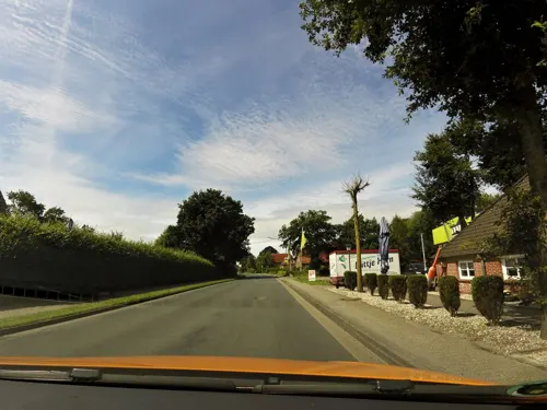

Alte Wache
Restaurant · Greek
56 Burgstraße, Aurich
Mo-Th 12:00-14:30,18:00-23:00;Fr-Sa 12:00-14:30,18:00-00:00;Su...

Historisches Compagniehaus
Restaurant · Regional, German, Fish · 11.0 km
64 Kanalstraße Süd, Großefehn
Mo-Sa 10:00-19:00; Tu 10:00-14:00; PH,We off; Su 10:00-16:00
Holtroper Krug
Restaurant · German · 7.4 km
6 Mühlenweg, Großefehn
Mo-Fr 17:00-24:00; Sa-Su 11:00-24:00
Michelangelo da Gianni Cucina Italiana
Restaurant · Pizza, Pasta, Italian
48 Burgstraße, Aurich
We-Mo 11:30-14:30,17:30-23:00
Mikado
Restaurant · Vietnamese, Sushi, Japanese, Thai
1 Leerer Landstraße, Aurich
Mo,We-Fr 11:00-15:00,17:00-22:00; Sa,Su 12:00-22:00; Tu off
142 more on the map.
History
The history of Aurich dates back to the 13th century, when the settlement of Aurechove was mentioned in a Frisian document called the Brokmerbrief in 1276. There are various hypotheses about the interpretation of the city name. It either refers to a person (Affo, East Frisian first name) and his property (Reich) or it refers to waterworks on the fertile, water-rich lowland of the Aa (or Ehe) river, upon which the city was built; medieval realizations were Aurichove, Aurike, Aurikehove, Auerk, Auryke, Auwerckhove, Auwerick, Auwerck, Auwreke, Awerck, Awreke, Awrik, Auwerich and Aurickeshove.
In 1517, Count Edzard from the House of Cirksena began rebuilding the town after an attack. In 1539, the land authorities were brought together in Aurich, making it the county capital and, later, East Frisia, remaining the seat of the land authorities when East Frisia was inherited by the Kingdom of Prussia in 1744. After the Prussian Army was defeated in the Battle of Jena in 1807, Aurich became part of the Kingdom of Holland in 1808. In 1810, the Kingdom of Holland was annexed by France and Aurich was made the capital of the department Ems-Oriental of the First French Empire. After Napoleon was defeated in 1814, it passed to the Kingdom of Hanover in 1815, and then was annexed by Prussia in 1866 and made part of the Province of Hanover.
Read more of the history
From 21 October 1944, until 23 December 1944, a Nazi concentration camp was established in Aurich. The camp was a subcamp to the Neuengamme concentration camp.
After World War II, Aurich became part of the new state of Lower Saxony.
From the History section of Aurich on Wikipedia, under CC BY-SA 4.0.
Notable people from Aurich
 Rudolf von JheringGerman jurist (1818–1892)Photo: Unknown photographer, Public domain
 Enno III, Count of East Frisiacount of East Frisia (1563-1625)Photo: unknown medieval artist, Public domain
 Ulrich II, Count of East FrisiaRuler of East Frisia in the later years of the Thirty Years' War (1605-1648)Photo: Not mentioned, Public domain
 Anna Maria of OstfrieslandDuchess consort of Mecklenburg-SchwerinPhoto: Agnete, CC BY-SA 4.0
 Charles EdzardPrince of East FrisiaPhoto: Not mentioned, Public domain
 Enno Louis, Prince of East FrisiaFrisian princePhoto: Not mentioned, Public domain
 George Albert, Prince of East FrisiaPrince of East FrisiaPhoto: Johann Conrad Eichler, Public domain
 George Christian, Prince of East FrisiaPrince of OstfrieslandPhoto: Heimatvereins Leer, Public domain
 Friedrich Theodor von FrerichsGerman pathologist (1819–1885)Photo: Lithography by P. Rohrbach, 1859,..., Public domain
- Rudolf Christoph Eucken(1846-1926) German philosopher
- Uwe RosenbergGerman game designer
- Anne of OstfrieslandGerman noblewoman (1562-1621)
Born in Aurich, according to Wikidata (CC0). Each name links to its Wikipedia article.
Where to stay22
Churches and places of worship30
Kirche Zum guten Hirten Münkeboe-Moorhusen
Church · Lutheran · 9.1 km
65 Upender Straße, Südbrookmerland
Mittegroßefehner Kirche
Church · Lutheran · 10.1 km
13 Kirchstraße, Großefehn
Baptisten-Kirche Moorhusen
Church · Baptist · 10.1 km
64 Rüskeweg, Südbrookmerland
Shopping55
Gas and EV charging21
Schools, colleges and libraries44
Healthcare19
Map of Aurich
250 places. The map loads OpenStreetMap tiles when you open it.
Getting there and nearby towns
Flugplatz Emden (EME) is the nearest airport with scheduled flights listed in OpenStreetMap, 19 km away.
- Moordorf 5 km west, about 5 min by car
- Wiesmoor 18 km east, about 18 min by car
- Hinte 20 km west, about 20 min by car
- Veenhusen 20 km south, about 20 min by car
- Emden 22 km southwest, about 22 min by car
- Esens 22 km northeast, about 22 min by car
- Wittmund 23 km northeast, about 23 min by car
- Norden 23 km northwest, about 23 min by car
- Friedeburg 23 km east, about 23 min by car
- Leer 27 km south, about 27 min by car
Drive times are estimates from straight-line distance, not routes.
Towns near Aurich


Keep exploring
Local news
Headlines from INDB.
Reviews, tips and questions
Loading what members have shared...
Sources and licences
- GeoNames (CC BY 4.0): population, coordinates, regions and time zone
- Mapillary (see each image): photos
- OpenStreetMap contributors (ODbL 1.0): places, airports, map data
- Wikidata (CC0 1.0): elevation, founding date, time zone, website, landmarks and historic places
- Wikimedia Commons (see each image): photos
- Wikipedia (CC BY-SA 4.0): overview and history text
Photo credits
- Auricherschloss, Pixelfehler, CC BY-SA 3.0
- Sous-Turm Aurich 1, Gerd Fahrenhorst, CC BY 4.0
- Sous-Turm Aurich 2, Gerd Fahrenhorst, CC BY 4.0
- Aurich, Am Markt 28, A1000, CC0
- Stolpersteinlage Aurich Marktplatz 31, Gmbo 2013, CC0
- Stolpersteine Aurich Marktplatz 31, Gmbo 2013, CC0
- Stolperstein Aurich Marktplatz 31 Karl Gidanski, Gmbo 2013, CC0
- Stolperstein Aurich Marktplatz 31 Erich Gidanski, Gmbo 2013, CC0
- Stolperstein Aurich Marktplatz 31 Gertrude Gidanski, Gmbo 2013, CC0
- Stolperstein Aurich Marktplatz 31 Mary Gidanski, Gmbo 2013, CC0
- Marktplatz Aurich 2023-03, Gerd Fahrenhorst, CC BY 4.0
- Raiffeisen-Volksbank, Marktplatz in Aurich, Gerd Fahrenhorst, CC BY 4.0
- Aurich, Norderstrasse 16, A1000, CC0
- Aurich, Am Markt 5, A1000, CC0
- Aurich, Marktplatz mit Kugelbrunnen, ( A1000 ( talk )), CC0
- Aurich, Osterstrasse 26, A1000, CC0
- Aurich, Osterstrasse 13, A1000, CC0
- Fassadenreliefs Markthalle Aurich 2, Gerd Fahrenhorst, CC BY 4.0
- Stolpersteine Aurich Osterstraße Familien Hartog und Bargerbuhr, Heinrich Stürzl, CC BY-SA 4.0
- Fassadenreliefs Markthalle Aurich 1, Gerd Fahrenhorst, CC BY 4.0
- Stolpersteine Aurich Osterstraße Familie Goldschmidt, Heinrich Stürzl, CC BY-SA 4.0
- Stolpersteine Aurich Osterstraße 18 Familien Sternberg, Heinrich Stürzl, CC BY-SA 4.0
- Stolpersteine Aurich Osterstraße Familien Wolff, Heinrich Stürzl, CC BY-SA 4.0
- Aurich, Am Markt 10, A1000, CC0
- Aurich, Lambertikirche (02), Subbass1, CC BY-SA 4.0
- Aurich, Lambertikirche (04), Subbass1, CC BY-SA 4.0
- Upstallsbohm2008msu, Matthias Süßen, CC BY-SA 2.5
- ChurchPlaggenburg, Frisia Orientalis, CC BY-SA 3.0
- Aurich (1), Dickelbers, CC BY-SA 3.0
- Orgel Barstede, RugesReinhard, CC BY-SA 3.0
- Brockzeteler Moor, Mien.Deern, CC BY-SA 4.0
- ChurchMittegroßefehn, Frisia Orientalis, CC BY-SA 3.0
- Westerhusen msu-9986, User:Matthias Süßen, CC BY-SA 3.0
- Ulricianum-3, ( A1000 ( talk )), CC BY-SA 3.0
- Münkeboe Kirche, Hendrik Dochhorn, CC BY-SA 3.0
- HistorischesMuseumAurich44, User:Matthias Süßen, CC BY 3.0
- ChurchHoltrop, Frisia Orientalis, CC BY-SA 3.0
- Engerhafe Kirche, Matthias Süßen at de.wikipedia, CC BY-SA 3.0
- Baptistenkapelle Moorhusen, Gregor Helms 11:14, 11. Nov. 2010 (CET), CC BY-SA 3.0
- Aurich, Lambertikirche (17), Subbass1, CC BY-SA 4.0
- Aurichrefkirche, pixelfehler, CC BY-SA 2.5
- Moormuseum Moordorf view, Matthias Süßen, CC BY 3.0
- Muehle Wiegboldsbur80, Matthias Süßen, CC BY 3.0
- ChurchWeene, Frisia Orientalis, CC BY-SA 3.0
- CatholicChurchAurich 2, CatholicChurchAurich.JPG : Frisia Orientalis derivative work: Rabanus Flavus ( talk ), CC BY-SA 3.0
- Teehaus kunstpavillion aurich, MyName ( A1000 ( talk )), CC0
- Aurich, Ostfriesland, Hotel am Schloss (früher Piqueurhof) im September 2015 (1), Arno Bendszeit, CC BY-SA 3.0
- Moorheide Ewiges Meer, Elke Freese, CC BY-SA 3.0
- BSV Ihlow 7568, Ein Dahmer, CC BY-SA 4.0
- Aurich Stiftsmühle 1, Evergreen68, CC BY-SA 3.0
- Aurich-Tannenhausen Sowjetische Kriegsgräberstätte (01), Heinrich Stürzl, CC BY-SA 4.0
- St.-Victor-Kirche (Victorbur)-2025-msu-7050-, Matthias Süßen, CC BY-SA 4.0
- DorfmuseumMuenkeboe MatthiasSuessen-9450, User:Matthias Süßen, CC BY-SA 3.0
- Street-level photo, minzkraut, CC BY-SA 4.0
- Street-level photo, minzkraut, CC BY-SA 4.0
- Street-level photo, minzkraut, CC BY-SA 4.0
- Street-level photo, bejotel, CC BY-SA 4.0
- Street-level photo, moenk, CC BY-SA 4.0
- Street-level photo, moenk, CC BY-SA 4.0
- Street-level photo, minzkraut, CC BY-SA 4.0
- Street-level photo, atze777, CC BY-SA 4.0
- Street-level photo, heetENkoel, CC BY-SA 4.0
- Street-level photo, heetENkoel, CC BY-SA 4.0
- Street-level photo, atze777, CC BY-SA 4.0
- Street-level photo, minzkraut, CC BY-SA 4.0
- Street-level photo, moenk, CC BY-SA 4.0
- Street-level photo, heetENkoel, CC BY-SA 4.0


Page built November 9, 2026. Spotted a mistake? Tell us or suggest a place.