


Why visit Leer
Townapedia lists 128 museums and landmarks, 39 parks and trails, 128 places to eat, 22 places to stay and 8 attractions in and around town.
Highlights include Ledabrücke Amdorf, Weener railway bridge, Haus Samson and Pünte Wiltshausen.
Weather in Leer
Forecast from MET Norway (CC BY 4.0). Full forecast
About Leer
Leer (German pronunciation: [leːɐ̯] ) is a town in the district of Leer in the region of East Frisia, in the northwestern part of Lower Saxony, Germany. It is situated on the river Leda, a tributary of the river Ems, near the border with the Netherlands. With 34,958 inhabitants (2021), it is the third-largest city in East Frisia after Emden and Aurich.
From the Wikipedia article Leer, Lower Saxony (this version), under CC BY-SA 4.0.
Travel tips from other travellers: Leer on Wikivoyage (CC BY-SA 4.0).
Photos of Leer


Things to do8

Ledabrücke Amdorf
Bridge · 5.0 km
Mit einer Fahrbahnbreite von 1,80 m ist die Ledabrücke in Amdorf die schmalste Autobrücke Deutschlands. Stahlfachwerkkonstruktion, Länge...
Trappenweg, Detern




Museums and landmarks128

Haus Samson
Museum · 0.8 km
Wohnkultur in Ostfriesland im 18. und 19. Jahrhundert / Home decor in East Frisia during 18th and 19th century
18 Rathausstraße, Leer (Ostfriesland)
Mo-Fr 09:00-18:00; Sa-Su off; PH off

Pünte Wiltshausen
Monument and historic site · 4.4 km
Die Pünte in Wiltshausen ist eine kleine handbetriebene Fähre über die Jümme. Betrieb vom 01.05 bis 03.10 jährlich, immer je nach Tide....
May-Oct Th-Su "Abhängig von Tide/Gezeiten"

Schloss Evenburg
Monument and historic site · 2.2 km
25 Am Schlosspark, Leer
Mar 15-Oct 31: 10:00-18:00; Nov 01-Jan 10: 11:00-17:00


Trappenweg
Monument and historic site · 5.0 km
Deutschlands schmalste Autobrücke

Bentumersiel
Monument and historic site · 4.9 km
Archaeological site in Lower Saxony, Germany



116 more on the map.
Parks, trails and playgrounds39





Ems im Fluss
Sports field and stadium · 2.6 km
Historische Entwicklung der Unterems von 1850 bis heute
24/7

Wassersportverein "Luv up" eV Jemgum
Marina and boat launch · 5.8 km
27 more on the map.
Restaurants and cafes128
360°
Restaurant · Pizza
36 Mühlenstraße, Leer (Ostfriesland)
Mo-Fr 09:00-14:00,17:00-22:00, Sa 09:00-22:00; Su 09:00-21:00
J. Bünting Coloniale
Cafe · Tea · 0.7 km
39 Brunnenstraße, Leer (Ostfriesland)
Mo-Sa 08:00-17:30; Su off; PH off
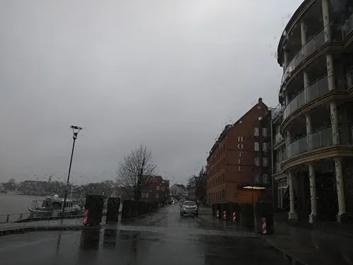
Restaurant Saloniki
Restaurant · Greek
18 Georgstraße, Leer (Ostfriesland)
Mo-Su 11:30-14:30,17:30-23:30; Jan 01 off
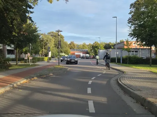
Schiffsrestaurant Spiekeroog III
Restaurant · Regional, German, Seafood · 0.9 km
1 Dr.-vom-Bruch- Brücke, Leer (Ostfriesland)
We-Su 12:00-14:00,17:30-23:00
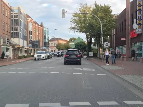
Syrtaki
Restaurant · Greek
16 Bahnhofsring, Leer (Ostfriesland)
Mo off; Tu-Sa 16:30-21:30; Su, PH 16:00-21:00

Dionysos
Restaurant · Greek · 0.8 km
Dienstag Ruhetag
5-7 Brunnenstraße, Leer (Ostfriesland)
Mo, We-Su 11:30-14:00, 17:00-21:30
Zum Bingumer Sand
Restaurant · Regional, Asian, Italian · 2.9 km
Küchenangebot international, Regionaltypische Küche, regionale Küche
14 Marinastraße, Leer
Mo-Su 17:00-22:00; Tu closed; PH off
Bruno Gelato da Placido
Restaurant · Italian, Ice Cream · 3.2 km
2 Nüttermoorer Straße, Leer (Ostfriesland)
Mo-Sa 10:00-20:00

Melkhuske
Cafe · Cake, Tea, Coffee · 5.8 km
47 Königsmoorstraße, Moormerland
May-Oct: Sa 13:00-17:00; May-Oct: Su 13:00-17:00
116 more on the map.
History
There are many traces of early settlements in the area, including crude flint tools that are dated back to roughly 3200 BCE.
In 791 CE Saint Ludger built the first chapel in East Frisia at the western edge of the settlement Leer, then still named Hleri after 'feetlot', 'willow'. This chapel is mentioned for the first time in a written document from 850 CE.
During the 14th and 15th centuries, Leer was hometown of the Ukena family, which was one most influential East-Frisian chieftain families of that time. The town profited from the trade with the Hanse, and a fortress Leerort was built.
In 1508, Count Edzard obtained the official right to host a market, which started the tradition of the Gallimarkt, which is now an annual fair. In 1744 East Frisia fell to Prussia, then ruled by Frederick the Great. Town privileges were awarded in 1823 by George IV, King of Hanover.
In 1854 Leer became connected to the Hannoversche Westbahn railway, which at that time connected Emden and Rheine in the Ruhr area. In 1856, the Westbahn was connected to the central German railway network.
Unlike Emden, Leer only suffered little damage by Allied bombing in World War II. The city was occupied by Canadian troops on 28 April 1945.
On 1 October 1955, Leer received the status of an independent city.
From the History section of Leer, Lower Saxony on Wikipedia, under CC BY-SA 4.0.
More about Leer
Geography
Leer had been a settlement long before it was first mentioned in written documents. Originally, the city was situated at a meander near the mouth of the river Leda into the Ems, which is still the center of the town today. Even though Leer is some 30 km (19 mi) away from the coast, it can be reached by large ships via the Ems.
Leer lies close to the Dutch border; the district of Leer shares a border with the Dutch province of Groningen. The island and nature reserve of Bingumer Sand lies within the district.
Education
In Leer there are seven primary schools and numerous secondary schools. The two gymnasiums, Telletta-Gross-Gymnasium and Ubbo-Emmius-Gymnasium, educate more than 1,500 pupils each and are two of the largest grammar schools in Lower Saxony. The Navigation School is now a faculty of the Hochschule Emden – Leer (University of applied science). The town also offers education at two vocational schools.
From the Wikipedia article Leer, Lower Saxony, under CC BY-SA 4.0.
Notable people from Leer
 H.P. BaxxterGerman singerPhoto: Stefan Brending ( 2eight ), CC BY-SA 4.0
 Gustaaf Willem van ImhoffDutch aristocratsPhoto: Jan Maurits Quinkhard, Public domain
 Hermann LangeRoman Catholic priest and martyr of the Nazi period in Germany (1912-1943)Photo: (Fotograf unbekannt), CC BY-SA 4.0
 Garrelt DuinGerman politician (SPD)Photo: Mozamaniac, CC BY-SA 4.0
 Matthias GrooteGerman politicianPhoto: Martin Rulsch , Wikimedia Commons, CC BY-SA 4.0
 Petrus Hofstede de GrootDutch theologian (1802-1886)Photo: Jan Ensing, Public domain
 Gitta ConnemannGerman politicianPhoto: Superbass, CC BY-SA 4.0
 Okka RauGerman beach volleyball player (1977-)Photo: Christian Jansky ( User:Tschaensky ), CC BY-SA 3.0
 Ralf BrieseGerman politician (1971-2011)Photo: Martina Nolte, CC BY-SA 3.0 de
 Ulf ThieleGerman politicianPhoto: Foto-AG Melle, CC BY 3.0
 Luisa HartemaGerman modelPhoto: Michael Schilling, CC BY-SA 3.0
- Onno KloppGerman historian (1822-1903)
Born in Leer, according to Wikidata (CC0). Each name links to its Wikipedia article.
Where to stay22
Churches and places of worship37
Ev.-Freikirchliche Gemeinde Leer (Baptisten) K.d.ö.R.
Church · Baptist · 0.7 km
4 Ubbo-Emmius-Straße, Leer (Ostfriesland)
Shopping51
Gas and EV charging18
SCORE-Tankstellen und Mineralölhandels-GmbH
Gas station · 5.1 km
2 Zoostraße, Leer (Ostfriesland)
Schools, colleges and libraries32
Emden/Leer University of Applied Sciences - Maritime Studies
School
36 Bergmannstraße, Leer (Ostfriesland)
Healthcare14
Löwen-Apotheke
Clinic and pharmacy · 0.8 km
19 Brunnenstraße, Leer (Ostfriesland)
Map of Leer
250 places. The map loads OpenStreetMap tiles when you open it.
Getting there and nearby towns
Flugplatz Emden (EME) is the nearest airport with scheduled flights listed in OpenStreetMap, 23 km away.
- Anleger "Warsteiner Admiral" map
- Veenhusen 7 km north, about 7 min by car
- Weener 10 km southwest, about 10 min by car
- Bunde 14 km southwest, about 14 min by car
- Ostrhauderfehn 15 km southeast, about 15 min by car
- Papenburg 17 km south, about 17 min by car
- Barßel 20 km east, about 20 min by car
- Emden 22 km northwest, about 22 min by car
- Apen 23 km east, about 23 min by car
- Aurich 27 km north, about 27 min by car
- Hinte 26 km northwest, about 26 min by car
Drive times are estimates from straight-line distance, not routes.
Towns near Leer


Keep exploring
Local news
Headlines from INDB.
Reviews, tips and questions
Loading what members have shared...
Sources and licences
- GeoNames (CC BY 4.0): population, coordinates, regions and time zone
- Mapillary (see each image): photos
- OpenStreetMap contributors (ODbL 1.0): places, airports, map data
- Wikidata (CC0 1.0): elevation, founding date, time zone, website, landmarks and historic places
- Wikimedia Commons (see each image): photos
- Wikipedia (CC BY-SA 4.0): overview and history text
Photo credits
- Leer Rathaus Hafen townhall harbour 2008, Benutzer:Brunswyk, CC BY-SA 3.0 de
- Nails by Perlglanz, Leer (2018), Donald_Trung, CC BY-SA 4.0
- Krokodil-Apotheke, Leer (2018), Donald_Trung, CC BY-SA 4.0
- Commerzbank, Leer (2018), Donald_Trung, CC BY-SA 4.0
- Deichmann, Leer (2018), Donald_Trung, CC BY-SA 4.0
- Marc O'Polo, Leer (2018), Donald_Trung, CC BY-SA 4.0
- Mai Anh, Leer (2018), Donald_Trung, CC BY-SA 4.0
- Favors! by cbr, Leer (2018), Donald_Trung, CC BY-SA 4.0
- Rücks biomarkt, Leer (2018), Donald_Trung, CC BY-SA 4.0
- H&M, Leer (2018), Donald_Trung, CC BY-SA 4.0
- NewYorker, Leer (2018), Donald_Trung, CC BY-SA 4.0
- Reisbüro im Ceka, Leer (2018), Donald_Trung, CC BY-SA 4.0
- Müller, Leer (2018), Donald_Trung, CC BY-SA 4.0
- Public flower bed, Leer (2018), Donald_Trung, CC BY-SA 4.0
- Candle products sold at Rossmann, Leer (2018), Donald_Trung, CC BY-SA 4.0
- Mister Lady, Leer (2018), Donald_Trung, CC BY-SA 4.0
- T-Mobile (Deutsche Telekom) telephone booth, Leer (2018) 01, Donald Trung, CC BY-SA 4.0
- Kochlöffel Leer 2019-04, Gerd Fahrenhorst, CC BY 4.0
- Stolperstein Leer Mühlenstraße 98 Jonas de Vries, Günther Lübbers, CC0
- Stolperstein Leer Mühlenstraße 98 Bertha de Vries, Günther Lübbers, CC0
- Stolperstein Leer Mühlenstraße 98 Sicilia de Vries, Günther Lübbers, CC0
- Stolperstein Leer Mühlenstraße 98 Elisa de Vries, Günther Lübbers, CC0
- Stolpersteine Leer Mühlenstraße 98, Günther Lübbers, CC0
- Stolperstein Mühlenstr 98 (Leer) Jonas de Vries, OTFW , Berlin, CC BY-SA 3.0
- Stolperstein Mühlenstr 98 (Leer) Elisa de Vries, OTFW , Berlin, CC BY-SA 3.0
- Stolperstein Mühlenstr 98 (Leer) Sicilia de Vries, OTFW , Berlin, CC BY-SA 3.0
- Stolperstein Mühlenstr 98 (Leer) Bertha de Vries, OTFW , Berlin, CC BY-SA 3.0
- Deutsche Bank, Leer (2018), Donald_Trung, CC BY-SA 4.0
- Darry's Pub, Leer (2018), Donald_Trung, CC BY-SA 4.0
- C&A, Leer (2018), Donald_Trung, CC BY-SA 4.0
- T-Mobile, Leer (2018), Donald_Trung, CC BY-SA 4.0
- Waterborg, Leer (2018), Donald_Trung, CC BY-SA 4.0
- Eis Cafe Venezia, Leer (2018), Donald_Trung, CC BY-SA 4.0
- Frisia Center Leer (2025)-2, JoachimKohler-HB, CC BY-SA 4.0
- Frisia Center Leer (2025), JoachimKohler-HB, CC BY-SA 4.0
- Anschlag in Hanau 2020 - Erinnerung und Protest in Leer 2025, JoachimKohler-HB, CC BY-SA 4.0
- Gedenkstein zur Erinnerung an die Opfer des Nationalsozialismus (Leer, 2025), JoachimKohler-HB, CC BY-SA 4.0
- Douglas, Leer (2018), Donald_Trung, CC BY-SA 4.0
- Denkmal Bahnhofsring 2 (Leer) Liesel Aussen&Gerhard Christmann&20222, OTFW , Berlin, CC BY-SA 3.0
- Gedenktafel Bahnhofsring 2 (Leer) Liesel Aussen, OTFW , Berlin, CC BY-SA 3.0
- 2013-05-03 Fotoflug Leer Papenburg DSCF7028, Martina Nolte, CC BY-SA 3.0 de
- Puente Wiltshausen, Kai Kowalewski, CC BY-SA 2.0 de
- ChurchAmdorf-2, Frisia Orientalis, CC BY-SA 3.0
- ChurchBingum, Frisia Orientalis, CC BY-SA 3.0
- Ubboemmiusgymnasium, No machine-readable author provided. Termo assumed (based on copyright claims)., CC BY-SA 3.0
- Leer - Hindenburgstraße - Friedenskirche 09 ies, Frank Vincentz, CC BY-SA 3.0
- LeerChurch, Niels Elgaard Larsen, CC BY-SA 3.0
- Leer Heimat Museum bwo 07 1, Heimatmuseum Leer, CC BY-SA 4.0
- ChurchLogabirum, Frisia Orientalis, CC BY-SA 3.0
- Leer Lutherkirche2, Wikiwal, CC BY 3.0
- SchulmuseumFolmhusen951, User:Matthias Süßen, CC BY 3.0
- Plytenberg, Benutzer:Columbus, CC BY-SA 3.0
- Reformierte Kirche (Leer-Loga) 06, Dickelbers, CC BY-SA 3.0
- Leer Teletta-Groß-Gymnasium, Reise Reise, CC BY-SA 3.0
- Detern - Trappenweg - Ledabrücke Amdorf 01 ies, Frank Vincentz, CC BY-SA 3.0
- Flutlicht, Mario Rauch / Germania Leer, CC BY-SA 3.0 de
- Buildings in de old town of Leer (Ost Friesland) 08, Dickelbers, CC BY-SA 3.0
- Leer - Bavinkstraße - St. Marien 04 ies, Frank Vincentz, CC BY-SA 3.0
- Jugendherberge Leer, Eingang, Gerd Fahrenhorst, CC BY 4.0
- Baptistenkirche Leer, GregorHelms at German Wikipedia, CC BY-SA 3.0
- Evenburg2007, Kuifje, CC BY-SA 3.0
- Leer St.-Michael-Kirche, Wikiwal, CC BY-SA 4.0
- AmdorfBridge, Frisia Orientalis, CC BY-SA 3.0
- Mennonitenkirche Leer-msu-1169, Matthias Süßen, CC BY-SA 4.0
- Kunsthaus Leer, Snirtje, CC BY-SA 4.0
- Germania romana, ReMaps, CC BY-SA 4.0
- Ehemalige Juedische Schule Leer-msu-1231, Matthias Süßen, CC BY-SA 4.0
- ND-LER 001 Plytenberg mit 1 Linde in Leer, Klinkenborg, CC BY-SA 4.0
- Leeraner Miniaturland - panoramio (6), Holger Düttmann, CC BY-SA 3.0
- Street-level photo, hotteliene, CC BY-SA 4.0
- Street-level photo, fabs, CC BY-SA 4.0
- Street-level photo, changchun1, CC BY-SA 4.0
- Street-level photo, hotteliene, CC BY-SA 4.0
- Street-level photo, robinvdlinde, CC BY-SA 4.0
- Street-level photo, changchun1, CC BY-SA 4.0
- Street-level photo, changchun1, CC BY-SA 4.0
- Street-level photo, hotteliene, CC BY-SA 4.0
- Street-level photo, thetornado76, CC BY-SA 4.0
- Street-level photo, thetornado76, CC BY-SA 4.0
- Street-level photo, changchun1, CC BY-SA 4.0
- Street-level photo, changchun1, CC BY-SA 4.0
- Street-level photo, bep12, CC BY-SA 4.0
- Street-level photo, changchun1, CC BY-SA 4.0
- Street-level photo, thetornado76, CC BY-SA 4.0
- Street-level photo, hotteliene, CC BY-SA 4.0
- Street-level photo, changchun1, CC BY-SA 4.0
- Street-level photo, hotteliene, CC BY-SA 4.0
- Street-level photo, changchun1, CC BY-SA 4.0
- Street-level photo, mfa, CC BY-SA 4.0
- Street-level photo, robinvdlinde, CC BY-SA 4.0
- Street-level photo, ezinge, CC BY-SA 4.0


Page built November 9, 2026. Spotted a mistake? Tell us or suggest a place.