


Rheinbach, Germany
Rheinbach is a town of 26,262 people in North Rhine-Westphalia, Germany.
Why visit Rheinbach
Townapedia lists 159 museums and landmarks, 49 parks and trails, 140 places to eat, 16 places to stay and 21 attractions in and around town.
Highlights include Lapinchen’s Hofladen, Grafschafter Krautfabrik Werksverkauf, Munitionsbunker and Kutschenmuseum Mostert.
Weather in Rheinbach
Forecast from MET Norway (CC BY 4.0). Full forecast
About Rheinbach
Rheinbach (German pronunciation: [ˈʁaɪnbax] ) is a town in the Rhein-Sieg-Kreis district (Landkreis), in North Rhine-Westphalia, Germany. It belongs to the administrative district (Regierungsbezirk) of Cologne.
From the Wikipedia article Rheinbach (this version), under CC BY-SA 4.0.
Things to do21

Lapinchen’s Hofladen
Farm and orchard · 6.9 km
Kanninchen, Lamm, Zicklein, Geflügelspezialitäten aus der Eifel
34 Dompfaffstraße, Euskirchen
Th,Fr 09:00-18:00; Sa 09:00-13:00
Grafschafter Krautfabrik Werksverkauf
Farm and orchard · 4.7 km
22-26 Wormersdorfer Straße, Meckenheim
Mo-Th 08:00-16:00; Fr-Su off
Obst-Gemüsebau Früh
Farm and orchard · 5.6 km
81 Madbachstraße, Rheinbach
Mo-Fr 09:00-18:00; Sa 09:00-17:00; Su 10:00-17:00
Milchziegenhof Minten Hofkäserei mit Bauernladen
Farm and orchard · 2.3 km
8 Peppenhoven, Rheinbach
Mo-Fr 17:00-18:00; Sa 10:00-13:00
Hofladen Pude-Nolden
Farm and orchard · 3.4 km
26 Zippengasse, Rheinbach
Mo-Sa 09:00-19:00


9 more on the map.
Museums and landmarks159


Kutschenmuseum Mostert
Museum
Kutschensammlung der Familie Mostert mit Fahrzeugen aus dem 19. Jahrhundert
4 Koblenzer Straße, Rheinbach
Mo-Th 08:00-17:00; Fr 08:00-13:00

Glasmuseum
Museum
Museum zur historischen und modernen Glasherstellung
3 Polligsstraße, Rheinbach
Tu-Fr 10:00-12:00, Tu-Fr 14:00-17:00, Sa,Su 11:00-17:00


Burg Flamersheim
Monument and historic site · 6.9 km
1 Burg Flamersheim, Euskirchen

Burg Morenhoven
Monument and historic site · 4.3 km
52 Burgstraße, Swisttal

Burg Ringsheim
Monument and historic site · 5.5 km
2 Burg Ringsheim, Euskirchen

Burg Schweinheim
Monument and historic site · 5.7 km
5 Burg Schweinheim, Euskirchen

Naturparkzentrum Himmeroder Hof
Museum
Die Bildungs- und Informationseinrichtung des Naturpark Rheinland stellt landschaftliche und kulturelle Vielfalt des 1.000 km² großen...
3 Polligsstraße, Rheinbach
Tu-Fr 10:00-12:00,14:00-17:00; Sa,Su 11:00-17:00; Mo off; Jan...
Römerkanal-Infozentrum
Museum
Ausstellung, Führungen und Bildungsangebote zum Römerkanal-Wanderweg und der Region
6 Himmeroder Wall, Rheinbach
Tu-Fr 10:00-12:00,14:00-17:00 open "Rheinbach Classics...
147 more on the map.
Parks, trails and playgrounds49

Monte Mare Rheinbach
Sports field and stadium · 1.3 km
Sauna, Sport- und Freizeitbad, Tauchzentrum, Freibad
69 Münstereifeler Straße, Rheinbach
Mo-Su,PH 10:00-19:00
Monte Mare
Sports field and stadium · 1.3 km
69 Münstereifeler Straße, Rheinbach
Mo-Su,PH 10:00-19:00 open "Sport- & Freizeitbad und Freibad;...
Monte Mare Freibad
Sports field and stadium · 1.4 km
Freibad mit fast 1.000 m² Wasserfläche und über 7.000 m² Liegefläche. Enthält ein 50m Schwimmbecken, einen Sprungturm sowie einen...
69 Münstereifeler Straße, Rheinbach
2022 Jun 03-2022 Sep 04 Mo-Su,PH 10:00-19:00




Freizeitpark
Park · 1.1 km
Öffentlicher Freizeitpark Rheinbach
Apr-Sep 08:00-21:00; Oct-Mar 08:00-19:00

37 more on the map.
Restaurants and cafes140
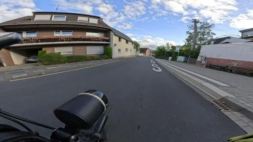
Dorfschänke Alt Merzbach
Restaurant · Regional, Kleine Einfache Speisen · 3.0 km
Dorfschänke betrieben von der Genossenschaft Dorfschänke Alt Merzbach eG. Unser Motto Miteinander - Füreinander. Alle die hier...
45 Merzbacher Straße, Rheinbach
We,Fr 18:00-22:00; Su 11:00-21:00
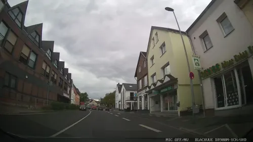
Mingo China Restaurant
Restaurant · Chinese
Chinesisches Buffet und japanische Sushi
12 Grabenstraße, Rheinbach
Mo,We-Sa 11:30-15:00,17:30-22:30; PH,Su 11:30-22:30
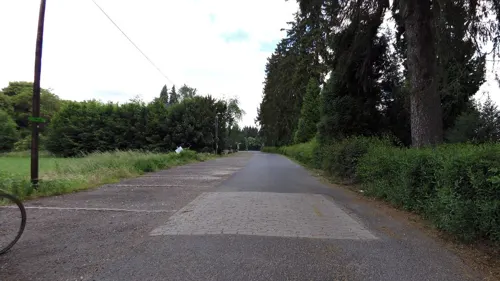
Waldgaststätte Bahnhof Kottenforst
Restaurant · German · 6.6 km
8 Bahnhof Kottenforst, Meckenheim
Tu-Su 11:00+; Mo off
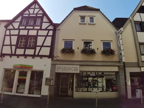
Anna Seibert
Restaurant · Regional
5 Am Bürgerhaus, Rheinbach
Mo-Tu 12:00-15:00,17:30-22:00; Th-Sa 12:00-15:00,17:30-22:00; Su...

Da Ernesto
Restaurant · Pizza, Noodle, Italian · 6.6 km
3 Toniusplatz, Swisttal
Tu, Sa 18:00-22:00; We,Th,Fr,Su 12:00-14:30,18:00-22:00
Der Süden - Café & italienische Küche
Restaurant · Italian
19 Pützstraße, Rheinbach
Tu-Th 09:30-18:00, Fr-Sa 10:00-21:30
Kumar´s Restaurant
Restaurant · Burger, Indian, Regional
17 Langgasse, Rheinbach
Tu-Sa 17:00-23:00; Su 12:00-14:00, 17:00-22:00


La Taverna
Restaurant · Indian · 5.1 km
80 Hauptstraße, Meckenheim
Su-Mo, We-Fr 11:30-14:30, 17:00-22:30; Sa 17:00-22:30
128 more on the map.
History
Around 80 AD, the Eifel Aqueduct, one of the longest aqueducts of the Roman Empire, was running through what is today Rheinbach's town centre. The first written documentation of Rheinbach dates back to 762, when Pepin the Short, then King of the Franks, gave lands to the Prüm Abbey. In the early 17th century, Rheinbach came to prominence because of its witch hunts.
First referred to as a town in 1298, the Archbishop of Cologne purchased Rheinbach and the surrounding villages in 1343. Till 1789, Rheinbach was part of the Electorate of Cologne. In 1794, Rheinbach was incorporated into France within the Département de Rhin-et-Moselle before coming under the auspices of Prussia in 1815.
Around 1947, a considerable number of displaced people from the Sudetenland settled in Rheinbach. Having brought their traditions of glasscraft, Rheinbach became famous for its glass art and today hosts a glass art museum and a specialized school.
From the History section of Rheinbach on Wikipedia, under CC BY-SA 4.0.
Where to stay16
Churches and places of worship37
Alt St. Petrus und Paulus
Church · Roman Catholic · 5.3 km
Orbachstraße, Swisttal
St. Stephanus
Church · Catholic · 6.9 km
1 Markt Flamersheim, Euskirchen
Wallfahrtskirche Sankt Katharina
Church · Roman Catholic · 6.6 km
Dietkirchenstraße, Swisttal
St. Ägidius
Church · Roman Catholic · 2.6 km
21 Oberdreeser Straße, Rheinbach
Shopping51
Gas and EV charging27
Strom-Strassenlaterne Himmeroder Wall 11
EV charging
11 Himmeroder Wall, Rheinbach
Schools, colleges and libraries35
Katholische Öffentliche Bücherei St. Martin
Library · 3.7 km
16 Kantenberg, Rheinbach
Healthcare17
Map of Rheinbach
250 places. The map loads OpenStreetMap tiles when you open it.
Getting there and nearby towns
Cologne Bonn Airport (CGN) is the nearest airport with scheduled flights listed in OpenStreetMap, 30 km away.
- Wachtberg 11 km east, about 11 min by car
- Bonn 16 km northeast, about 16 min by car
- Weilerswist 16 km northwest, about 16 min by car
- Wesseling 22 km north, about 22 min by car
- Zülpich 22 km west, about 22 min by car
- Sankt Augustin 24 km northeast, about 24 min by car
- Troisdorf 25 km northeast, about 25 min by car
- Siegburg 27 km northeast, about 27 min by car
- Zündorf 28 km north, about 28 min by car
- Köln 34 km north, about 34 min by car
Drive times are estimates from straight-line distance, not routes.
Local news
Headlines from INDB.
Reviews, tips and questions
Loading what members have shared...
Sources and licences
- GeoNames (CC BY 4.0): population, coordinates, regions and time zone
- Mapillary (see each image): photos
- OpenStreetMap contributors (ODbL 1.0): places, airports, map data
- Wikidata (CC0 1.0): elevation, founding date, time zone, website, landmarks and historic places
- Wikimedia Commons (see each image): photos
- Wikipedia (CC BY-SA 4.0): overview and history text
Photo credits
- Rheinbach August 2013, ToLo46, CC BY-SA 4.0
- Offenes Bücherregal Rheinbach, Bungert55, CC BY-SA 3.0
- Rheinbach Weiherstraße 10 (02), Prof. emeritus Hans Schneider (Geyersberg), CC BY-SA 4.0
- Rheinbach Weiherstraße 10 (01), Prof. emeritus Hans Schneider (Geyersberg), CC BY-SA 4.0
- Rheinbach Weiherstraße 10 (03), Prof. emeritus Hans Schneider (Geyersberg), CC BY-SA 4.0
- RheinbachHauptstraße 10 (04), Prof. emeritus Hans Schneider (Geyersberg), CC BY-SA 4.0
- RheinbachHauptstraße 10 (03), Prof. emeritus Hans Schneider (Geyersberg), CC BY-SA 4.0
- Rheinbach Hauptstraße Kirche (06), Prof. emeritus Hans Schneider (Geyersberg), CC BY-SA 4.0
- Rheinbach, Aufräumen nach dem Hochwasser Juli 2021-2563, Raimond Spekking, CC BY-SA 4.0
- RheinbachHauptstraße 10 (01), Prof. emeritus Hans Schneider (Geyersberg), CC BY 4.0
- Rheinbach Hauptstraße Kirche (04), Prof. emeritus Hans Schneider (Geyersberg), CC BY-SA 4.0
- Rheinbach Hauptstraße Kirche (01), Prof. emeritus Hans Schneider (Geyersberg), CC BY 4.0
- Wohnhaus Rheinbach Bachstraße 3 (01), Prof. emeritus Hans Schneider (Geyersberg), CC BY-SA 4.0
- Rheinbach, die Hauptstraße, Dguendel, CC BY 3.0
- Rheinbach, Raths Gasthaus, Dguendel, CC BY 3.0
- Rheinbach Polligsstraße 13 (01), Prof. emeritus Hans Schneider (Geyersberg), CC BY-SA 4.0
- Wohnhaus Rheinbach Bachstraße 3 (02), Prof. emeritus Hans Schneider (Geyersberg), CC BY-SA 4.0
- Rheinbach, Aufräumen nach dem Hochwasser Juli 2021-2583, Raimond Spekking, CC BY-SA 4.0
- Rheinbach, Aufräumen nach dem Hochwasser Juli 2021-2582, Raimond Spekking, CC BY-SA 4.0
- Rheinbach Hauptstraße Kirche (05), Prof. emeritus Hans Schneider (Geyersberg), CC BY-SA 4.0
- Rheinbach, die Blindgasse, Dguendel, CC BY 3.0
- Rheinbach Bachstraße 14 (03), Prof. emeritus Hans Schneider (Geyersberg), CC BY-SA 4.0
- Rheinbach, Aufräumen nach dem Hochwasser Juli 2021-2579, Raimond Spekking, CC BY-SA 4.0
- Rheinbach Bachstraße 5 (01), Prof. emeritus Hans Schneider (Geyersberg), CC BY-SA 4.0
- Rheinbach, Aufräumen nach dem Hochwasser Juli 2021-2564, Raimond Spekking, CC BY-SA 4.0
- Rheinbach Weiherstraße 24 (01), Prof. emeritus Hans Schneider (Geyersberg), CC BY-SA 4.0
- Rheinbach, Kirche St. Martin, Dguendel, CC BY 3.0
- Rheinbach, Aufräumen nach dem Hochwasser Juli 2021-2559, Raimond Spekking, CC BY-SA 4.0
- Rheinbach Polligsstraße 7 (03), Prof. emeritus Hans Schneider (Geyersberg), CC BY-SA 4.0
- Rheinbach Bachstraße 14 (02), Prof. emeritus Hans Schneider (Geyersberg), CC BY-SA 4.0
- Rheinbach Hauptstraße Kirche (02), Prof. emeritus Hans Schneider (Geyersberg), CC BY-SA 4.0
- Rheinbach Polligsstraße 17 (04), Prof. emeritus Hans Schneider (Geyersberg), CC BY-SA 4.0
- Rheinbach Polligsstraße 13 (02), Prof. emeritus Hans Schneider (Geyersberg), CC BY-SA 4.0
- Rheinbach, Aufräumen nach dem Hochwasser Juli 2021-2584, Raimond Spekking, CC BY-SA 4.0
- Rheinbach, Aufräumen nach dem Hochwasser Juli 2021-2558, Raimond Spekking, CC BY-SA 4.0
- Rheinbach Polligsstraße 6 (02), Prof. emeritus Hans Schneider (Geyersberg), CC BY-SA 4.0
- Rheinbach Bachstraße 14 (01), Prof. emeritus Hans Schneider (Geyersberg), CC BY-SA 4.0
- Rheinbach, Aufräumen nach dem Hochwasser Juli 2021-2557, Raimond Spekking, CC BY-SA 4.0
- Rheinbach Bachstraße 16 (04), Prof. emeritus Hans Schneider (Geyersberg), CC BY-SA 4.0
- Rheinbach Polligsstraße 7 (02), Prof. emeritus Hans Schneider (Geyersberg), CC BY-SA 4.0
- Alt St. Peter und Paul (Odendorf) (04), Chris06, CC BY-SA 4.0
- Burg Peppenhoven 005x, Wolkenkratzer, CC BY-SA 3.0
- St. Joseph-Gymnasium Rheinbach, tohma, CC BY-SA 4.0
- 2025 Evangelische Versöhnungskirche Buschhoven (1), Chris06, CC BY-SA 4.0
- Schweinheim (Euskirchen) Heilige Dreifaltigkeit5800, Reinhardhauke, CC BY-SA 3.0
- St. Stephanus Flamersheim-3030, Raimond Spekking, CC BY-SA 4.0
- StKatharinaBuschhoven, Túrelio, CC BY-SA 3.0 de
- Waldhotel Rheinbach 2010, Elke Wetzig ( Elya ), CC BY-SA 3.0
- Burg Morenhoven 013x, Wolkenkratzer, CC BY-SA 3.0
- Rheinbach, Polligsstr. 3-5, Himmeroder Hof Glasmuseum (27), Elke Wetzig ( User:Elya ), CC BY-SA 3.0
- Rheinbach OT Hilberath, Eidbusch 8, Katholische Pfarrkirche St. Martin (13), Elya, CC BY-SA 3.0
- St. Antonius (Niederdrees) (1), Chris06, CC BY-SA 4.0
- Oberdrees Sankt Aegidius, Klaus Graf, CC BY 2.0
- 2025 Friedenskirche (Meckenheim im Rheinland) (1), Chris06, CC BY-SA 4.0
- Evangelisches Dietrich-Bonhoeffer-Haus (Odendorf) (1), Chris06, CC BY-SA 4.0
- Ramershoven Schmidtheimer Straße Kirche (02), Prof. emeritus Hans Schneider (Geyersberg), CC BY 4.0
- BusinessCampus RB, Unkulus, CC BY 3.0
- Burg Flamersheim 024x, Wolkenkratzer, CC BY-SA 4.0
- Burg Ringsheim 002x, Wolkenkratzer, CC BY-SA 4.0
- Burg Schweinheim 008x, Wolkenkratzer, CC BY-SA 4.0
- Lüfthildis-Bildstock im Kottenforst, ToLo46, CC BY-SA 4.0
- Tomburg 2006, Mabol!, CC BY-SA 3.0
- Naturschutzgebiet Eifelfuß 01, Assenmacher, CC BY-SA 4.0
- Flerzheim 2014, Elldex, CC BY-SA 3.0
- Rheinbach, Hauptstraße 8, Katholische Pfarrkirche St. Martin (195), Elke Wetzig ( User:Elya ), CC BY-SA 3.0
- Street-level photo, chuck, CC BY-SA 4.0
- Street-level photo, mapillaryme, CC BY-SA 4.0
- Street-level photo, dcp, CC BY-SA 4.0
- Street-level photo, raymond, CC BY-SA 4.0
- Street-level photo, dcp, CC BY-SA 4.0
- Street-level photo, dcp, CC BY-SA 4.0
- Street-level photo, dcp, CC BY-SA 4.0
- Street-level photo, raymond, CC BY-SA 4.0
- Street-level photo, coha, CC BY-SA 4.0
- Street-level photo, VIA_KK, CC BY-SA 4.0
- Street-level photo, VIA_DT, CC BY-SA 4.0
- Street-level photo, KernelError, CC BY-SA 4.0
- Street-level photo, coha, CC BY-SA 4.0
- Street-level photo, VIA_KK, CC BY-SA 4.0
- Street-level photo, dcp, CC BY-SA 4.0
- Street-level photo, raymond, CC BY-SA 4.0
- Street-level photo, Lowiekse, CC BY-SA 4.0
- Street-level photo, raymond, CC BY-SA 4.0
- Street-level photo, dcp, CC BY-SA 4.0
- Street-level photo, raymond, CC BY-SA 4.0
- Street-level photo, raymond, CC BY-SA 4.0
- Street-level photo, VIA_DT, CC BY-SA 4.0
- Street-level photo, pepu0815, CC BY-SA 4.0


Page built November 8, 2026. Spotted a mistake? Tell us or suggest a place.