


Bad Oeynhausen, Germany
Bad Oeynhausen is a town of 49,513 people in North Rhine-Westphalia, Germany.
Why visit Bad Oeynhausen
Townapedia lists 90 museums and landmarks, 40 parks and trails, 194 places to eat, 68 places to stay and 9 attractions in and around town.
Highlights include GOP Bad Oeynhausen, Theater im Park, Deutsche Märchen- und Wesersagenmuseum and Schloss Ovelgönne.
Weather in Bad Oeynhausen
Forecast from MET Norway (CC BY 4.0). Full forecast
About Bad Oeynhausen
Bad Oeynhausen (German: [baːt ˈʔøːnˌhaʊ̯zn̩] ) is a spa town on the southern edge of the Wiehengebirge in the district of Minden-Lübbecke in the East-Westphalia-Lippe region of North Rhine-Westphalia, Germany. The closest larger cities are Bielefeld (39 kilometres southwest) and Hanover (80 km east).
From the Wikipedia article Bad Oeynhausen (this version), under CC BY-SA 4.0.
Photos of Bad Oeynhausen


Things to do9



MOHMES BIO LADEN
Farm and orchard · 1.8 km
Selbstbedienung
68 Hahnenkampstraße, Bad Oeynhausen
06:00-22:00


Museums and landmarks90

Deutsche Märchen- und Wesersagenmuseum
Museum · 0.6 km
Villa
3 Am Kurpark, Bad Oeynhausen
We-Su 10:00-12:00,14:00-17:00; Mo-Tu off

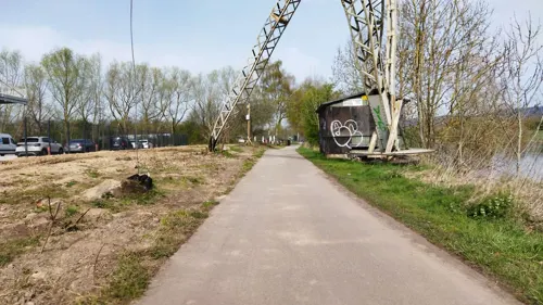
historischer Ladekran
Monument and historic site · 2.3 km
Technical_monument



78 more on the map.
Parks, trails and playgrounds40


Großsteingrab von Werste
Park · 2.1 km
Rekonstruktion eines Großsteingrabes, von anderer Stelle versetzt



28 more on the map.
Restaurants and cafes194
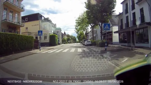
Der Koch
Restaurant · German · 1.1 km
36 Herforder Straße, Bad Oeynhausen
We-Sa 11:00-14:00,17:00+; Su 11:00+
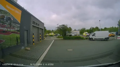
Pizzaria Rondinella Inh. Faris Seven
Restaurant · Pizza · 3.4 km
20 Wibbeltstraße, Löhne
We-Mo,PH 17:00-24:00
Reyna
Restaurant · Turkish
59 Herforder Straße, Bad Oeynhausen
Mo-Tu 11:00-23:00; Fr-Sa 11:00-00:00; Su 10:00-23:00
Syrtaki
Restaurant · Greek
3 Alter Rehmer Weg, Bad Oeynhausen
Tu-Sa 17:30-23:00; Su 11:30-14:30, 17:30-23:00

China Restaurant CAO
Restaurant · Asian · 1.0 km
14 Parkstraße, Bad Oeynhausen
Mo 17:30-24:00; Tu-Su 12:00-15:00,17:30-24:00
Hotel Restaurant WeserSchiffchen
Restaurant · Regional · 4.0 km
62 Unterloh, Porta Westfalica
Tu-Sa 11:30-14:00,17:00-22:00, Su 11:30-22:00
La Fontana
Restaurant · Italian · 3.2 km
5 Nordbahnstraße, Löhne
Mo-Tu, Th-Fr 17:00-22:00; Sa-Su 11:00-15:00, 17:00-22:00
182 more on the map.
History
In the village of Bergkirchen, which belongs to Bad Oeynhausen, a wellspring sanctuary existed in pre-Christian (Saxon) times at the local crossing of the Wiehengebirge, which was replaced in the 9th century by a church. Today's church is a subsequent building. On the church and the downhill-situated Widukind spring plates explain this further. A few metres from the church a 13th-century timbered homestead can still be found.
In 753 Pepin the Short, according to the Royal Frankish Annals, stopped over ad locum qui dicitur Rimiae, so that Rehme is commonly accepted as the oldest part of town.
The origin myth of Bad Oeynhausen relates that in 1745 a local farmer named Sültemeyer noticed that after his pigs had wallowed in nearby mud they had a salty crust on their backs and he decided to investigate the source. After public awareness of this finding, King Frederick II of Prussia ordered the construction of a saltworks, which was named "Royal Saline Neusalzwerk". Today's Sültemeyer Fountain (colloquial: Pig-Fountain), in the city centre, is a reminder of the city's beginning.
Read more of the history
After 1830, mining captain Carl Baron of Oeynhausen (1795–1865) oversaw drilling in today's spa garden area in search of salt deposits, but instead found a thermal salt spring in 1845. Quickly the healing abilities of this spring were discovered and first baths were built in the community, which now was called "Neusalzwerk near Rehme". In 1848 King Frederick William IV of Prussia renamed it to "Royal Bath (German: Bad) Oeynhausen", and this name was retained after receiving its own town charter in 1860.
The opening of the Cologne-Minden railway line in 1847 connected the city with railroad network.
The growth of spa activities and the town's development continued into World War II. Among other things the Kurpark (spa garden), according to plans by Peter Joseph Lenné, and the Kurhaus (spa hotel) in 1908 (from 1980 to 2002 a Casino was located here; today called the Kaiserpalais, it hosts a Varieté, a noble restaurant and a discothèque) were constructed. At the beginning of the 20th century residential houses for the bourgeoisie were built around the spa garden. The extraordinary conglomeration of different architectural styles of the spa garden's buildings and the surrounding mansions bestowed Bad Oeynhausen the unofficial title "Museum for the Architecture of the 19th Century".
One of the most famous buildings, the "Farne-Villa" was replaced by a new building in 1969.
In the first half of the 20th century additional thermal salt springs were drilled. Among these the Jordansprudel, drilled in 1926, is best known and with a capacity of 6000 L/min and a total height of up to 40 m it is the world's highest carbonated thermal salt spring and de facto the town's landmark.
Under Nazi Germany, Bad Oeynhausen hosted a synod of the Confessing Church, as well as the home congregation to Jakob Emil Karl Koch, a leading member. The World War II tank factory of the town was bombed on 30 March 1945. Post-war, the town hosted the Control Commission for Germany – British Element (CCG/BE), the military government for the British Zone of Occupation and served as the British Army of the Rhine headquarters.
The town was returned to local control in 1954 and spa activities resumed. In 1973, the seven surrounding municipalities Wulferdingsen, Volmerdingsen, Werste, Eidinghaisen, Dehme, Rehme and Lohe of the former "Amt Rehme" were merged with Bad Oeynhausen into one commune. The "State-owned Spa Bad Oeynhausen" (German: Staatsbad), property of the state of North Rhine-Westphalia, was municipalised in 2004.
From the History section of Bad Oeynhausen on Wikipedia, under CC BY-SA 4.0.
More about Bad Oeynhausen
Geography
Bad Oeynhausen is located on the left bank of the Weser river. It has the world's most highly carbonated thermal saltwater fountain, the Jordansprudel. On calm days the fountain gets up to 40 metres high. The water of the spring is believed to have many medicinal qualities, giving rise to a number of health spas.
This applies to the entire district of Minden-Lübbecke, where the majority of the land is used for agriculture.
From the Wikipedia article Bad Oeynhausen, under CC BY-SA 4.0.
Notable people from Bad Oeynhausen
 Arne FriedrichGerman association football playerPhoto: Sven Mandel, CC BY-SA 4.0
 Ernst-Wilhelm RaheGerman politicianPhoto: Gerd Seidel ( Rob Irgendwer ), CC BY-SA 3.0
 Grant Hendrik TonneGerman politicianPhoto: Foto-AG Melle, CC BY 3.0
 Arndt KlockeGerman politicianPhoto: Grüne Landtagsfraktion NRW, CC BY-SA 4.0
 F. Wolfgang SchnellAgroscientist (1913–2006)Photo: Sabine Schnell - digitized image, CC BY-SA 3.0
- Arnold BüscherGerman Nazi concentration camp commandant (1899-1949)
- August von BorriesGerman railway engineer (1852–1906)
- Friedrich AltemeierGerman flying ace (1886-1968)
- Friedhelm FarthmannGerman politician
- Walther LudwigGerman opera singer (1902-1981)
- Rita RohlfingGerman painter, photographer and installation artist
- Victor PerliGerman politician
Born in Bad Oeynhausen, according to Wikidata (CC0). Each name links to its Wikipedia article.
Where to stay68
Churches and places of worship40
Evangelische Kirche Babbenhausen-Oberbecksen
Church · Lutheran · 3.0 km
51 Babbenhausener Straße, Bad Oeynhausen
Shopping45
Gas and EV charging24
Kohlenhof Gohfeld H. Koch GmbH & Co. KG
Gas station · 2.8 km
45 Im Depenbrock, Löhne
Schools, colleges and libraries32
Medizinische Bibliothek Herzzentrum Bad Oeynhausen
Library · 1.7 km
11 Georgstraße, Bad Oeynhausen
Healthcare29
Map of Bad Oeynhausen
250 places. The map loads OpenStreetMap tiles when you open it.
Getting there and nearby towns
Flugplatz Bielefeld (BFE) is the nearest airport with scheduled flights listed in OpenStreetMap, 32 km away.
- Vlotho 6 km southeast, about 6 min by car
- Löhne 8 km west, about 8 min by car
- Porta Westfalica 8 km east, about 8 min by car
- Minden 12 km northeast, about 12 min by car
- Kirchlengern 12 km west, about 12 min by car
- Hüllhorst 12 km northwest, about 12 min by car
- Herford 14 km southwest, about 14 min by car
- Hiddenhausen 14 km west, about 14 min by car
- Stift Quernheim 13 km west, about 13 min by car
- Bad Salzuflen 14 km south, about 14 min by car
Drive times are estimates from straight-line distance, not routes.
Towns near Bad Oeynhausen


Keep exploring
Local news
Headlines from INDB.
Reviews, tips and questions
Loading what members have shared...
Sources and licences
- GeoNames (CC BY 4.0): population, coordinates, regions and time zone
- Mapillary (see each image): photos
- OpenStreetMap contributors (ODbL 1.0): places, airports, map data
- Wikidata (CC0 1.0): elevation, founding date, time zone, website, landmarks and historic places
- Wikimedia Commons (see each image): photos
- Wikipedia (CC BY-SA 4.0): overview and history text
Photo credits
- Bad Oeynhausen Sültemeierbrunnen 2011, Ub12vow, CC BY 3.0
- Bahnhofsschild Bad Oeynhausen 190601, Clic, CC BY-SA 4.0
- Bad Oeynhausen, 2009-Nov (3), TUBS, Public domain
- Bad Oeynhausen, 2009-Nov (2), TUBS, Public domain
- Von-Moeller-Straße 19 in Bad Oeynhausen, Curata Pflegeresidenz Haus Svenja (81819), Bernd Schwabe in Hannover, CC BY-SA 4.0
- Von-Moeller-Straße 19 in Bad Oeynhausen, Curata Pflegeresidenz Haus Svenja, Bernd Schwabe in Hannover, CC BY-SA 4.0
- (20250716) Bad Oeynhausen 33, Roy Zuo, CC BY-SA 4.0
- Bad Oeynhausen, 2009-Nov (4), TUBS, Public domain
- Najade-Brunnen Bad Oeynhausen 7588, Gerd Fahrenhorst, CC BY 4.0
- Stadtsparkasse Bad Oeynhausen, Gerd Fahrenhorst, CC BY 4.0
- Bad Oeynhausen station in 2026, Schwede66, CC BY-SA 4.0
- (20250716) Bad Oeynhausen 41, Roy Zuo, CC BY-SA 4.0
- (20250716) Bad Oeynhausen 32, Roy Zuo, CC BY-SA 4.0
- Bad Oeynhausen, 2009-Nov (1), TUBS, Public domain
- (20250716) Bad Oeynhausen 36, Roy Zuo, CC BY-SA 4.0
- (20250716) Bad Oeynhausen 35, Roy Zuo, CC BY-SA 4.0
- (20250716) Bad Oeynhausen 40, Roy Zuo, CC BY-SA 4.0
- (20250716) Bad Oeynhausen 42, Roy Zuo, CC BY-SA 4.0
- (20250716) Bad Oeynhausen 38, Roy Zuo, CC BY-SA 4.0
- (20250716) Bad Oeynhausen 34, Roy Zuo, CC BY-SA 4.0
- (20250716) Bad Oeynhausen 28, Roy Zuo, CC BY-SA 4.0
- (20250716) Bad Oeynhausen 27, Roy Zuo, CC BY-SA 4.0
- (20250716) Bad Oeynhausen 31, Roy Zuo, CC BY-SA 4.0
- (20250716) Bad Oeynhausen 43, Roy Zuo, CC BY-SA 4.0
- (20250716) Bad Oeynhausen 30, Roy Zuo, CC BY-SA 4.0
- (20250716) Bad Oeynhausen 29, Roy Zuo, CC BY-SA 4.0
- Najade-Brunnen vor der Hohenzollernpassage in Bad Oeynhausen, Mozamaniac, CC BY-SA 4.0
- Holocaust-Gedenkbrunnen in Bad Oeynhausen, Mozamaniac, CC BY 4.0
- Sültemeyer-Brunnen Bad Oeynhausen 6084, Gerd Fahrenhorst, CC BY 4.0
- Sültemeyer-Brunnen Bad Oeynhausen 6085, Gerd Fahrenhorst, CC BY 4.0
- (20250716) Bad Oeynhausen 26, Roy Zuo, CC BY-SA 4.0
- (20250716) Bad Oeynhausen 39, Roy Zuo, CC BY-SA 4.0
- (20250716) Bad Oeynhausen 25, Roy Zuo, CC BY-SA 4.0
- Porta Westfalica - Altteich Costedt - 04, Ath, CC0
- Vlotho-Amthausberg-Weser, Jcg2006, Public domain
- Auferstehungskirche Bad Oeynhausen 2021-04-25, Z thomas, CC BY-SA 4.0
- Auferstehungskirche Dehme nach 1951, Torman70, CC BY-SA 4.0
- Werste-Steingrab, Grugerio, CC BY-SA 3.0
- BadO-Denkmal-072-2012-06-21-0992, Gwexter, CC BY-SA 3.0
- Laurentiuskirche-Rehme, Grugerio, CC BY-SA 3.0
- Kirche-Holtrup, Grugerio, CC BY-SA 3.0
- Bad Oeynhausen Werre-Park 2011, Ub12vow, CC BY-SA 3.0
- GutDeesberg1, Ingo2802, CC BY-SA 3.0
- Haupteingang HDZ NRW, HDZ NRW, CC BY-SA 3.0
- Kirche-Bonneberg-2009-05-16-0457, Gwexter, CC BY-SA 3.0
- Löhne Wittel Lukaskirche gesamt, Tebdi, CC BY-SA 3.0
- Kirche Lohe 2012-04-19-10091, Gwexter, CC BY-SA 3.0
- Schloss Ovelgoenne, The original uploader was Ingo2802 at German Wikipedia . ( Original text: Ingo2802 21:26, 26. Jan. 2008 (CET) ), CC BY-SA 3.0
- Gohfeld Simeonkirche, Chris06, Public domain
- Bad Oeynhausen Kurparktheater 2011, Ub12vow, CC BY 3.0
- Bad Oeynhausen, 2009-Nov (44), TUBS, Public domain
- Exter - NSG Mittelbachtal - 4, Ath, CC0
- Kurpark in Bad Oeynhausen - panoramio, qwesy qwesy, CC BY 3.0
- Löhne Siemshof Heilandkirche, Tebdi, CC BY-SA 3.0
- Stolperstein Adolf Meyer, Uwe Rohwedder, CC BY-SA 4.0
- Stolperstein Adolf Wolf, Uwe Rohwedder, CC BY-SA 4.0
- Stolperstein Benjamin Berlinger, 1, Wiesenstraße 28, Bad Oeynhausen, Landkreis Minden-Lübbecke, GeorgDerReisende, CC BY-SA 4.0
- Stolperstein Berta Grünenklee, 1, Öringsener Straße 1, Bad Oeynhausen, Landkreis Minden-Lübbecke, GeorgDerReisende, CC BY-SA 4.0
- Stolperstein Berta Meyer, Uwe Rohwedder, CC BY-SA 4.0
- Stolperstein Edith Ruth Frank, 1, Herforder Straße 44, Bad Oeynhausen, Landkreis Minden-Lübbecke, GeorgDerReisende, CC BY-SA 4.0
- NSG-Blutwiese 01, Grugerio, CC0
- NSG-Borstenbachtal-01, Grugerio, CC BY-SA 3.0
- NSG-Sudbachtal, Grugerio, CC BY-SA 3.0
- Klinik am Korso, Veit Mette, CC BY-SA 3.0
- Stolpersteine Familie Vorreuter, Uwe Rohwedder, CC BY-SA 4.0
- Street-level photo, derlipper, CC BY-SA 4.0
- Street-level photo, derlipper, CC BY-SA 4.0
- Street-level photo, derlipper, CC BY-SA 4.0
- Street-level photo, derlipper, CC BY-SA 4.0
- Street-level photo, derlipper, CC BY-SA 4.0
- Street-level photo, Schmarvis, CC BY-SA 4.0
- Street-level photo, Schmarvis, CC BY-SA 4.0
- Street-level photo, derlipper, CC BY-SA 4.0
- Street-level photo, Hightower-, CC BY-SA 4.0
- Street-level photo, changchun1, CC BY-SA 4.0
- Street-level photo, derlipper, CC BY-SA 4.0
- Street-level photo, Schmarvis, CC BY-SA 4.0
- Street-level photo, thetornado76, CC BY-SA 4.0
- Street-level photo, Schmarvis, CC BY-SA 4.0
- Street-level photo, derlipper, CC BY-SA 4.0
- Street-level photo, Schmarvis, CC BY-SA 4.0
- Street-level photo, Schmarvis, CC BY-SA 4.0
- Street-level photo, derlipper, CC BY-SA 4.0
- Street-level photo, Schmarvis, CC BY-SA 4.0
- Street-level photo, Schmarvis, CC BY-SA 4.0
- Street-level photo, Schmarvis, CC BY-SA 4.0
- Street-level photo, derlipper, CC BY-SA 4.0
- Street-level photo, derlipper, CC BY-SA 4.0
- Street-level photo, Schmarvis, CC BY-SA 4.0
- Street-level photo, Schmarvis, CC BY-SA 4.0


Page built November 9, 2026. Spotted a mistake? Tell us or suggest a place.