


Bad Salzuflen, Germany
Bad Salzuflen is a town of 54,899 people in North Rhine-Westphalia, Germany.
Why visit Bad Salzuflen
Townapedia lists 116 museums and landmarks, 60 parks and trails, 197 places to eat, 35 places to stay and 21 attractions in and around town.
Highlights include Tierpark Herford, Bismarckturm Bad Salzuflen, Bismarckturm Herford and Katzenturm.
Weather in Bad Salzuflen
Forecast from MET Norway (CC BY 4.0). Full forecast
About Bad Salzuflen
Bad Salzuflen (German pronunciation: [baːt zaltsˈʔʊflən] ) is a town and thermal spa resort in the Lippe district of North Rhine-Westphalia, Germany. At the end of 2013, it had 52,121 inhabitants.
From the Wikipedia article Bad Salzuflen (this version), under CC BY-SA 4.0.
Photos of Bad Salzuflen


Things to do21


Bismarckturm Bad Salzuflen
Scenic view · 3.5 km
Schlüssel im Cafe Hollenstein abholen

Bad Salzuflen
Monument and historic site
Town in the Lippe district of North Rhine-Westphalia, Germany

Stadttheater Herford
Cinema and theater · 5.9 km
Theatre in Herford, Germany, used by touring companies


Hofladen C. v. Laer
Farm and orchard · 5.3 km
Senderstraße, Herford
Mo-Fr 09:00-19:00, Sa,Su 08:00-19:00
Hofladen Weißenbach
Farm and orchard · 2.7 km
1 Fritz-Niewald-Weg, Bad Salzuflen
Tu 09:30-12:30,15:00-18:00, Th 09:00-12:30, Fr...


9 more on the map.
Museums and landmarks116

Bismarckturm Herford
Monument and historic site · 4.3 km
Bismarckturm; Stuckenberg; Gedenk- und Aussichtsturm
Apr-Oct: Su[1] 11:00-17:00; Apr-Oct: Su[3] 11:00-17:00; Apr-Oct:...


Bauernburg Schwaghof
Monument and historic site · 2.4 km
Schwaghof, Bad Salzuflen

Gut Steinbeck
Monument and historic site · 2.3 km
1 Steinbeck, Bad Salzuflen

Haus Gießenbier
Monument and historic site
32 Am Markt, Bad Salzuflen


Leopold Sprudel
Monument and historic site · 0.6 km
Baujahr: 1905/06; Tiefe: 543m

104 more on the map.
Parks, trails and playgrounds60

H2O Herford
Sports field and stadium · 4.5 km
90 Wiesestraße, Herford
Mo-Fr 10:00-22:00;PH,Sa,Su 09:00-22:00


Ludwig-Jahn-Stadion
Sports field and stadium · 4.4 km
22 Dennewitzstraße, Herford

48 more on the map.
Restaurants and cafes197
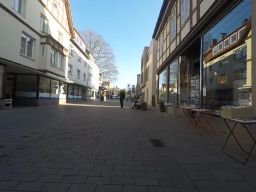
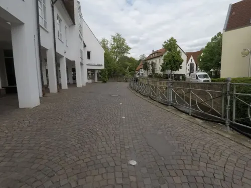
Café Rosenbogen
Cafe · Coffee Shop, Breakfast
4 Im Ort, Bad Salzuflen
Mo,PH off; Tu 14:00-18:00; We-Fr 09:30-18:00; Sa 09:30-17:00; Su...
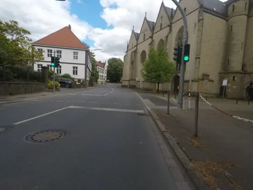
Griechisches Restaurant Sokrates
Restaurant · Greek · 5.2 km
16 Steinweg, Herford
We-Sa 17:30-23:00; Su 12:00-14:30,17:30-23:00
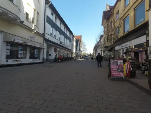
Koi Sushi
Restaurant · Japanese, Vietnamese
7 Am Markt, Bad Salzuflen
Mo-Fr 11:30-15:00,17:00-22:00; Sa,Su 12:00-15:00,16:30-22:00
Namaste
Restaurant · Indian
49 Wenkenstraße, Bad Salzuflen
Tu-Fr 11:30-14:30,17:00-22:00; Sa,Su 12:00-22:00

Restaurant und Hofcafe von Laer
Restaurant · Regional · 5.3 km
Hofanlage;Haupthaus, datiert 1769 mit Erweiterung aus dem 19. Jahrhundert, mit mehreren Nebengebäuden aus der Zeit um 1800 mit...
23 Senderstraße, Herford
Tu-Th 14:30-22:00; Fr,Sa 12:00-22:00; Su 10:00-22:00
Akropolis Bad Salzuflen
Restaurant · Greek
1 Martin-Luther-Straße, Bad Salzuflen
Tu-Sa 17:00-23:00; Su 12:00-14:00, 17:00-22:00; Mo closed

Cafe Extrablatt
Cafe · Coffee Shop · 0.8 km
1 Lietholzstraße, Bad Salzuflen
Mo-Sa 08:30-24:00; Su 09:00-24:00

Karlchens Backstube
Bakery
32 Lange Straße, Bad Salzuflen
Mo-Fr 07:30-18:00; Sa 07:30-13:30; Su 09:00-17:00
Perle Sarde
Restaurant · Italian
4 Parkstraße, Bad Salzuflen
We,Th 16:30-22:00; Fr,Sa 11:00-13:30,16:30-22:00; Su 11:00-15:00
185 more on the map.
History
The first mention of the settlement of Uflon comes in the middle of the eleventh century and of a place of salt nearby. In Old High German "Uflon" means The Woods/Forest. This later evolved into Uflen, Mitteluflen and Dorf Uflen. Therefore, the entire name means The salt baths in the woods.
It was the use of the Pauline salt source in the Middle Ages that led to the establishment of the first Saline. These salt workshops were located at a place which is still called the Salt Yard or Salzhof and the well is represented in the town's coat of arms. Thanks to the lucrative salt trade and the promotion of the town to a city by the Counts of Sternberg, it was fortified with a circular wall and four gates. The Schliepsteiner gateway lies to the north (toward Exter), Heßkamper gateway to North East (toward Wüsten), Arminius to the southeast (toward Schotmar) and Herford Gateway to the West (toward Herford) with three fortified towers which also included the Katzenturm which can still be seen today. Until the Thirty Years' War, trading flourished with the white gold and brought great wealth to the town. The old houses, the sumptuous Bürgerhäuser and the Town Hall built in 1545/47 bear witness to this. The oldest surviving building in the city today is a three-storey Traufenbau of 1520.
Read more of the history
Bad Salzuflen was made famous by its cures. With its three drinking water, three thermal and three salt springs it had the status of a Lippischer State bath. Although the founding of the royal Solebads was made nearly 100 years ago, Salzuflen only received the additional name "Bad" on 14 April 1914.
Bad Salzuflen was one of the few cities in the Middle Ages that did not suffer from financial difficulties because of its salt production, its topographical position and its thriving commercial development. This is proven today by the many beautiful houses with their typical architectural style for that time. The high healing properties of the water meant that new bath houses were built and other sources were drilled, such as the Leopoldsprudel whose sacred well is in the midst of today's spa gardens. The development of the resort led to significant changes in the cityscape. The saltworks on the Salzhof discontinued salt production and is now the "town square" where the weekly market and town festivals take place. The Gradierwerke developed into a place that people with respiratory diseases retreated to. Over time, the long-established industry sectors disappeared and were replaced by the trading and spa industry, which benefited the numerous inns of the city.
The economic boom in the nineteenth century was also closely followed by the founding in 1850 of the Hoffmann starch factories that later rose to be the biggest European starch producers. The strategic location of Bad Salzuflen was rather insignificant and so was preserved largely during the Second World War from Allied bombing raids, and survived the war relatively unscathed after the war ended.
Between 1909 and 1924, the Bad Salzufler und Schötmarschen Straßenbahn GmbH plied their trade between those towns. From 1963, the Herford Light railway ran between the towns of Wallenbrück, Spenge, Herford, Vlotho, Weserhafen and the west of Herford.
From the History section of Bad Salzuflen on Wikipedia, under CC BY-SA 4.0.
More about Bad Salzuflen
Geography
Bad Salzuflen lies on the eastern edge of the Ravensberg Basin, at the confluence of the rivers Salze (Bega) with the Werre. Compared with other North Lippe communities it is densely populated. The city centre is surrounded by districts with a village-like feel to them and agricultural land. North east of the River Werre and Salze (Bega) a strand of the Lipper highlands runs through the largely wooded hills with elevations up to 250 metres in the city. The lowest point is on the border of the River Werre at Herford at about 70 metres. Since 2008 the city has been part of the Teutoburg Forest Nature Park / Eggegebirge.
The municipal area is crossed by the river floodplains of the Werre and the Salze. Podzol and Stagnosol brown soils prevail as soil types. The podzolic soils are mainly found in layers from the Tertiary Period, which are crossed by fault block from the Mesozoic. Characteristic of Bad Salzuflen are the saline springs that emerge at these geological folds and which give the region the name of "Germany's healing garden".
The geothermal heat sources are of sufficient quality that it makes it viable to use heat recovery systems utilising borehole heat exchangers and heat pumps.
Economy
Bad Salzuflen lies on Bundesstraße 239. The A2 (E34) runs near the city and has easy accessibility to Junction 28 from the Ostwestfalenstraße and Junction 29 from the 239 feeder road. Today Lockhauser Straße connects the eastern and the western part of the city. The two previously existing roads over the Bega and Werre rivers were not able to accommodate the traffic in the city. Therefore, in the early 1980s the construction of a four-lane elevated highway was needed in the city.
The central Bus station is called Am Markt. The city has four bus routes running hourly services which all run through Am Markt. All routes are operated by Bad Salzuflen GmbH, a subsidiary of Stadtwerke Bad Salzuflen. The surrounding cities of Bielefeld, Herford, Lemgo and on weekdays Oerlinghausen Vlotho-Exter are accessible by local buses from the bus station. Bad Salzuflen is part of the tariff association known as "The Six" (OWL Transport GmbH).
In the spa area operates a round route tourist service, the "Pauline-train". Starting point is the main entrance to the spa, at the Gradierwerk.
Arts and culture
The spa and town theatre has 498 seats but does not have its own ensemble. It is regularly played by the National Detmold and other visiting ensembles. The Detmold State ensemble regularly plays at the theatre.
On Kurgastzentrum is the entrance to the Kurpark and is adjacent to the Country Park. There are 120 acres available for long walks and are one of the largest town parklands in Germany.
The Kurpark of 1907 extends along the Salze river with lawns, mature trees and a large floral inventory with entrance controlled by a ticket attendant. Exiting at the large Kurparksee, where can be found a fountain and boat hire, charges do not apply and landscaped gardens can be found emptying onto the urban forest with hiking and biking trails up to the Salzuflen Bismarck Tower on the Vierenberg, Loose and the Herford Bismarck tower.
Located in the middle of Kurpark stands the landmark of Bad Salzuflen. The fountain temple of the Leopold thermal bubble. With the development of the spa in 1906 to a 534 m depth, it linked Salzuflen to the thermal bath.
In the district Schotmar part of the castle of Stietencron contains a park with old trees.
From the Wikipedia article Bad Salzuflen, under CC BY-SA 4.0.
Notable people from Bad Salzuflen
 Johann SchröderGerman chemist (1600-1664)Photo: The original uploader was Wewoewi at..., Public domain
 Jürgen von der LippeGerman entertainerPhoto: Raimond Spekking, CC BY-SA 4.0
 Rudolph BrandesGerman pharmacist (1795–1842)Photo: F. A. Zimmermann, Public domain
 Bettina HerlitziusGerman politicianPhoto: Bündnis 90/Die Grünen..., CC BY-SA 2.0
 Bernd BegemannGerman musicianPhoto: Hinnerk R , Hinnerk Rümenapf, CC BY-SA 3.0
- Ingrid HartmannCanoe racer (1930-2006)
- Hildegard OchseGerman photographer (1935-1997)
- Friedrich FrisiusGerman admiral (1895–1970)
- Janina KlassenGerman musicologist (born 1953)
- Walter BrandtGerman fighter ace and Knight's Cross recipient
- Peter SchwartzeGerman neuroscientist and former politician
- Jörg Sasseartist (born 1962)
Born in Bad Salzuflen, according to Wikidata (CC0). Each name links to its Wikipedia article.
Where to stay35
Churches and places of worship37
Sankt Johannes Baptist
Church · Catholic · 5.6 km
4 Komturstraße, Herford
Shopping48
Zentauron Showroom - Manufaktur für taktische Ausrüstung
Shop · 2.3 km
41 Otto-Hahn-Straße, Bad Salzuflen
Gas and EV charging18
Schools, colleges and libraries29
Healthcare26
MEDIAN Klinik am Burggraben Bad Salzuflen
Hospital · 1.6 km
47-49 Alte Vlothoer Straße, Bad Salzuflen
Map of Bad Salzuflen
250 places. The map loads OpenStreetMap tiles when you open it.
Getting there and nearby towns
Flugplatz Bielefeld (BFE) is the nearest airport with scheduled flights listed in OpenStreetMap, 19 km away.
- Herford 6 km northwest, about 6 min by car
- Leopoldshöhe 9 km south, about 9 min by car
- Lage 11 km south, about 11 min by car
- Löhne 12 km north, about 12 min by car
- Vlotho 12 km northeast, about 12 min by car
- Lemgo 12 km southeast, about 12 min by car
- Hiddenhausen 12 km northwest, about 12 min by car
- Bad Oeynhausen 14 km north, about 14 min by car
- Enger 14 km northwest, about 14 min by car
- Bielefeld 16 km west, about 16 min by car
Drive times are estimates from straight-line distance, not routes.
Towns near Bad Salzuflen


Keep exploring
Local news
Headlines from INDB.
Reviews, tips and questions
Loading what members have shared...
Sources and licences
- GeoNames (CC BY 4.0): population, coordinates, regions and time zone
- Mapillary (see each image): photos
- OpenStreetMap contributors (ODbL 1.0): places, airports, map data
- Wikidata (CC0 1.0): elevation, founding date, time zone, website, landmarks and historic places
- Wikimedia Commons (see each image): photos
- Wikipedia (CC BY-SA 4.0): overview and history text
Photo credits
- Gradierwerk Bad Salzuflen 3, Nakonana, CC BY-SA 4.0
- Bad Salzuflen - 207 - Im Ort 4, Tsungam, CC BY-SA 3.0
- Bad Salzuflen - 068 - Im Ort 5, Tsungam, CC BY-SA 3.0
- Bad Salzuflen - 016 - Im Ort 2, Tsungam, CC BY-SA 3.0
- Bad Salzuflen - 043 - Steege 2+4 (2), Tsungam, CC BY-SA 3.0
- Haus Obermeyer in Bad Salzuflen (20240924), Nakonana, CC BY-SA 4.0
- Geysirbrunnen Lange Straße Bad Salzuflen, Gerd Fahrenhorst, CC BY 4.0
- Brunnen Rosengarten Süd in Bad Salzuflen 1, Gerd Fahrenhorst, CC BY 4.0
- Brunnen Rosengarten Süd in Bad Salzuflen 2, Gerd Fahrenhorst, CC BY 4.0
- Steege 6 (Bad Salzuflen), Nakonana, CC BY-SA 4.0
- Steege 6 (Bad Salzuflen) 2, Nakonana, CC BY-SA 4.0
- Bad Salzuflen - 043 - Steege 2+4, Tsungam, CC BY-SA 3.0
- Lange Straße 35 (Bad Salzuflen) 2, Nakonana, CC BY-SA 4.0
- Lange Straße 35 (Bad Salzuflen) 3, Nakonana, CC BY-SA 4.0
- Lange Straße 35 (Bad Salzuflen), Nakonana, CC BY-SA 4.0
- Lange Straße 33 (Bad Salzuflen) 20240924 223135, Nakonana, CC BY-SA 4.0
- Lange Straße 33 (Bad Salzuflen), Nakonana, CC BY-SA 4.0
- Lange Straße 33 (Bad Salzuflen) 2, Nakonana, CC BY-SA 4.0
- Brunnenskulptur Rosengarten Mitte Bad Salzuflen 2, Gerd Fahrenhorst, CC BY 4.0
- Brunnenskulptur Rosengarten Mitte Bad Salzuflen 1, Gerd Fahrenhorst, CC BY 4.0
- Haus Backs (Bad Salzuflen) 2, Nakonana, CC BY-SA 4.0
- Wenkenstraße 10a (Bad Salzuflen) 20240518 202541 (retouched), Nakonana, CC BY-SA 4.0
- Haus Backs (Bad Salzuflen), Nakonana, CC BY-SA 4.0
- Denkmal 450 Jahre Schützengemeinschaft Bad Salzuflen 2, Gerd Fahrenhorst, CC BY 4.0
- Denkmal 450 Jahre Schützengemeinschaft Bad Salzuflen 1, Gerd Fahrenhorst, CC BY 4.0
- Brunnen auf dem Salzhof Bad Salzuflen, Gerd Fahrenhorst, CC BY 4.0
- Bad Salzuflen Gradierwerk 01310, Pelz, CC BY-SA 3.0
- Wenkenstraße 10a (Bad Salzuflen) 20240518 202330 (retouched), Nakonana, CC BY-SA 4.0
- Bad Salzuflen, die Paulinenquelle, Dguendel, CC BY 3.0
- Bad-Salzuflen Altes-Rathaus, Grugerio, CC BY-SA 3.0
- Herford, Baudenkmal 469, Portal, Drahreg01, CC BY-SA 3.0
- BS-Bauernburg-Schwaghof, Grugerio, CC BY-SA 3.0
- Bismarckturm-Bad-Salzuflen, Grugerio, CC BY-SA 3.0
- Herford - 2015-06-06 - Bismarckturm (01), Tsungam, CC BY-SA 4.0
- Evangelische-Kirche-Wüsten, Grugerio, CC BY-SA 3.0
- Herford St. Johannes Baptist entzerrt, Photo taken by Tebdi edited and uploaded by DaBroMfld, CC BY-SA 3.0
- Bergkirchen-Kirche-Innen 21, Grugerio, CC BY-SA 3.0
- Geschwister-Scholl-Schule Herford, P6G47TG, CC BY-SA 4.0
- Fachwerkhaus hotel arminius 02, CT Nehls, CC BY-SA 3.0
- BS-Schötmar-Kilianskirche DM20, Grugerio, CC BY-SA 3.0
- Hortus-Vitalis Hindernis, Johannes Schirge, CC BY-SA 3.0
- St Marien Herford1, Chris06, Public domain
- Bad-Salzuflen Kath.-Kirche-Liebfrauen, Grugerio, CC BY-SA 3.0
- Königin-Mathilde-Gymnasium Herford, Jankra66, CC BY-SA 4.0
- 2010-02-04 Herford 237, TUBS, Public domain
- BS-Schötmar-Kath.Kirche-St.Kilian, Grugerio, CC BY-SA 3.0
- Tierpark Herford Teich, A.Savin, CC BY-SA 3.0
- Schloss Stietencron BS, Wewoewi, CC0
- Gut Steinbeck BS, Wewoewi at German Wikipedia /wewoewi, Public domain
- Auferstehungskirche Bad Salzuflen, Wewoewi at de.wikipedia, CC BY-SA 3.0
- Bad-Salzuflen Erlöserkirche 29, Grugerio, CC BY-SA 3.0
- Grundschule Falkstraße Herford, P6G47TG, CC BY-SA 4.0
- BS Am-Markt-32 5, Grugerio, CC BY-SA 3.0
- Herford - 2015-06-06 - LSG-3917-007 Herforder Bergland (05), Tsungam, CC BY-SA 4.0
- Bad-Salzuflen Stadtkirche 01, Grugerio, CC BY-SA 3.0
- Bad Salzuflen Leopold-Sprudel 2022, Grugerio, CC BY-SA 3.0
- Evangelisch reformierte Kirche Wülfer–Knetterheide, Grugerio, CC BY-SA 3.0
- Bad-Salzuflen-Lange-Str41, Grugerio, CC BY-SA 3.0
- Bad Salzuflen neues Gradierwerk 2011, Ub12vow, CC BY-SA 3.0
- Bad Salzuflen NSG-Bachtal bei Gruenau (LIP-043) 00, Grugerio, CC BY-SA 4.0
- Bad Salzuflen - 2015-06-10 - LIP-044 Bexter Wald (25), Tsungam, CC BY-SA 4.0
- Bad Salzuflen - 2015-07-17 - Glimketal (10), Tsungam, CC BY-SA 4.0
- Bad Salzuflen - 2015-06-11 - LIP-042 In der Masch (13), Tsungam, CC BY-SA 4.0
- Der Bach Salze, J.Weger, CC BY-SA 4.0
- Bad Salzuflen - 2015-07-16 - Salzetal (17), Tsungam, CC BY-SA 4.0
- Bad Salzuflen - 2015-06-06 - LIP-041 Stadtwald (06), Tsungam, CC BY-SA 4.0
- Ludwig-Jahn-Stadion 1, Hiddenhauser, CC0
- H2O Herford Luftbild, P6G47TG, CC BY-SA 4.0
- Katzenturm Bad Salzuflen, ANKAWÜ, Public domain
- Luttenberg 6, Hiddenhauser, CC0
- Street-level photo, mapiman, CC BY-SA 4.0
- Street-level photo, mapiman, CC BY-SA 4.0
- Street-level photo, mapiman, CC BY-SA 4.0
- Street-level photo, mapiman, CC BY-SA 4.0
- Street-level photo, mapiman, CC BY-SA 4.0
- Street-level photo, ber319, CC BY-SA 4.0
- Street-level photo, Schmarvis, CC BY-SA 4.0
- Street-level photo, derlipper, CC BY-SA 4.0
- Street-level photo, toaskoas, CC BY-SA 4.0
- Street-level photo, Schmarvis, CC BY-SA 4.0
- Street-level photo, mapiman, CC BY-SA 4.0
- Street-level photo, derlipper, CC BY-SA 4.0
- Street-level photo, mapiman, CC BY-SA 4.0
- Street-level photo, derlipper, CC BY-SA 4.0
- Street-level photo, mapiman, CC BY-SA 4.0
- Street-level photo, toaskoas, CC BY-SA 4.0
- Street-level photo, derlipper, CC BY-SA 4.0
- Street-level photo, toaskoas, CC BY-SA 4.0
- Street-level photo, mapiman, CC BY-SA 4.0
- Street-level photo, derlipper, CC BY-SA 4.0
- Street-level photo, toaskoas, CC BY-SA 4.0
- Street-level photo, thorstenh, CC BY-SA 4.0


Page built November 9, 2026. Spotted a mistake? Tell us or suggest a place.