


Why visit Herford
Townapedia lists 190 museums and landmarks, 60 parks and trails, 162 places to eat, 11 places to stay and 8 attractions in and around town.
Highlights include Stadttheater Herford, Tierpark Herford, Daniel-Pöppelmann-Haus and Bismarckturm Herford.
Weather in Herford
Forecast from MET Norway (CC BY 4.0). Full forecast
About Herford
Herford (German: [ˈhɛʁfɔʁt] ; Low German: Hiarwede) is a town in North Rhine-Westphalia, Germany, located in the lowlands between the hill chains of the Wiehen Hills and the Teutoburg Forest. It is situated in the cultural region of Ostwestfalen-Lippe (OWL) and the administrative region of Detmold. It is the capital of the district (Landkreis) of Herford.
From the Wikipedia article Herford (this version), under CC BY-SA 4.0.
Photos of Herford


Things to do8

Stadttheater Herford
Cinema and theater · 0.7 km
Stadttheater, 1960/1961
11 Mindener Straße, Herford

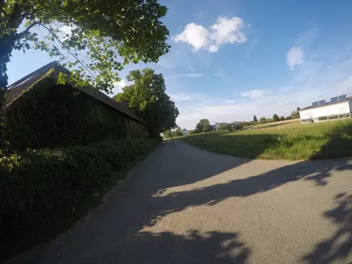
Bio-Markt Meyer-Arend
Farm and orchard · 3.1 km
60 Im Barrenholze, Herford
Mo-Fr 09:00-18:30; Sa 08:00-14:00

Bad Salzuflen
Monument and historic site · 6.1 km
Town in the Lippe district of North Rhine-Westphalia, Germany

Steintorbrücke
Bridge · 0.7 km
Steintorbrücke; technisches Denkmal; 1808/1809



Bergs Hof
Farm and orchard · 2.5 km
69 Im Heidsiek, Herford
Mo-Fr 09:00-18:00, Sa 09:00 - 16:00
Museums and landmarks190

Daniel-Pöppelmann-Haus
Museum · 0.7 km
Städtisches Museum; Stuckzierfassade; 1874; Oesterlen-Anbau des Städtischen Museums; 1973–1975
2 Deichtorwall, Herford
Tu-Su 11:00-18:00, Th[1] 11:00-20:00

Bismarckturm Herford
Monument and historic site · 3.0 km
Bismarckturm; Stuckenberg; Gedenk- und Aussichtsturm
Apr-Oct: Su[1] 11:00-17:00; Apr-Oct: Su[3] 11:00-17:00; Apr-Oct:...

Marta Herford
Museum · 0.8 km
4 Goebenstraße, Herford
Tu,Th-Su,PH 11:00-18:00; We 11:00-20:00; Jan 01: 13:00-18:00; Dec...

Neustädter Rathaus
Monument and historic site
Neustädter Rathaus; Renaissancegiebel um 1600
1a Neuer Markt, Herford

Remensniderhaus
Monument and historic site
Remensniderhaus; Schnürrollen; 1560
26 Brüderstraße, Herford


Schiller-Denkmal
Monument and historic site
Schiller-Denkmal; Gedenkstein zu Ehren Schillers, 1905 und 1956

Spätgotische Süsternkapellenruine
Monument and historic site
Wohnhaus, Rückseite; Kapellenruine, 15. Jahrhundert


Wulferthaus
Monument and historic site
Wulferthaus; Renaissancetreppengiebel; 1560/1579
2 Neuer Markt, Herford

Ehemaliger Adelshof
Monument and historic site
Fachwerktraufenhaus; Querdeele, steinerner Torbogen; 1648
5 Löhrstraße, Herford
178 more on the map.
Parks, trails and playgrounds60

H2O Herford
Sports field and stadium · 1.3 km
90 Wiesestraße, Herford
Mo-Fr 10:00-22:00;PH,Sa,Su 09:00-22:00


Ludwig-Jahn-Stadion
Sports field and stadium · 1.4 km
22 Dennewitzstraße, Herford



Springolino
Playground · 2.2 km
35 Ackerstraße, Herford
We-Fr 14:30-19:00, Sa,Su,PH 11:00-19:00; SH Mo,We-Su,PH...


48 more on the map.
Restaurants and cafes162
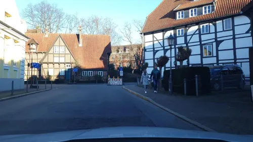
Ristorante Sardegna
Restaurant · Italian
Wohn- und Geschäftshaus; Fachwerk, 18. Jahrhundert
5 Elisabethstraße, Herford
Tu-Su 12:00-14:00,18:00-22:00
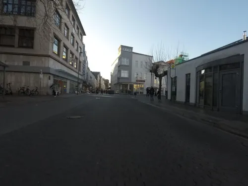
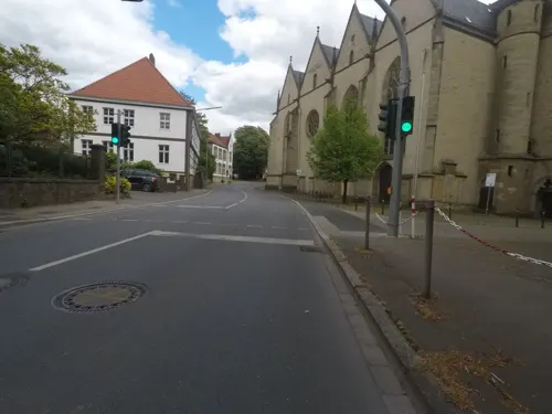
Griechisches Restaurant Sokrates
Restaurant · Greek · 0.9 km
16 Steinweg, Herford
We-Sa 17:30-23:00; Su 12:00-14:30,17:30-23:00
Pizzeria Taverna
Restaurant · Pizza · 1.0 km
49 Sachsenstraße, Herford
Mo,We-Sa,PH,PH -1 day 12:00-14:00,17:30-22:30; Su 12:00-14:00,17:30-22:00
Café Kleine
Bakery
37 Rennstraße, Herford
Mo-Fr 08:00-17:00, Sa 08:00-16:00, Su 08:00-17:00; PH 08:00-17:00

Alte Schule
Restaurant · Fine Dining
Fachwerktraufenhaus; ältestes Herforder Schulhaus; 1559/1560
39 Holland, Herford
Tu-Sa 18:00-22:00
Le Feu
Restaurant · Tarte Flambee
17 Holland, Herford
Tu-Th,Su 17:00-21:00, Fr-Sa 17:00-22:00; PH 17:00-21:00
Am Osterfeuer
Restaurant · 1.1 km
35 Hellerweg, Herford
We-Sa 17:30-23:00+; Su 11:30-14:00,17:30-23:00+
Elsbach Restaurant & Bar
Restaurant · 0.8 km
3 Goebenstraße, Herford
Mo-Sa 12:00-14:30, 18:00-22:00; Su,PH off
150 more on the map.
History
The town was founded in 789 by Charlemagne in order to guard a ford in the narrow Werre river. A century later, Matilda, daughter of Dietrich of Ringelheim, a count of Saxony, grew up in the abbey of Herford; she was a descendant of the Saxon leader Widukind. In Herford she met Henry the Fowler, who later became king of Germany.
In late medieval times Herford was a member of the Hanseatic League. It was a Free Imperial City, i.e. it was directly subordinated to the emperor. This status was lost after the Peace of Westphalia (1648), when Herford was annexed by Brandenburg-Prussia. It was administered within the Province of Westphalia following the Napoleonic Wars, and made part of the new state North Rhine-Westphalia after World War II.
From the History section of Herford on Wikipedia, under CC BY-SA 4.0.
More about Herford
Geography
The former Hanseatic town of Herford is situated in the chain of hills south of the Wiehen Hills (Ravensberg Hills). The highest place is the Dornberg (240 m) in the Schwarzenmoor district; the lowest point (56 m) is located in the Werretal in the Falkendiek district. The River Aa joins the river Werre in the centre of the town. The Stuckenberg is located east of the town.
Arts and culture
The Herford Minster (Münsterkirche) is a late Romanesque hall church, built about 1220–1250 for the Fürstabtei Herford (Herford monastery). It is one of the earliest hall churches in Germany
St. James' (Jakobikirche/Radewiger Kirche) is a late Gothic hall church (1330)
St. John's (St. Johannis/Neustädter Kirche) is a late Gothic hall church (1340)
St. Mary's (St. Marien auf dem Berge) is also a late Gothic hall church. It was completed about 1325/50 and part of a monastery
Neustädter Rathaus (former town hall), built 1600, aesthetic pediment 1930 removed, 1988/89 reconstructed
Remensnider-Haus, Brüderstraße 26, a late Gothic half-timbered building from 1521
Kantorhaus, Elisabethstraße 2, a half-timbered building, about 1484/1494
Bürgermeisterhaus, Höckerstraße 4, a late Gothic stone building from 1538 with a stepped gable similar to houses in Münster and Bielefeld
Wulfert-Haus, Neuer Markt 2 with a brick-built Renaissance gable, 1560
The MARTa Herford, a museum for contemporary art and design, housed in a building designed by Frank Gehry, has been open to the public since May 2005. Its exhibits change regularly.
From the Wikipedia article Herford, under CC BY-SA 4.0.
Notable people from Herford
 Thomas HelmerGerman footballerPhoto: Michael Lucan, CC BY-SA 3.0 de
 Diego DemmeGerman association football playerPhoto: Christian Bier, CC BY-SA 4.0
 Marian GoldGerman musicianPhoto: Alphavilleofficial, CC BY-SA 4.0
 Kristin PudenzGerman athletics competitorPhoto: Ailura, CC BY-SA 3.0 at
 Louisa LippmannGerman volleyball playerPhoto: Ralf Lotys (Sicherlich), CC BY 4.0
 Karl-Heinz WiesemannGerman Roman-Catholic bishopPhoto: Klaus Landry, CC BY-SA 4.0
- Edon ZhegrovaKosovar association football player
- Matthäus Daniel PöppelmannGerman architect
- Gerhard Friedrich MüllerGerman historian and ethnologist
- Otto WeddigenGerman World War I U-boat commander
- Carl SeveringGerman politician (1875-1952)
- Hans QuestGerman actor and director (1915–1997)
Born in Herford, according to Wikidata (CC0). Each name links to its Wikipedia article.
Where to stay11
Churches and places of worship33
Friedhofskapelle
Place of worship · 0.7 km
24 Friedhofstraße, Herford
Gemeindehaus Freie Evangeliums Christen e.V.
Church · Protestant · 2.2 km
92 Bünder Fußweg, Herford
Katholisch-Apostolische Gemeinde Herford
Church · Catholic Apostolic
23 Renntorwallstraße, Herford
Shopping55
Gas and EV charging16
Schools, colleges and libraries35
Healthcare17
Map of Herford
250 places. The map loads OpenStreetMap tiles when you open it.
Getting there and nearby towns
Flugplatz Bielefeld (BFE) is the nearest airport with scheduled flights listed in OpenStreetMap, 19 km away.
- Bad Salzuflen 6 km southeast, about 6 min by car
- Hiddenhausen 7 km northwest, about 7 min by car
- Löhne 8 km north, about 8 min by car
- Enger 8 km west, about 8 min by car
- Kirchlengern 10 km north, about 10 min by car
- Bünde 11 km northwest, about 11 min by car
- Leopoldshöhe 11 km south, about 11 min by car
- Bielefeld 13 km southwest, about 13 min by car
- Bad Oeynhausen 14 km northeast, about 14 min by car
- Spenge 13 km west, about 13 min by car
Drive times are estimates from straight-line distance, not routes.
Towns near Herford


Keep exploring
Local news
Headlines from INDB.
Reviews, tips and questions
Loading what members have shared...
Sources and licences
- GeoNames (CC BY 4.0): population, coordinates, regions and time zone
- Mapillary (see each image): photos
- OpenStreetMap contributors (ODbL 1.0): places, airports, map data
- Wikidata (CC0 1.0): elevation, founding date, time zone, website, landmarks and historic places
- Wikimedia Commons (see each image): photos
- Wikipedia (CC BY-SA 4.0): overview and history text
Photo credits
- Stolpersteinlage Herford Gehrenberg 17, Gmbo 2013, CC0
- Stolperstein Herford Gehrenberg 17 Regina Spanier, Gmbo 2013, CC0
- Herford 2009-12-16 (128), TUBS, Public domain
- Herford 2009-12-16 (127), TUBS, Public domain
- Herford 2009-12-16 (126), TUBS, Public domain
- Augustiner-Platz Herford, P6G47TG, CC BY-SA 4.0
- 2010-02-04 Herford 188, TUBS, Public domain
- 2010-02-04 Herford 187, TUBS, Public domain
- Stolperstein Herford Gehrenberg 12 Adolf Abraham Neumann, Gmbo 2013, CC0
- Stolperstein Herford Gehrenberg 12 Bernhard Os, Gmbo 2013, CC0
- Stolperstein Herford Gehrenberg 12 Frieda Goldberg, Gmbo 2013, CC0
- Stolperstein Herford Gehrenberg 12 Rosa Os, Gmbo 2013, CC0
- Stolperstein Herford Gehrenberg 12 Margarete Neumann, Gmbo 2013, CC0
- Stolperstein Herford Gehrenberg 12 Johanna Mosberg, Gmbo 2013, CC0
- Stolperstein Herford Gehrenberg 12 Rosa Goldberg, Gmbo 2013, CC0
- Stolpersteine Herford Gehrenberg 12, Gmbo 2013, CC0
- Stolpersteinlage Herford Gehrenberg 12, Gmbo 2013, CC0
- 2010-02-04 Herford 192, TUBS, Public domain
- 2010-02-04 Herford 190, TUBS, Public domain
- 2010-02-04 Herford 194, TUBS, Public domain
- 2010-02-04 Herford 191, TUBS, Public domain
- 2010-02-04 Herford 193, TUBS, Public domain
- 2010-02-04 Herford 189, TUBS, Public domain
- 2010-02-04 Herford 222, TUBS, Public domain
- 2010-02-04 Herford 221, TUBS, Public domain
- Stolpersteine Herford Gehrenberg 1, Gmbo 2013, CC0
- Stolperstein Herford Gehrenberg 1 Irmgard Levy, Gmbo 2013, CC0
- Stolperstein Herford Gehrenberg 1 Erich Walter Hoffmann, Gmbo 2013, CC0
- Stolperstein Herford Gehrenberg 1 Hetti Goldwein, Gmbo 2013, CC0
- Stolperstein Herford Gehrenberg 1 Werner Hoffmann, Gmbo 2013, CC0
- Stolperstein Herford Gehrenberg 1 Hermann Hecht, Gmbo 2013, CC0
- Stolperstein Herford Gehrenberg 1 Max Hoffmann, Gmbo 2013, CC0
- Stolperstein Herford Gehrenberg 1 Hedwig Hecht, Gmbo 2013, CC0
- Herford, Baudenkmal 469, Portal, Drahreg01, CC BY-SA 3.0
- Bad-Salzuflen Altes-Rathaus, Grugerio, CC BY-SA 3.0
- Martadach, 007-IAIM, CC BY-SA 2.5
- Herford - 2015-06-06 - Bismarckturm (01), Tsungam, CC BY-SA 4.0
- Friedrichs-Gymnasium (1), Hiddenhauser, CC0
- PAN Herford 2009-12-16 (04), TUBS, Public domain
- 2010-02-04 Herford 037, TUBS, Public domain
- Herford Süsternkapelle1, Chris06, Public domain
- GER Herford Stuckenberg, Grueslayer, CC BY-SA 4.0
- Herford - 2014-07-20 - Goebenstraße 3, Elsbach-Haus (4), Tsungam, CC BY-SA 4.0
- Herford St. Johannes Baptist entzerrt, Photo taken by Tebdi edited and uploaded by DaBroMfld, CC BY-SA 3.0
- Herford - Landbauschule, Tsungam, CC BY-SA 3.0
- 2010-02-04 Herford 186, TUBS, Public domain
- Herford, St. Johannis, Chris06, CC BY-SA 4.0
- Friedrich-List-Schule, P6G47TG, CC BY-SA 4.0
- Herford 2009-12-16 (88), TUBS, Public domain
- Geschwister-Scholl-Schule Herford, P6G47TG, CC BY-SA 4.0
- St Marien Herford1, Chris06, Public domain
- Königin-Mathilde-Gymnasium Herford, Jankra66, CC BY-SA 4.0
- 2010-02-04 Herford 237, TUBS, Public domain
- Herford 2009-12-16 (68), TUBS, Public domain
- Herford Ev.ref.Petrikirche, ludger1961, CC BY-SA 3.0
- Ravensberger Gymnasium (4), Hiddenhauser, CC0
- Herford St. Jakobi 01, ErwinMeier, CC BY-SA 4.0
- Tierpark Herford Teich, A.Savin, CC BY-SA 3.0
- Wilhelm-Oberhaus-Schule (Herford), Jankra66, CC BY-SA 4.0
- Herford 2009-12-16 (283), TUBS, Public domain
- Stadtbibliothek Herford, P6G47TG, CC BY-SA 4.0
- Otto-Hahn-Schule Herford 01, Hiddenhauser, CC0
- Herford Albert-Schweitzer-Schule, Reise Reise, CC BY-SA 4.0
- Volkeninghaus (Hiddenausen-Sundern), Chris06, CC BY-SA 4.0
- Herford InterCityHotel, Reise Reise, CC BY-SA 4.0
- Herford Schiller-Denkmal (01), Reise Reise, CC BY-SA 4.0
- Herford, Steintorbrücke 2012-09-04 HDR, G8w, CC BY-SA 3.0
- Sundern Füllenbruch, Hiddenhauser, CC0
- Herforder Brauerei, P6G47TG, CC BY-SA 4.0
- Ludwig-Jahn-Stadion 1, Hiddenhauser, CC0
- H2O Herford Luftbild, P6G47TG, CC BY-SA 4.0
- Jüdischer Friedhof Herford1, Chris06, CC0
- Luttenberg 6, Hiddenhauser, CC0
- Kino Capitol Herford, P6G47TG, CC BY-SA 4.0
- Archäologisches Fenster am Münster, P6G47TG, CC0
- Aawiesenpark Panorama, P6G47TG, CC0
- Freibad Elverdissen, P6G47TG, CC BY-SA 3.0
- Street-level photo, Schmarvis, CC BY-SA 4.0
- Street-level photo, O408G, CC BY-SA 4.0
- Street-level photo, mapiman, CC BY-SA 4.0
- Street-level photo, mapiman, CC BY-SA 4.0
- Street-level photo, derlipper, CC BY-SA 4.0
- Street-level photo, mapiman, CC BY-SA 4.0
- Street-level photo, derlipper, CC BY-SA 4.0
- Street-level photo, derlipper, CC BY-SA 4.0
- Street-level photo, mapiman, CC BY-SA 4.0
- Street-level photo, mapiman, CC BY-SA 4.0
- Street-level photo, derlipper, CC BY-SA 4.0
- Street-level photo, Schmarvis, CC BY-SA 4.0
- Street-level photo, toaskoas, CC BY-SA 4.0
- Street-level photo, Schmarvis, CC BY-SA 4.0
- Street-level photo, thorstenh, CC BY-SA 4.0
- Street-level photo, mapiman, CC BY-SA 4.0
- Street-level photo, mapiman, CC BY-SA 4.0
- Street-level photo, mapiman, CC BY-SA 4.0
- Street-level photo, toaskoas, CC BY-SA 4.0
- Street-level photo, mapiman, CC BY-SA 4.0
- Street-level photo, derlipper, CC BY-SA 4.0
- Street-level photo, derlipper, CC BY-SA 4.0
- Street-level photo, geogladbecker, CC BY-SA 4.0


Page built November 9, 2026. Spotted a mistake? Tell us or suggest a place.