


Why visit Bad Sachsa
Townapedia lists 35 museums and landmarks, 25 parks and trails, 33 places to eat, 19 places to stay and 58 attractions in and around town.
Highlights include Römerstein, Harzfalkenhof, ZisterzienserMuseum Kloster Walkenried and Glasmuseum.
Weather in Bad Sachsa
Forecast from MET Norway (CC BY 4.0). Full forecast
About Bad Sachsa
Bad Sachsa (German pronunciation: [baːt ˈzaksa] ) is a town in the district of Göttingen, in Lower Saxony, Germany. The town was one of the few municipalities in West Germany that imported electric power from former East Germany. This was done via Neuhof Substation.
From the Wikipedia article Bad Sachsa (this version), under CC BY-SA 4.0.
Things to do58



46 more on the map.
Museums and landmarks35


Dreiherrenstein
Monument and historic site · 3.5 km
Historische Grenze Königreich Preußen, Königreich Hannover und Herzogtum Braunschweig bis 1866




Eulenstein
Monument and historic site · 4.0 km
Isolierter herausgewitterter Dolomitfelsen, Naturdenkmal ND-OHA 15 im Landschaftsschutzgebiet LSG-OHA 10 "Harz".

23 more on the map.
Parks, trails and playgrounds25

Gipskarstlandschaft Bad Sachsa und Walkenried
Hiking and trails · 3.6 km






13 more on the map.
Restaurants and cafes33

Backwood Burger
Restaurant · Burger, American, Salad
4 Schulweg
Mo-Th 17:30-22:00; Fr 17:00-22:00; Sa-Su 12:30-22:00
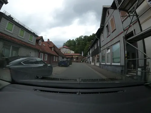
Fanny's - Harzer Schnitzelhaus & Waffelbäckerei
Restaurant · German, Waffle
13 Schützenstraße
Mo-Su 12:00-22:00
Kiwi
Restaurant · Balkan · 4.8 km
7 Ellricher Straße, Walkenried
Jun 1-Sep 30 Mo-Su 14:30-17:00; Mo, We-Su 11:30-14:30, 17:00-22:00
Am Kloster Eck
Restaurant · German · 4.5 km
13a Schloßstraße, Walkenried
Th,Fr 17:00-18:00+; Sa,Su 12:00-18:00+
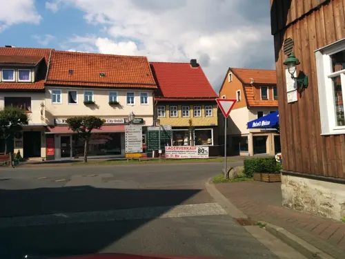
Dionysos
Restaurant · Greek
52 Marktstraße, Bad Sachsa
11:30-14:30, 17:30-22:00
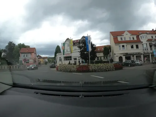
LEO's Deutsches Speiserestaurant
Restaurant · Regional
1 Kirchstraße, Bad Sachsa
Tu-Su 10:00-14:30,17:00-21:00; Mo off
Pizzeria Mamma Mia
Restaurant · Italian, Pizza, Pasta
8 Uffestraße
Mo-Tu,Th-Su 11:30-14:00,17:30-21:30; We off
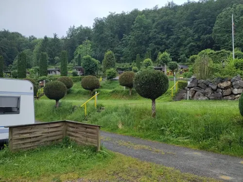


Bei Helena
Restaurant · Greek
3a Hindenburgstraße
We-Sa 09:00-18:00; Su 12:00-14:00, 17:30-21:00
21 more on the map.
History
The oldest existing document in which Sachsa is mentioned was written in 1229. The settlement officially gained town status in 1525. Tourism started around 1860. After the town had been recognized as a health resort by the government in 1905 the name was changed to "Bad Sachsa" with "Bad" meaning spa.
Bad Sachsa is known for being the town where Berthold Maria Schenk Graf von Stauffenberg and his four siblings were sent by the Nazis in 1944, following the failed 20 July plot. Their father was executed and their pregnant mother was interned in a concentration camp with two elders. The Stauffenberg children lived in Bad Sachsa during 1944-45. Other families of the executed officers were imprisoned here. All were left there without their parents and with changed names.
From the History section of Bad Sachsa on Wikipedia, under CC BY-SA 4.0.
Where to stay19
Jugend- und Bildungshaus Tettenborn e. V.
Motel and hotel · 3.6 km
6 Klettenberger Straße, Bad Sachsa
Churches and places of worship19
St. Andreas
Church · Protestant · 4.5 km
Branderoder Kirchstraße, Hohenstein
St. Nikolai
Church · Protestant · 5.2 km
Ernst-Thälmann-Straße, Hohenstein
Shopping10
Gas and EV charging4
Schools, colleges and libraries3
Healthcare5
Rehaklinik Zorge für Mutter-Vater-Kind
Hospital · 5.1 km
34 Schlesierstraße, Walkenried
Map of Bad Sachsa
211 places. The map loads OpenStreetMap tiles when you open it.
Getting there and nearby towns
Magdeburg-Cochstedt Airport (CSO) is the nearest airport with scheduled flights listed in OpenStreetMap, 66 km away.
- Bad Lauterberg im Harz 7 km northwest, about 7 min by car
- Sankt Andreasberg 13 km north, about 13 min by car
- Braunlage 15 km north, about 15 min by car
- Herzberg am Harz 16 km northwest, about 16 min by car
- Nordhausen 20 km southeast, about 20 min by car
- Duderstadt 22 km southwest, about 22 min by car
- Leinefelde-Worbis 28 km southwest, about 28 min by car
- Clausthal-Zellerfeld 28 km northwest, about 28 min by car
- Wernigerode 31 km northeast, about 31 min by car
- Bad Harzburg 32 km north, about 32 min by car
Drive times are estimates from straight-line distance, not routes.
Local news
Headlines from INDB.
Reviews, tips and questions
Loading what members have shared...
Sources and licences
- GeoNames (CC BY 4.0): population, coordinates, regions and time zone
- Mapillary (see each image): photos
- OpenStreetMap contributors (ODbL 1.0): places, airports, map data
- Wikidata (CC0 1.0): elevation, founding date, time zone, website
- Wikimedia Commons (see each image): photos
- Wikipedia (CC BY-SA 4.0): overview and history text
Photo credits
- BadSachsaRiver, Torbenbrinker, CC BY-SA 3.0
- Bad Sachsa Stolperstein Bernhard Meyer, Migebert, CC BY-SA 4.0
- St. Nikolai (Bad Sachsa) 180, Migebert, CC BY-SA 4.0
- Bad Sachsa St. Nikolai 01, ErwinMeier, CC BY-SA 4.0
- Kriegerdenkmal Marktstraße (Bad Sachsa) 07, Migebert, CC BY-SA 4.0
- Kriegerdenkmal Marktstraße (Bad Sachsa) 08, Migebert, CC BY-SA 4.0
- Kriegerdenkmal Marktstraße (Bad Sachsa) 06, Migebert, CC BY-SA 4.0
- Schulstraße 13-16 (Bad Sachsa), Migebert, CC BY-SA 4.0
- Kriegerdenkmal Marktstraße (Bad Sachsa) 09, Migebert, CC BY-SA 4.0
- Kriegerdenkmal Marktstraße (Bad Sachsa) 04, Migebert, CC BY-SA 4.0
- Kriegerdenkmal Marktstraße (Bad Sachsa) 03, Migebert, CC BY-SA 4.0
- Kriegerdenkmal Marktstraße (Bad Sachsa) 02, Migebert, CC BY-SA 4.0
- Marktstraße 4 (Bad Sachsa), Migebert, CC BY-SA 4.0
- St. Nikolai (Bad Sachsa) 02, Migebert, CC BY-SA 4.0
- Kriegerdenkmal Marktstraße (Bad Sachsa) 01, Migebert, CC BY-SA 4.0
- Kriegerdenkmal Marktstraße (Bad Sachsa) 05, Migebert, CC BY-SA 4.0
- St. Nikolai (Bad Sachsa) Grabstein 01, Migebert, CC BY-SA 4.0
- St. Nikolai (Bad Sachsa) 2023-02 Sanierung, Migebert, CC BY-SA 4.0
- Marktstraße 7-9 (Bad Sachsa), Migebert, CC BY-SA 4.0
- St. Nikolai (Bad Sachsa) Nebeneingang, Migebert, CC BY-SA 4.0
- St. Nikolai (Bad Sachsa) 179, Migebert, CC BY-SA 4.0
- St. Nikolai (Bad Sachsa) Grabstein 02, Migebert, CC BY-SA 4.0
- St. Nikolai (Bad Sachsa) Turm 01, Migebert, CC BY-SA 4.0
- Bad Sachsa Stolperstein Bernhard Meyer schräg, Migebert, CC BY-SA 4.0
- Uffestraße 32 (Bad Sachsa) 02, Migebert, CC BY-SA 4.0
- Uffestraße 32 (Bad Sachsa) 01, Migebert, CC BY-SA 4.0
- Uffestraße 31 (Bad Sachsa), Migebert, CC BY-SA 4.0
- Uffestraße 31-32 (Bad Sachsa), Migebert, CC BY-SA 4.0
- Uffestraße 36 (Bad Sachsa), Migebert, CC BY-SA 4.0
- Uffestraße 37 (Bad Sachsa), Migebert, CC BY-SA 4.0
- Bad Sachsa St. Nikolai 02, ErwinMeier, CC BY-SA 4.0
- St. Nikolai (Bad Sachsa) Turm und Kirchhof, Migebert, CC BY-SA 4.0
- Uffestraße 35-37 (Bad Sachsa), Migebert, CC BY-SA 4.0
- Kirchstraße 25 (Bad Sachsa) 02, Migebert, CC BY-SA 4.0
- Uffestraße 39 (Bad Sachsa), Migebert, CC BY-SA 4.0
- Uffestraße 41 (Bad Sachsa) 02, Migebert, CC BY-SA 4.0
- Uffestraße 41 (Bad Sachsa) 01, Migebert, CC BY-SA 4.0
- St. Nikolai (Bad Sachsa) Rotbuche, Migebert, CC BY-SA 4.0
- Uffestraße 41 (Bad Sachsa) 03, Migebert, CC BY-SA 4.0
- Brunnen Schulstraße (Bad Sachsa), Migebert, CC BY-SA 4.0
- Walkenried-Zisterzienserkloster 2011 börste, Börste, CC BY-SA 3.0
- Sachsenstein1, Markscheider, CC BY 3.0
- Eingang Harzfalkenhof Bad Sachsa, Klappi1988, CC BY-SA 3.0
- NSG Gipskarstlandschaft Bad Sachsa und Walkenried - Die Wieda beim Kloster Walkenried (4), Ragnar1904, CC BY-SA 4.0
- Ichte, Ravie, CC BY-SA 4.0
- Pädagogium Ostertal (Bad Sachsa) 01, Migebert, CC BY-SA 4.0
- Priorteich Walkenried, Guesti, CC BY-SA 3.0
- Römerstein, Acavado, CC BY-SA 4.0
- Klettenberg (Hohenstein) Kirche, Wikswat, CC BY 3.0
- Walkenried Kirche kath 2011, Kirchenfan, CC0
- Dreiherrenstein Ravensberg 02, Migebert, CC BY-SA 3.0
- Branderode Kirche, Wikswat, CC BY 3.0
- Am Kirchplatz 2 (Steina) Glasmuseum 01, Migebert, CC BY-SA 3.0
- Mackenrode Kirche 2, Wikswat, CC BY 3.0
- St. Andreas (Tettenborn) 01, Migebert, CC BY-SA 3.0
- Minen und Stacheldraht, Synonyme der Trennung, Matthias Merkermann, CC BY-SA 4.0
- Lutherkirche (Wieda) 04, Migebert, CC BY-SA 3.0
- St. Antonius (Neuhof) 05, Migebert, CC BY-SA 3.0
- Am Kirchplatz 1 (Steina) Katharinenkirche 03, Migebert, CC BY-SA 3.0
- Bad Sachsa Stolperstein Adolf Klapproth, Migebert, CC BY-SA 4.0
- Bad Sachsa Stolperstein Albert Vieth, Migebert, CC BY-SA 4.0
- Bad Sachsa Stolperstein Golda-Maria Ebschütz, Migebert, CC BY-SA 4.0
- Bad Sachsa Kirche Josef, Kirchenfan, CC0
- Eulenstein ND (Bad Lauterberg), Sillywalks, CC BY-SA 4.0
- Street-level photo, bitnapper, CC BY-SA 4.0
- Street-level photo, AlexSpritze, CC BY-SA 4.0
- Street-level photo, fod, CC BY-SA 4.0
- Street-level photo, CellerBuerger, CC BY-SA 4.0
- Street-level photo, moenk, CC BY-SA 4.0
- Street-level photo, bitnapper, CC BY-SA 4.0
- Street-level photo, AlexSpritze, CC BY-SA 4.0
- Street-level photo, bitnapper, CC BY-SA 4.0
- Street-level photo, HansTenner, CC BY-SA 4.0
- Street-level photo, fod, CC BY-SA 4.0
- Street-level photo, fod, CC BY-SA 4.0
- Street-level photo, surveyor99, CC BY-SA 4.0
- Street-level photo, sennewald63, CC BY-SA 4.0
- Street-level photo, bitnapper, CC BY-SA 4.0
- Street-level photo, bitnapper, CC BY-SA 4.0


Page built November 9, 2026. Spotted a mistake? Tell us or suggest a place.